|
The Chinese Wall is located at the northern edge of central Idaho’s White Cloud Mountains. It forms an impressive barrier along the west side of the basin that holds Crater Lake, and separates Crater Lake from Gunsight Lake to the south. It’s a very attractive peak made up of numerous layers of different colored rock stacked and twisted together. In spite of a lofty elevation of 11,328’, it is seldom climbed. This is partially due a steep and intimidating summit pinnacle, and partially due to the fact that it has only 218 feet of prominence, meaning it is not “ranked”. But the Chinese Wall is a peak that begs to be climbed because of its aesthetic qualities.
The trailhead we chose for the Chinese Wall was on Railroad Ridge, which as far as I know is the highest elevation road in Idaho. We didn’t need 4WD on this trip, but high clearance is a must. It took us over 4.5 hours from Boise. Sean and I packed the rope, harnesses, and a light alpine rack, and were hiking by about 9:30am. There wasn’t much time to warm up, with the route climbing quickly up some goat trails to the top of “Gunsight Point” (Peak 10817’). From the summit, we studied the steep east face of the Chinese Wall. There had been a light dusting of snow earlier in the week, and there were some ominous dark clouds rolling in from the west. But we had come too far to turn back, so we continued on with our adventure. This trip had a high “adventure factor” since neither of us could find any beta on how to climb Chinese Wall other than our own photos from our WCP-10 climb a few years earlier.
 From Gunsight Point, we descended a steep scree gully into the basin below that held Tin Cup Lake and Gunsight Lake. The open terrain in the basin made for easy travel as we headed east toward the base of the south ridge of the Chinese Wall. The basin made for a neat vantage point to check out an aptly named feature call The Gunsight, to the north. A light snow had begun to fall. Not sure if we were mentally prepared for a snowy climb, but we needed to get prepared quickly. From Gunsight Point, we descended a steep scree gully into the basin below that held Tin Cup Lake and Gunsight Lake. The open terrain in the basin made for easy travel as we headed east toward the base of the south ridge of the Chinese Wall. The basin made for a neat vantage point to check out an aptly named feature call The Gunsight, to the north. A light snow had begun to fall. Not sure if we were mentally prepared for a snowy climb, but we needed to get prepared quickly.
As we climbed through boulders and talus to reach the base of the ridge, Sean spotted a couple goats high above us. If the goats could make it, so could we, right? On we went, up a gully that appeared to be the path of least resistance. It skirted the some cliffs, and took us to the lowest point on the ridge between Calkens Peak, and the Chinese Wall. Once on the summit ridge, we got blasted with a stiff wind from the west. Blowing snow pelted us, so we bundled up and tried to acclimate to the sudden winter we were now experiencing. We continued north along the relatively flat ridge to the base of the very steep and scary looking summit pinnacle.
 Once at the base of the summit block, it became obvious that a direct assault on the ridge was not an option, so the next idea was to skirt around the peak and look for a way up. On the east side of the peak, there were some steep scree and sand slopes that terminated at the base of some stable looking rock. We decided to traverse along the top of the scree, holding onto the rock above for protection. After not too long, we could see what looked like some good ramps and ledges leading upward, so we gave them a try. But the climbing was very tedious on loose rock, which Sean described as being more similar to sawdust than rock. At some point we realized that down climbing the crumbly rock would become nearly impossible if we kept going, and there were no places to place any protection to rappel from either. So back down we went. It probably took us over 30 minutes to down-climb the 50 feet back down to the scree slope. At this point, I think we were both pretty discouraged, but decided to continue traversing around the east face of the peak, losing a bit of elevation as we went. The visibility was probably less than 50 feet by now, since clouds engulfed the peak making it difficult to see up or down. Once at the base of the summit block, it became obvious that a direct assault on the ridge was not an option, so the next idea was to skirt around the peak and look for a way up. On the east side of the peak, there were some steep scree and sand slopes that terminated at the base of some stable looking rock. We decided to traverse along the top of the scree, holding onto the rock above for protection. After not too long, we could see what looked like some good ramps and ledges leading upward, so we gave them a try. But the climbing was very tedious on loose rock, which Sean described as being more similar to sawdust than rock. At some point we realized that down climbing the crumbly rock would become nearly impossible if we kept going, and there were no places to place any protection to rappel from either. So back down we went. It probably took us over 30 minutes to down-climb the 50 feet back down to the scree slope. At this point, I think we were both pretty discouraged, but decided to continue traversing around the east face of the peak, losing a bit of elevation as we went. The visibility was probably less than 50 feet by now, since clouds engulfed the peak making it difficult to see up or down.
After traversing for a while, we finally got into some darker rock that was more supportive, and a shallow gully that seemed like it might work in taking us upward. But to access the gully there was a steep and tricky class 4 move to get past. Sean went first, and I stayed down on the scree in case he was to need a spotter to help him back down the crux. Once Sean found a place we could set up a rappel station if needed, I followed him up the gully.
 The stable dark rock was short-lived, and we found ourselves back on the crumbly lighter colored rock we had experienced earlier. But we continued heading up since the ridgeline was coming into view above us, and there appeared to be some boulders that we hoped we could anchor onto, and allow us to rappel down the face later. But soon the rock became too unstable to safely climb up. Luckily Sean found the one stable rock on the entire east face of the peak, and he used it to set up an anchor to set up a belay station. The next trick was getting our harnesses on. This was very tricky since we had only a couple of small footholds to stand on. Eventually get got set up, and I belayed while Sean made his way up toward the ridge. Once on top, he set up another anchor, and I was able to follow his route up. The stable dark rock was short-lived, and we found ourselves back on the crumbly lighter colored rock we had experienced earlier. But we continued heading up since the ridgeline was coming into view above us, and there appeared to be some boulders that we hoped we could anchor onto, and allow us to rappel down the face later. But soon the rock became too unstable to safely climb up. Luckily Sean found the one stable rock on the entire east face of the peak, and he used it to set up an anchor to set up a belay station. The next trick was getting our harnesses on. This was very tricky since we had only a couple of small footholds to stand on. Eventually get got set up, and I belayed while Sean made his way up toward the ridge. Once on top, he set up another anchor, and I was able to follow his route up.
 As I got close to the summit ridge, I heard Sean say “Its really nasty up here.” I thought he meant we’d have to do some dicey climbing along the ridge. But as I got closer, I could hear the wind howling, and realized he was actually talking about the weather. As I neared to top of the ridge, there were a couple low fifth class moves, followed by an arctic blast of wind and ice particles. Fortunately, the ridge looked straightforward. So we untied from the rope, and made our way north through the wind along the ridge to the summit. The highpoint was located on top of a steep slab made of stable rock with plenty of foot and handholds. Once on top, we took a few photos and looked around for any signs of prior summit visitation, but there were none, so I built a small cairn. I seriously doubt if there have been many other attempts to climb this peak. The summit pinnacle is pretty intimidating for a casual peak bagger, and the rock quality is way too poor to attract any serious technical climbers. As I got close to the summit ridge, I heard Sean say “Its really nasty up here.” I thought he meant we’d have to do some dicey climbing along the ridge. But as I got closer, I could hear the wind howling, and realized he was actually talking about the weather. As I neared to top of the ridge, there were a couple low fifth class moves, followed by an arctic blast of wind and ice particles. Fortunately, the ridge looked straightforward. So we untied from the rope, and made our way north through the wind along the ridge to the summit. The highpoint was located on top of a steep slab made of stable rock with plenty of foot and handholds. Once on top, we took a few photos and looked around for any signs of prior summit visitation, but there were none, so I built a small cairn. I seriously doubt if there have been many other attempts to climb this peak. The summit pinnacle is pretty intimidating for a casual peak bagger, and the rock quality is way too poor to attract any serious technical climbers.
 The wind and snow weren’t letting up, so we made a hasty retreat down the ridge. We briefly discussed descending the west face since it didn’t look as steep, but we decided against it due to lack of visibility. So we opted to head back down the east face, which was a scary but known entity. Sean set up a sling around a mostly stable rock, while I bounced around and beat my hands against my sides to try and stay warm. Sean clipped in, and the anchor held just fine as he rappelled down the crumbly face. Once he was down to the prior belay station, I clipped and followed his lead, trying my best not to dislodge many rocks along the way. After two more rappels, we made it back down to the base of dark gully, and the scree slope. The wind and snow weren’t letting up, so we made a hasty retreat down the ridge. We briefly discussed descending the west face since it didn’t look as steep, but we decided against it due to lack of visibility. So we opted to head back down the east face, which was a scary but known entity. Sean set up a sling around a mostly stable rock, while I bounced around and beat my hands against my sides to try and stay warm. Sean clipped in, and the anchor held just fine as he rappelled down the crumbly face. Once he was down to the prior belay station, I clipped and followed his lead, trying my best not to dislodge many rocks along the way. After two more rappels, we made it back down to the base of dark gully, and the scree slope.
 We carefully retraced our steps back along the scree slope, back into the wind on the south ridge, then down the prominent gully. An inch or two of new snow had fallen since the morning, so our descent was an adventure. After some plunge stepping and boot glissading, we were back in the basin making our way to the last obstacle of the day, which was to re-climb Gunsight Point. I never like going uphill at the end of a day, but we found a gully with mostly stable rock, and we made steady upward progress. The wind was fierce as we crested the ridge, and continued be fierce all the way back to the car. We decided it was just plain too cold to spend much time in the wind, so we ended up driving all the way back down to Livingston Mill before stopping to take of off our climbing harnesses and other gear. We carefully retraced our steps back along the scree slope, back into the wind on the south ridge, then down the prominent gully. An inch or two of new snow had fallen since the morning, so our descent was an adventure. After some plunge stepping and boot glissading, we were back in the basin making our way to the last obstacle of the day, which was to re-climb Gunsight Point. I never like going uphill at the end of a day, but we found a gully with mostly stable rock, and we made steady upward progress. The wind was fierce as we crested the ridge, and continued be fierce all the way back to the car. We decided it was just plain too cold to spend much time in the wind, so we ended up driving all the way back down to Livingston Mill before stopping to take of off our climbing harnesses and other gear.
In spite of a long drive, unseasonably harsh weather, and horrific rock quality, it had been a very rewarding day. Climbing a peak with almost no beta made for a very exciting climb and satisfying summit. It had taken us 8.5 hours to cover 5 miles and 2500 feet of elevation gain. If you or anyone you know has summited the Chinese Wall, I’d love to hear from you. It would be fun to swap stories about this whopper of a peak.
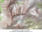
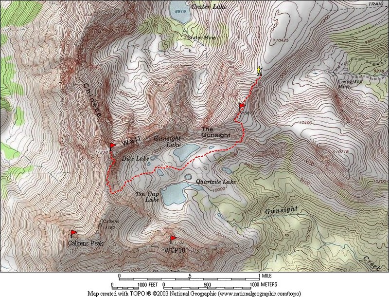
Map of the route, 5 miles round trip with 2500 elevation gain. |
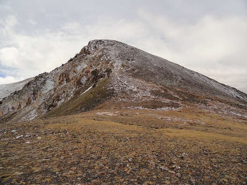
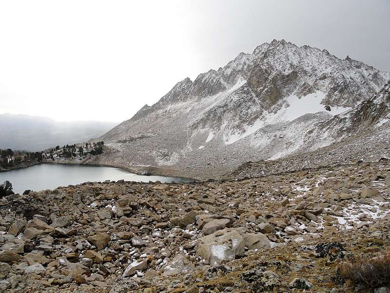
Gunsight Point (10817') from the trailhead. |
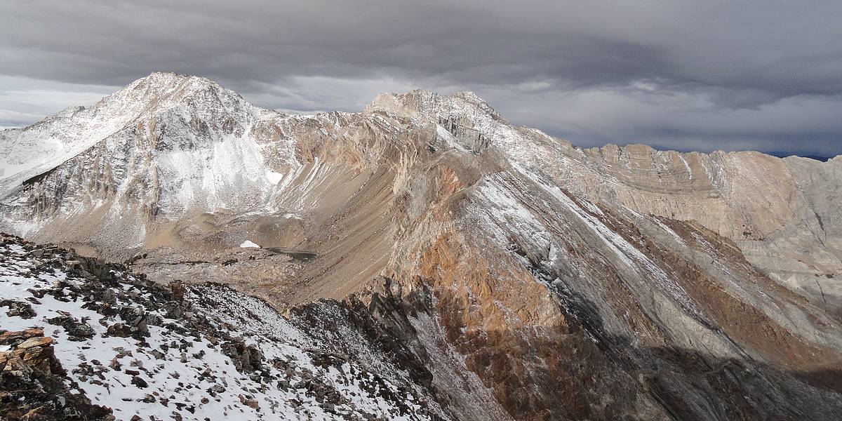
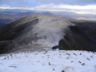
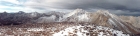
Calkens Peak and Chinese Wall from Gunsight Point.
|
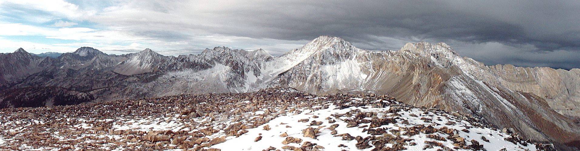
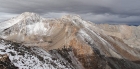
Northern White Cloud panorama from Gunsight Point.
|
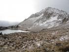
WCP-10, DO Lee, Calkens, and Chinese Wall above Tin Cup Lake. |
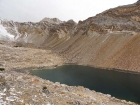
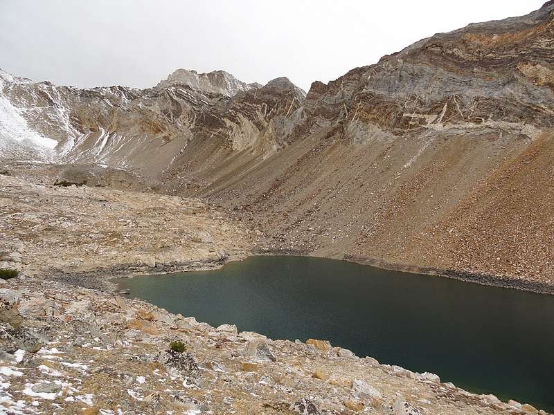
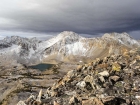
The Chinese Wall above Gunsight Lake.
|
The very rugged White Cloud Peak #10 above Tin Cup Lake.
|
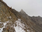
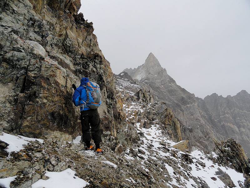
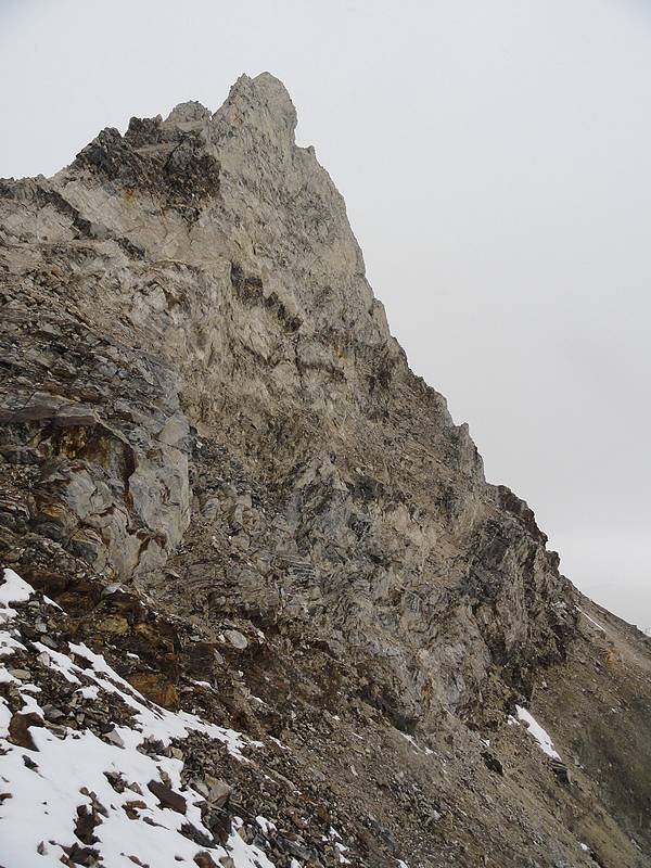
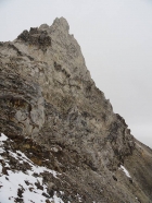
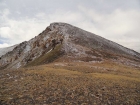
Chinese Wall summit pinnacle from the south.
|
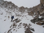
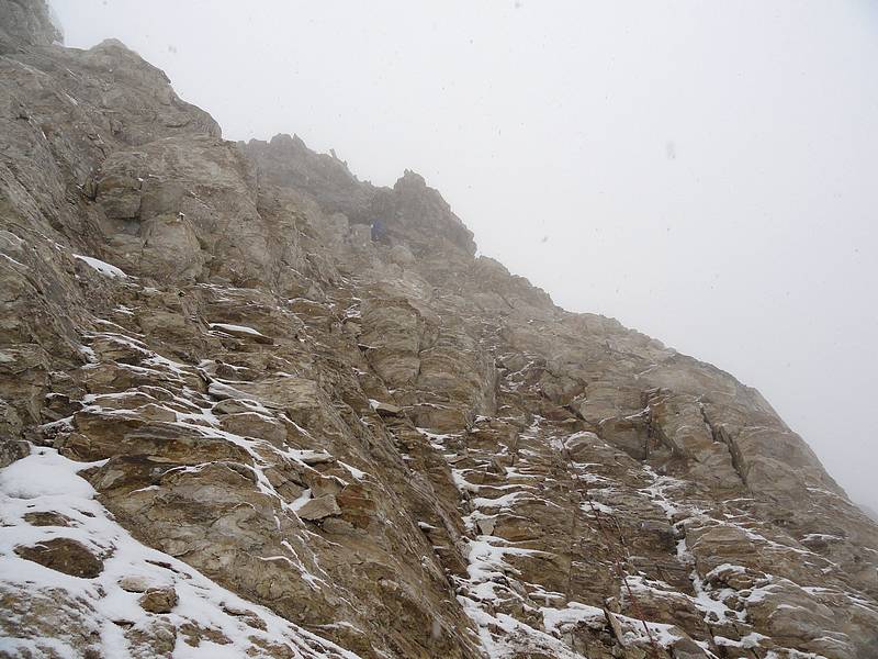
Sean nearing the top of the gully.
|
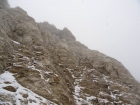
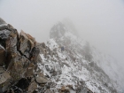
Beginning of the traverse around the east side of the Chinese Wall. |
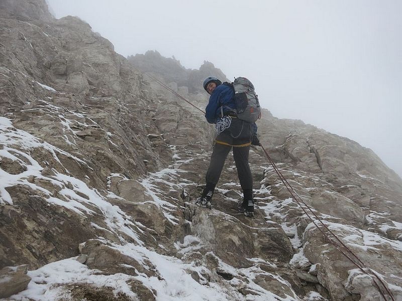
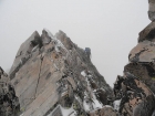
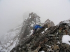
Sean on the upper east face, nearing the top of the roped pitch. |
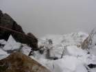
Getting pelted with wind and snow on the summit ridge.
|
Sean about to summit the Chinese Wall.
|
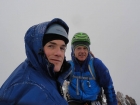
Quick summit shot. Time to head down before we get blown off this thing. |
Being careful on the downclimb from the summit.
|
Sean making the first rappel from the summit ridge. |
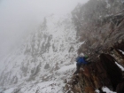
Dave rappelling down the east face. SeanD photo. |
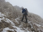
Making our way back around the east face.
|
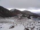
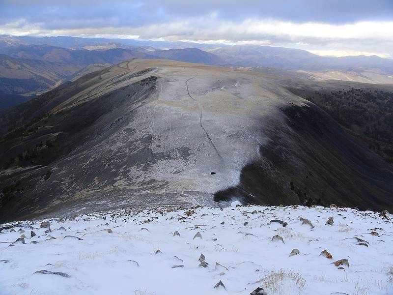
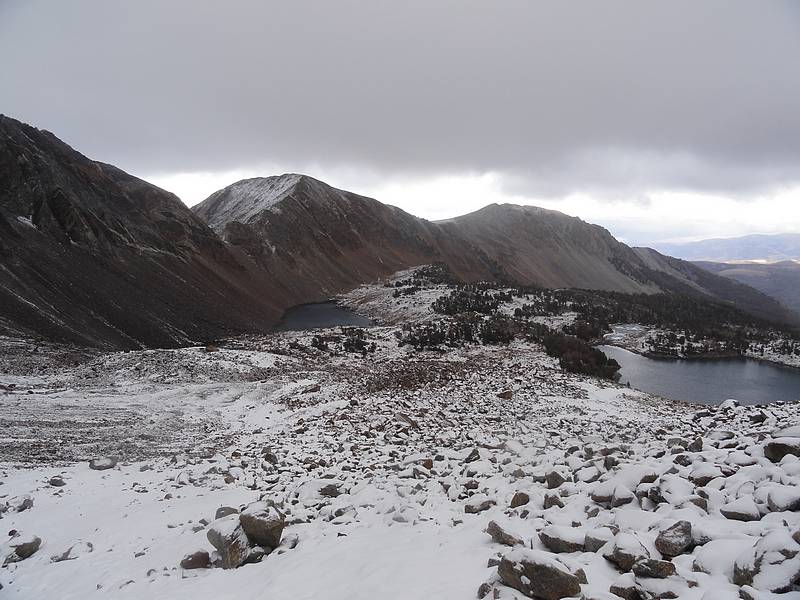
Gunsight Point above Gunsight Lake and Tin Cup Lake. |
Looking down on the car, Railroad Ridge in the background. |
|