|
The northern White Clouds are one of the most scenic areas in all of Idaho, with an abundance of high alpine lakes and tall rugged mountains. The Tin Cup Lake area has plenty of these features. Plus, a trip here involves driving to what could be the highest elevation road/trailhead in all of Idaho, located on Railroad Ridge, not too far west from Livingston Mill.
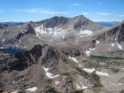
After a 4.5 hour drive from Boise, and a bumpy drive from Livingston Mill up to the trailhead at around 10400', SeanD and I hit the trail just before 10am. We were surprised to see another truck at the trailhead, and a fairly well worn path that climbed the slopes up to "Gunsight Point" (elevation 10817'). From the summit, we spent some time taking in the views. The Tin Cup Lake basin was at our feet, about 800' below, but most of our attention was on the next objective on the other side of the basin, White Cloud Peak #10 (WCP-10). There have been very few known ascents of WCP-10, so the beta was a limited. After talking over our options, we decide to go with the safest bet and climb the northwest face, since this was a similar line to what George/John/Pat had climbed the summer before.
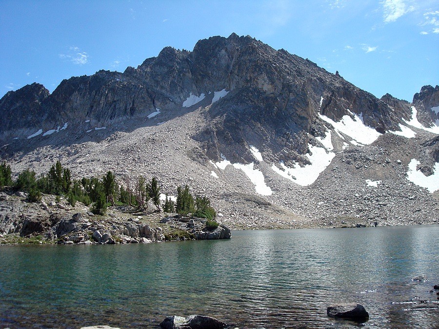
From the summit of "Gunsight Point", we went a little to the left (east) then down a loose gully. After a while, we opted for the more stable rock on one of the ribs, and were able to make a little better time the rest of the way down. Once down in the basin, we wandered across a few rises and over to the edge of Tin Cup Lake. The lake looked like an excellent place to camp, with great views of WCP-10, Chinese Wall, and The Gunsight. We circled around the east side of the lake, and then climbed the boulder fields up into the small cirque between WCP-10 and Caulkens Peak.
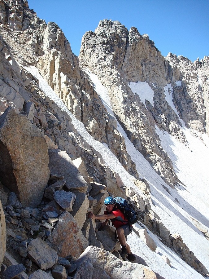
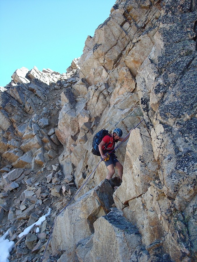
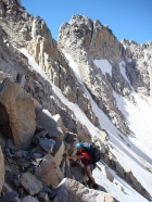
The going had been pretty easy up until this point, but the real work began at the base of WCP-10's northwest slopes. The rock was steep and loose, but we were able to climb a chute next to some cliffs. We fanned out to keep from kicking down rocks on each other, but I think we both had a couple class 4 moves in order to make it up that section. This got us to within a hundred feet or so from the top of the ridgeline, where we stopped on a ledge to put on climbing harnesses (the first time I'd ever worn one). We didn't know for sure if we'd need to use the technical gear, but the other guys had used it the prior summer, so we brought it a long just in case.
 After climbing the chute, we angled along the side of the ridge, staying a ways below the top to avoid sketchier terrain. Soon enough, we came to a notch that was the crux of the climb. The notch was just past a rib that came up the north face, and the summit appeared to be just past that, but it wasn't obvious what to do next. Crossing directly over the notch would be very exposed, and might be hard to protect. The other option was a nasty looking narrow chute full of loose rock, which crossed below the apparent summit block. Not liking the looks of the notch, we down climbed a bit then traversed over to the base of the chute to take a look. Fortunately, it wasn't quite as steep looking up close, and there were a couple stable holds, so we were able to get up it with a few delicate moves on the rotten rock. Once up the chute, we reached the ridgeline and weren't positive which of the points was the summit. I decided to climb the one we'd just passed by, and sure enough it was the highpoint. It was a very rewarding summit to me, and I was pretty fired up after the challenging climb and the adventure of climbing it with limited beta. To be honest, I seriously doubt I would have even tried this one without such an experienced climbing partner like Sean alongside. After climbing the chute, we angled along the side of the ridge, staying a ways below the top to avoid sketchier terrain. Soon enough, we came to a notch that was the crux of the climb. The notch was just past a rib that came up the north face, and the summit appeared to be just past that, but it wasn't obvious what to do next. Crossing directly over the notch would be very exposed, and might be hard to protect. The other option was a nasty looking narrow chute full of loose rock, which crossed below the apparent summit block. Not liking the looks of the notch, we down climbed a bit then traversed over to the base of the chute to take a look. Fortunately, it wasn't quite as steep looking up close, and there were a couple stable holds, so we were able to get up it with a few delicate moves on the rotten rock. Once up the chute, we reached the ridgeline and weren't positive which of the points was the summit. I decided to climb the one we'd just passed by, and sure enough it was the highpoint. It was a very rewarding summit to me, and I was pretty fired up after the challenging climb and the adventure of climbing it with limited beta. To be honest, I seriously doubt I would have even tried this one without such an experienced climbing partner like Sean alongside.
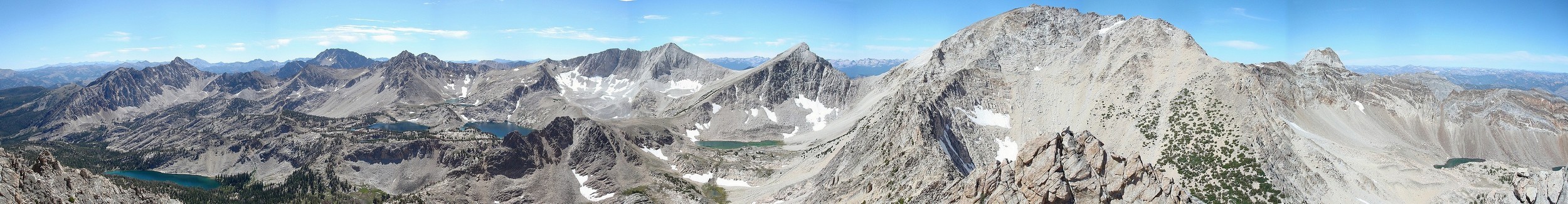
Sean placed an updated PVC summit canister, which was a good thing since the existing "tin can wrapped in tin foil" was on its last legs. There were only two other recorded ascents (but I know of at least one other). The first being in 1999 (I forgot the name), and the other being in 2006 (when R. Landis climbed the Class 4 southern slopes from Sheep Lake). I perched on the summit eating a PB&J taking in the views of the Tin Cup Lake basin, as well as David O Lee Peak and the Big Boulder Lakes.
The next trick would be how to get down. We weren't in the mood to downclimb the rotten chute, so the decision was made to rappel off the summit ridge, down a steeper but less rotten crack. I'd never rappelled before, so I worked up quite the stomach full of butterflies while Sean set up the gear. After some instruction from Sean, it was go time. The first several steps were pretty slow on my part, but I gradually got more comfortable the farther I went. Once at the bottom of the crack, I unhooked and got out of the way for Sean, who make it all seem very easy. From here, we retraced our steps along the face, then down the northwest slopes back into the cirque. We'd originally planned to also climb Caulkens and Chinese Wall, but the drive and WCP-10 had both taken longer than expected, so we opted not to push our luck. It would have been nice to climb the other peaks, but I was very satisfied with WCP-10, arguably the most challenging peak I've ever climbed.
After deciding against climbing the other peaks, the time pressures were out the window, so we took a leisurely pace back down to the lake and across the basin, with lots of good sports discussion along the way. The climb back up "Gunsight Point" was kind of a pain to do at the end of the day, but it wasn't too bad. We actually met some other hikers during the hike out, so the Railroad Ridge trailhead is apparently more popular that I thought. At the end of the day, we covered the 5 miles and 2500 feet of total elevation gain in a total time of 7 hours (3hrs to summit, half hour on summit, 3.5 hours return. It was a great day in a great area.
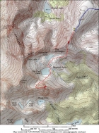
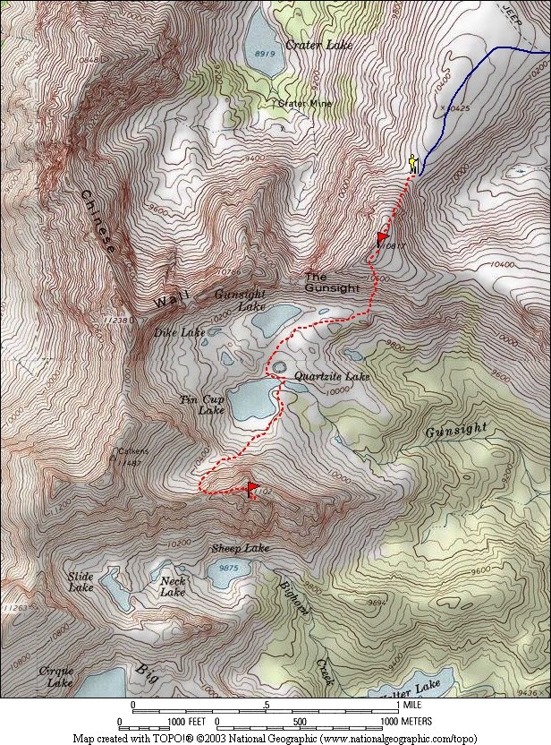
Overview map of our route.
|
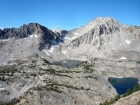
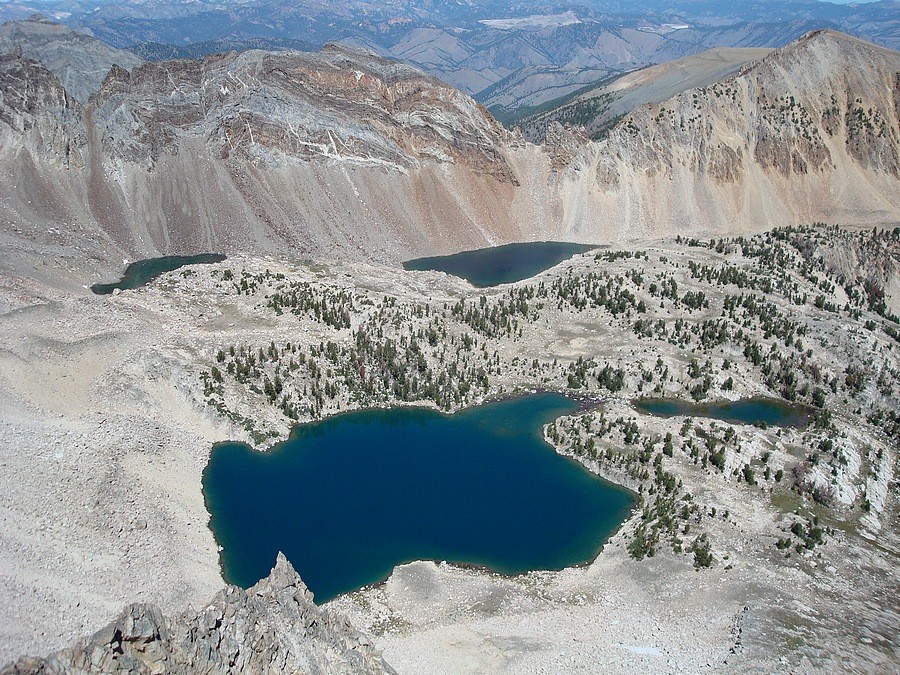
Tin Cup Lake basin from "Gunsight Point". WCP-10 on the left, the east face of Caulkens Peak on the right, and DO Lee in-between.
|
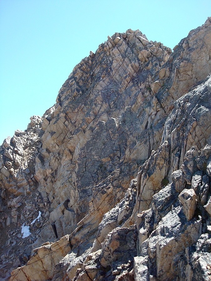
Marbled rock on the Chinese Wall, from Tin Cup Lake.
|
Sean climbing the steep northwest slopes of WCP-10.
|

The summit of WCP-10 in the upper right. We climbed the rotten chute on the far left.
|
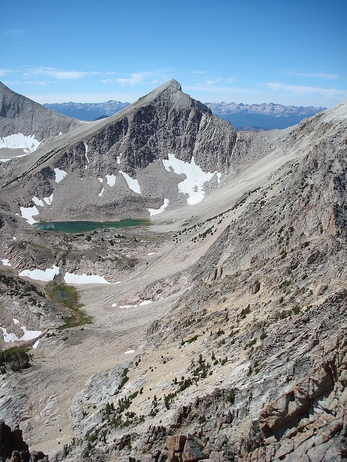
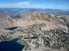
David O Lee Peak from the summit of WCP-10.
|

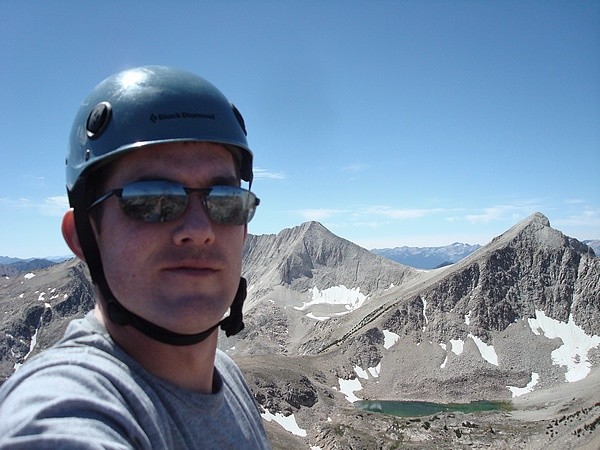
My splattski photo on the summit of WCP-10.
|
The east face of WCP-9 and Slide Lake from WCP-10.
|
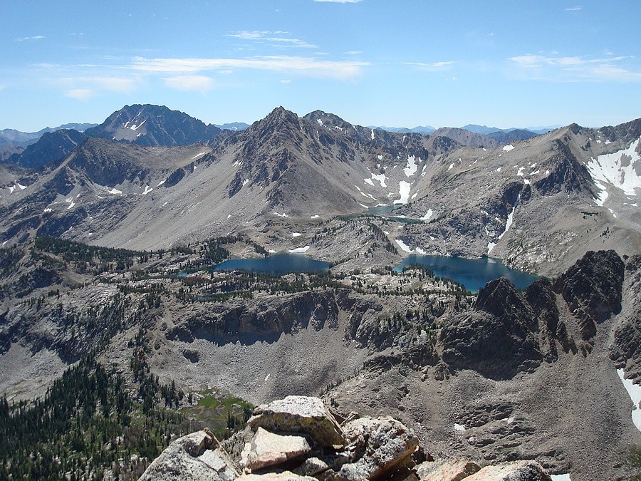
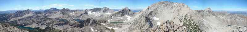
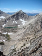
Big Boulder Lakes as seen from WCP-10.
|

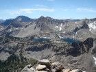
Tin Cup Lake basin from WCP-10.
|
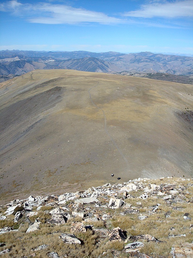
"Gunsight Point" from WCP-10.
|

Sean finishing off his rappel.
|
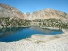
Tin Cup Lake and The Gunsight.
|
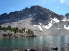
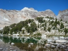
The north face of WCP-10 from Tin Cup Lake.
|

Looking down on our cars from "Gunsight Point", Railroad Ridge in the background.
|
|