|
White Cloud Peak #10
White Cloud Peak #10 (aka WCP-10) is located in central Idaho’s White Cloud Mountains. The peak can be found in the northern section of the White Clouds and is arguably the most challenging mountain to climb in the entire range. It is also a very attractive mountain, and creates a rugged backdrop to the tailless Tin Cup Lake Basin, home to some amazing alpine terrain.
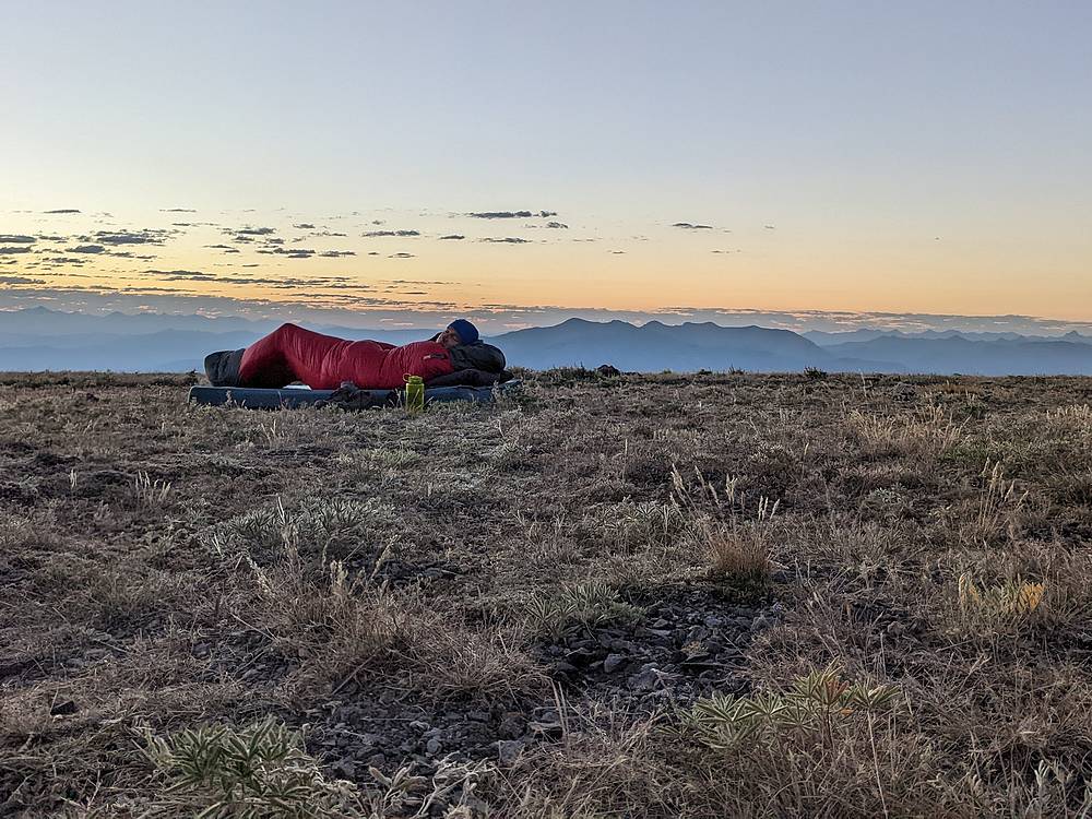
With a big weekend of mountain climbing ahead of us, Michael and I decided to get a head start and made the 5 hour drive from Boise to the end of the road on Railroad Ridge. After the long drive, we laid out our bedrolls for a night under the stars on the highest drivable road in Idaho.
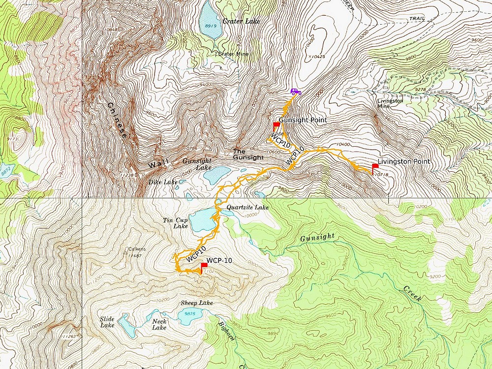
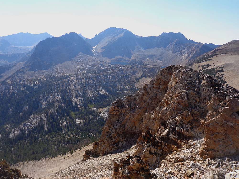
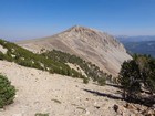
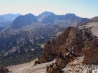
The next morning, we started our day with a quick climb up “Gunsight Point” (10817’). From here we had great views of WCP-10 and the gorgeous lake basin below. We then hung a left and descended a couple hundred feet along the ridge before dropping into a gully that we followed down to ~10,100’. From here we contoured around to Tin Cup Lake where we stopped for a snack and enjoyed the beautiful morning.
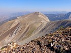
WCP-10 was staring us in the face from Tin Cup Lake. We headed up the cirque toward the saddle west of the peak. A bit before the saddle, we hopped into a gully that lead us up toward the ridge. After some climbing, we stopped short of the ridge and angled across the face toward the summit, taking the path of least resistance along the way. This part of the climb involves a little route-finding, but is no harder than class 3.
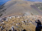
The terrain was slow going, so after almost 4 hours from the trailhead, we arrived at the base of the summit block. From here we had to choose from the “dirty gully”, a loose steep gully east of the summit block. Or a steeper but more stable gully the goes up just east of the summit. I’d done the dirty gully on my first trip back in 2008, and didn’t really want to repeat it. Plus we’d heard the other gully wasn’t bad, so up we went.
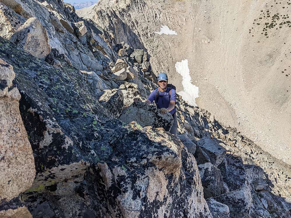
The western gully was pretty steep, but the rock was stable and it was chimney-like in certain parts, so the exposure didn’t feel too bad. Although I’d still consider this class IV. I climbed to the ridge-line, and called Michael up as soon as I could tell the route would work. From there, it was just a short scramble to the summit.
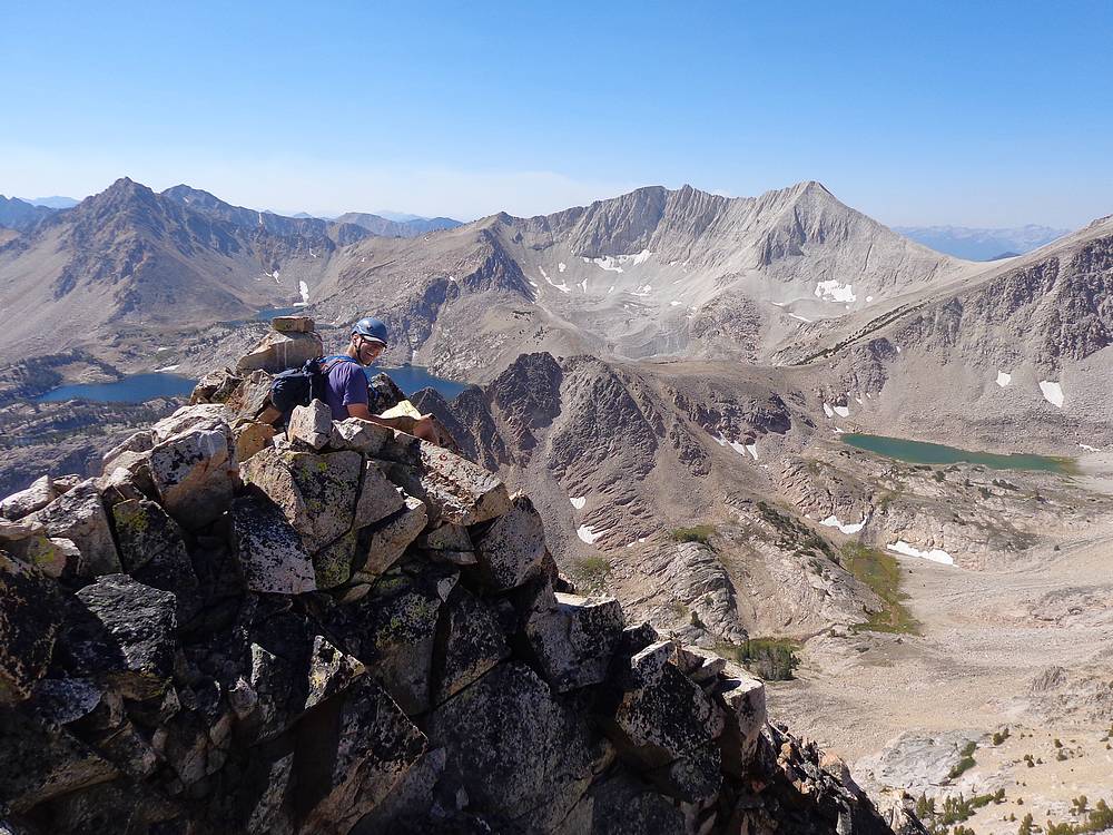
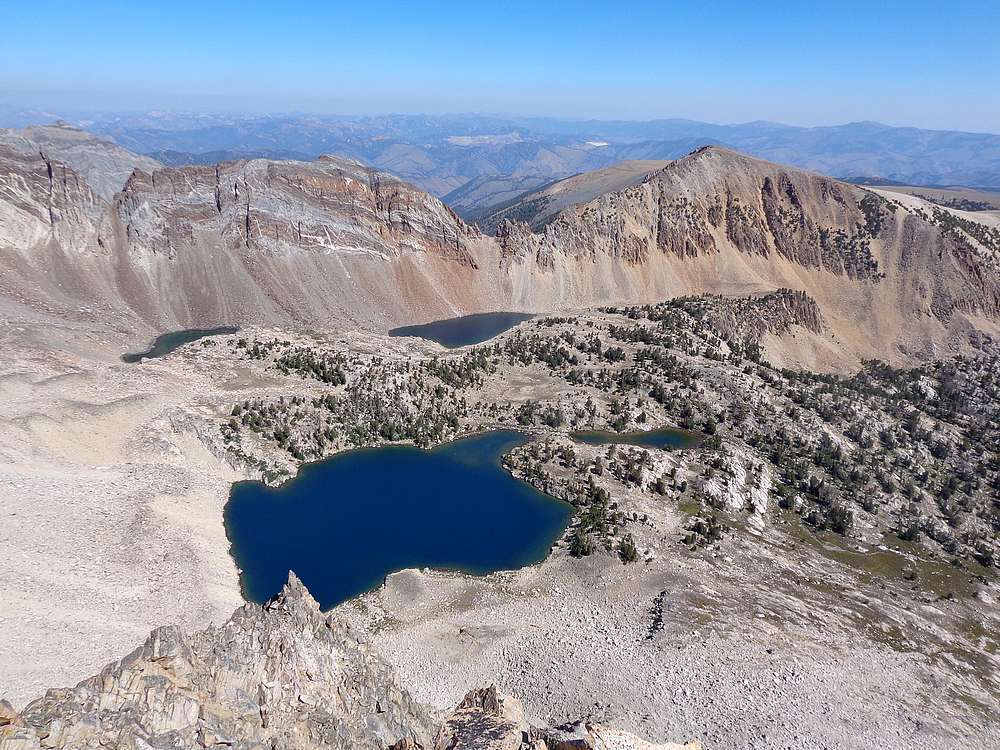
Reaching the summit was very satisfying, and views were nothing short of spectacular with alpine lakes and other peaks all around us. But it was hard to relax knowing a challenging descent was still needed. I think we could have down-climbed the steep gully, but we’d carried rope and harnesses up here, so we chose to rappel for some added safety. Michael tied a long sling around a big rock on the ridge, and did the rappel like a pro. I followed, but a little less pro-like. Down at the base of the summit block, it felt good to have the hard part finished.
We still had some ground to cover though. We made our way back across the face, and took the same gully back down into the cirque, and then some boulder hopping before arriving back at Tin Cup Lake for a well-deserved snack break, and pumping some refreshing cool water.
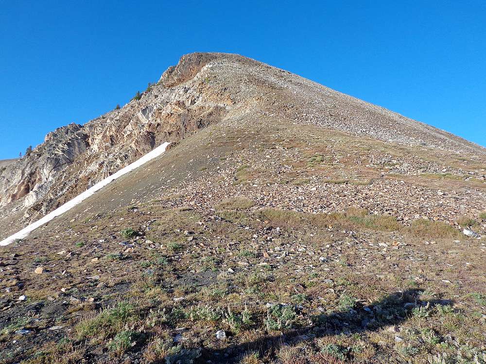
On the way out, the climb back up to the ridge below Gunsight Point seemed a little easier than my prior 2 times, thanks to taking a gully a little further east. Once on the ridge, Michael headed back toward the car, and I detoured further east for a quick climb up Pt 10718’ (I nicknamed this “Livingston Point”). The climb was straightforward, with just a little scrambling below the summit. After that I made my way back to join Michael.
White Cloud Peak #10 is no joke! My stats for the day were only 6 miles and 2400’ of elevation gain. But it took almost 9 hours due to the nature of the terrain and slow careful climbing. Still definitely a great day in the mountains, and a very satisfying summit. No doubt one of the hardest Idaho 11ers to climb!
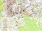
Map of the route, just over 6 miles and 2400' gain round trip. |
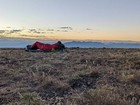
Waking up after a night under the stars on Railroad Ridge. |
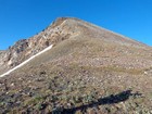
About to start our day, with a hike up Gunsight Point. |
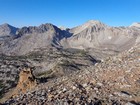
Looking down into the Tin Cup Lake basin. |
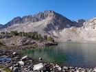
WCP-10 from Tin Cup Lake. |
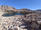
Heading up from the lake. |
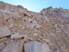
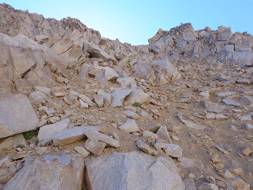
Some talus climbing as we head toward the ridge. |
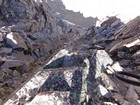
Gully scrambling on the way to the ridge. |

Taking a break on the west ridge of WCP-10. |
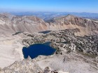
Tin Cup Lake basin from the summit of WCP-10, The Gunsight in the background. |
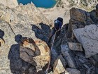
Starting the rappel. |
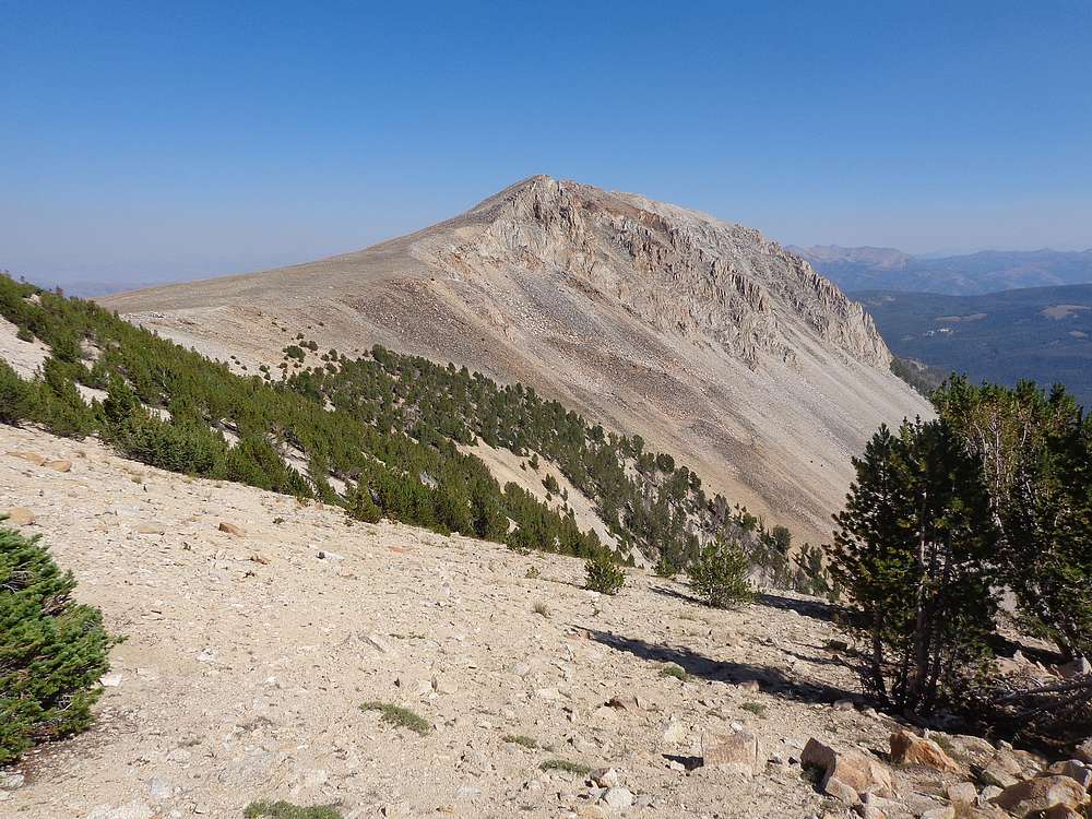
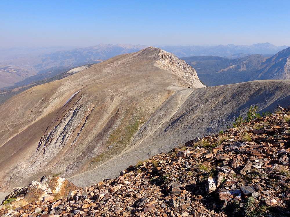
Looking across at Livingston Point. |
Livingston Point summit view of the Tin Cup Lake basin. |
Looking back on Livingston Point. |
Final descent to the car on Railroad Ridge. |
|
|
|