|
Ocalkens Lake & White Cloud Peaks
August 16-17, 2009
The northern section of central Idaho’s White Cloud Mountains offer some of the best solitude to scenery ratio that you’ll find anywhere. Ocalkens Lake is found in the heart of the northern White Clouds, and makes an excellent location for a base camp to explore surrounding features like Bighorn Basin, Iron Basin, and the numerous White Cloud Peaks found nearby.
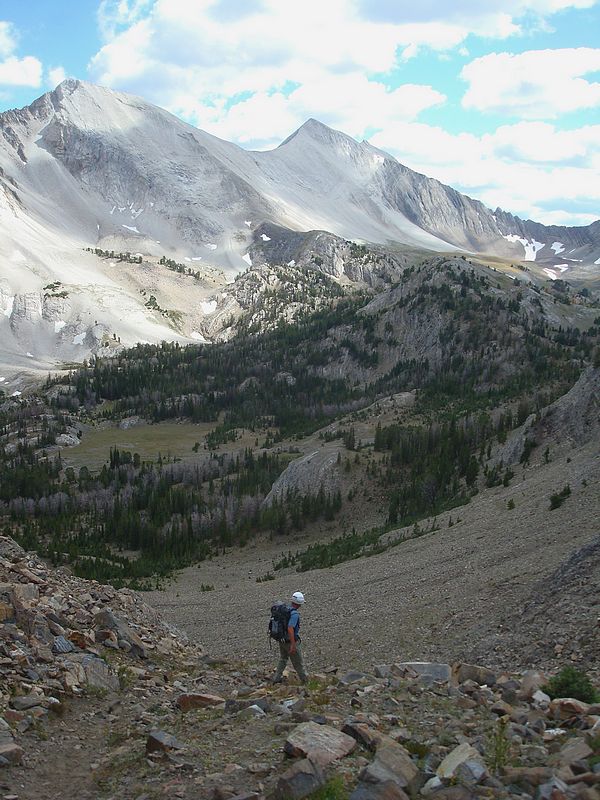
After almost 4 hours of driving time from Boise, Splattski and I arrived at the Slate Creek Trailhead and hit the trail a little after noon. The fork in the trail to Ocalkens Lake was a little tricky to find since someone had recently buried it in brush. But I knew the fork was near a chest-freezer sized piece of rusty machinery just after crossing the creek, so we bushwhacked for a bit and then found the trail. It was unseasonably cool, which allowed us to made good time up to the lake, covering the 4+ miles and 2000’ of elevation gain in just over 2 hours (including a lunch stop). The trail fades in and out a couple times, but is generally easy to follow.
Once camp was set-up, the next goals for the day were WCP-6 and WCP-5, located at the northeast end of Iron Basin. It took us a half-hour to climb from Ocalkens Lake to the pass at the head of Iron Basin (a section that we’d grow familiar with over the next two days), then another half-hour to climb the south ridge of WCP-6 to its summit. This peak is one of the shorter ones in the area, but provides great views of the surroundings. The weather on top was far from August-like, and there was some gropple (round like hail, but fluffy like snow) floating down on us.
 Our next step was the traverse from WCP-6 over to the ominous looking WCP-5. I’d been shut down on WCP-5 two years earlier, and was hoping to clear up some unfinished business today. From the east, there’s no obvious route, but I knew we could follow the ridge for a while before working out onto the south face, then up a gully to a notch between the peak’s twin summits. John and I were both wondering if a summit would be in the cards, but as we neared the notch, a route up the west side of the eastern summit became apparent. The rock was loose and with a couple Class 4 moves require, but there was a line to be had. John let me go first and gave me a head start so I wouldn’t kick any rocks down on him. I climbed briefly to the right and then back to the left before following the spine of the ridge to the high point. When I reached the summit, I could barely contain myself and let out a few Woo Hoo’s and Yes’s! The views were great, and included Iron Basin, Swimm Lake, Bighorn Basin, etc. John made it to the top soon after, and we studied the lay of the land for a couple minutes before starting the descent. When John climbed down, I dug around in the rubble looking for a register. All I could find was a flat rock with some pink surveyor’s flagging tied around it. I built a small cairn, and started heading down. John was waiting in the notch, and had a good view of my down climb. He was nice enough to share some warnings about the looseness of the rock, and to watch my step. I eventually made it down without issue, relieved to be past the crux. Our next step was the traverse from WCP-6 over to the ominous looking WCP-5. I’d been shut down on WCP-5 two years earlier, and was hoping to clear up some unfinished business today. From the east, there’s no obvious route, but I knew we could follow the ridge for a while before working out onto the south face, then up a gully to a notch between the peak’s twin summits. John and I were both wondering if a summit would be in the cards, but as we neared the notch, a route up the west side of the eastern summit became apparent. The rock was loose and with a couple Class 4 moves require, but there was a line to be had. John let me go first and gave me a head start so I wouldn’t kick any rocks down on him. I climbed briefly to the right and then back to the left before following the spine of the ridge to the high point. When I reached the summit, I could barely contain myself and let out a few Woo Hoo’s and Yes’s! The views were great, and included Iron Basin, Swimm Lake, Bighorn Basin, etc. John made it to the top soon after, and we studied the lay of the land for a couple minutes before starting the descent. When John climbed down, I dug around in the rubble looking for a register. All I could find was a flat rock with some pink surveyor’s flagging tied around it. I built a small cairn, and started heading down. John was waiting in the notch, and had a good view of my down climb. He was nice enough to share some warnings about the looseness of the rock, and to watch my step. I eventually made it down without issue, relieved to be past the crux.
Now that the rough part was finished, all that was left was some scrambling and scree-skiing back to the floor of Iron Basin. At times, the whole mountainside would start moving, which induced some quick sidestepping footwork more than once to keep form getting overtaken. Once back in the basin, we snapped a few photos of our route, and then made our way back through the saddle, and down to Ocalkens Lake.
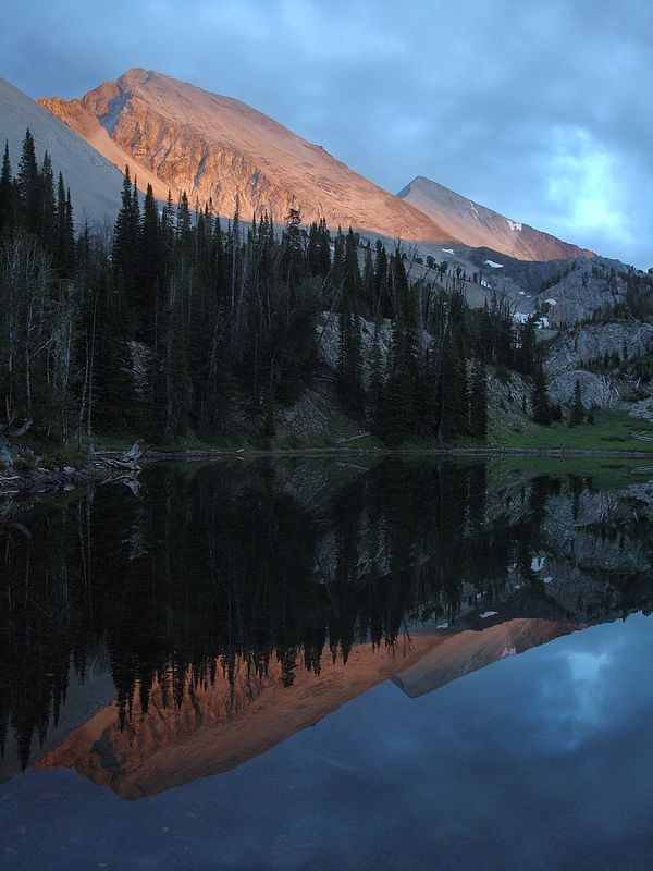
 It was starting to cool off, and some hot Mountain House meals hit the spot. Next the sunset began, and it was a great one. The rock in the White Clouds is very reflective and make for some great color when the sun is going down. The alpenglow on DO Lee Peak, WCP-9 and Calkens Peak was very impressive. I took a ton of photos during the light show, while staying warm in my down parka. Eventually it was time to turn in for the night, and get rested for another big day. It was starting to cool off, and some hot Mountain House meals hit the spot. Next the sunset began, and it was a great one. The rock in the White Clouds is very reflective and make for some great color when the sun is going down. The alpenglow on DO Lee Peak, WCP-9 and Calkens Peak was very impressive. I took a ton of photos during the light show, while staying warm in my down parka. Eventually it was time to turn in for the night, and get rested for another big day.
The next morning, there was ice on the surface of my water bottle, a rarity for August. But we warmed up soon enough as we climbed back up the trail to the Iron Basin pass. WCP-7 was the first objective for the day. From below, it looked very steep and the route was not obvious, but we were armed with knowledge of others who had climbed the northeast ridge. Up we went, first following a gully, and then angled left to the ridge. It was steep, but with mostly solid rock. The climbing was fun, and we made it to the summit in a little less than two hours from camp. The views were great, and it put us in good position to see the route over the WCP-8. It was early in the day, so we didn’t dawdle in descending off WCP-7 to the south, and continuing along the ridge to WCP-8. We had some good game trails to follow, and took advantage of those as we climbed along the west side of the ridge. There was a little scrambling to do just below the summit, but nothing too challenging. It took us about an hour to cover this section, and made for good timing for a lunch break. I felt very satisfied while sitting there eating my PB&J on the summit of my tenth and final of the numbered WCP’s. The views of Bighorn Basin are fantastic, and we had good views to the south of Antz Basin as well.
 But our day wasn’t done. Next up was a small peak in the southeast corner of Iron Basin. Peak 10182’ (Iron Basin Point) wasn’t particularly impressive looking, but it did meet the 300’ prominence rule, so up we went. It was a quick scramble to the summit, which offered some great views of WCP-7 and Iron Basin. From this vantage point, John and I discussed our options. We’d seen a cairn up the ridge that pointed towards a descent route back into Bighorn Basin, but John was leaning towards taking the scenic route through Iron Basin. He figured the extra 3 miles would be worth it, and he was right. The tour through Iron Basin was very scenic, with an abundance of wildflowers still blooming in August. The trail was fleeting, but it didn’t really matter in the open terrain we traveled through. Soon enough we’d rounded the bend and made our final descent through the pass and back down the to the lake. Michael was waiting for us at the campsite, fresh off an impressive single day climb of DO Lee, WCP-9 and Calkens Peak. He hung out while John and I broke camp, and we all made the hike out together. But our day wasn’t done. Next up was a small peak in the southeast corner of Iron Basin. Peak 10182’ (Iron Basin Point) wasn’t particularly impressive looking, but it did meet the 300’ prominence rule, so up we went. It was a quick scramble to the summit, which offered some great views of WCP-7 and Iron Basin. From this vantage point, John and I discussed our options. We’d seen a cairn up the ridge that pointed towards a descent route back into Bighorn Basin, but John was leaning towards taking the scenic route through Iron Basin. He figured the extra 3 miles would be worth it, and he was right. The tour through Iron Basin was very scenic, with an abundance of wildflowers still blooming in August. The trail was fleeting, but it didn’t really matter in the open terrain we traveled through. Soon enough we’d rounded the bend and made our final descent through the pass and back down the to the lake. Michael was waiting for us at the campsite, fresh off an impressive single day climb of DO Lee, WCP-9 and Calkens Peak. He hung out while John and I broke camp, and we all made the hike out together.
The White Clouds are my favorite range, and the area we had just visited could be my favorite within the range. It’s hard to beat the combination of scenery and solitude that you can find in the northern White Clouds. .
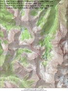
Map of our route, 22 miles round trip and 7600' elevation gain.
|

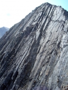
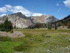
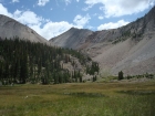
Our campsite at Ocalkens Lake, with the Chinese Wall in the background.
|
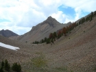
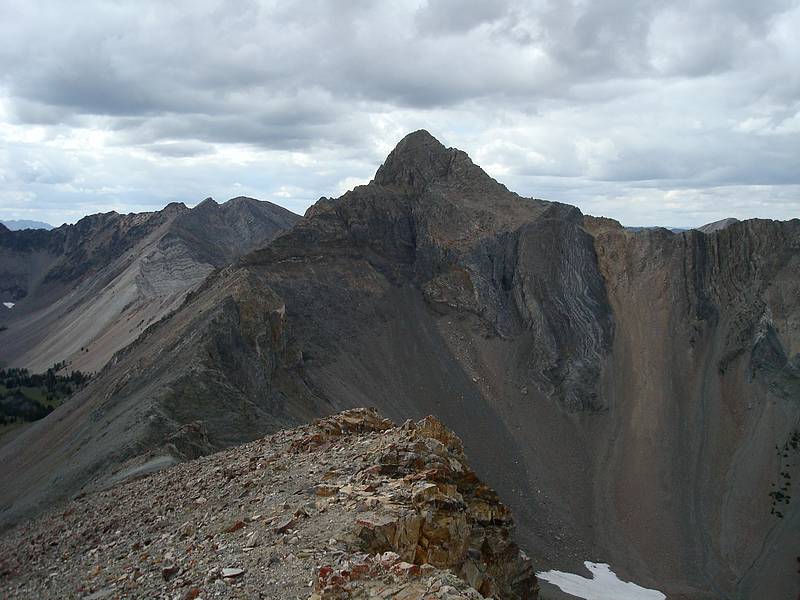
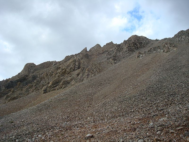
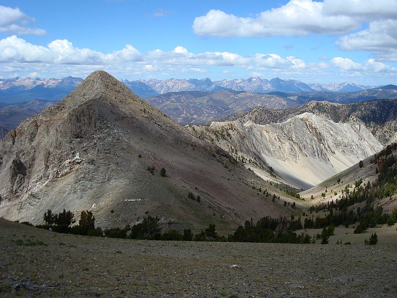
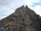
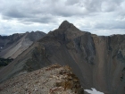
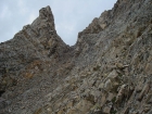
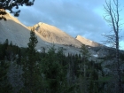
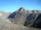
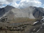
WCP-5 from the Iron Basin saddle.
|
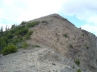
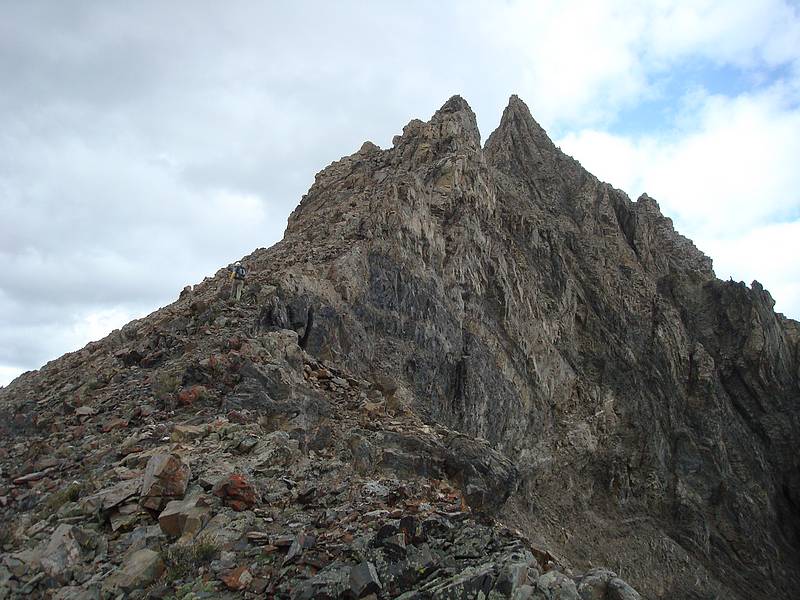
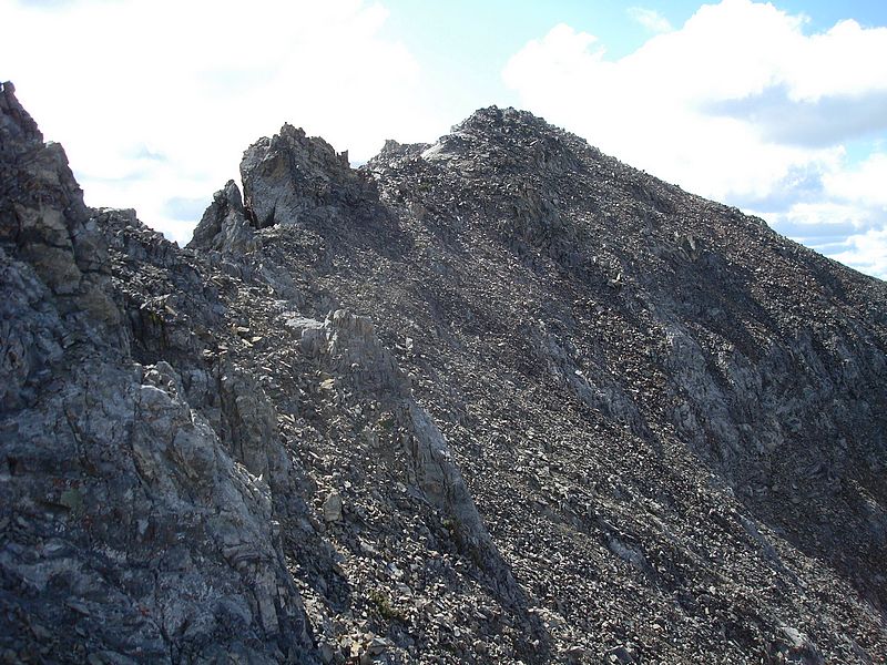
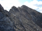
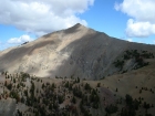
Nearing the summit of WCP-6.
|
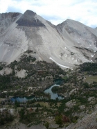
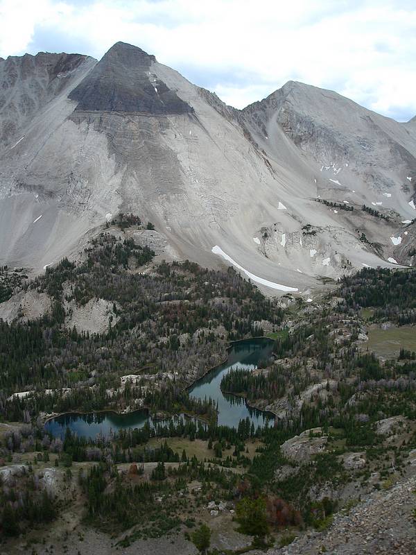
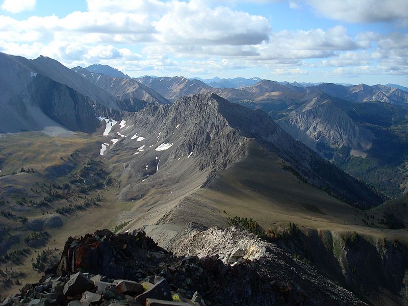
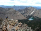
Ocalkens Lake and Calkens Peak from WCP-6.
|
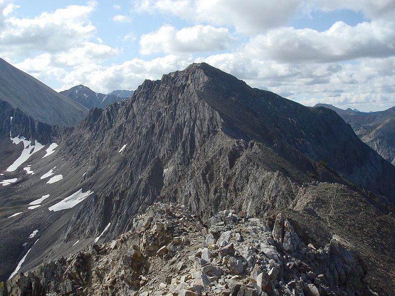
The east face of WCP-5 from WCP-6.
|
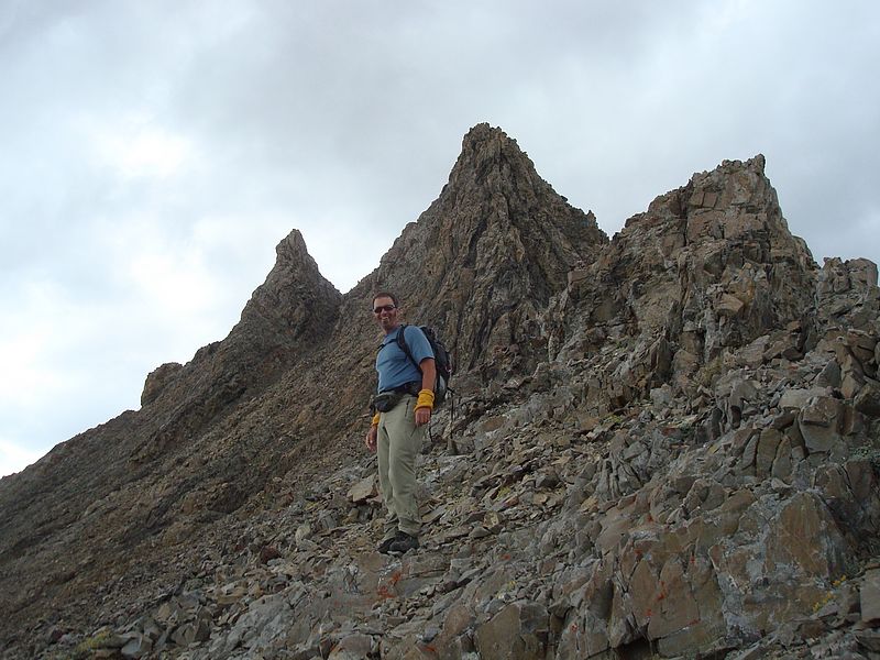
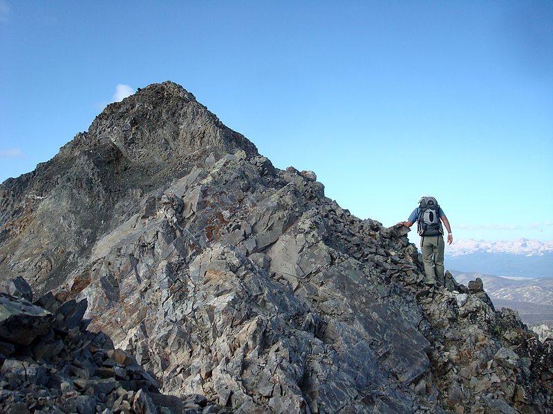
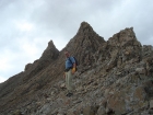
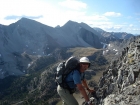
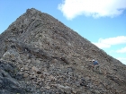
John on the southeast ridge of WCP-5.
|
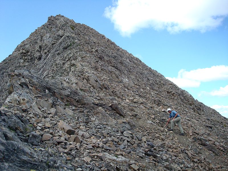
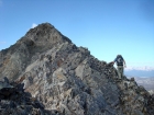
John climbing the Class 4 west side of the WCP-5 summit block.
|
Just a few moves below the summit of WCP-5, Swimm Lake in the background.
|
The view southeast from the summit of WCP-5.
|
John descending the notch on WPC-5.
|
Happy to be out of the tricky section, WCP-5's twin summits in the background.
|
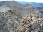
Tons of scree on the south face of WCP-5.
|
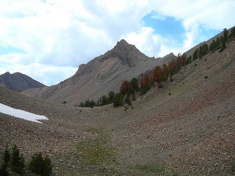
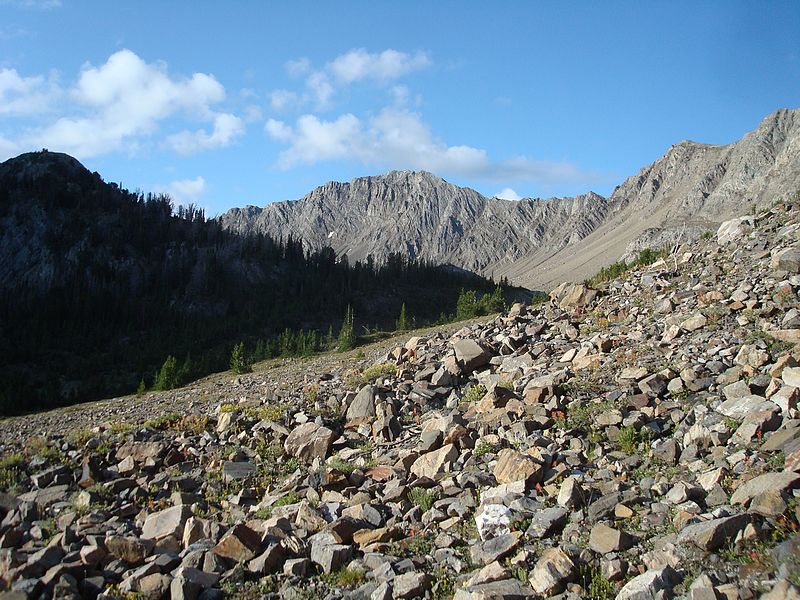
The northwest face of WCP-7 from Iron Basin.
|
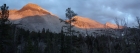
The beginnings of a beautiful sunset on WCP-9 and David O Lee Peak from Ocalkens Lake.
|
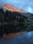
Alpenglow reflections at Ocalkens Lake.
|
Panorama of Calkens Peak, WCP-9, and David O. Lee Peak during the sunset.
|
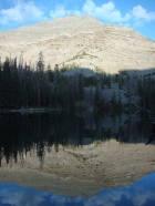
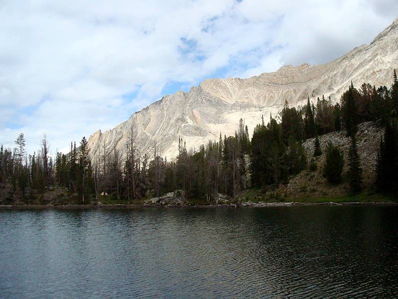
Morning reflection of WCP-7 from Ocalkens Lake.
|
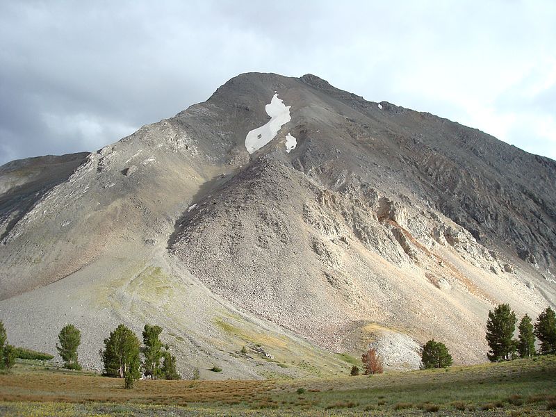
The north face of WCP-8 from the mouth of Bighorn Basin.
|
WCP-5 from the lower slopes of WCP-7.
|
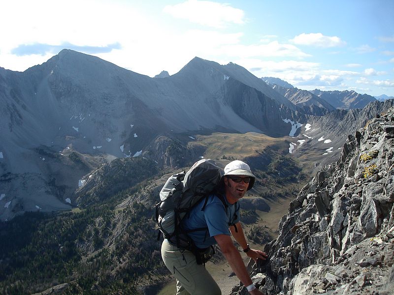
John climbing the steep but stable northeast ridge of WCP-7.
|
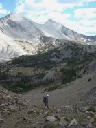
Nearing the summit of WCP-7.
|

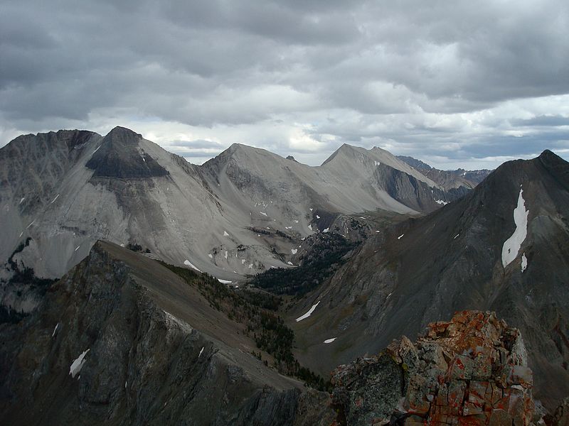
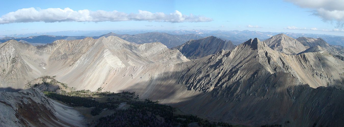
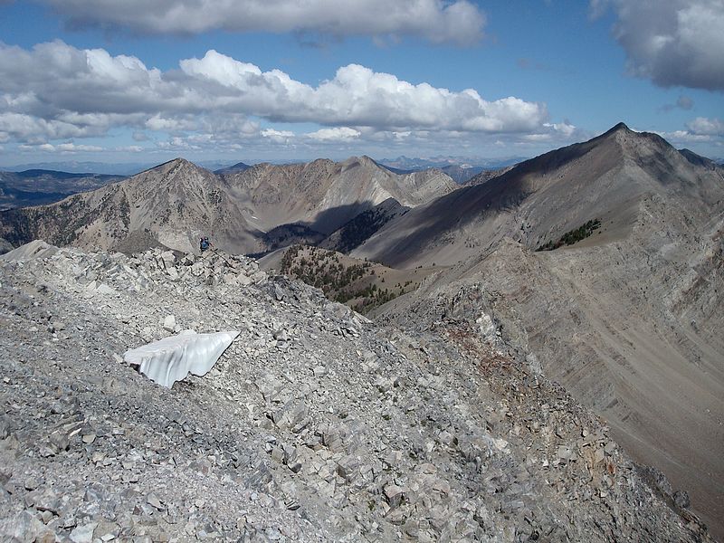
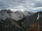
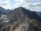
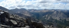
Panoramic view of Iron Basin from WCP-7.
|

Looking down from WCP-7 on the connecting ridge to WCP-8.
|
Getting closer to WCP-8.
|
Slabs on the steep north face of WCP-8.
|
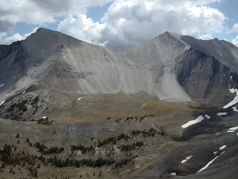
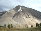
The crumbling west face of WCP-8.
|

John nearing the summit of WCP-8.
|
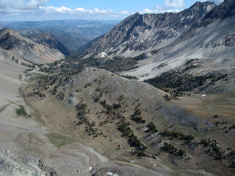
Bighorn Basin from WCP-8.
|
The view south from WCP-8 includes Castle Peak and the Antz Basin area.
|
WCP-9 and David O. Lee Peak above Bighorn Basin.
|

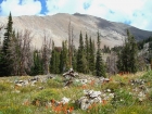
Iron Basin Point, with the Sawtooths in the background.
|
John climbing through the talus on the northeast slopes of Iron Basin Point.
|
The south face of WCP-7 from Iron Basin Point.
|
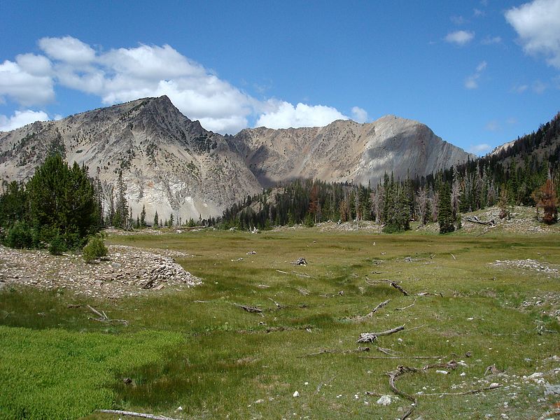
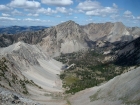
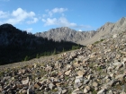
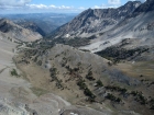
Iron Basin from Iron Basin Point. Watson Peak and WCP-4 in the background.
|
Watson Peak and WCP-4 from a meadow high the southeast corner of Iron Basin.
|
Looking back up at Iron Basin Point from the northwest.
|
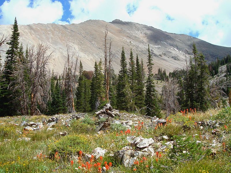
Wildflowers and snags with WCP-7 in the background.
|
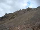
John descending the trail back down to Ocalkens Lake.
|
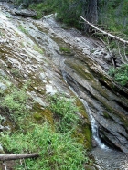
Waterfall on Slate Creek.
|
|