|
Northern White Cloud Backpacking
Swimm Lake & Ocalkens Lake & White Cloud Peaks
August 4-7, 2007
|
Related Links:
- IdahoSummits Trip Report
- Scrapper Blackwell Blog
- WCP-1: IS, SP, LOJ, MAP
- WCP-3: SP, LOJ, MAP
- WCP-2: SP, LOJ, MAP
- WCP-4: SP, LOJ, MAP
- WCP-5: LOJ, MAP
- WCP-6: SP, LOJ, MAP
- Caulkens Peak: SP, LOJ, MAP
- WCP-9: SP, LOJ, MAP
- David O Lee Peak: SP, LOJ, MAP
|
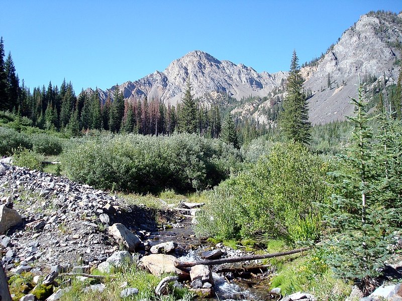
The northern section of central Idaho’s White Cloud Mountains offer’s some of the best solitude to scenery ratio you can find. Trails are scarce, so putting together a loop hike results in a fairly strenuous route. But the terrain is pretty open so navigation is made a little easier. When I first saw Swimm Lake from White Cloud Peak #3 (WCP-3) last summer, I knew I had to camp there someday. At some point, a route for a backpacking loop dawned on me. It would connect Swimm Lake along with Ocalkens Lake, and offer plenty of peak bagging opportunities along the way. There would be some steep sections involved, but the mileage seemed short enough that I could hopefully keep myself off of Ken, JJ, and Jordan’s bad sides.
Day 1
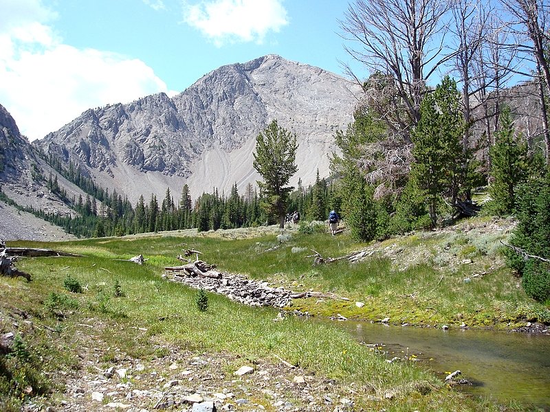
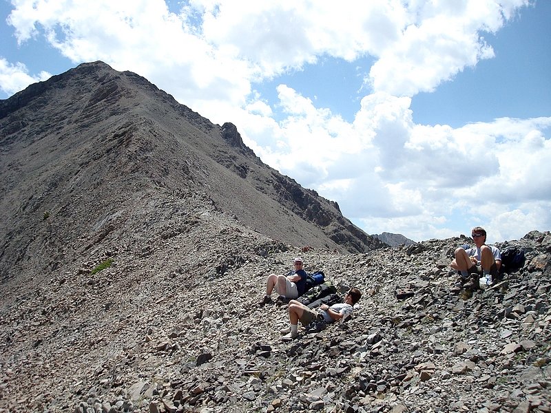
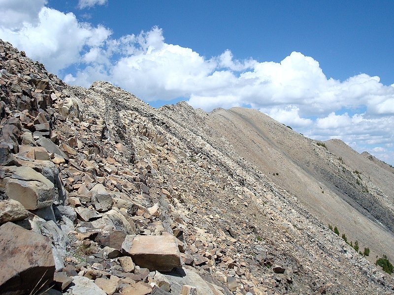
After a four hour drive from Boise to the Slate Creek trailhead (ominously located up FS road 666), we were off and hiking. The first section of the route follows a long since abandoned mining road, which climbs steadily (1500’ in 1.75 miles) up to Hoodoo Lake. We stopped there for a short break, and then bushwhacked southwest up to the scenic basin below WCP-3. From this vantage point, I’m sure the other guys were wondering what I was smoking. The top looked a long way up there, and we had to cross the summit on our way to Swimm Lake. The next portion of the hike from the basin, up to the saddle north of WCP-3 was the most draining for me. The slope was relentless in our full packs, but we made finally made it to the ridge, just in time for some 40 mph winds. After resting there for a little while, I headed south for a quick half mile jaunt to WCP-1, while the others made their way up to the summit of WCP-3 where they waited for me to catch up. We down-climbed together to the saddle west of the summit, where we parted ways again. They scree-skied to Swimm Lake for some relaxing, while I continued south to WCP-2.
I’d attempted WCP-2 last summer, but didn’t complete it as a result of rough conditions along the ridge. The contour map makes the ridge look like a simple route, but there are way too many loose and exposed sections for my liking. On this return trip, I’d decided to traverse along the side of the peak, and then climb up to the summit from below. This sounded good in theory, but the south face of the peak is guarded by a few tall cliff bands the pushed me lower and lower to avoid exposure. Eventually I got around the cliffs, and made it to the summit. There was no sign of a human ever having been there. I took a few photos, and built a cairn before retracing my route back to the saddle where I left my pack. Seeing a goat out ahead of me at one point had made me go a little faster, but it still took me 2.5 hours round trip, and I still had to make the surprisingly steep descent to Swimm Lake. Once at the lake, it was obvious that few people ever visit, but amazingly, we weren’t the only campers that day. A guy and his dog were also there. We ended up talking with him quite a bit about how the heck to get back over the ridge out of the basin that held Swimm Lake. He’d come over the ridge east of the lake, after making his way up from Hoodoo Lake, and ended up doing roughly the same on his return. A side benefit was that he had some good quality binoculars that he let us use for checking out a heard of Bighorn Sheep above the lake. Very cool.
Day 2
The next morning we slept in a little, and spent some time eyeing our intended escape route, before starting to hike at about 10am. The plan was to cross through the saddle to the south of Swimm Lake, but it sure looked nasty from a distance, steep and scree filled. As we got closer to the ridge, Ken suggested a gully east of the saddle that looked quite a bit more stable. It still ended up having some loose rock and a couple Class 3 moves involved, but we split into groups of two’s, and made the climb without issues. Eventually we reached the ridge, and soon spotted three Bighorn Rams. When we tried to move closer, they high-tailed it out of sight toward Watson Peak.
Once on the ridge, we split up again. I went west to climb WCP-4, and the other descended into Iron Basin. Traversing the loose rocks in my big pack seemed to take forever, and I was happy to leave it behind at the low point on the ridge east of the peak. The climb to the summit wasn’t bad at all. On top, there was a small cairn on the north summit, and evidence of Sheep/Goats was abundant. The exposure looking over the east face of the peak was very impressive. After snapping a few photos, I headed down to get my pack, then on to Iron Basin. I contemplated how to tackle WCP-5. I’d originally hopped to traverse the ridge from WCP-4, to WCP-5, and then to WCP-6. But the south face of WCP-5 was way too steep. In the end, I decided to leave my pack in Iron Basin at around the 9500’ contour, and head up the talus to the ridge. From the ridge, both of the twin summits of WCP-5 looked like pinnacles. But I’d gone too far not to continue on for a closer look. The southeast ridge of WCP-5 wasn’t bad, but I was forced out onto the south face as I neared the top. From the face, I was able to climb up a chute to the notch between the two summits. The wind was howling in the notch, and the climb to the taller eastern summit was very exposed Class 4. I probably could have made it up, but was pretty concerned about the down-climb. I climbed the western summit to get a better look at the highpoint, and made the decision to back off. That bummed me out quite a bit, but I knew it was the right choice.
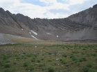
After leaving WCP-5, I followed a goat trail over to WCP-6. This is the shortest of the “White Cloud Peaks”, but its central position makes it an excellent vantage point to check out the surroundings, namely the brilliant white colored 11000 footers to the east. I rested there for a while, and then headed back to my pack in Iron Basin. Once back at my pack, the sun came out and I had a snack and watched blue birds for a while before hitting the trail, and making my way down to join the others at Ocalkens Lake. The lake's inlet stream had dried up, so the water level had dropped a couple feet, making for a muddy shoreline. This made the lake itself less desirable, but the views of the surrounding peaks definitely made up for it.
Day 3
My big plans for this day were originally to traverse the peaks that surround Bighorn Basin, but I could sense pretty early on that my energy/motivation levels would make that unlikely. I didn’t leave camp until 10am again, and headed towards the gully between Caulkens Peak and WCP-9. Ken gave me a little head start, and we planned to join up to climb David O Lee Peak later in the day. I headed south from the lake, then west up the gully. My pace was slow and energy levels were low, but the abundant scenery made it all worth it. In the gully, I happened upon a pair of critters at around 10400’ elevation. They were similar in size and demeanor to house cats. (I later found out that they were Martens, a pretty rare find.) They let me take several photos of them, and I eventually climbed around them on the way up to the ridge.
The first goal for the day was Caulkens Peak, the second highest summit in the range (ranked only behind Castle Peak). From there I hoped to traverse over to WCP-10. The connecting ridge looked like it might be doable, but my energy levels were way too low, and Ken had radioed that he was already on top of WCP-9 waiting for me. After a snack break, I decided that the north ridge of WCP-9 was dicey’r than I was in the mood for, so I scree-skied all the way down to Slide Lake instead. From there I made the 1000’ climb up the east ridge of WCP-9, with abundant views of the Big Boulder Lakes on the way up.
My stay on the summit of WCP-9 was short, just taking enough time to sign the register. Based on the number entries, it might be one of the most climbed peaks in the range. After a quick jaunt down the south ridge, I met up with Ken in the saddle. We then made the 600’ climb up the north ridge of David O Lee Peak. There is a trail to follow most of the way, with about 30’ feet of scrambling to finish it off. The views were excellent in all directions. This peak is one of my favorites, and I had wanted to climb it for a long time. I wasn’t disappointed. The dazzling white rock, the views, and tons of exposure on the west face (Ken’s favorite) make it an awesome destination.
After taking in the DO Lee summit views, we headed back down the ridge. I’d decided earlier that the traverse around to WCP-8 and WCP-7 just wasn’t in the cards (but the ridge did look doable). So we followed a Sheep trail heading southwest for a while, before taking the plunge, and riding the scree down to Bighorn Basin. We decided to cross over to the west side of the basin to hopefully see some Sheep, and that ended up working out for us. Out on the rise that runs down the middle of the basin, we spotted a group of about 25 sheep including one large ram and a few lambs. This was very cool, and made me glad I hadn’t tried the traverse. When Ken and I got back to camp, we heard from JJ and Jordan that they had also hiked up to the same area and saw the same group. With this we were well pleased, and ended up spending the evening reciting rock ballads from the 80’s. Good thing we were the only ones camped there.
Day 4
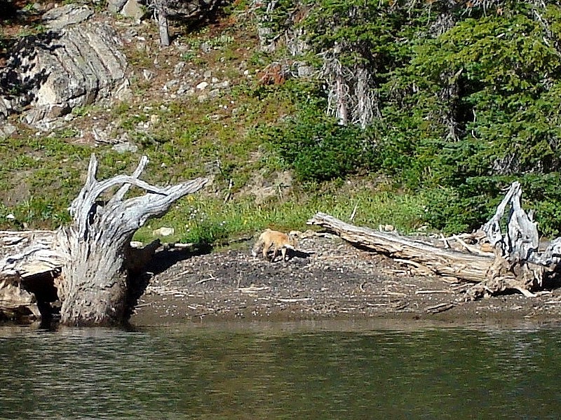
The next morning was pretty chilly, and we marveled at Ken’s lack of long pants for the trip. But the highlight of the morning was a Red Fox that wandered down to the lake while we were pumping water for the hike out. It wasn’t too concerned with us, and stayed around for several minutes before returning to the forest. The hike down the meandering trail to the car was uneventful other than spotting a deer and a Rough Grouse that let us get within about 5 feet of him. All in all, a very enjoyable trip. The highlight was the amount of wildlife we saw, but reaching nine different summits was very cool too. My ending stats were 26 miles, and over 12000’ of cumulative elevation gain.

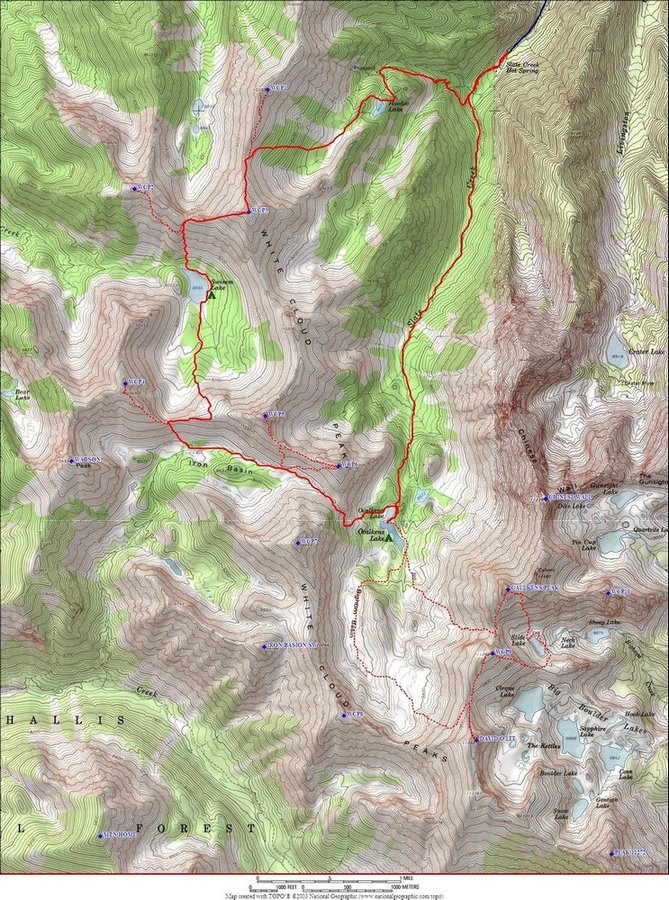
Map of the area. The route we chose isn't for casual backpackers. It was strenuous, with a couple Class 3 moves in big packs required.
|
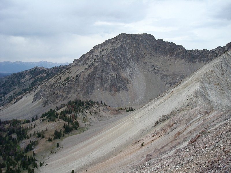
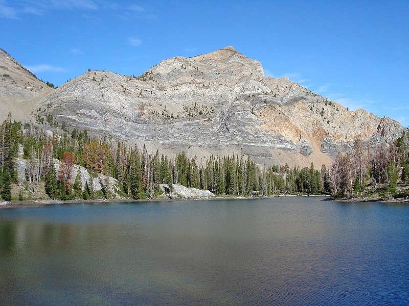
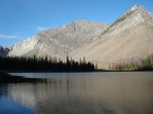
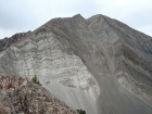
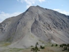
Hoodoo Lake and WCP-3.
|

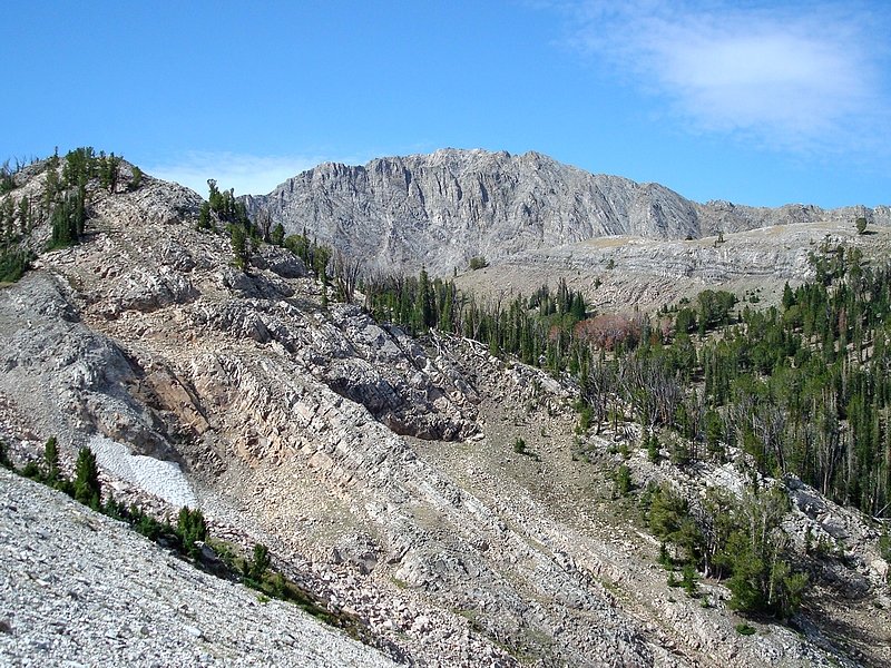
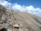
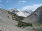
Crossing the basin above Hoodoo Lake, en route to WCP-3.
|
Resting in the saddle north of WCP-3.
|
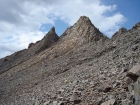
The ridge leading north to WCP-1.
|
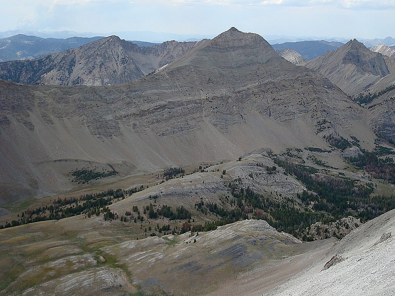
WCP-2 as seen from the summit of WCP-1.
|
Dropping down to Swimm Lake from the ridge to the north. The slope is gradual at first, but gets steeper real quick & makes for some dicey scree ski'n.
|
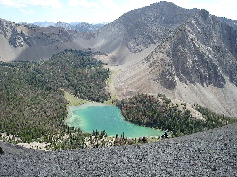
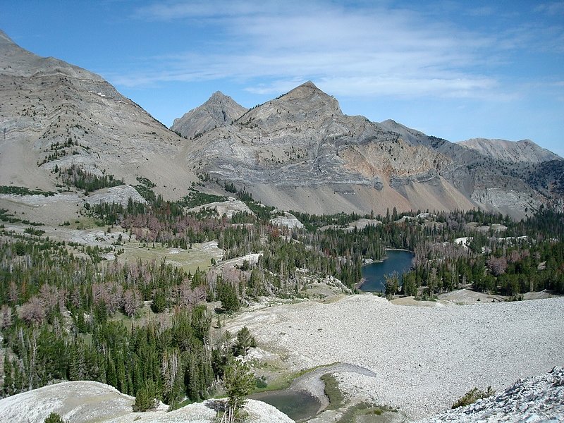
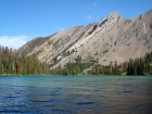
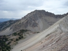
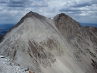
WCP-5 and Swimm Lake from the south face of WCP-2
|

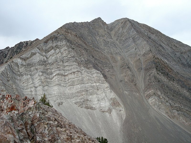
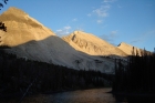
Alpenglow on WCP-5, from Swimm Lake.
|
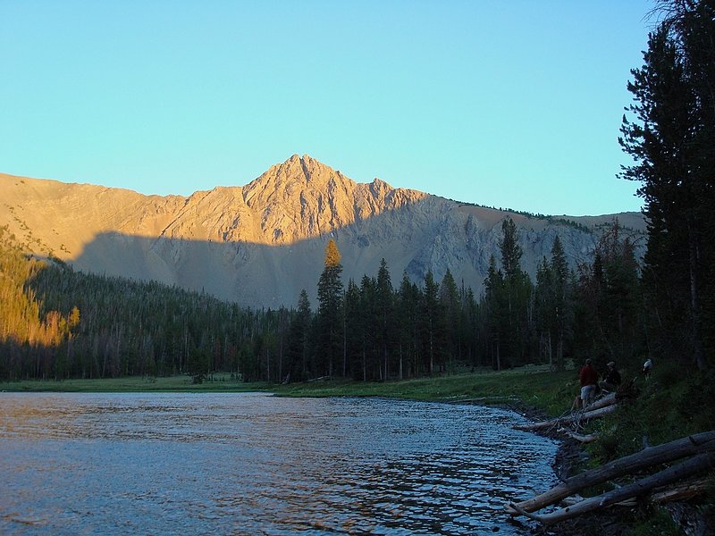
WCP-4 in the morning from Swimm Lake.
|
Looking up the southern slopes of WCP-2 from Swimm Lake.
|
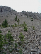
The gully we climbed to get from Swimm Lake to Iron Basin.
|
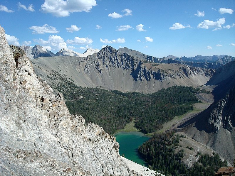
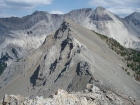
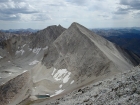
WCP-2 & WCP-3 from the ridge south of Swimm Lake.
|
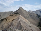
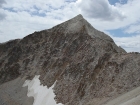
The steep east face of WCP-4.
|
Watson Peak as seen from the ridge east of WCP-4.
|
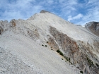
WCP-5 from the east ridge of WCP-4.
|

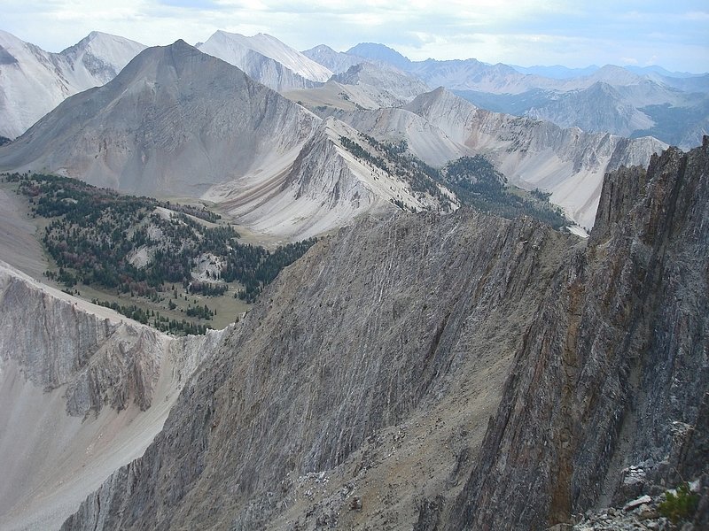
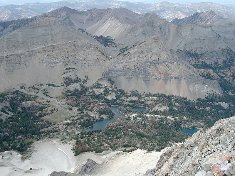
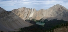
Summit view from WCP-4 looking across the east face, down to Iron Basin with WCP-7 in the background along with DO Lee etc.
|
WCP-4 from Iron Basin.
|
The northwest side of WCP-7 above Iron Basin. Photo taken from the talus slopes southeast of WCP-5.
|
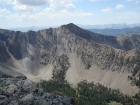
Looking through the WCP-6/WCP-7 saddle at Caulkens Peak and WCP-9.
|
The view down on WCP-6 from the east ridge of WCP-5.
|
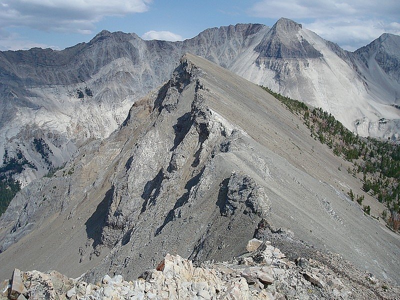
The twin summits of WCP-5 from the southeast.
|
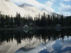
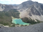
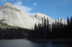
WCP-9 and David O Lee Peak reflecting in Ocalkens Lake. This short looks even better upside-down.
|
Alpenglow on Caulkens Peak, WCP-9, and David O Lee Peak above Ocalkens Lake.
|

Looking up at WCP-6 from the southeast corner of Ocalkens Lake.
|
The view south to WCP-8 from the slopes west of Caulkens Peak.
|

WCP-6 above Ocalkens Lake with WCP-5 in the background. Photo taken from the slopes west of Caulkens Peak.
|
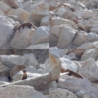
I came across this pair of Martens in the gully between Caulkens Peak and WCP-9, at around 10400' elevation.
|
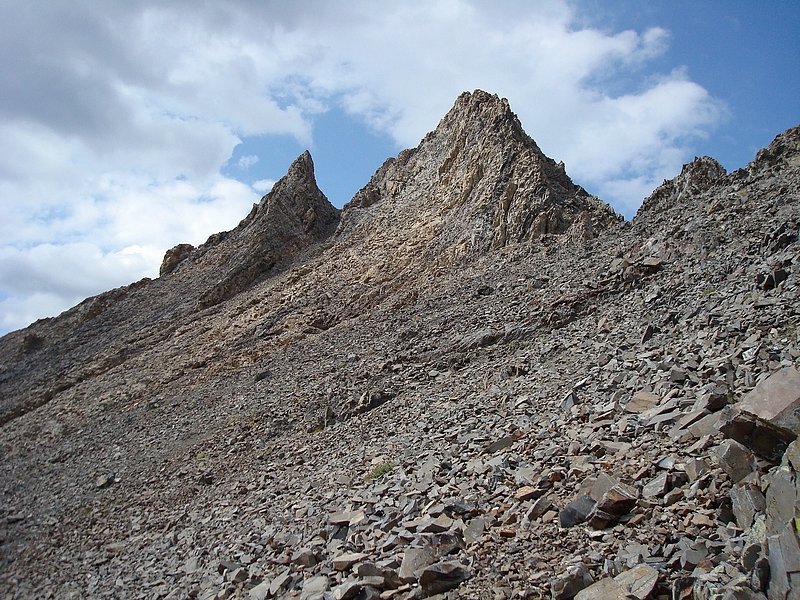
The south ridge of Caulkens Peak.
|
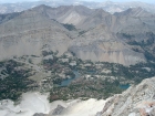
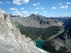
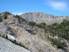
Ocalkens Lake from the summit of Caulkens Peak, with Iron Basin and the WCP's in the background.
|
WCP-9 from the south face of Caulkens Peak.
|
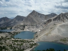
The Big Boulder Lakes and Peak 11272 from the start of WCP-9's east ridge.
|
South face of Caulkens Peak from WCP-9. I had descended the chute on the right, the one with snow patches at top and bottom.
|
David O Lee Peak from the east ridge of WCP-9.
|

Bighorn Basin and WCP-7 from WCP-9.
|
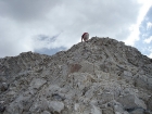
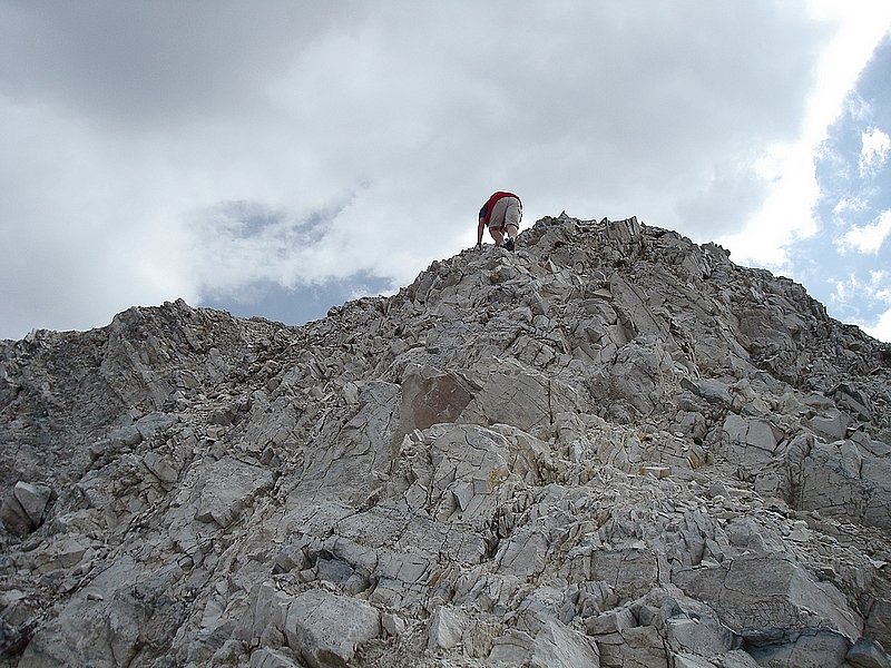
Ken finishing off the scramble at the top of the south ridge of David O Lee Peak.
|
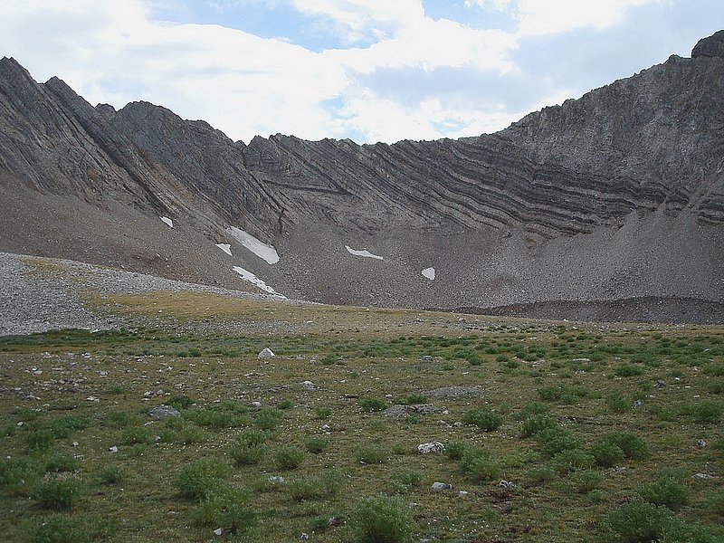
Neat looking z-shaped rock layers at the southern terminus of Bighorn Basin.
|
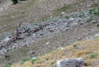
Sheep in Bighorn Basin. There's a ram and ewe in the lower left, with several other ewes and lambs scampering away in the upper right.
|
A herd of Bighorn Sheep crossing a hill in Bighorn Basin, with WCP-6 in the background.
|

WCP-9 and David O Lee Peak from Bighorn Basin.
|

Jordan sleeping at our Ocalkens Lake campsite.
|
Caulkens Peak, WCP-9, and David O Lee Peak from Ocalkens Lake.
|

A Red Fox on the shores of Ocalkens Lake.
|
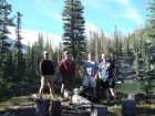
Group shot taken at our Ocalkens Lake campsite.
|
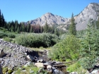
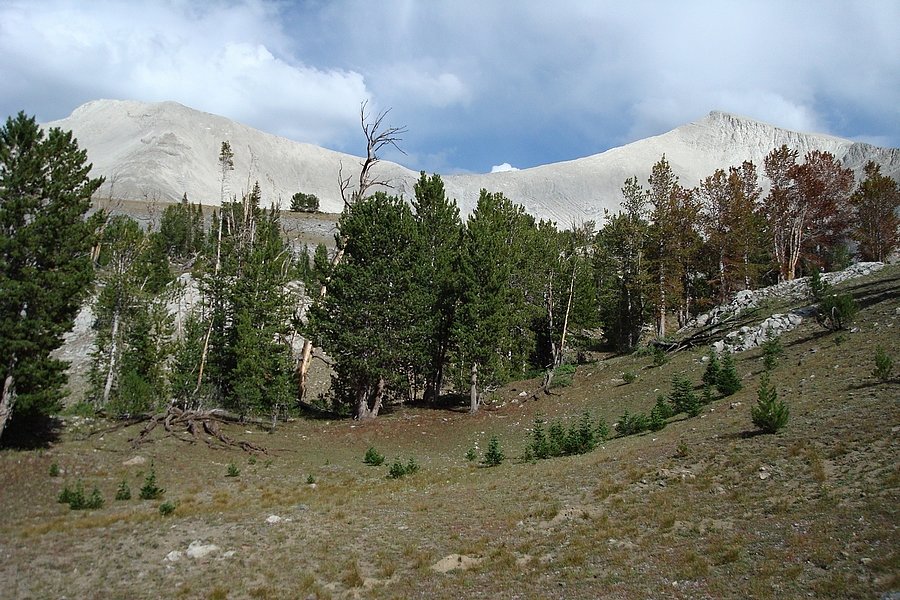
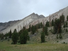
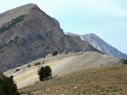
One last view of WCP-6 from the Slate Creek trail.
|
|