|
Idaho’s Sawtooth Mountains are known for their awesome scenery, with many well-known destinations. But there are plenty of lesser-known areas that are just as scenic. One of those areas is the Fly Trip Creek Basin, accessible from Alpine Creek. It takes some effort to reach this area, so the traffic is low. The solitude and scenery are excellent, but be prepared for some extensive off-trail navigation and occasional rock scrambling along the way.
Day 1
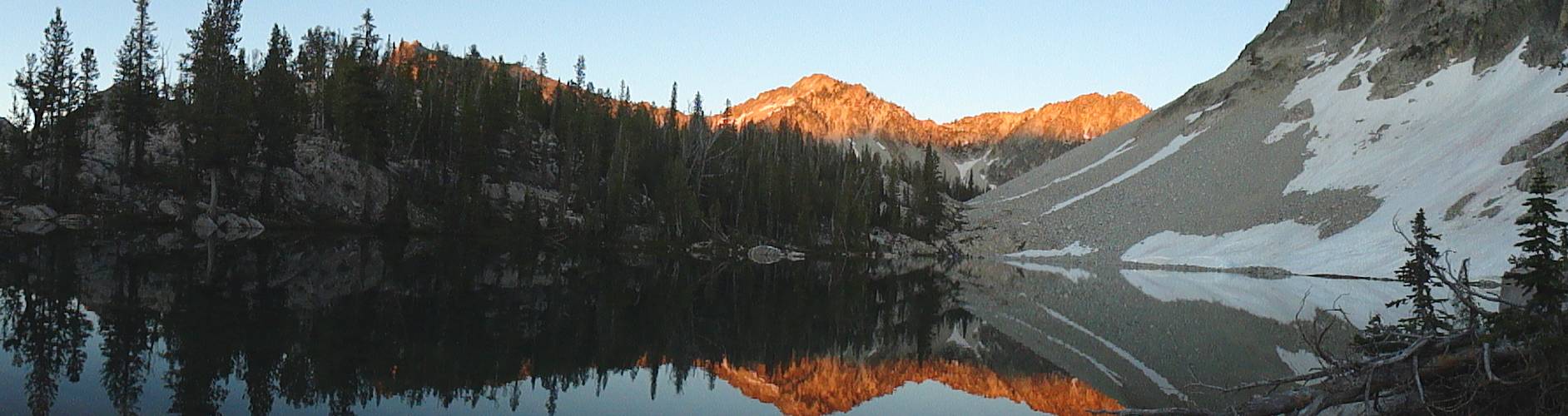
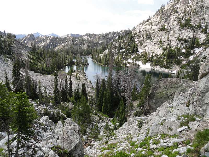
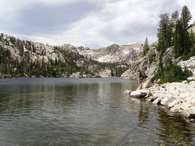
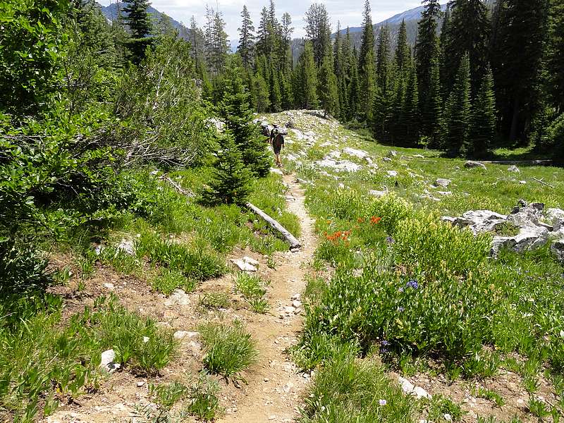
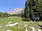
North Fork Alpine Creek Lakes: Our party of five (Jordan, Reed, JJ, Ken & Dave) hit the trail at about 11am, starting from the Alpine Creek trailhead near Alturas Lake. The first section was pretty mellow, and the trail was easy going as it wound its way through sagebrush and wildflowers. There were some great views of a jagged ridge to the north. After a couple miles, we entered a conifer forest zone to hike through, which got a little denser as we climbed. After a lunch break in the trees at the three-mile mark, the maintained trail ended, and we started making our way up steeper terrain up the north fork of Alpine Creek. The trail climbed through the forest, then eventually entered some wildflower filled meadows. This area was beautiful, and we soon reached the first lake at 8523’. After some fishing, we continued up the faint path. We visited a handful of small lakes before taking an extended break at a very scenic lake at around 9100’. We did a little fishing, and Ken practiced his cannon-ball technique off a big rock on one side of the snow-ringed lake. Based on his reaction upon entering the water, we decided it was too cold for the rest of us.
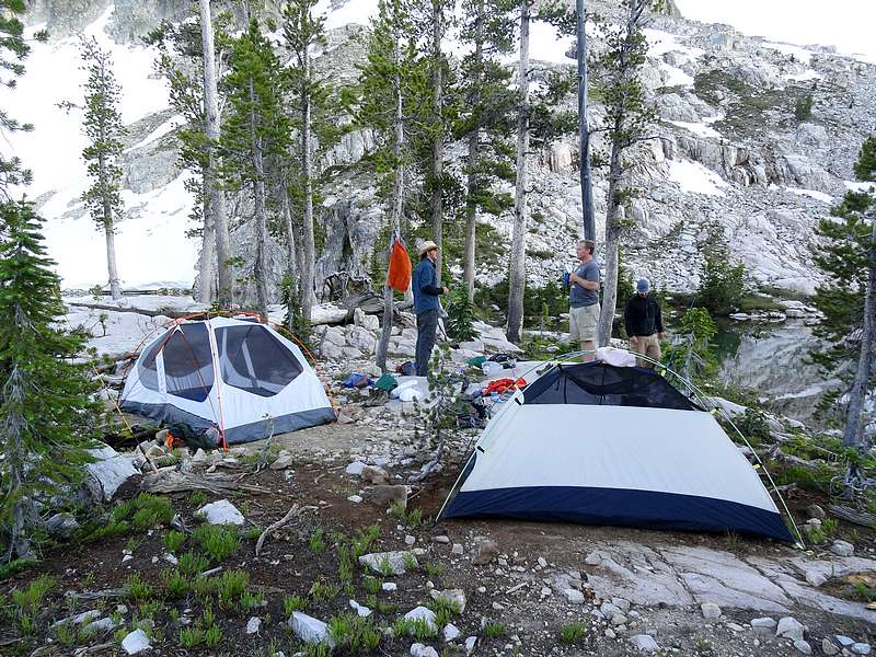
 From there, it was a short wander to the larger upper lakes. Still lots of snow up there in late July. I’d was hoping to climb over the pass into the Fly Trip drainage, but fortunately JJ talked me into hanging back. The lakes were beautiful, and we were able to find just enough flat ground without snow to set up camp at Lake 9050’. It was a very cool setting. Ken and I fished our way around the lake, catching Rainbow, Golden, and Grayling along the way. Then it was back to camp for some quesadillas and a well deserved rest. From there, it was a short wander to the larger upper lakes. Still lots of snow up there in late July. I’d was hoping to climb over the pass into the Fly Trip drainage, but fortunately JJ talked me into hanging back. The lakes were beautiful, and we were able to find just enough flat ground without snow to set up camp at Lake 9050’. It was a very cool setting. Ken and I fished our way around the lake, catching Rainbow, Golden, and Grayling along the way. Then it was back to camp for some quesadillas and a well deserved rest.
Day 2
 Snowyside Peak Climb: I got up early to give myself enough of a head start so that the others wouldn’t have to wait too long while I climbed Snowyside Peak. I made the hike up to the saddle, crossing a few frozen snowfields along the way, and then dropped my big pack at the saddle before heading up the southwest ridge. The first two-thirds of the climb was straightforward class 2 hiking following the goat trails through the talus. Higher up, it got much more interesting. The ridge got steeper, which led to some fun scrambling on the stable granite. It was a blast. The summit views were fantastic, with tons of lakes visible in all directions. I didn’t want to leave, but I knew the others would be waiting for me, so I had to head down. Round trip from the saddle was just over a mile, with 1100 feet of elevation gain. It too me an hour and a half round trip, and I got back to the saddle just a couple minutes after the others. Snowyside Peak Climb: I got up early to give myself enough of a head start so that the others wouldn’t have to wait too long while I climbed Snowyside Peak. I made the hike up to the saddle, crossing a few frozen snowfields along the way, and then dropped my big pack at the saddle before heading up the southwest ridge. The first two-thirds of the climb was straightforward class 2 hiking following the goat trails through the talus. Higher up, it got much more interesting. The ridge got steeper, which led to some fun scrambling on the stable granite. It was a blast. The summit views were fantastic, with tons of lakes visible in all directions. I didn’t want to leave, but I knew the others would be waiting for me, so I had to head down. Round trip from the saddle was just over a mile, with 1100 feet of elevation gain. It too me an hour and a half round trip, and I got back to the saddle just a couple minutes after the others.
 Flytrip Creek Basin: Next was the descent into the Fly Trip Creek Basin. From the saddle, we headed north across the boulders, talus, and snowfields. The frozen snow made the travel pretty easy since it covered to loose rock. We made our way toward the upper lake, then played connect to dots down the string of lakes. It was very pretty, with the north ridge of Snowyside creating a rugged backdrop behind us. We stopped for lunch at PS Lake (8646’), then had another extended fishing stop at Heart Lake (8562’). From there we headed down to Camp Lake and then began a nice bushwhacking adventure. We basically followed the 8200’ contour around to the trail for Spangle Lake. It wasn’t all that bad, just a little taxing in our big packs. Once at Spangle, we fished for a while, had some conversations about me being a slave driver, and then decided to head up to Lake Ingeborg to camp for the night. Flytrip Creek Basin: Next was the descent into the Fly Trip Creek Basin. From the saddle, we headed north across the boulders, talus, and snowfields. The frozen snow made the travel pretty easy since it covered to loose rock. We made our way toward the upper lake, then played connect to dots down the string of lakes. It was very pretty, with the north ridge of Snowyside creating a rugged backdrop behind us. We stopped for lunch at PS Lake (8646’), then had another extended fishing stop at Heart Lake (8562’). From there we headed down to Camp Lake and then began a nice bushwhacking adventure. We basically followed the 8200’ contour around to the trail for Spangle Lake. It wasn’t all that bad, just a little taxing in our big packs. Once at Spangle, we fished for a while, had some conversations about me being a slave driver, and then decided to head up to Lake Ingeborg to camp for the night.
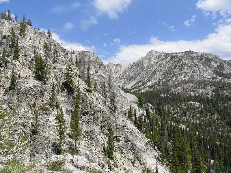
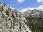
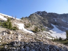
 Benedict Peak Climb: I left Spangle first while the others fished, and hiked up to Ingeborg. I dropped my pack there before heading out for a climb of Benedict Peak (Peak 9930’). From the north end of the lake, I wandered up through the trees, and then angled across the talus-covered face on the way to Benedict’s southeast ridge. The ridge was very cool, with lots of great views. At the point where the ridge turns north, there was a tower to bypass. I dropped off to the south side, and did some fun boulder hopping through the refrigerator-sized rocks. Then it was back to the ridge for the final climb to the summit. The peak had dramatic cliffs on the north and east sides. The Rakers stared me in the face from the west. I then retraced my path back to Ingeborg, having covered 3.6 miles round trip and 1000 of elevation gain on the climb. Benedict Peak Climb: I left Spangle first while the others fished, and hiked up to Ingeborg. I dropped my pack there before heading out for a climb of Benedict Peak (Peak 9930’). From the north end of the lake, I wandered up through the trees, and then angled across the talus-covered face on the way to Benedict’s southeast ridge. The ridge was very cool, with lots of great views. At the point where the ridge turns north, there was a tower to bypass. I dropped off to the south side, and did some fun boulder hopping through the refrigerator-sized rocks. Then it was back to the ridge for the final climb to the summit. The peak had dramatic cliffs on the north and east sides. The Rakers stared me in the face from the west. I then retraced my path back to Ingeborg, having covered 3.6 miles round trip and 1000 of elevation gain on the climb.
Day 3
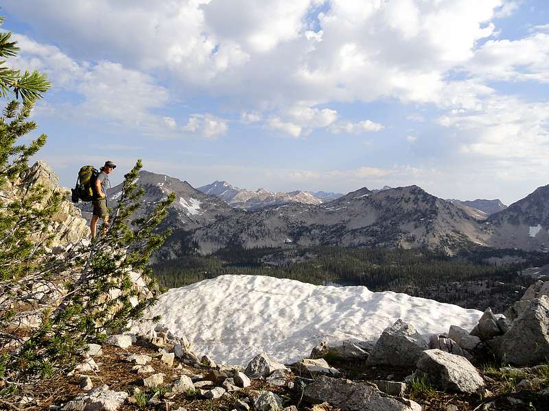
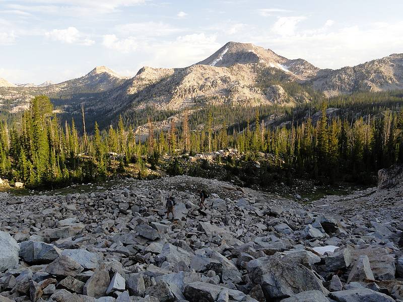
 Exploring Ten Lake Basin: The next morning we split up and headed in various directions. JJ and Jordan hiked over to Rock Slide Lake. Ken and Reed fished Ingeborg and Spangle. And I headed to Ten Lake Basin for some exploring. I backtracked along the trail to Spangle, and then took the trail toward Ardeth. From the Ardeth saddle, I had to carefully cross a few snowfields on the north facing slopes, and then left the trail at the easternmost switchback at around 8000’. I contoured through the talus and boulders, aiming for a faint saddle that held an outlet stream from Ten Lake Basin. The alpine scenery, and the crystal clear water in the first lake immediately dazzled me. I could see trout swimming in the lake, and of course stopped for some fishing. I got a few nibbles, but most of the fish were too busy spawning in the gravel to have any interest in my lure. My solo tour through Tenlake Basin was probably the highlight of the trip. I was very impressed by the area. I stopped for lunch at the eastern end of the basin, while I eyed the upcoming climb to the saddle east of Glens Peak. There was quite a bit of snow lingering, which made for easy hiking in the softening mid-day snow. The 300’ climb took less than 20 minutes. Exploring Ten Lake Basin: The next morning we split up and headed in various directions. JJ and Jordan hiked over to Rock Slide Lake. Ken and Reed fished Ingeborg and Spangle. And I headed to Ten Lake Basin for some exploring. I backtracked along the trail to Spangle, and then took the trail toward Ardeth. From the Ardeth saddle, I had to carefully cross a few snowfields on the north facing slopes, and then left the trail at the easternmost switchback at around 8000’. I contoured through the talus and boulders, aiming for a faint saddle that held an outlet stream from Ten Lake Basin. The alpine scenery, and the crystal clear water in the first lake immediately dazzled me. I could see trout swimming in the lake, and of course stopped for some fishing. I got a few nibbles, but most of the fish were too busy spawning in the gravel to have any interest in my lure. My solo tour through Tenlake Basin was probably the highlight of the trip. I was very impressed by the area. I stopped for lunch at the eastern end of the basin, while I eyed the upcoming climb to the saddle east of Glens Peak. There was quite a bit of snow lingering, which made for easy hiking in the softening mid-day snow. The 300’ climb took less than 20 minutes.
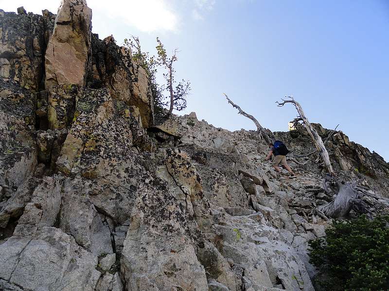
 Glens Peak Climb: Once at the saddle, I dropped my big pack and began the climb up the east ridge of Glens Peak. It was steep in places, but the rock was solid, which made for some fun exposed class 3 scrambling. As I got higher, the ridge became steeper and the exposure grew. There was one spot above me that would require an airy class 4 friction move, so I retreated to the south face for some safer climbing. Near the summit, the ridge got much flatter, and it became an easy stroll to the highpoint. The summit was a great vantage point to survey the terrain we’d been exploring during the past few days. On top I found the USFS marker placed by Arval Anderson in 1927. The views and weather were great, so I hung out for a while having a snack and snapping photos. The down climb was straightforward, and I returned to my pack after a side trip of 1.3 miles round trip and 850’ gain. Glens Peak Climb: Once at the saddle, I dropped my big pack and began the climb up the east ridge of Glens Peak. It was steep in places, but the rock was solid, which made for some fun exposed class 3 scrambling. As I got higher, the ridge became steeper and the exposure grew. There was one spot above me that would require an airy class 4 friction move, so I retreated to the south face for some safer climbing. Near the summit, the ridge got much flatter, and it became an easy stroll to the highpoint. The summit was a great vantage point to survey the terrain we’d been exploring during the past few days. On top I found the USFS marker placed by Arval Anderson in 1927. The views and weather were great, so I hung out for a while having a snack and snapping photos. The down climb was straightforward, and I returned to my pack after a side trip of 1.3 miles round trip and 850’ gain.
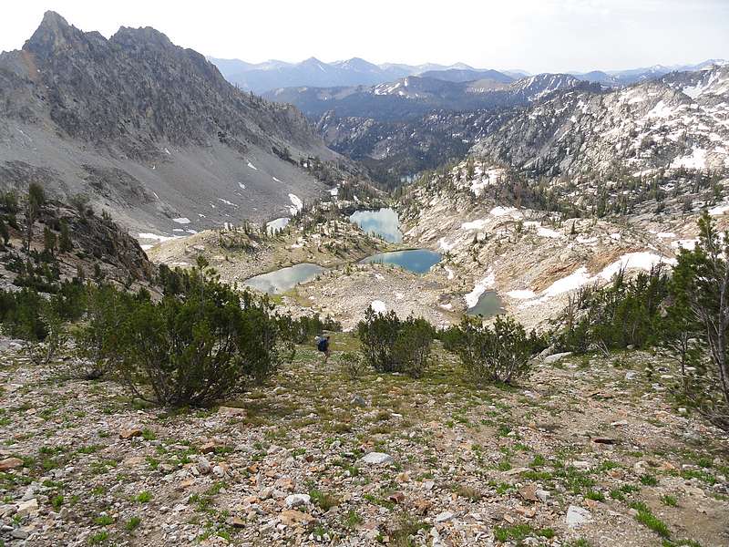
Crossing Flytrip Creek Basin: Next I descended to the south toward the cluster of lakes shown on the map at 8900’, just east of Glens. It must be a high-water year, as the cluster seemed like one large lake. It was very pretty, and it would have been tempting to camp there if it weren’t for the fact that I needed to meet the other guys later on. So down I went to Heart Lake, and then continued bushwhacking south for some more connecting the lake dots. I met the other guys at Fly Trip Lake #1 (the large lake that sits below the north face of Peak 9963’). They’d been there for about an hour. We’d read reports that the lake was full of fish, but there wasn’t a single one to be seen this year. But it was a beautiful and rugged setting, and made for a great campsite. After setting up camp, I wandered east to explore the upper lakes. They were very scenic. I made it back to camp just in time to witness an awesome alpenglow sunset on the ridge above our lake. Awesome.
Day 4
 Climbing “Alpine Creek Lakes Peak” (Peak 9963’): We awoke the next morning to some raindrops and blowing wind indicating some weather might be heading our way. Needless to say the thought of climbing an exposed ridge in a rainstorm wasn’t very appealing, so we broke camp quickly and were hiking by 7am. Fortunately, the bad weather never materialized. After angling around to a low saddle west of the peak, we began the climb. The 1000’ climb may have killed us on Day 1, but I think our bodies were getting used to the workout by Day 4, so we made pretty good time climbing up through the boulders on our way to the upper ridge. After a quick break for some great photos and giving Ken a chance to from some dizziness (the sudden steep drop off the north side of the ridge caught him by surprise), we headed up the ridge to the summit. From the highpoint, we soaked in the views, trying to identify various peak in the difference. It was a great vantage point. Climbing “Alpine Creek Lakes Peak” (Peak 9963’): We awoke the next morning to some raindrops and blowing wind indicating some weather might be heading our way. Needless to say the thought of climbing an exposed ridge in a rainstorm wasn’t very appealing, so we broke camp quickly and were hiking by 7am. Fortunately, the bad weather never materialized. After angling around to a low saddle west of the peak, we began the climb. The 1000’ climb may have killed us on Day 1, but I think our bodies were getting used to the workout by Day 4, so we made pretty good time climbing up through the boulders on our way to the upper ridge. After a quick break for some great photos and giving Ken a chance to from some dizziness (the sudden steep drop off the north side of the ridge caught him by surprise), we headed up the ridge to the summit. From the highpoint, we soaked in the views, trying to identify various peak in the difference. It was a great vantage point.
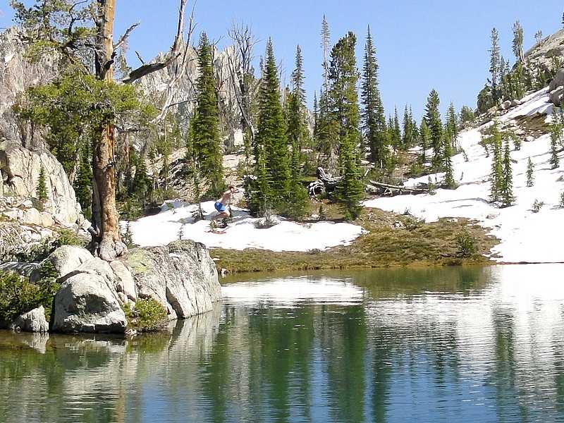
 Descending the Middle Fork of Alpine Creek: From the summit, we headed down the southwest ridge for a little ways, and then dropped down the slopes toward the lakes. It wouldn’t have been much fun to climb up, but descending wasn’t too bad. The upper lakes were pretty. At one point I got distracted by the scenery, which caused Ken and I to get separated from the others. We eventually determined that they had headed down to the larger lower lakes, so we followed suit. The sketchy trail descended next to a waterfall above Lake 8662’, and then made its way down to the largest lake at 8522’. We hiked along the north shore, and stopped for some good fishing along the way. Once at east end of the lake, we packed up our rod and reels for good, and headed down. I was amazed by the “trail” in this section. It was steep and rocky, with some class 3 scrambling in many places. It was definitely not a family friendly hiking trail. But it made for a good adventure. Soon enough, we were back down in the trees and back on the trail we’d used to hike in three days earlier. The temperatures increased as we hike through the wildflowers and sagebrush back to the trailhead, so we were plenty happy to reach the car and with some fresh clothes waiting for us. Yet another great backpacking adventure was in the books. Descending the Middle Fork of Alpine Creek: From the summit, we headed down the southwest ridge for a little ways, and then dropped down the slopes toward the lakes. It wouldn’t have been much fun to climb up, but descending wasn’t too bad. The upper lakes were pretty. At one point I got distracted by the scenery, which caused Ken and I to get separated from the others. We eventually determined that they had headed down to the larger lower lakes, so we followed suit. The sketchy trail descended next to a waterfall above Lake 8662’, and then made its way down to the largest lake at 8522’. We hiked along the north shore, and stopped for some good fishing along the way. Once at east end of the lake, we packed up our rod and reels for good, and headed down. I was amazed by the “trail” in this section. It was steep and rocky, with some class 3 scrambling in many places. It was definitely not a family friendly hiking trail. But it made for a good adventure. Soon enough, we were back down in the trees and back on the trail we’d used to hike in three days earlier. The temperatures increased as we hike through the wildflowers and sagebrush back to the trailhead, so we were plenty happy to reach the car and with some fresh clothes waiting for us. Yet another great backpacking adventure was in the books.
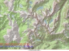
Map of our trip. Base route was 27 miles and 6400' gain, or 34.5 miles and 9550' gain with side trips.
|
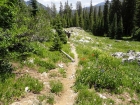
Early in the hike.
|

Cannonball Ken.
|

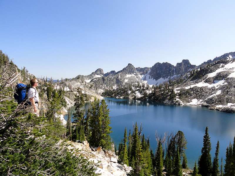
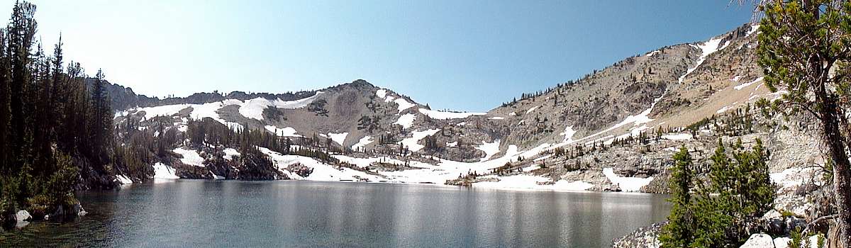
Lake 9167' panoramic view.
|

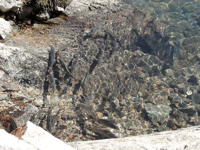
Arctic Grayling spawning in the lake.
|

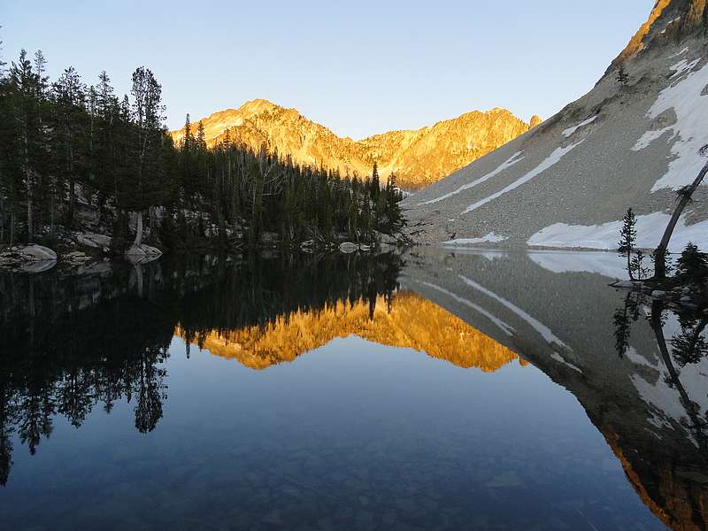
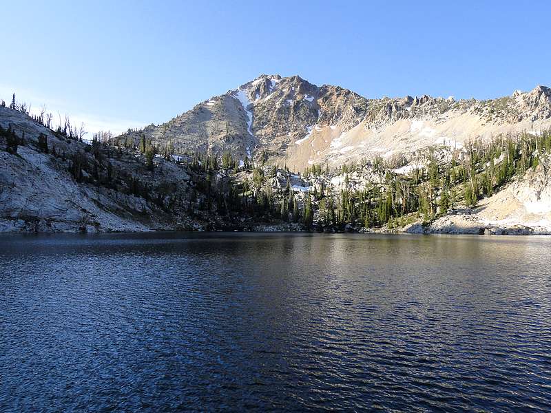
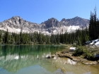
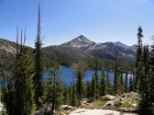
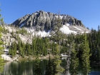
Snowyside Peak from Lake 9050'.
|

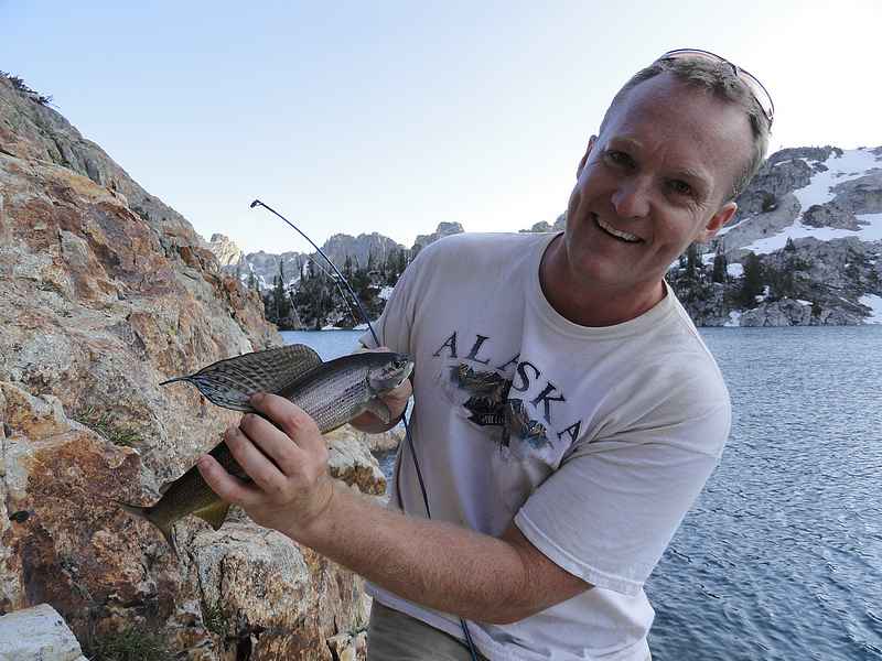
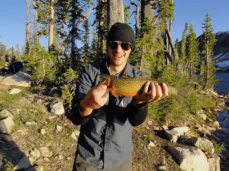
Ken caught this Grayling at the end of the day.
|
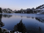
Dusk at Lake 9050'.
|
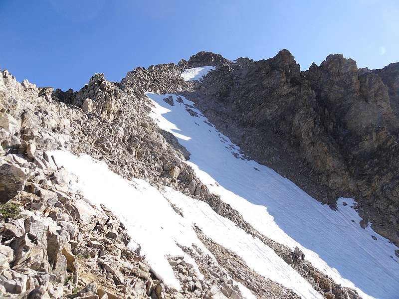
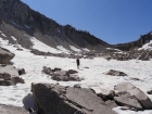
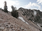
Climbing toward Snowyside pass.
|

Looking back at the upper Alpine Creek Lakes.
|
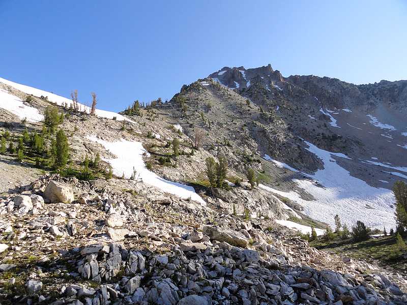
Peak 9963' from Snowyside's southwest ridge.
|
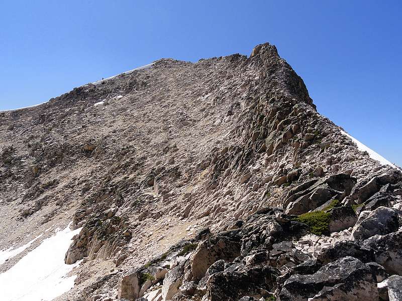
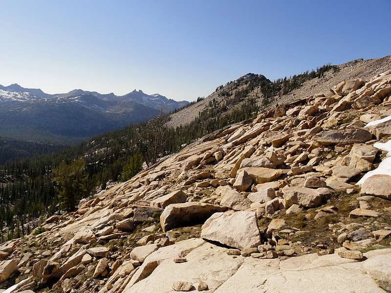
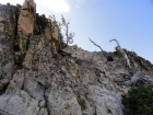
Final scramble section of the Snowyside Peak climb.
|
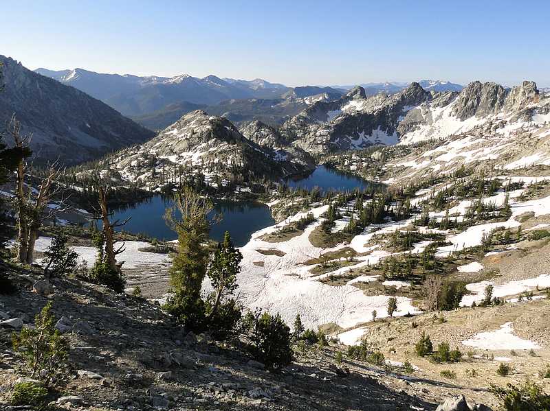
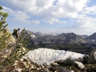
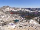
Flytrip Creek Basin from the summit of Snowyside Peak.
|
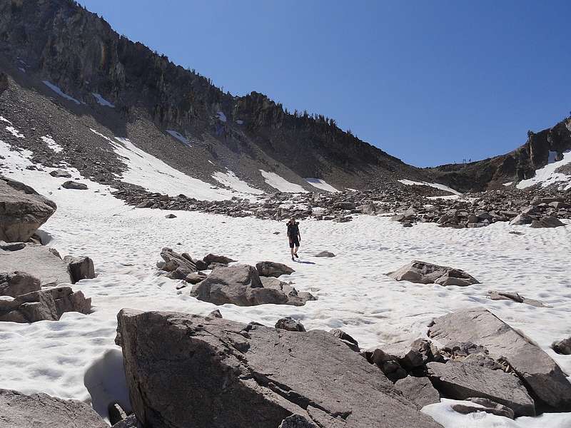
Crossing snowfields as we drop into the Flytrip Basin.
|
Impressive north ridge of Snowyside Peak from one of the upper lakes.
|
Approach to Benedict Peak, with the Rakers in the background.
|
Looking back on Lake Ingeborg and the ridge to Benedict Peak.
|

Large Cutthroat the Reed caught.
|
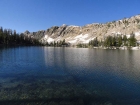
Lake Ingeborg in the morning.
|
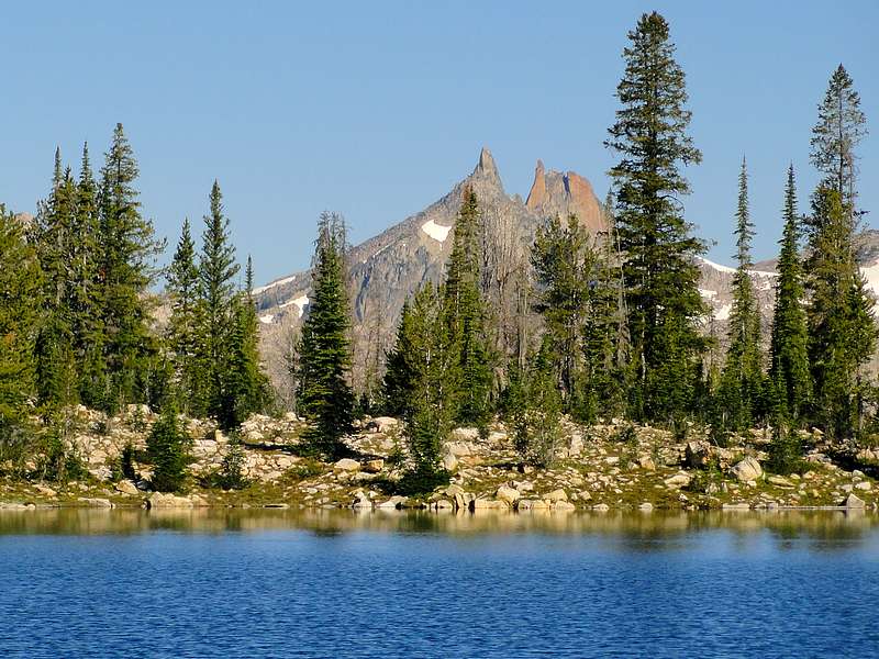
Zoom in of the Rakers from Ingeborg.
|
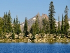
Glens Peak and Spangle Lake.
|
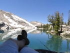
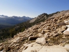
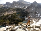
Me taking a break in Ten Lake Basin.
|

Climbing a snowfield to the pass above Ten Lake Basin.
|
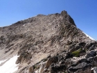
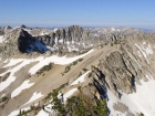
Very steep section on the east ridge of Glens Peak.
|
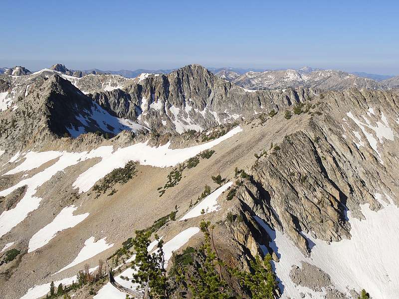
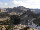
Glens Peak view of Flytrip Basin. Snowyside on the left, Peak 9963' on the right.
|
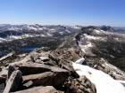
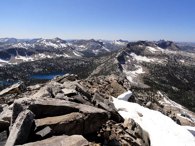
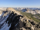
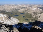
Glens Peak summit view. Spangle and Ingeborg on the left, Rakers and Benedict Peak on the right.
|
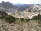
Beautiful lake just east of Glens Peak.
|
North face of Peak 9963' above one of the Flytrip Lakes.
|
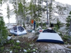
We had an abundance of intelligent conversation at camp.
|

Crossing a boulder field below Peak 9963', with Glens Peak in the background.
|
Looking toward the summit of Peak 9963' as we near the ridge.
|
JJ perched on the ridge with the some of the Flytrip lakes far below.
|
Ken on the final climb to the summit of Peak 9963'.
|
View from the summit of Peak 9963' of Snowyside Peak, Flytrip Lakes below.
|
Ken descending into the middle fork of Alpine Creek.
|
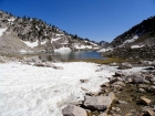
Beautiful lake high in the middle fork Alpine Creek cirque.
|

Descending to Lake 8662'.
|

Jordan Flyfishing at Lake 8522'.
|
View before dropping into the Alpine Creek valley.
|
Wildflowers next to the trail during the hike out.
|
|