|
White Cloud Backpacking 2015
Epic White Cloud Backpacking Loop
Combining several White Cloud highlight areas into one unforgettable trip
June 26-29, 2015
|
Related Links:
- Tom Oetzell Photos
- Trailhead Location
- Strawberry Point: TL, LOJ, Map
- West Strawberry Peak: LOJ, Map
- Little Strawberry Peak: LOJ, Map
- Watson Peak: TL, PB, LOJ, Map
- White Cloud Peak #9: TL, SP, PB, LOJ, Map
- David O. Lee Peak: TL, SP, PB, LOJ, Map
- Peak 11272': TL, SP, PB, LOJ, Map
- Pats Peak: TL, LOJ, Map
|
The White Cloud Mountains are home to some of the best scenery you will find anywhere. Tons of tall peaks, stunning alpine lakes, and wildflower filled meadows fill the range. But there is a distinct lack of maintained trails. That, combined with rugged the lay of the land, makes it hard to come up with good long loop backpacking options. However, with a little (or lot of) work, it is possible to do one epic backpacking loop that connects many of the highlight areas of the White Clouds, including: Strawberry Basin, Iron Basin, Bighorn Basin, Big Boulder Lakes, Boulder Chain Lakes, and Antz Basin.
I’d hatched up this mostly off-trail 4-day trip to the White Clouds a couple months ago, and my brother Ken ended up being the only willing participant in the epic backpacking loop. Although he later admitted he hadn’t really studied the planned route very closely. After leaving Boise around 7:30am, we were on our feet and hiking by 11am from the Fourth of July trailhead.
Day 1: Fourth of July Trailhead, Strawberry Basin, Warm Springs Creek, Iron Basin
From the trailhead, we began wandering north through the trees toward the saddle southwest of Blackmon Peak. There had once been an old mining road, but the Forest Service did extensive work a few years ago to return it to a natural state, so we mostly bushwhacked our way up. Once the saddle, the old road which is now a trail, becomes more obvious and we made quick time to the mouth of Strawberry Basin.
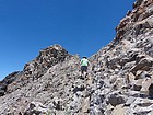
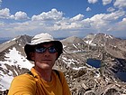
 We dropped off our packs above Strawberry Basin, then made the one mile class 3 ridge traverse to the summit of Strawberry Point (Peak 10111’). This ridge defines the east side of Strawberry Basin. The views in all directions were spectacular, and we even saw 4 mountain goats along the way. After retracing our steps back to our packs, Ken then headed down into Strawberry Basin while I traversed the ridge along the west side of the basin. I was able to tag two peaks along the ridge. The first was “West Strawberry Peak” (Peak 10132’), and then my turnaround point at “Little Strawberry Peak” (Peak 9958’). The terrain was mellow, but the views and wildflowers were excellent. Plus I got to within 50 yards of another mountain goat resting on a snowbank. We dropped off our packs above Strawberry Basin, then made the one mile class 3 ridge traverse to the summit of Strawberry Point (Peak 10111’). This ridge defines the east side of Strawberry Basin. The views in all directions were spectacular, and we even saw 4 mountain goats along the way. After retracing our steps back to our packs, Ken then headed down into Strawberry Basin while I traversed the ridge along the west side of the basin. I was able to tag two peaks along the ridge. The first was “West Strawberry Peak” (Peak 10132’), and then my turnaround point at “Little Strawberry Peak” (Peak 9958’). The terrain was mellow, but the views and wildflowers were excellent. Plus I got to within 50 yards of another mountain goat resting on a snowbank.
By the time I met with Ken at our meeting point in Strawberry Basin, it was after 6pm and we still had some ground to cover. So down the valley we went. Surprisingly, there was a pretty decent trail for a while. But that later disappeared, and we were left with some heavy duty bushwhacking through downed trees before reaching Warm Springs Creek.
 We found a great trail just north of Warm Springs Creek. There were a few sets of mountain bike tracks, but more noteworthy were the fresh bear tracks on the trail. Fortunately it was heading uphill, and we were heading downhill. We made good time along the trail, but it was still after 8am by the time we made it to the mouth of Iron Basin. The map showed that there should be a trail, but we had no luck finding it down low, even with some backtracking. We were pretty tired at this point, but wanted to get the climb out of the way now instead of waiting for morning. So up the steep hillside we went. It was painfully slow, but we kept plugging along. Miraculously, we happened upon a well-constructed trail a few hundred feet above the creek to the east. This raised our spirits for a while, and allowed us to make a little quicker time up the steep walled valley. We found a great trail just north of Warm Springs Creek. There were a few sets of mountain bike tracks, but more noteworthy were the fresh bear tracks on the trail. Fortunately it was heading uphill, and we were heading downhill. We made good time along the trail, but it was still after 8am by the time we made it to the mouth of Iron Basin. The map showed that there should be a trail, but we had no luck finding it down low, even with some backtracking. We were pretty tired at this point, but wanted to get the climb out of the way now instead of waiting for morning. So up the steep hillside we went. It was painfully slow, but we kept plugging along. Miraculously, we happened upon a well-constructed trail a few hundred feet above the creek to the east. This raised our spirits for a while, and allowed us to make a little quicker time up the steep walled valley.
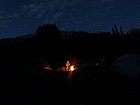 By the time the valley below Iron Basin started opening up, it was nearly 10pm, so we decided to make camp at about 8700’ in a scenic spot amongst the sagebrush. Ken had carried in same bratwurst and buns, so we gathered some wood and cooked over the fire. A great way to finish a long day. By the time the valley below Iron Basin started opening up, it was nearly 10pm, so we decided to make camp at about 8700’ in a scenic spot amongst the sagebrush. Ken had carried in same bratwurst and buns, so we gathered some wood and cooked over the fire. A great way to finish a long day.
Day 2: Iron Basin, Ocalkins Lake, Bighorn Basin, Big Boulder Lakes
In the morning, Ken stayed at camp while I climbed Watson Peak. From our campsite, I headed up the prominent gully on the east face of the peak. It seemed to take a long time, but eventually I crested Watson’s south ridge, where I was treated with great views of the Sawtooths in the distance. Once on the ridge, it was a straightforward climb to the summit. The views from the top were great, but I had to hurry back since it had taken me over two hours to climb the 1700’ up from camp. On the way down, I retraced my path down the gully, and all went smoothly.
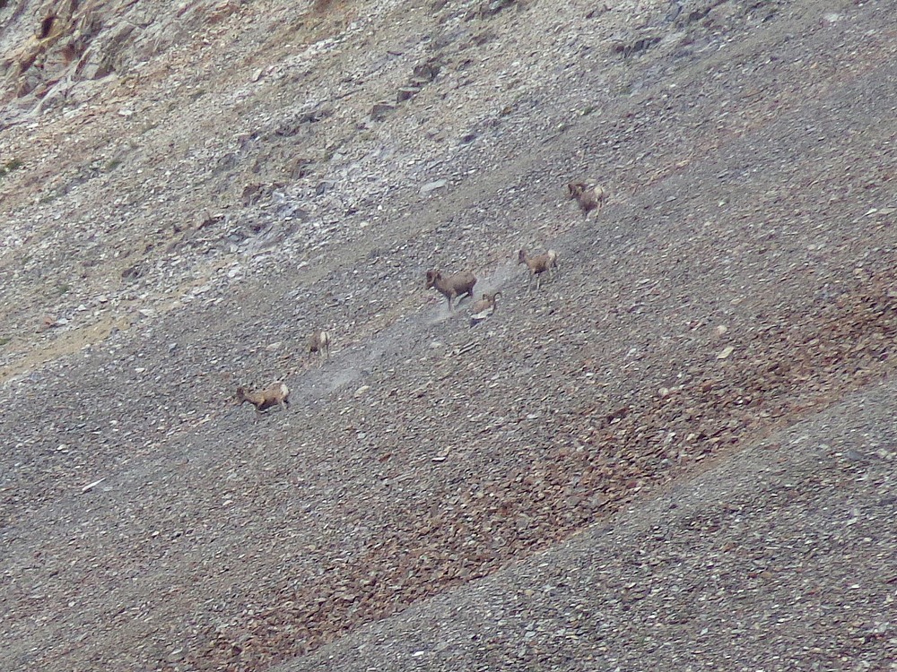
Because of my morning climb of Watson, we didn’t break camp until after 10am. Not exactly an early start. We made our way up through Iron Basin. The trail was sporadic at best, but the terrain was open so navigation was easy. In addition to the abundant wildflowers, the highlight of this area was spotting six bighorn rams up on the talus slope in the west end of the basin. My best guess is that these young males were outcasts from the main herd. Even in the distance, we could make out their curled horns. It was very cool.
 After a few hours of hiking, we made it to the east end of Iron Basin where we were treated to some amazing views of the northern White Cloud triumvirate of Caulkins Peak, White Cloud Peak #9, and David O Lee Peak. It was a great place for a lunch stop. The views were spectacular, but we were intimidated by the looks of the high pass we’d have to cross later in the afternoon. More on that later. After a few hours of hiking, we made it to the east end of Iron Basin where we were treated to some amazing views of the northern White Cloud triumvirate of Caulkins Peak, White Cloud Peak #9, and David O Lee Peak. It was a great place for a lunch stop. The views were spectacular, but we were intimidated by the looks of the high pass we’d have to cross later in the afternoon. More on that later.
 Ocalkens Lake was our next destination, and we made a quick stop there to pump some water before heading south up into Bighorn Basin. The afternoon sun was warm, so we set a slow but steady pace while hiking through the very open terrain. Wildflowers and views were abundant, and soon enough we made it to the large upper shelf of the basin. At this point we spotted some Bighorn Sheep hanging out around a snowfield. We eventually counted a total of nearly forty of them! The highlight was the lambs playfully bouncing all over the place. Ocalkens Lake was our next destination, and we made a quick stop there to pump some water before heading south up into Bighorn Basin. The afternoon sun was warm, so we set a slow but steady pace while hiking through the very open terrain. Wildflowers and views were abundant, and soon enough we made it to the large upper shelf of the basin. At this point we spotted some Bighorn Sheep hanging out around a snowfield. We eventually counted a total of nearly forty of them! The highlight was the lambs playfully bouncing all over the place.
 Next it was time for our big climb of the day. To get to the Big Boulder Lakes, we had to cross the high saddle between White Cloud Peak #9 and DO Lee Peak. Ken suggested we climb the dark firm looking rock on the west buttress of WCP-9. This worked out well. It was steep but stable, and we slowly climbed up past the highest outcropping before side-hilling across the face to the saddle using a sheep trail. Next it was time for our big climb of the day. To get to the Big Boulder Lakes, we had to cross the high saddle between White Cloud Peak #9 and DO Lee Peak. Ken suggested we climb the dark firm looking rock on the west buttress of WCP-9. This worked out well. It was steep but stable, and we slowly climbed up past the highest outcropping before side-hilling across the face to the saddle using a sheep trail.
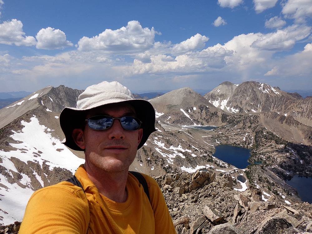
It was nearly 7pm by the time we reached the saddle overlooking the Big Boulder Lakes. But I couldn’t resist climbing both WCP-9 and DO Lee Peak since their summits were so close. Ken waited at the saddle while I made the quick climb up WCP-9. He then headed down to make camp at Sapphire Lake while I climbed DO Lee Peak. The ridge was steep but straightforward, and the snow that usually guards the top of the ridge until late July had already melted thanks to a dry winter and hot summer. I soaked in the views from the summit of DO Lee for a while, but it was getting late and I still had some ground to cover to reach the campsite.
 After a quick descent back to the saddle, I grabbed my pack and then headed down a sheep trail toward the lakes. I skirted the south side of Cirque Lake, then dropped down to Sapphire Lake where Ken was waiting. We had a late dinner then planned to turn in. But I was still wired from the day’s excitement so sleep did not come quickly. After a quick descent back to the saddle, I grabbed my pack and then headed down a sheep trail toward the lakes. I skirted the south side of Cirque Lake, then dropped down to Sapphire Lake where Ken was waiting. We had a late dinner then planned to turn in. But I was still wired from the day’s excitement so sleep did not come quickly.
Day 3: Big Boulder Lakes, Peak 11727’, Pats Peak, Boulder Chain Lakes
I didn’t sleep well that night and was up by about 6am. The sunrise at Sapphire Lake was just amazing, with the brilliant east face cliffs of DO Lee Peak reflecting the sun. I grabbed the camera and the fishing pole and headed down to the lake, where I made good use of both.
 After breakfast, we made the slow walk around Sapphire Lake and down to Cove Lake. The going was slow because it was impossible not to stop and gawk at the amazing views. These lakes are one of the most scenic places on the planet. From Cove Lake, we headed south toward another high ridge crossing. Our target was the high saddle just west of Point 10881’, from which point we could access the upper Boulder Chain Lakes. After breakfast, we made the slow walk around Sapphire Lake and down to Cove Lake. The going was slow because it was impossible not to stop and gawk at the amazing views. These lakes are one of the most scenic places on the planet. From Cove Lake, we headed south toward another high ridge crossing. Our target was the high saddle just west of Point 10881’, from which point we could access the upper Boulder Chain Lakes.
Our first order of business was to side-hill across a boulder and talus field. This section wasn’t as bad as it looked, and soon enough we reached the crest above the small icy lake shown on the map. Above that we crossed a steep snowfield and then made it to the saddle and had lunch.
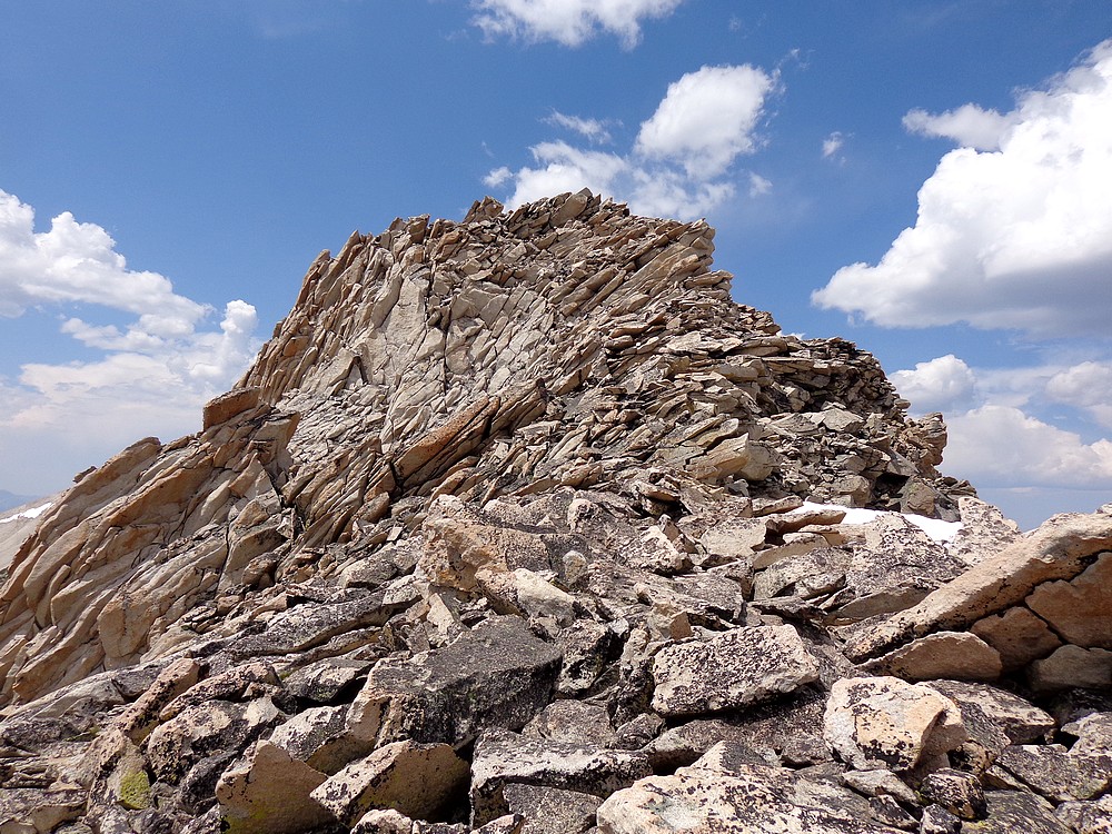
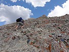
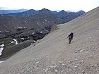
 From the saddle, I planned to climb the southeast ridge of Peak 11272’ while Ken waited. The ridge was a sea of boulders. It was less than 700’ of climbing to reach the summit. But there was a bunch of class 4 route-finding that made the climb take longer than expected. Definitely a lot of fun though. The down-climb was equally as exciting. I saw one goat on the way up, and three others on the way down. From the saddle, I planned to climb the southeast ridge of Peak 11272’ while Ken waited. The ridge was a sea of boulders. It was less than 700’ of climbing to reach the summit. But there was a bunch of class 4 route-finding that made the climb take longer than expected. Definitely a lot of fun though. The down-climb was equally as exciting. I saw one goat on the way up, and three others on the way down.
After climbing Peak 11272’, Ken decided to drop down to Hummock Lake for some fishing. Naturally I had a peak calling my name. The eighth and final peak of the trip for me would be “Pats Peak” (Peak 10718’). A few folks have given it that nickname since Pat McGrane has made the only reported ascent of the peak. Pat had climbed it from east, so I had no real beta for my west side approach other than various photos I’d taken over the years.
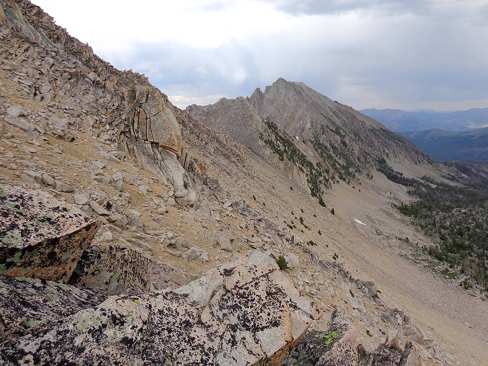
 I traversed the heinous south facing slopes below Point 10881’. I eventually reached the ridge, but the north side was all cliffs, so I had to down-climb a bit to the south to get around a big stack of shale that I dubbed “Jenga Rock”. At this point it started raining so I hid behind a small outcropping to wait it out. After the rain let up, I left my pack here and continued eastward toward Pat’s Peak. There was a bunch of route-finding, but I eventually made it over to the climbable northwest face of the peak, and up to the summit. I was tired but satisfied after summiting one of the harder to reach peaks in the range. I traversed the heinous south facing slopes below Point 10881’. I eventually reached the ridge, but the north side was all cliffs, so I had to down-climb a bit to the south to get around a big stack of shale that I dubbed “Jenga Rock”. At this point it started raining so I hid behind a small outcropping to wait it out. After the rain let up, I left my pack here and continued eastward toward Pat’s Peak. There was a bunch of route-finding, but I eventually made it over to the climbable northwest face of the peak, and up to the summit. I was tired but satisfied after summiting one of the harder to reach peaks in the range.
 From the summit of Pats Peak, I backtracked about a half mile back to my pack, and then made a steep descent through scree and talus before reaching Hummock Lake. I had used all my water and was happy to catch up with Ken and the pump so I could rehydrate. He had been having some great luck fishing at the lake, especially during the rainstorm. No big ones, just a lot of them. After dinner, the mosquitos drove us into our tents early, but sleep was hard to catch, even with the exertion of the prior days. From the summit of Pats Peak, I backtracked about a half mile back to my pack, and then made a steep descent through scree and talus before reaching Hummock Lake. I had used all my water and was happy to catch up with Ken and the pump so I could rehydrate. He had been having some great luck fishing at the lake, especially during the rainstorm. No big ones, just a lot of them. After dinner, the mosquitos drove us into our tents early, but sleep was hard to catch, even with the exertion of the prior days.
Day 4: Boulder Chain Lakes, Born Lakes, Antz Basin, Fourth of July Trailhead
 We had the primo campsite at Hummock Lake to ourselves. After breakfast I sat on the shore of the lake marveling at the scenery. It was bittersweet knowing it was the last day of the trip. The wilderness is always hard to leave, but I gotta admit that a bacon cheeseburger in Stanley was sounding pretty good right about now. We had the primo campsite at Hummock Lake to ourselves. After breakfast I sat on the shore of the lake marveling at the scenery. It was bittersweet knowing it was the last day of the trip. The wilderness is always hard to leave, but I gotta admit that a bacon cheeseburger in Stanley was sounding pretty good right about now.
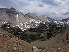
 After breaking camp, it was time to head up the trail to Scoop Lake, and then up the steep switchbacks to Windy Devil Pass. There was still snow covering several of the switchbacks, but is wasn’t too bad. After Windy Devil, we took a snack break at my favorite little tarn with in your face views of Castle Peak and Serrate Ridge. Next we headed cross county toward a faint trail visible on the hillside to the west. The trail took us to “keyhole rock” and the top of Devils Staircase. The descent down the staircase was steep, but there were just enough stable rock to piece together to allow for a mostly safe down-climb to Born Lakes. I feel there are actually two staircases. The southern and more slanted one is better climbed up from Born Lake. The northern one, accessible by the trail and keyhole rock, is better used if descending down to Born Lakes. After breaking camp, it was time to head up the trail to Scoop Lake, and then up the steep switchbacks to Windy Devil Pass. There was still snow covering several of the switchbacks, but is wasn’t too bad. After Windy Devil, we took a snack break at my favorite little tarn with in your face views of Castle Peak and Serrate Ridge. Next we headed cross county toward a faint trail visible on the hillside to the west. The trail took us to “keyhole rock” and the top of Devils Staircase. The descent down the staircase was steep, but there were just enough stable rock to piece together to allow for a mostly safe down-climb to Born Lakes. I feel there are actually two staircases. The southern and more slanted one is better climbed up from Born Lake. The northern one, accessible by the trail and keyhole rock, is better used if descending down to Born Lakes.
 During our snack break at Born Lakes, we got to see a Bald Eagle fly across the lake and land in a dead snag on the opposite side. It was very cool. After our snack, we wandered our way down through the trees and past the other lakes, then up the steep trail to Antz Basin. That was followed by the switchbacks up to Antz Basin Divide. Climbing the switchbacks in the afternoon sun was taxing, but we were fueled by the knowledge that this was the final uphill section of the trip. During our snack break at Born Lakes, we got to see a Bald Eagle fly across the lake and land in a dead snag on the opposite side. It was very cool. After our snack, we wandered our way down through the trees and past the other lakes, then up the steep trail to Antz Basin. That was followed by the switchbacks up to Antz Basin Divide. Climbing the switchbacks in the afternoon sun was taxing, but we were fueled by the knowledge that this was the final uphill section of the trip.
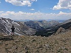
 The views from Antz Divide are some of the best you’ll find anywhere, so we sat there for a while not wanting to leave. But a bacon cheeseburger was calling my name, so we reluctantly started heading down the trail toward Fourth of July Lake. It was nice to be heading downhill on a trail. We made good time back to the trailhead, passing several day hikers along the way. The views from Antz Divide are some of the best you’ll find anywhere, so we sat there for a while not wanting to leave. But a bacon cheeseburger was calling my name, so we reluctantly started heading down the trail toward Fourth of July Lake. It was nice to be heading downhill on a trail. We made good time back to the trailhead, passing several day hikers along the way.
I can’t say enough about how epic this trip was. Tons of wildlife, amazing views, rugged terrain, and almost total solitude. The trip was a lot of work, but well worth it. I’m grateful for Ken’s sense of adventure and willingness to join me on this amazing loop. This one will be hard to top.
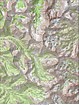
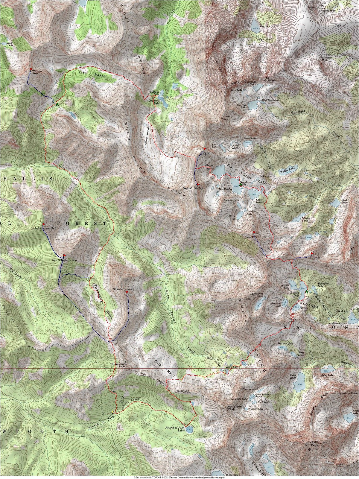
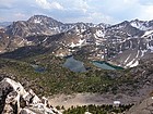
Map of the route, taken clockwise. Base loop is 25 miles, total of 36 miles with side trips for peaks. |
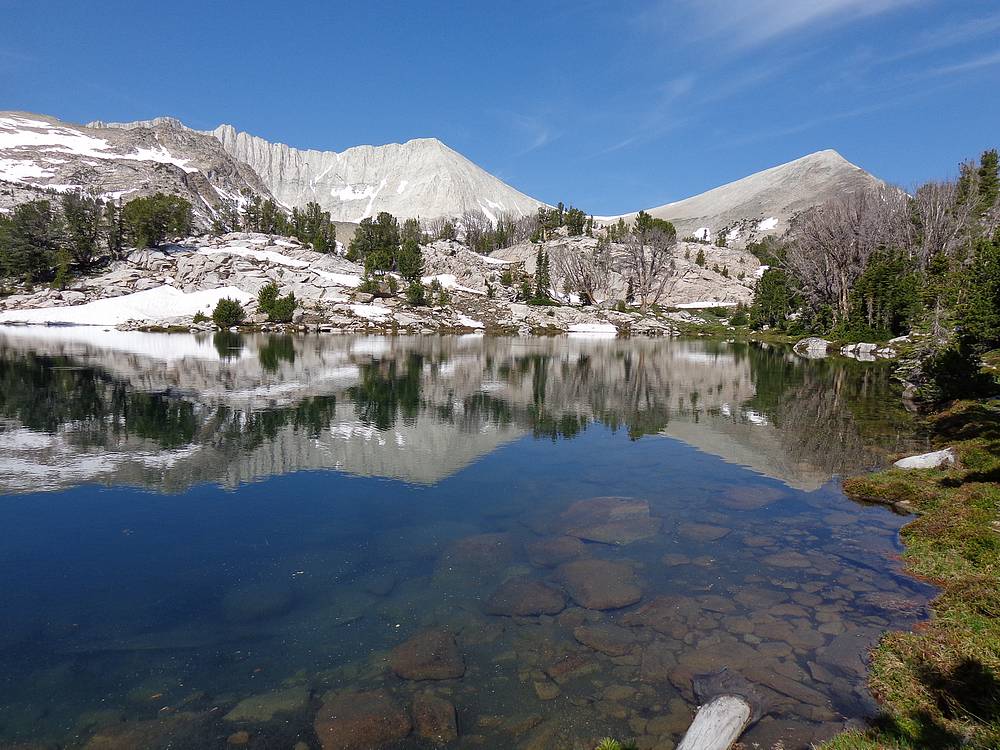
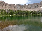
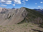
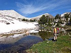
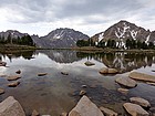
Strawberry Basin from the south. |
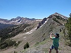
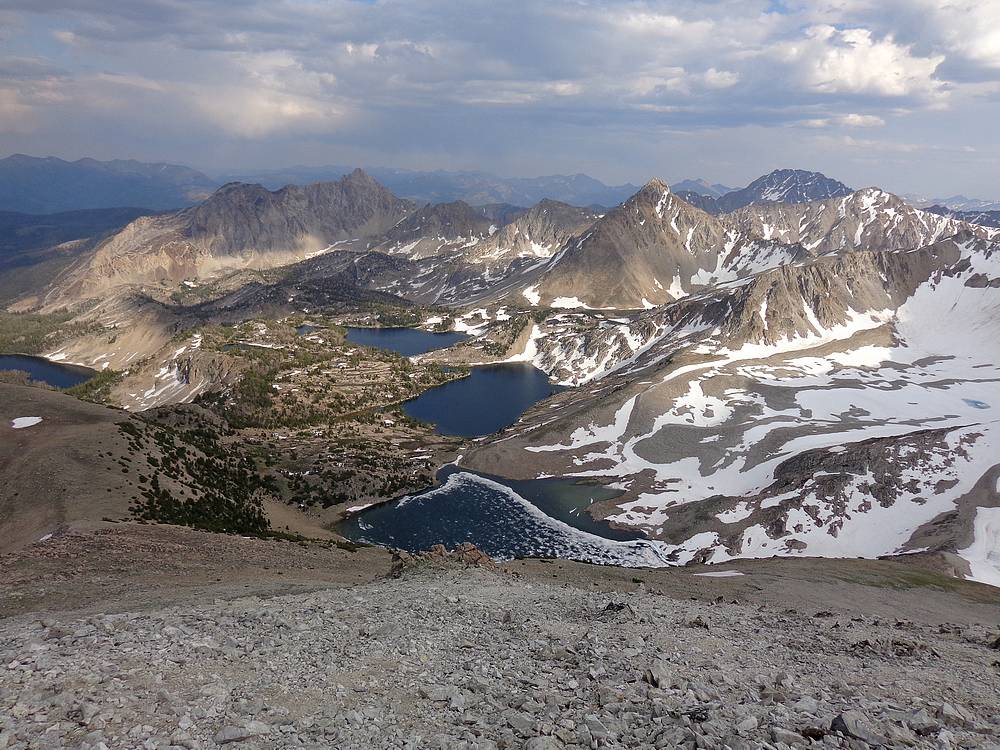
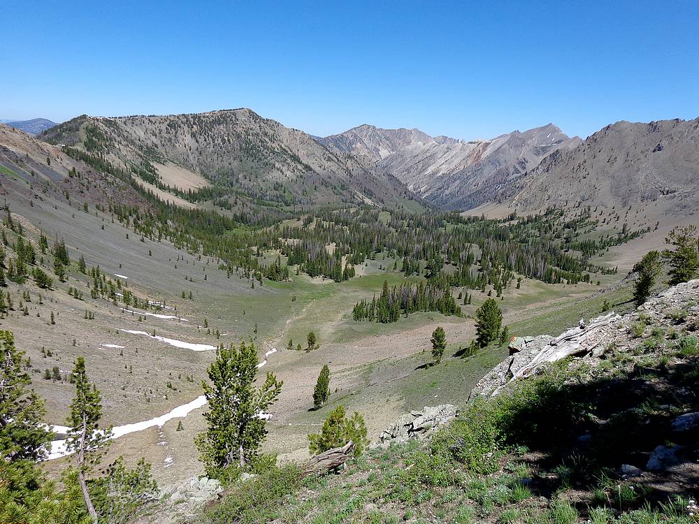
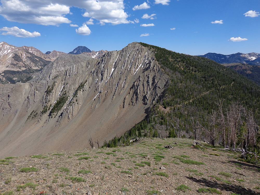
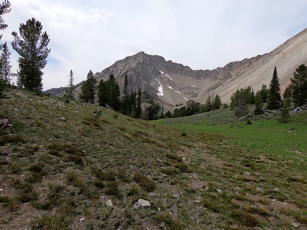
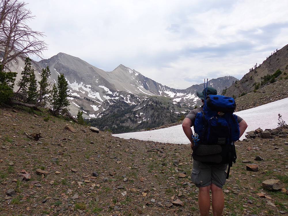
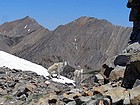
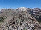
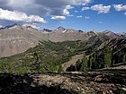
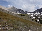
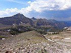
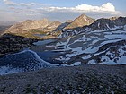
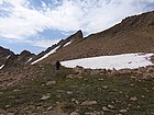
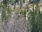
Taking a photo of Antz Basin and the upper Warm Springs Creek drainage. |
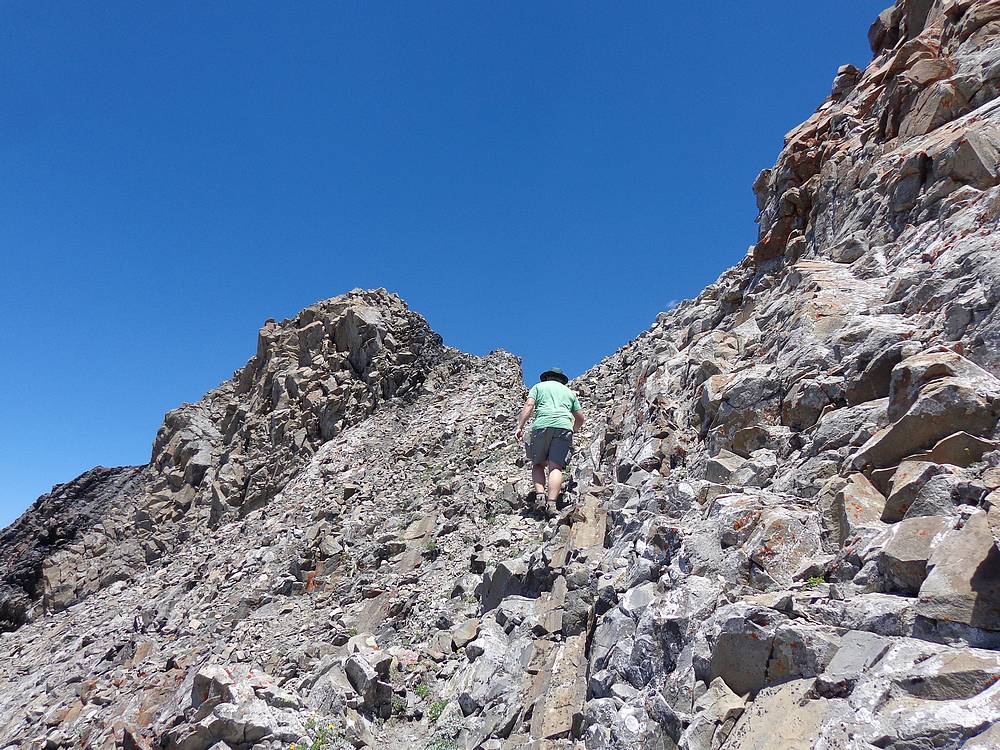
Heading north along the ridge to Strawberry Point (Peak 10111'). |
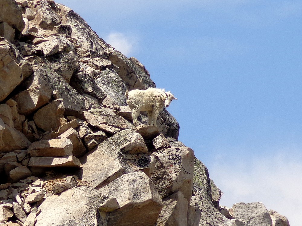
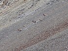
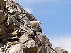
Mountain Goats on the ridge. |
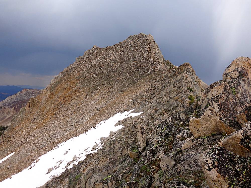
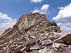
Nearing the summit of Strawberry Point. |
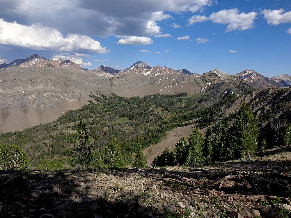
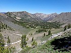
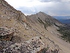
Amazing view of the upper Warm Springs Creek drainage. |
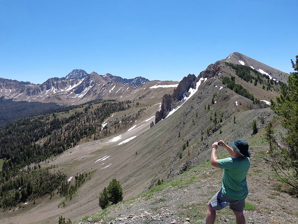
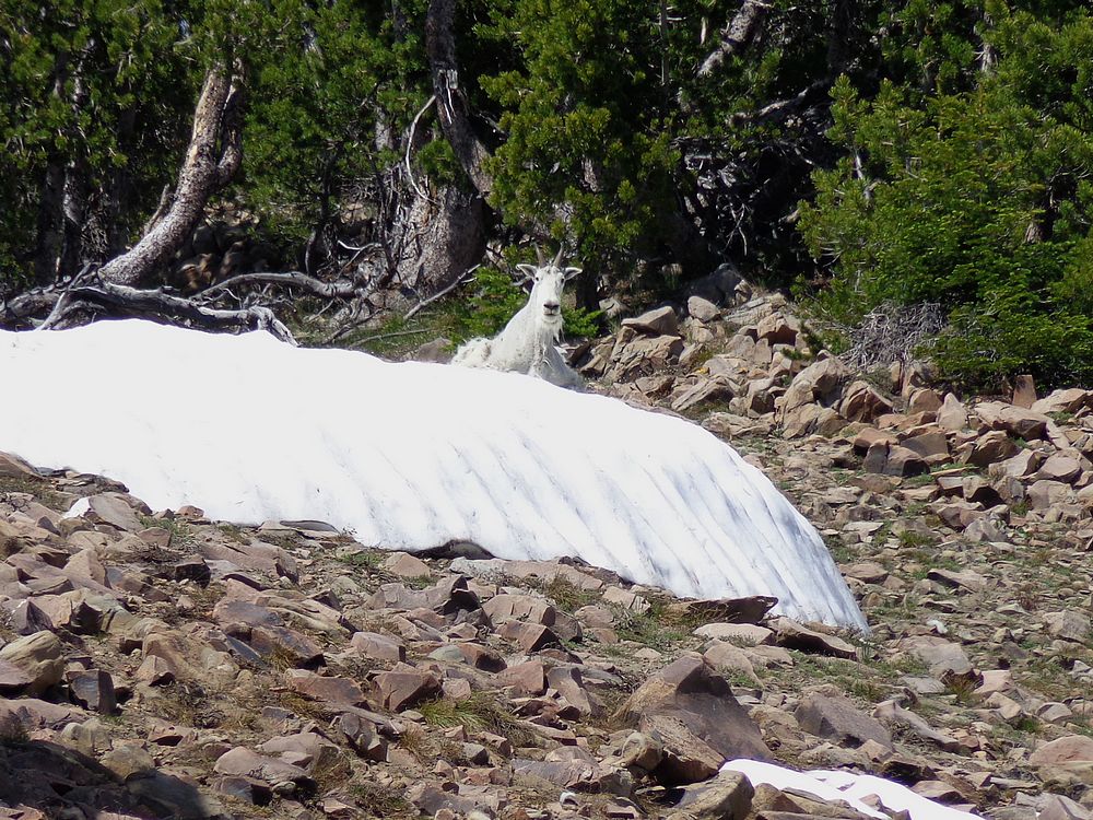
Goat cooling off in a snowbank on the way to West Strawberry Peak (Peak 10132'). |
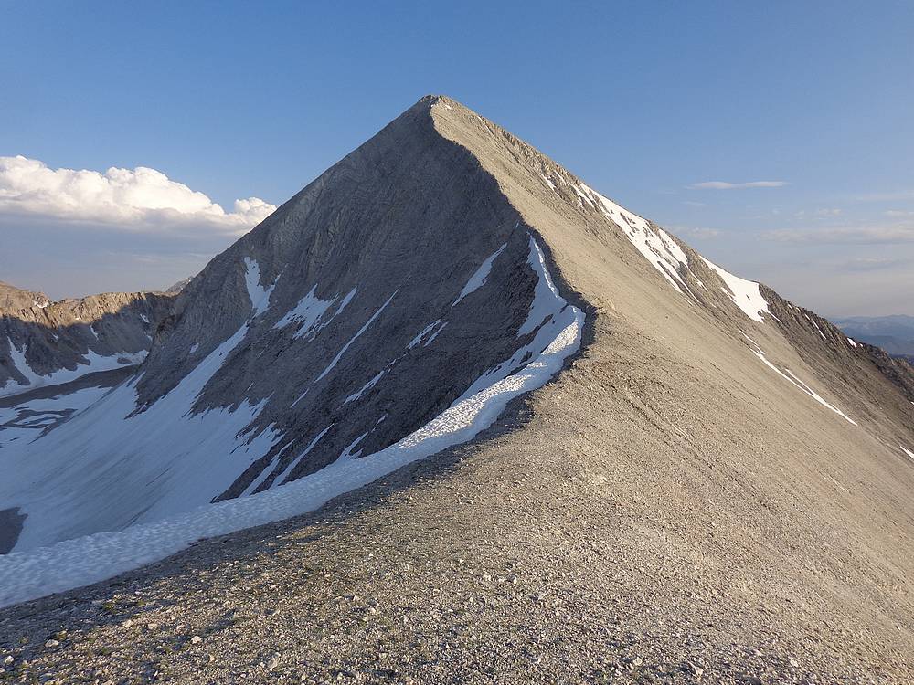
West Strawberry Peak (Peak 10132') from Little Strawberry Peak (Peak 9958'). |
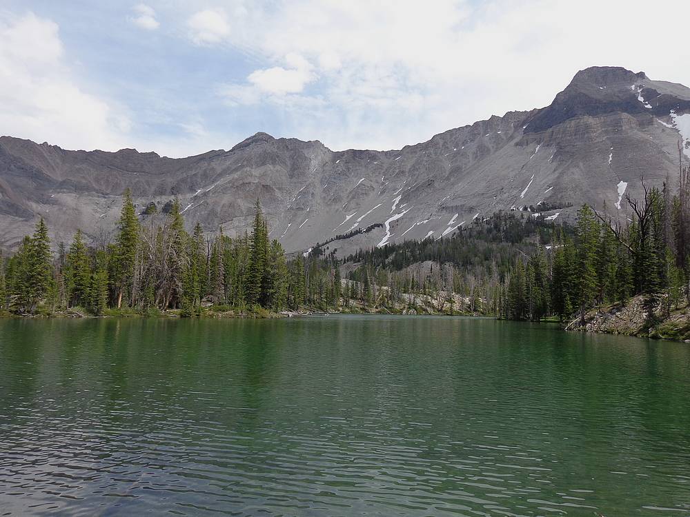
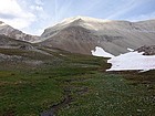
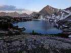
Strawberry Basin from the west, Castle Peak in the background. |
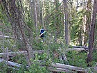
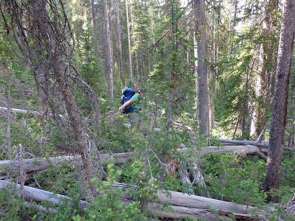
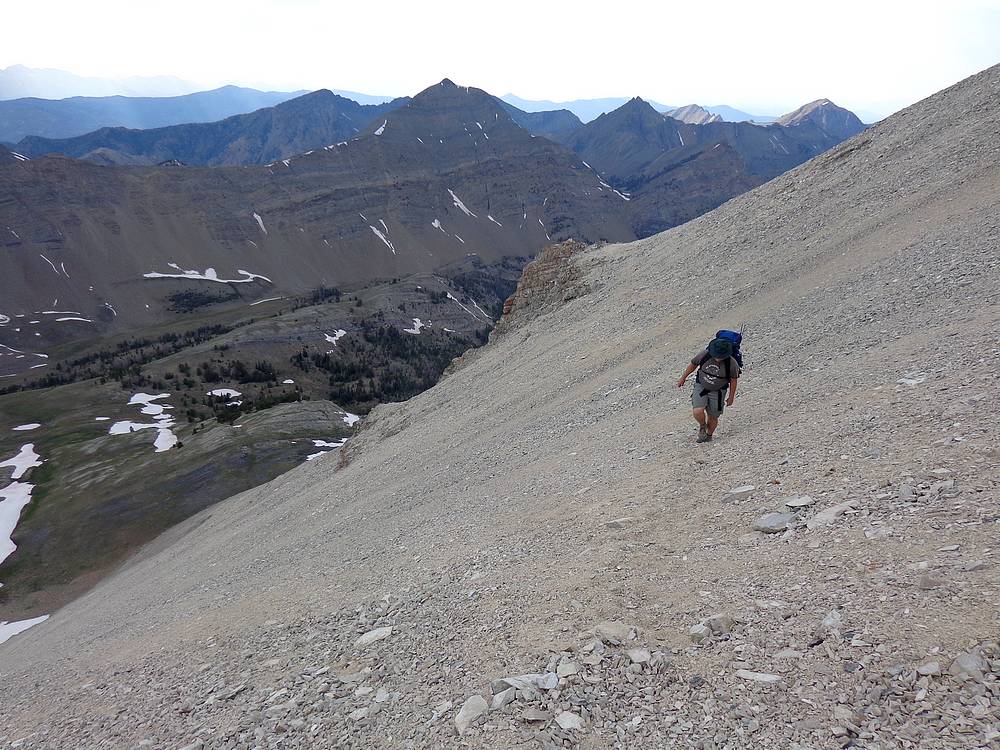
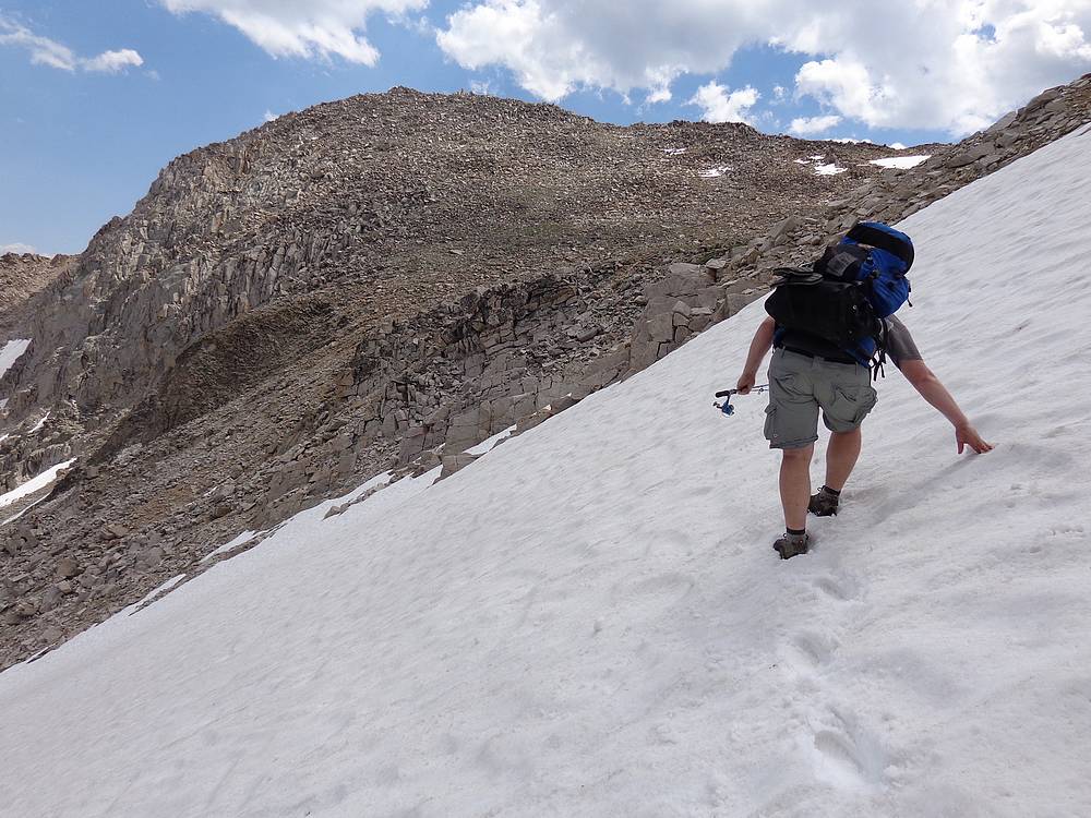
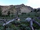
Some serious bushwhacking on our way down from Strawberry Basin. |
Our log crossing over Warm Springs Peak. |
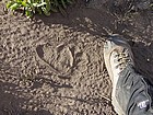
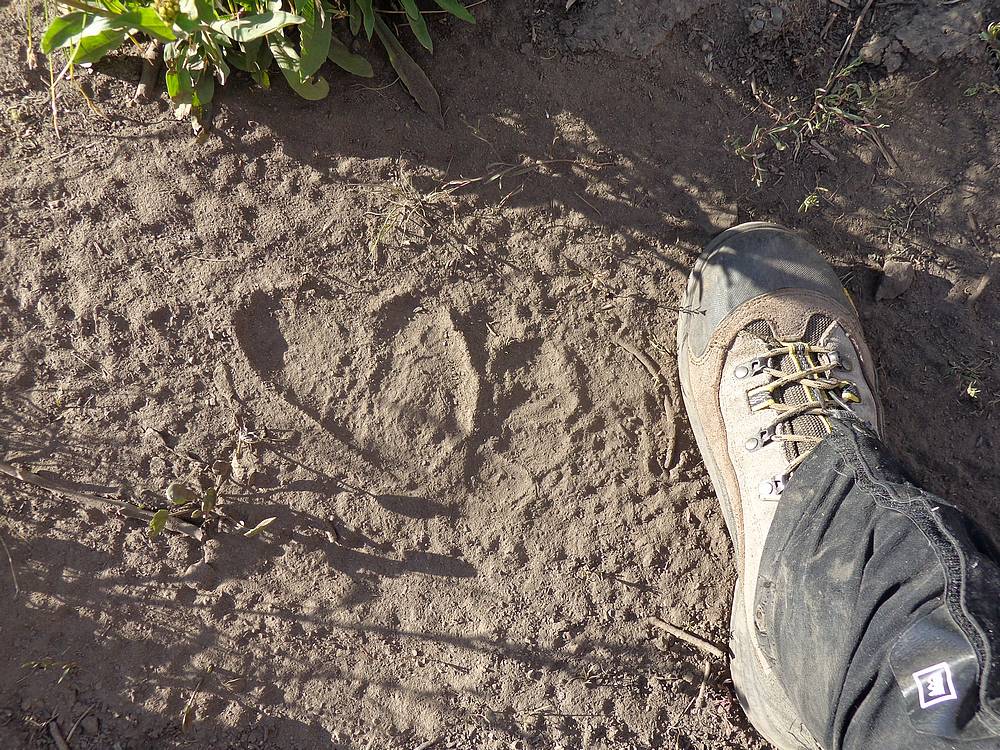
Bear tracks on the trail, not very old. |
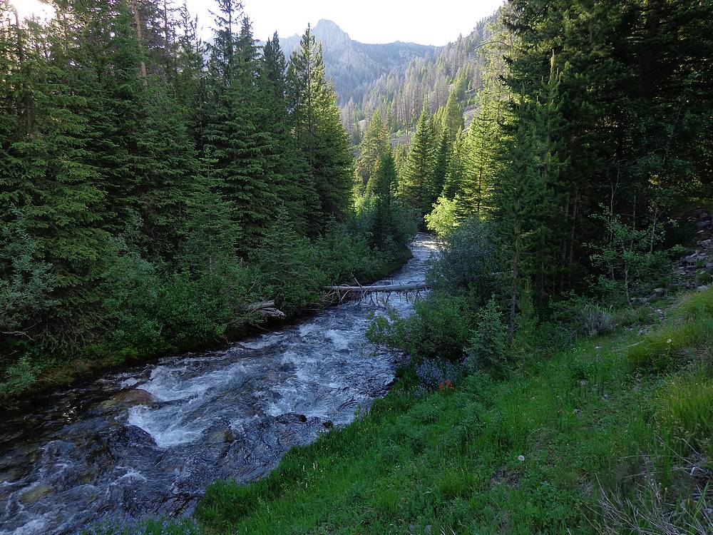
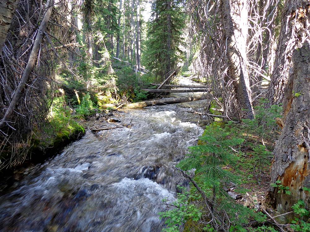
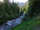
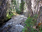
Warm Springs Creek near the fork to Iron Basin. |
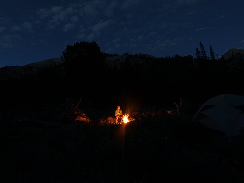
Cooking brats on the fire after a long day. |
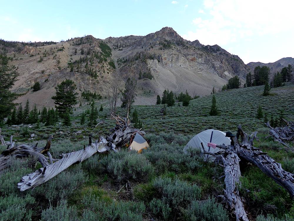
Our campsite in Iron Basin, Watson Peak in the background. |

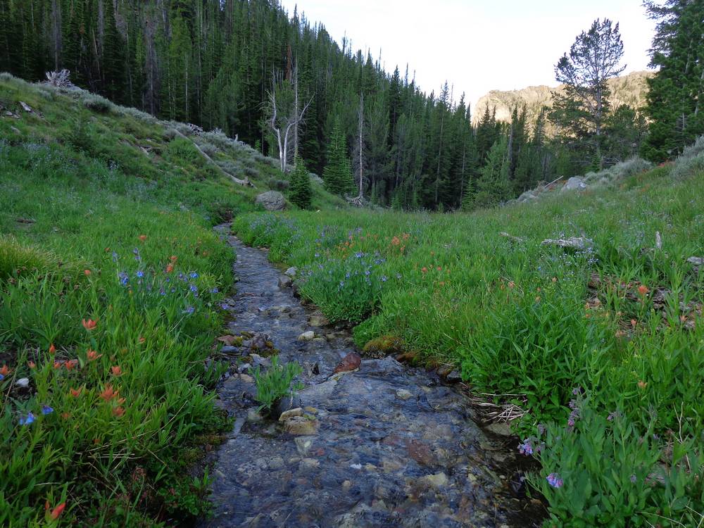
Wildflowers and the stream near our campsite in Iron Basin. |

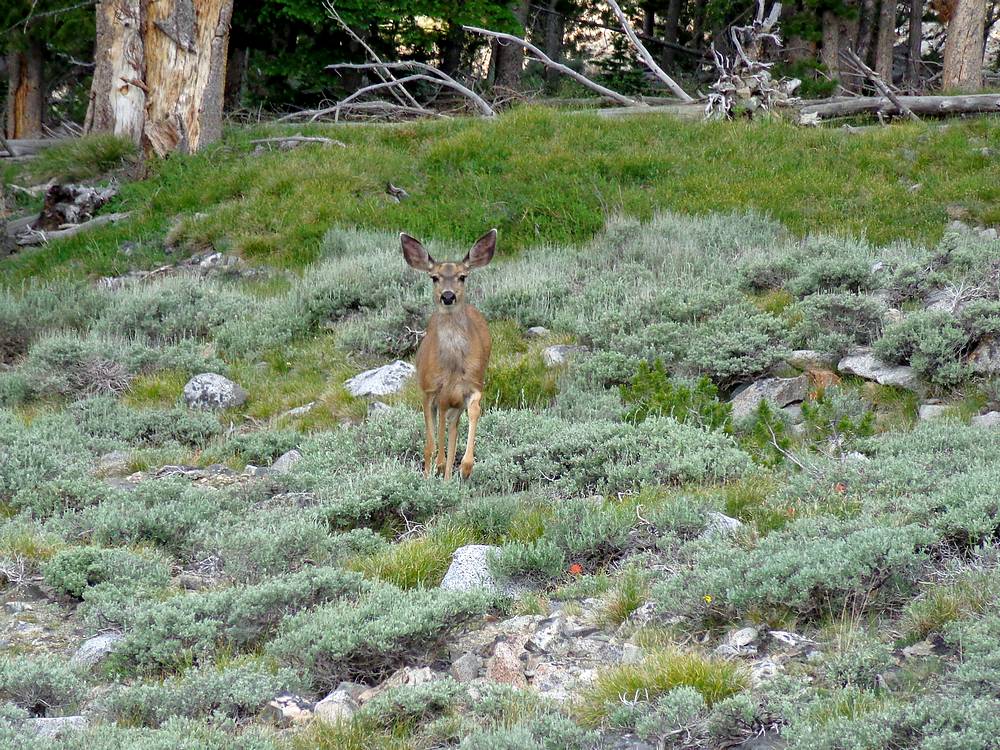
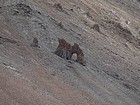
Inquisitive deer in Iron Basin. |
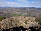
Watson Peak summit view, looking west toward the Sawtooths. The Meadows area below. |
Close up of a natural arch above Iron Basin. |
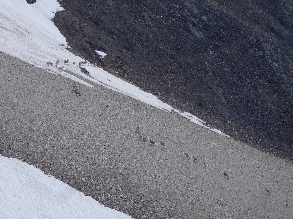
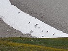
Six Bighorn Sheep above Iron Basin. The outcast group. |

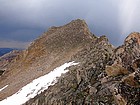
East face of Watson Peak above Iron Basin. |
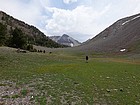
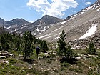
Typical open terrain in Iron Basin. |
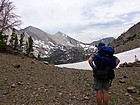
Contemplating the high pass we'd have to cross later in the day. |
Northern White Clouds from the Iron Basin pass. |
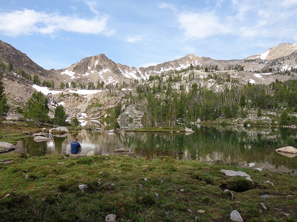
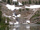
Ocaulkins Lake. |
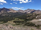
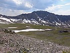
Bighorn Basin and DO Lee Peak. |
Bighorns on a snowfield. Notice the air born lamb in the center. |
We climbed this buttress to gain the saddle. |
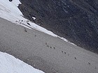
Bighorns climbing the mountainside, nearly 40 of them. |
White Cloud Peak #8 above Bighorn Basin. |
Looking back on Ocaulkins Lake and the pass to Iron Basin. |
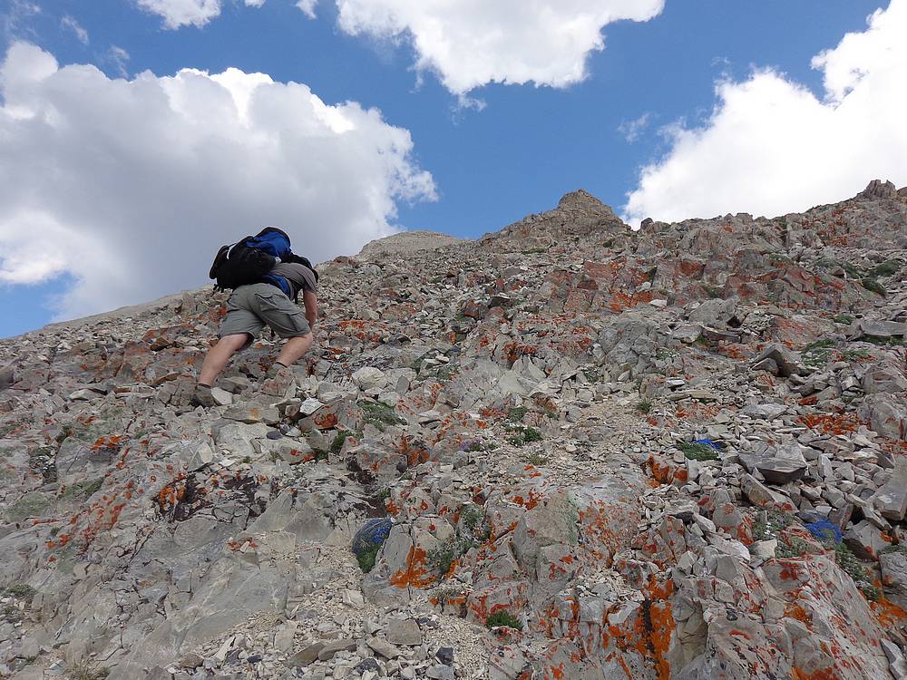
Climbing the buttress in full packs. |
Crossing the scree field to reach the saddle between WCP-9 and DO Lee Peak. |
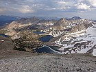
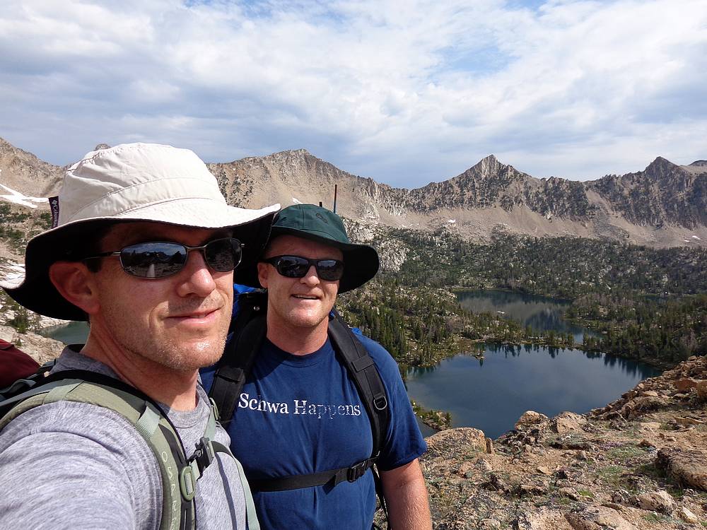
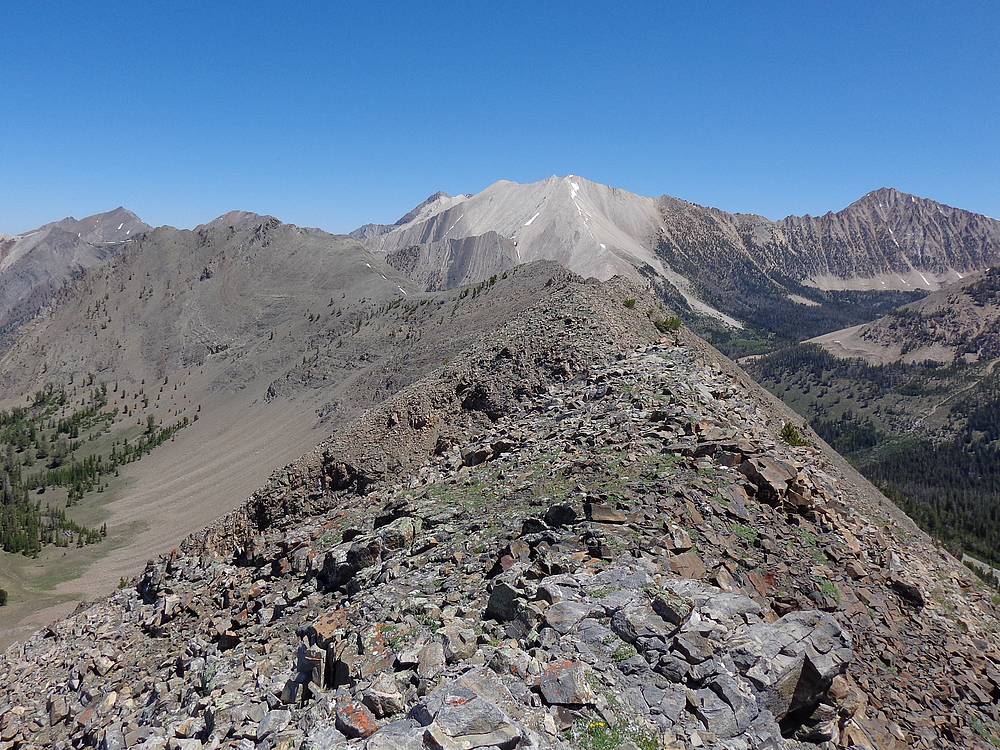
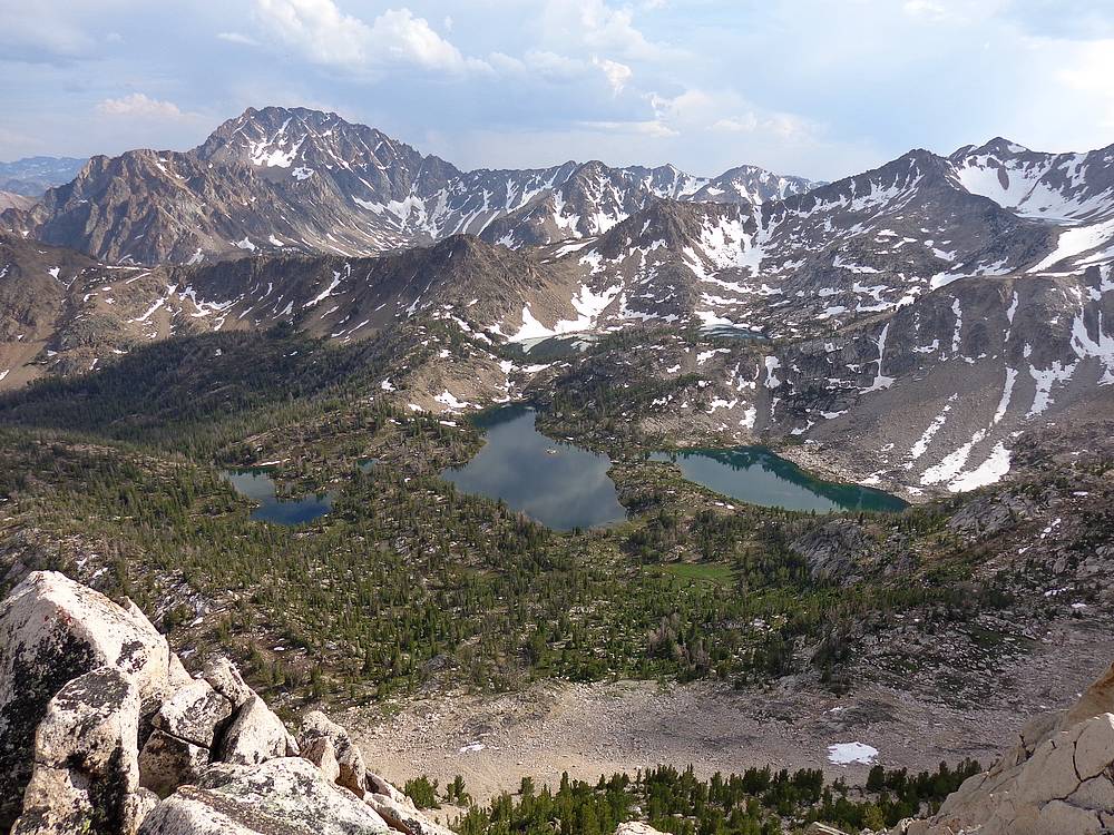
Big Boulder Lakes from the summit of WCP-9. |

DO Lee Peak from the north. |
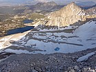
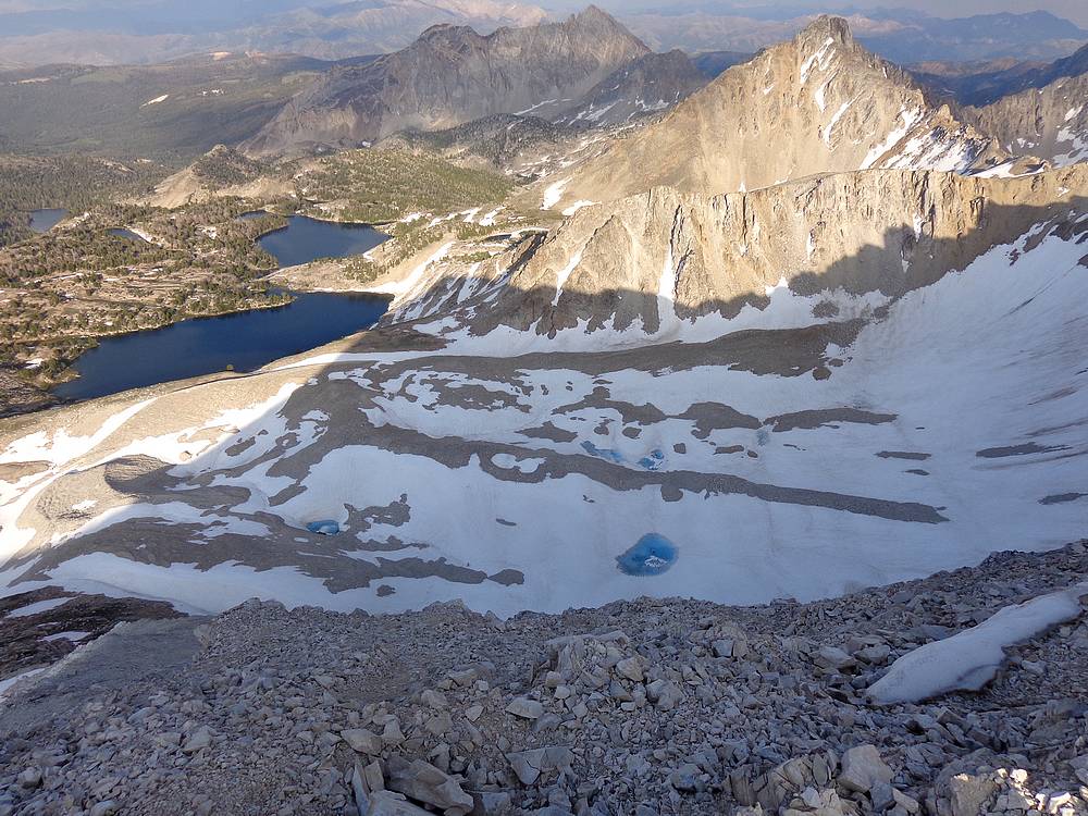
The Kettles and Big Boulder Lakes from the summit of DO Lee Peak. |
Descending to Big Boulder Lakes. |
Nearing Sapphire Lake. |
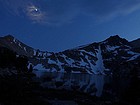
Moon overhead at our campsite at Sapphire Lake. |

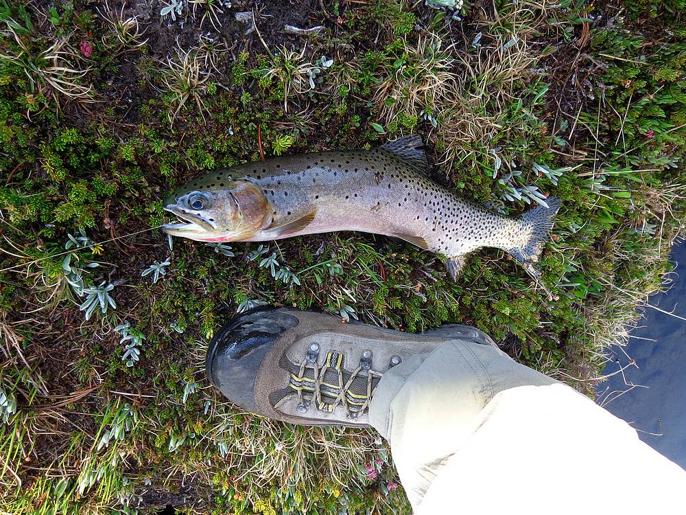
Big trout caught (and released) from Sapphire Lake. |
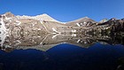
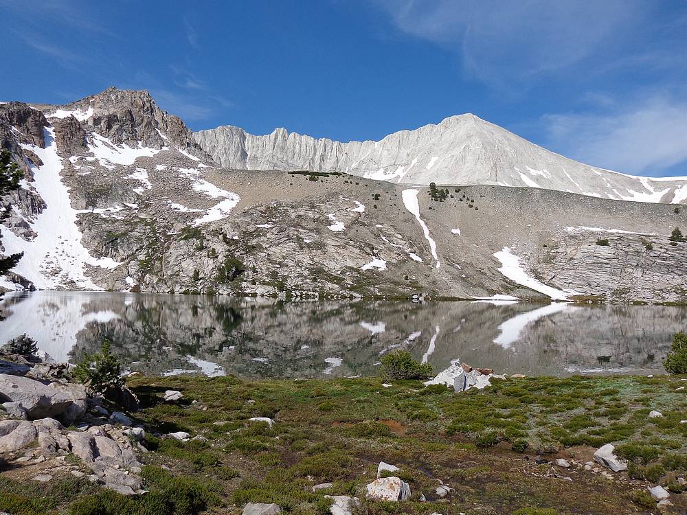
Panoramic view from Sapphire Lake. |
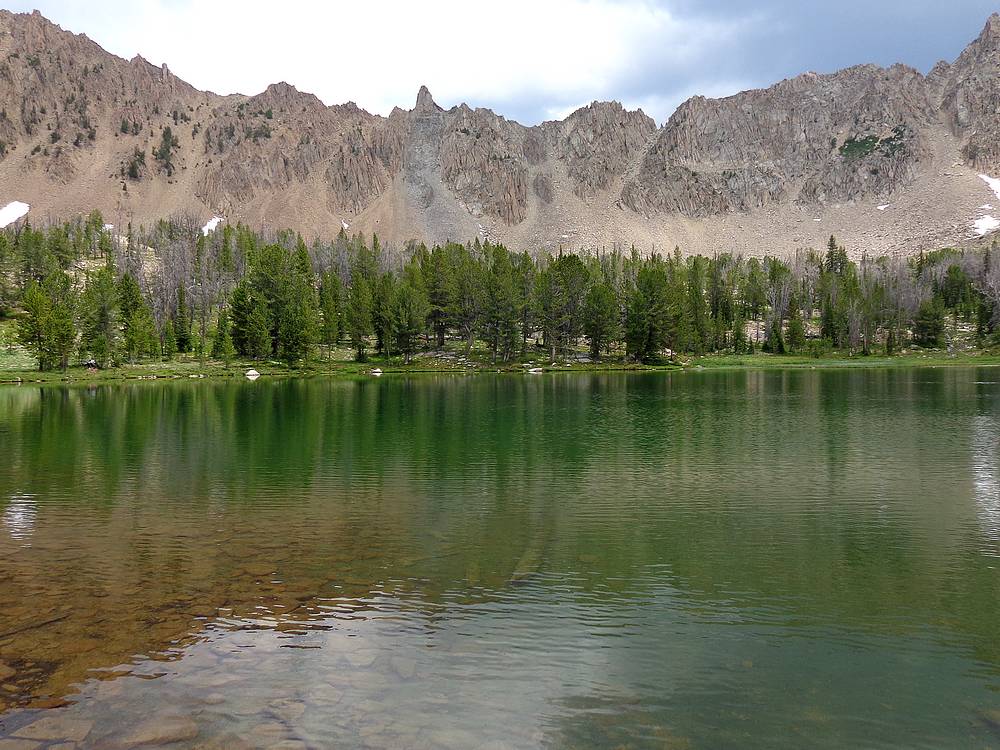
DO Lee Peak from Sapphire Lake. |
Me looking back on the saddle we crossed the prior day. |
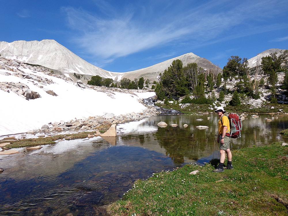
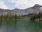
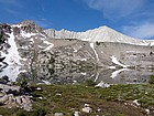
Amazing view from Cove Lake. |
Heading toward the ridge to the Upper Boulder Chain Lakes, saddle on the right. |
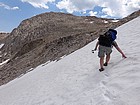
Snowfield crossing. |
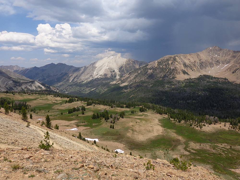
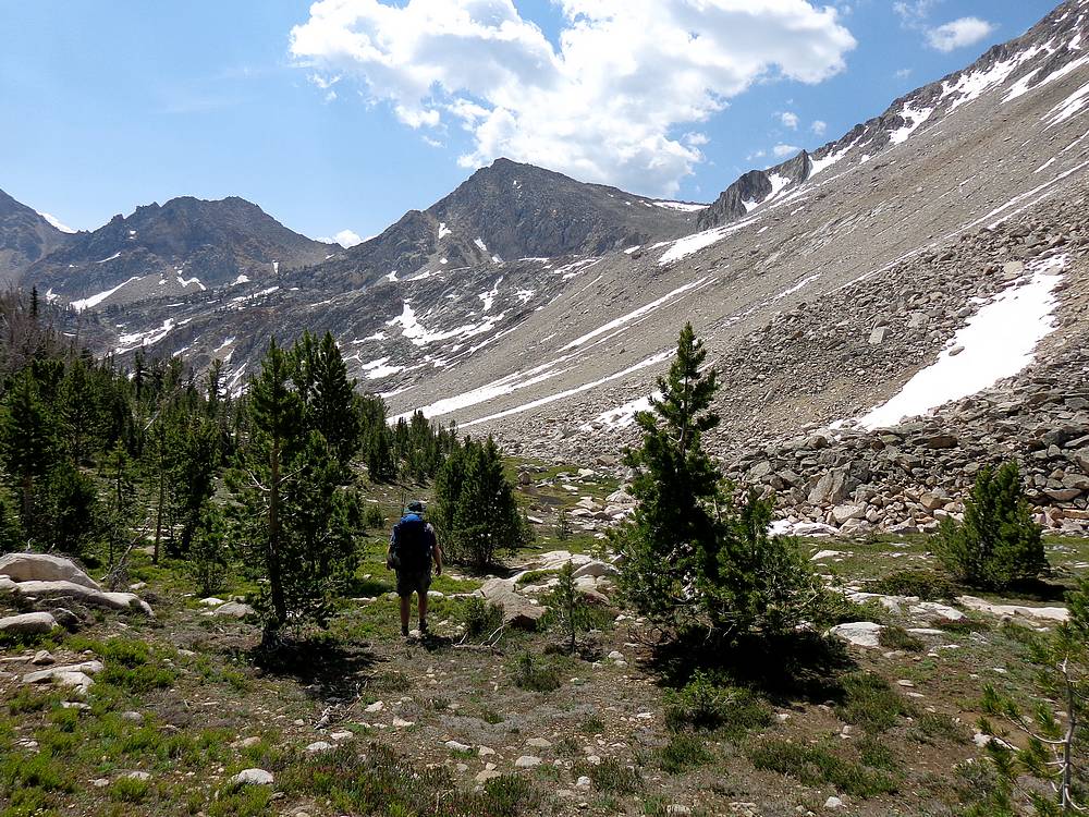
Warm Springs Creek drainage from the east. |
Mountain Goat posing on the southeast ridge of Peak 11272'. |
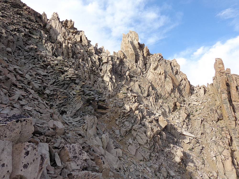
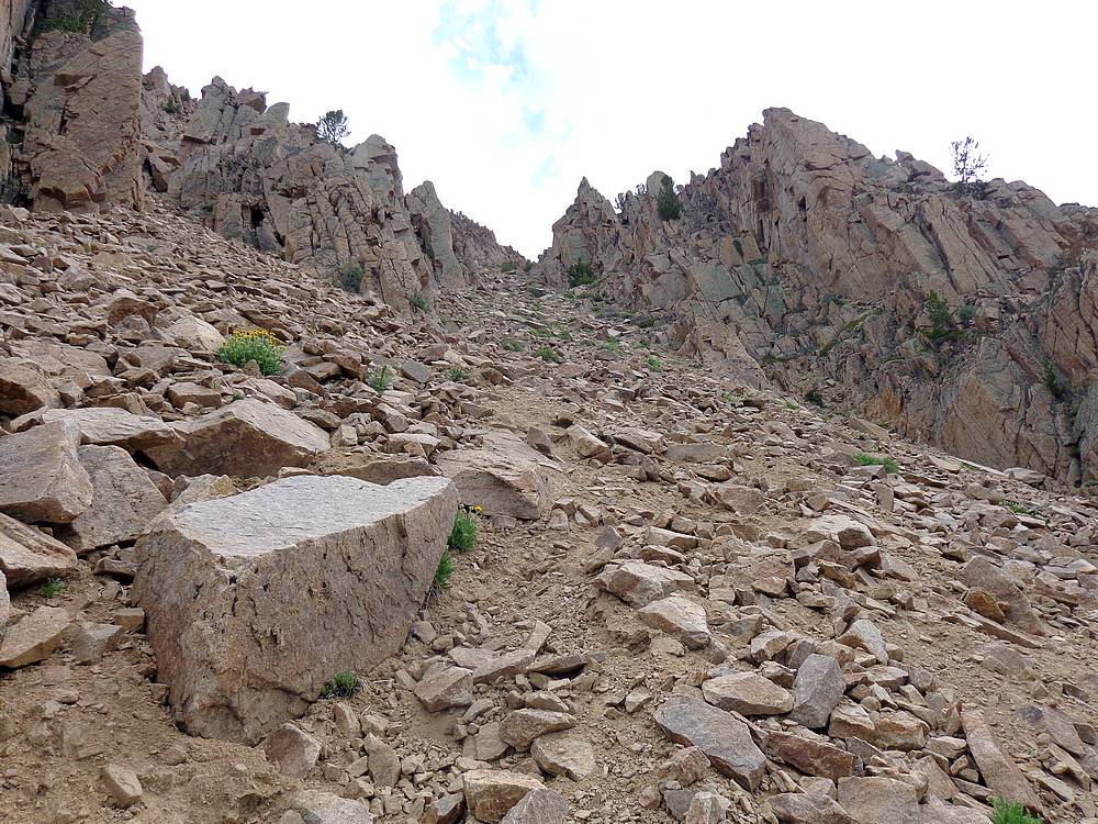
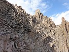
Jumbled rock on the southeast ridge of Peak 11272'. |
Me on the summit of Peak 11272', with the Big Boulder Lakes in the background. |
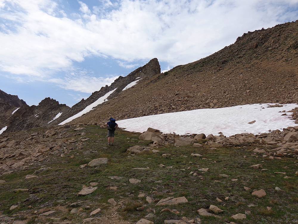
Heading east toward Pats Peak (Peak 10718'). |
Stack of "jenga rocks" on the ridge west of Pats Peak. |
Nearing the summit of Pats Peak. |
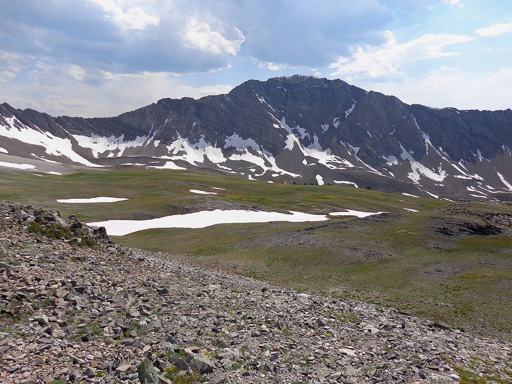
Pats Peak summit view of the upper Boulder Chain Lakes and Castle Peak. |
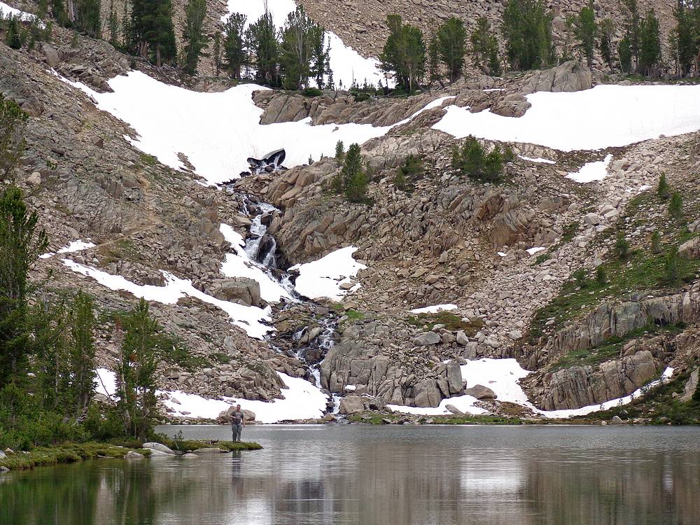
Ken and the waterfall feeding into Hummock Lake. |
Trout swimming in Hummock Lake. |
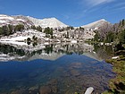
Beautiful morning at Hummock Lake. |
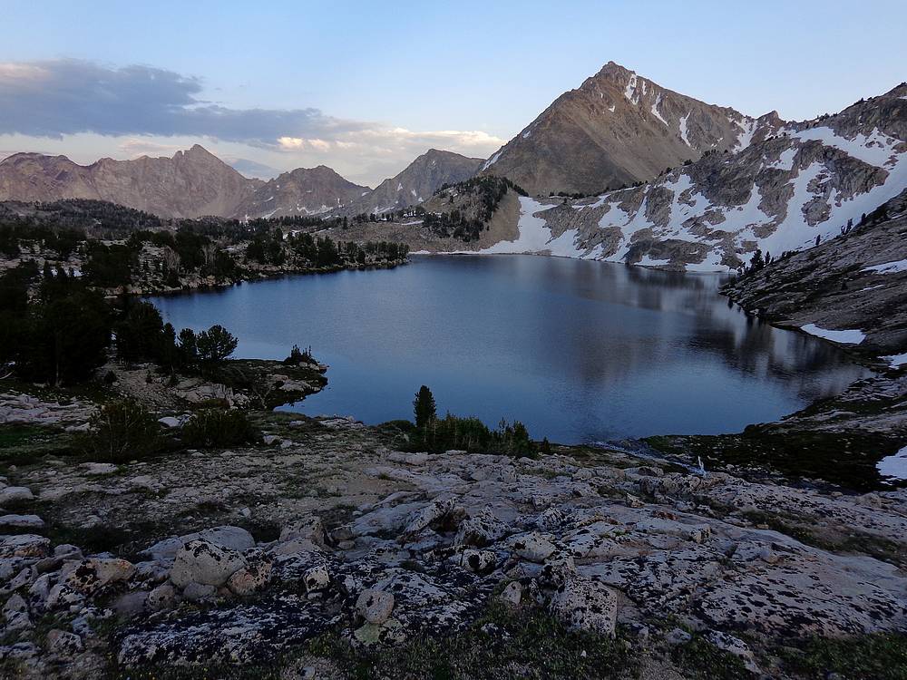
Windy Devil Pass with Hummock Lake in the background. |
Castle Peak and Mount Frank, from my favorite little tarn above Windy Devil Pass. |
Heading toward keyhole rock and access to the top of Devils Staircase. |

Looking back from the bottom of Devils Staircase. |
This Bald Eagle landed here after flying by us at the upper Born Lake. |
Devils Staircase above Born Lake 9555'. |
Final view of DO Lee Peak and Antz basin before descending to Fourth of July Lake. |
 |
|