|
Wind River Range Backpacking
Gannett Peak (13804') - Mount Helen (13620') - Fremont Peak (13745') - Jackson Peak (13517')
July 13-19, 2013
The Wind River Range is a spectacular mountain range located in western Wyoming on the continental divide. The area is full of just plain BIG terrain. Soaring granite peaks surround glacially carved valleys. Titcomb Basin and Indian Basin are located near the center of the range. Titcomb Basin provides access to Gannett Peak, the tallest mountain in the state of Wyoming. Gannett is the most remote of all the state high points in the lower 48 states.
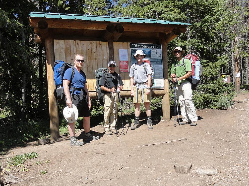
I'd been dreaming about a trip to the Winds for almost ten years, and Gannett Peak had been at the top of my wish list for some time. Based on the long approach trail from Elkhart Park, it seemed best to do an extended seven day trip. The thought process being if we were going to hike that far in, we might was well stay a while. Joining me for the trip would be Chris R, Mike W, and my brother Ken. 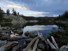 Day 1 Day 1
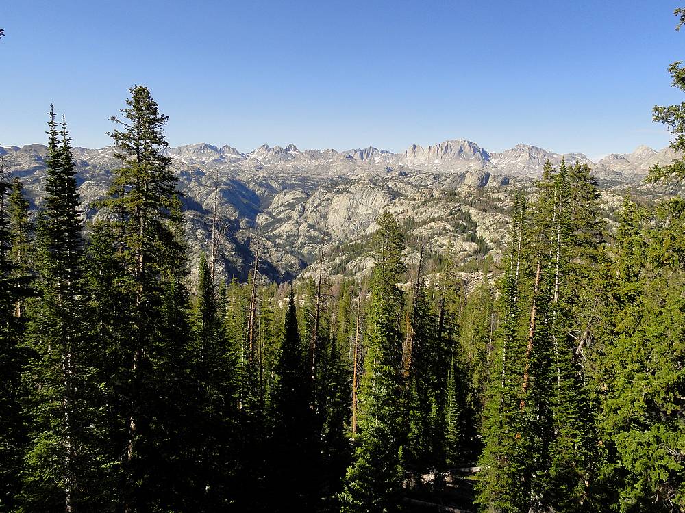
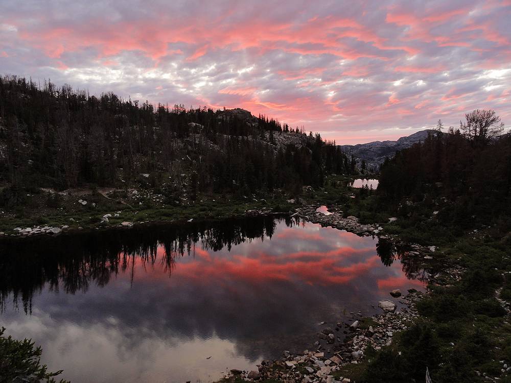
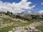
Elkhart Part to Hobbs Lake - After an eight hour drive from Boise, and a long wait in line in Pinedale to get a Subway sandwich to stuff in our packs for dinner, we finally hoisted our 50+ pound loads, and left the Elkhart Park trailhead a little before 4 pm. We had heard the first four miles of hiking to Photographer's Point would be boring, but we actually thought it was pretty nice, as the trail made its way through shady forest with occasional views. It took us two hours to reach the famous viewpoint, where we stopped for a snack and obligatory photos. Then we hit the trail again. Our intent was to get to at least Eklund Lake, which was 5.5 miles from the trailhead. But we were making good time and decided to continue another two miles to Hobbs Lake. We found a good campsite at the north end of the lake, west of the outlet stream. (There are better sites just a little further around the lake.) We enjoyed a great sunset, and turned in for the night.
Day 2
 Hobbs Lake to Upper Titcomb Basin - It was a beautiful morning with barely a cloud in the sky. After a leisurely breakfast, we didn't start hiking until almost 9:30am. The trail meandered through the forest, and made several drops and climbs on the way to Seneca Lake. The "undulating terrain" would make for a painful hike back out. Seneca Lake was long and beautiful. Next was Little Seneca Lake, where we opted to save a quarter mile by boulder hopping around the south side of the lake, before climbing to a 10600' pass and then dropping down to the gorgeous Island Lake for lunch. Hobbs Lake to Upper Titcomb Basin - It was a beautiful morning with barely a cloud in the sky. After a leisurely breakfast, we didn't start hiking until almost 9:30am. The trail meandered through the forest, and made several drops and climbs on the way to Seneca Lake. The "undulating terrain" would make for a painful hike back out. Seneca Lake was long and beautiful. Next was Little Seneca Lake, where we opted to save a quarter mile by boulder hopping around the south side of the lake, before climbing to a 10600' pass and then dropping down to the gorgeous Island Lake for lunch.
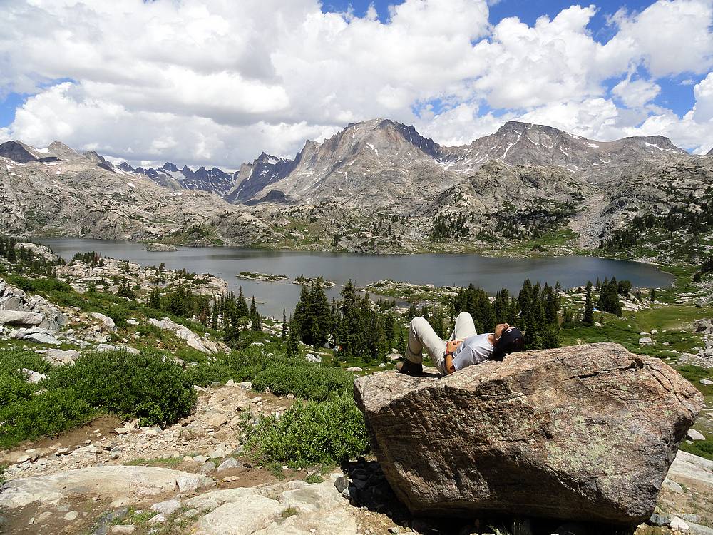
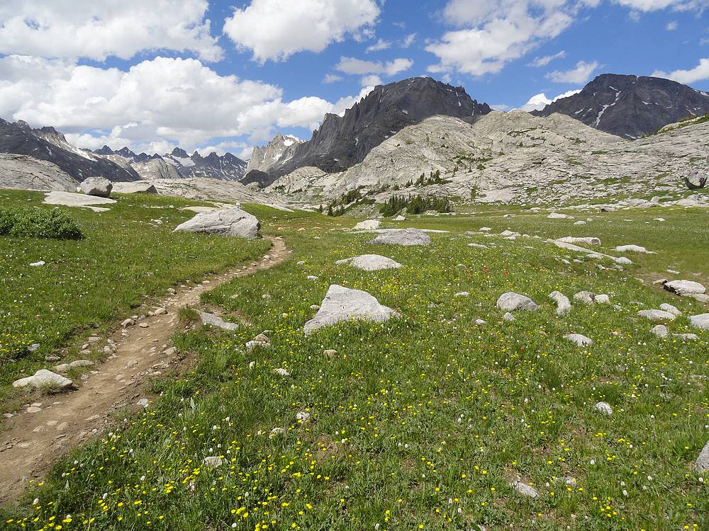
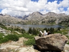
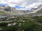
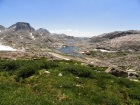
 Island Lake is highly scenic, with great views of the high peaks all around. Here we met a group that had climbed Gannett a few days earlier and reported that the snow bridge over the famous bergschrund was in place, which was very good news. After lunch, we got back on the trail, and headed into Titcomb Basin. All of us were muttering "wow" and "amazing" as we wandered through wildflower filled meadows and around glacially polished granite slabs. This is very high on my list of the most beautiful places I've ever seen. Island Lake is highly scenic, with great views of the high peaks all around. Here we met a group that had climbed Gannett a few days earlier and reported that the snow bridge over the famous bergschrund was in place, which was very good news. After lunch, we got back on the trail, and headed into Titcomb Basin. All of us were muttering "wow" and "amazing" as we wandered through wildflower filled meadows and around glacially polished granite slabs. This is very high on my list of the most beautiful places I've ever seen.
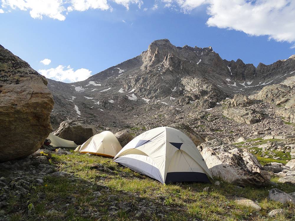
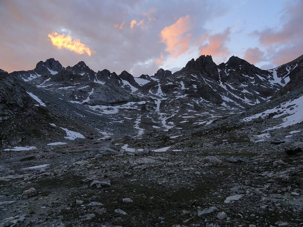
 The campsite plan was to continue past the last Titcomb Lake and make camp on some grassy ledges just west of Mount Helen at about 11000 feet. After some searching, we eventually found a good spot, and stopped hiking for the day at just after 6pm. We had covered almost 11 miles from Hobbs Lake, which put us at over 18 miles from the trailhead. We were a little tired, but the awesome scenery kept our spirits up. The great sunset didn't hurt either! The campsite plan was to continue past the last Titcomb Lake and make camp on some grassy ledges just west of Mount Helen at about 11000 feet. After some searching, we eventually found a good spot, and stopped hiking for the day at just after 6pm. We had covered almost 11 miles from Hobbs Lake, which put us at over 18 miles from the trailhead. We were a little tired, but the awesome scenery kept our spirits up. The great sunset didn't hurt either!
 Day 3 Day 3
Gannett Peak Climb - The big day was finally here. An alarm clock malfunction led to a delayed start of 5:30am. On the bright side, it was already plenty light to see as we made our way up through the boulders toward Bonney Pass without needing headlamps. It looked steep from the distance, but the angle seemed to lessen as we go closer. Once we reached the snow, we laced on our crampons and continued on up toward the pass. The snow was firm but not frozen, which made for good climbing conditions. Our progress was slow but steady as we reached the pass at just after 8am. At 12800', Bonney Pass is higher than any point in our home state of Idaho.
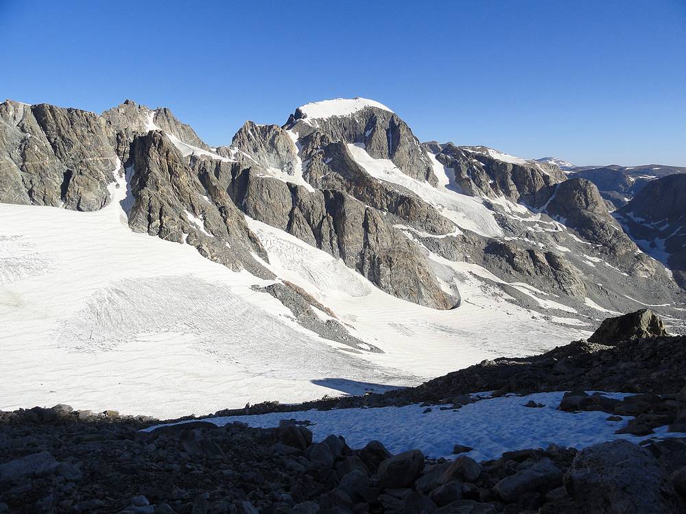
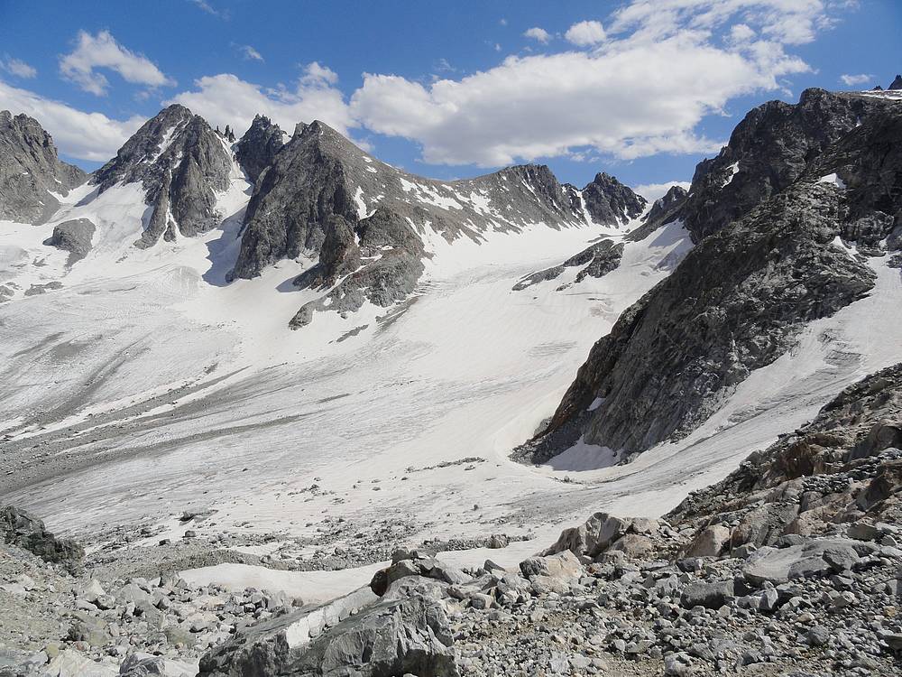
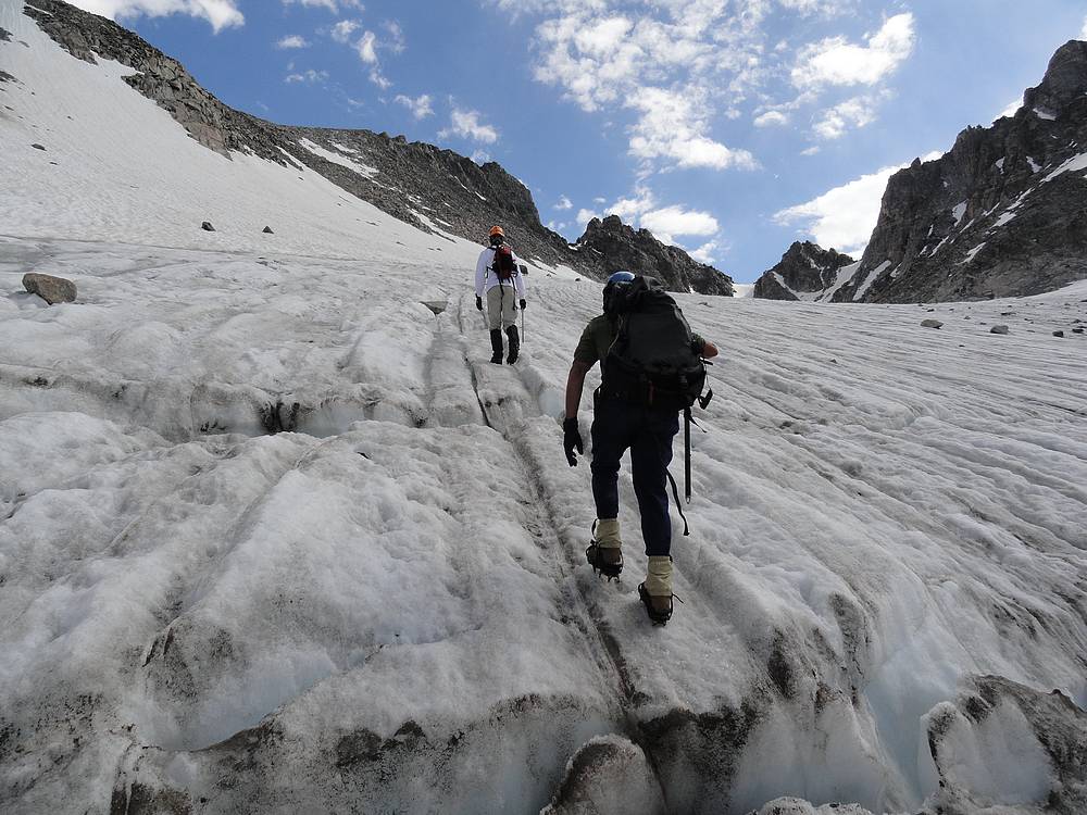
 From Bonney Pass, we got our first view of Gannett. Wow, what a mountain! After a short break, we began our descent down to the Dinwoody Glacier. We weren't looking forward to reclimbing the 1100 feet back up to the pass later in the day, but that's just the cruel reality of this route. After stepping over a few small crevasses, we soon made it to the moat down at 11700'. Here we could see where a couple days earlier, a Volkswagen sized rock had taken flight for about forty feet after it gained speed sliding down the glacier. We decided not to linger in case any more might be coming down. From Bonney Pass, we got our first view of Gannett. Wow, what a mountain! After a short break, we began our descent down to the Dinwoody Glacier. We weren't looking forward to reclimbing the 1100 feet back up to the pass later in the day, but that's just the cruel reality of this route. After stepping over a few small crevasses, we soon made it to the moat down at 11700'. Here we could see where a couple days earlier, a Volkswagen sized rock had taken flight for about forty feet after it gained speed sliding down the glacier. We decided not to linger in case any more might be coming down.
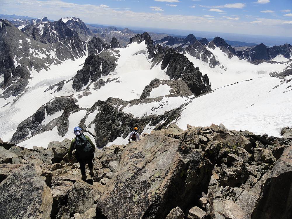
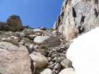
 Once at the moat, we then climbed a couple hundred feet up the glacier, then transitioned to rock for a while before reaching the bottom of the Gooseneck Glacier. We stayed toward the ridge to avoid steeper snow, then had to switch back to boulder hopping for a while before getting back onto the glacier further up. We continued parallel to the ridge until we passed the Gooseneck Pinnacle, where we began the steepest section of the climb, up and over the bergschrund. Fortunately, it was about half covered by the snow bridge, and we made it over without issue. The climbing was steep, and slow due to the effects of altitude, but we made steady progress. After a couple more transitions in and out of crampons, we reached the base of the final snowfield. We had watched another climber descend, and it looked pretty sloppy. Luckily, it wasn't as bad as it looked. The snow was mostly supportive, with just a few post hole steps along the way. We took it slowly and carefully here, and up onto the summit ridge. The ridge itself wasn't steep, but the exposure was huge, and a misstep may not have been survivable, especially if you were to slide off the steep east face. The views from the summit ridge were fantastic, and we took it slow and easy up to the summit. This was partially because we were being careful, but mostly because we were plum tuckered out after seven hours of climbing. Once at the moat, we then climbed a couple hundred feet up the glacier, then transitioned to rock for a while before reaching the bottom of the Gooseneck Glacier. We stayed toward the ridge to avoid steeper snow, then had to switch back to boulder hopping for a while before getting back onto the glacier further up. We continued parallel to the ridge until we passed the Gooseneck Pinnacle, where we began the steepest section of the climb, up and over the bergschrund. Fortunately, it was about half covered by the snow bridge, and we made it over without issue. The climbing was steep, and slow due to the effects of altitude, but we made steady progress. After a couple more transitions in and out of crampons, we reached the base of the final snowfield. We had watched another climber descend, and it looked pretty sloppy. Luckily, it wasn't as bad as it looked. The snow was mostly supportive, with just a few post hole steps along the way. We took it slowly and carefully here, and up onto the summit ridge. The ridge itself wasn't steep, but the exposure was huge, and a misstep may not have been survivable, especially if you were to slide off the steep east face. The views from the summit ridge were fantastic, and we took it slow and easy up to the summit. This was partially because we were being careful, but mostly because we were plum tuckered out after seven hours of climbing.
 Reaching the summit was a very rewarding feeling. Skies were blue, and there was barely any wind. Hard to ask for better conditions. During our 45 minute stay on the summit, we took a bunch of photos, marveled at the views in all directions, and enjoyed lunch. But there was still a lot of ground to cover to get back to camp, so it was time to head down, carefully retracing our steps back down the ridge. The descent had our full attention, and we took our time on the way back down to the Dinwoody Glacier. Once back on the glacier, my tank was empty and I had a hard time keeping up with Chris and Mike as we marched back toward Bonney Pass, climbing runnels and hopping over crevasses as we went. But by 5:30, were back at the saddle and all the uphill for the day was done. Now at that was left was the two hour trudge back to camp. We arrived there after 14 hours of hiking. We were pretty tired, but very satisfied with our day.
Day 4 Reaching the summit was a very rewarding feeling. Skies were blue, and there was barely any wind. Hard to ask for better conditions. During our 45 minute stay on the summit, we took a bunch of photos, marveled at the views in all directions, and enjoyed lunch. But there was still a lot of ground to cover to get back to camp, so it was time to head down, carefully retracing our steps back down the ridge. The descent had our full attention, and we took our time on the way back down to the Dinwoody Glacier. Once back on the glacier, my tank was empty and I had a hard time keeping up with Chris and Mike as we marched back toward Bonney Pass, climbing runnels and hopping over crevasses as we went. But by 5:30, were back at the saddle and all the uphill for the day was done. Now at that was left was the two hour trudge back to camp. We arrived there after 14 hours of hiking. We were pretty tired, but very satisfied with our day.
Day 4
Mount Helen Climb - After our big day on Gannett the prior day, we decided it was okay to sleep in a little. So Chris and I didn't start hiking until 9:30am to head toward Helen. Ken and Mike planned to relax at camp for a while, before packing up and getting started toward our next campsite in upper Indian Basin, where we'd meet them that evening. More on that later.
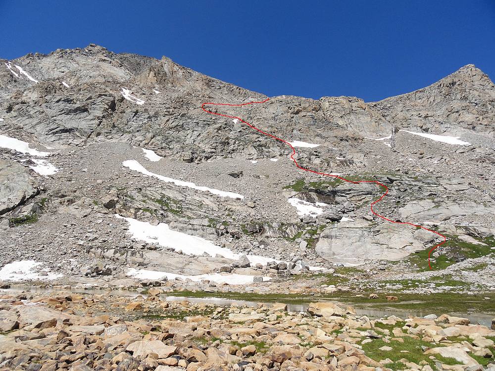
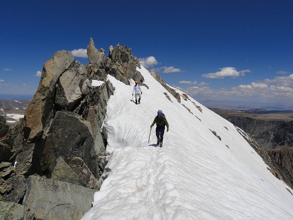
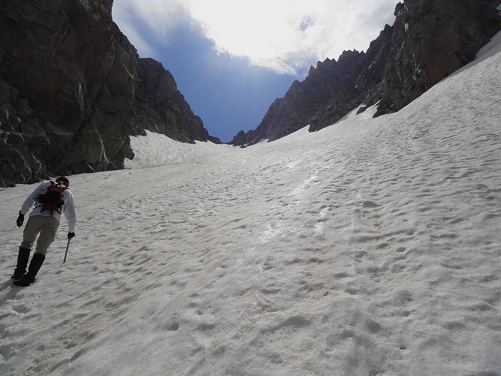
 There were several peaks around Titcomb Basin that I was interested in climbing, but after seeing the "Grand Couloir" on the northwest side of Mount Helen during our Gannett climb, I know the route was a must do. So Chris and I headed back toward Bonney Pass, before taking a right hand turn toward Mount Helen. The Grand Couloir is very easy to find, and we headed to the base of the snow and strapped on crampons for 1500 feet of snowclimbing. I'd say the steepness ranged from about 40 degrees at the easiest section near the top, all the way up to about 50 degrees at a steep inflection point about halfway up. Our progress wasn't fast as we switchbacked our way up to the saddle, which we reached after two hours of snow climbing, three hours total from camp. There were several peaks around Titcomb Basin that I was interested in climbing, but after seeing the "Grand Couloir" on the northwest side of Mount Helen during our Gannett climb, I know the route was a must do. So Chris and I headed back toward Bonney Pass, before taking a right hand turn toward Mount Helen. The Grand Couloir is very easy to find, and we headed to the base of the snow and strapped on crampons for 1500 feet of snowclimbing. I'd say the steepness ranged from about 40 degrees at the easiest section near the top, all the way up to about 50 degrees at a steep inflection point about halfway up. Our progress wasn't fast as we switchbacked our way up to the saddle, which we reached after two hours of snow climbing, three hours total from camp.
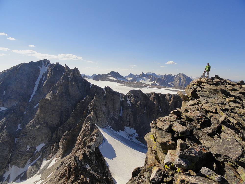
 As we started up the scramble portion of the climb, rain began to fall so we sought shelter in a notch until the rain let up. Then a bit of route finding our way up the summit ridge, and some more route finding on the ridge. Then came some more rain which drove us to seek cover again. Once the weather settled down, it was back to the ridge, which offered some great views and some easy but exposed class 4 moves along the way. When we reached the summit block, we traversed to the north and found a somewhat loose but climbable chimney that took us to just below the summit. After that, it was just a short scramble to the highpoint. The summit views were great. We could see Gannett to the north, along with Fremont Peak to the south. We could also see Titcomb Basin far below, and were even able to spot our campsite 2600 feet below us. It was a long way down! As we started up the scramble portion of the climb, rain began to fall so we sought shelter in a notch until the rain let up. Then a bit of route finding our way up the summit ridge, and some more route finding on the ridge. Then came some more rain which drove us to seek cover again. Once the weather settled down, it was back to the ridge, which offered some great views and some easy but exposed class 4 moves along the way. When we reached the summit block, we traversed to the north and found a somewhat loose but climbable chimney that took us to just below the summit. After that, it was just a short scramble to the highpoint. The summit views were great. We could see Gannett to the north, along with Fremont Peak to the south. We could also see Titcomb Basin far below, and were even able to spot our campsite 2600 feet below us. It was a long way down!
 But the weather was unsettled, and we quickly retraced our steps back down the ridge with the sound of thunder in the background. We got back to an earlier cover point just in time before the clouds opened up again. Once the weather settled back down a bit, we descended to the saddle followed by a ton of plunge stepping back down the couloir. Thanks to the weather stops, it was a little later than expected when we finally got back to camp at about 4:30pm. Now it was time to pack up go meet Ken and Mike at our next campsite in Upper Indian Basin.
Upper Titcomb Basin to Upper Indian Basin - After about an hour of packing up camp, it was time to get on the trail to go meet Ken and Mike at our next campsite in Upper Indian Basin. The clouds were dark, but it wasn't raining yet, so we enjoyed the views as we hiked down through Titcomb Basin. I'm not sure if I've ever seen so many wildflowers. After a while, I could tell I was moving slow and realized we hadn't eaten dinner. So we stopped for a break to eat, and then hit the trail again with renewed energy. With a total of 6 miles to cover, we would have to hustle to get to the campsite before dark. And to complicate things, a light rain was starting to fall. We made good time down to the Indian Creek trail junction, but our pace slowed when we began the climb up the Indian Basin trail. Several days of hiking and still heavy packs made it hard to set any land speed records. And the rain was picking up as well. By the time we neared the first lake, it was a total downpour and dusk was falling making it hard to see. Ken was going to leave a grocery sack tied to a rock to mark the spot on the trail nearest the campsite. But as we got higher and higher up the trail without seeing the marker, we began to wonder if we had missed it. We figured the farthest they'd go would be Lake 11008', but when we got to the lake, there was still no sign of them. By this time, it was almost 10pm, and the light was all but gone. We were soaked and shivering, and decided to stop there to set up camp. With limited dexterity in the cold wet conditions, setting up tents was no easy task, but we persevered. Ironically, the rain stopped about the time we got the tents up, and we turned in for the night. Dry clothes were a welcome relief, but we were still left wondering about our partners.
Day 5 But the weather was unsettled, and we quickly retraced our steps back down the ridge with the sound of thunder in the background. We got back to an earlier cover point just in time before the clouds opened up again. Once the weather settled back down a bit, we descended to the saddle followed by a ton of plunge stepping back down the couloir. Thanks to the weather stops, it was a little later than expected when we finally got back to camp at about 4:30pm. Now it was time to pack up go meet Ken and Mike at our next campsite in Upper Indian Basin.
Upper Titcomb Basin to Upper Indian Basin - After about an hour of packing up camp, it was time to get on the trail to go meet Ken and Mike at our next campsite in Upper Indian Basin. The clouds were dark, but it wasn't raining yet, so we enjoyed the views as we hiked down through Titcomb Basin. I'm not sure if I've ever seen so many wildflowers. After a while, I could tell I was moving slow and realized we hadn't eaten dinner. So we stopped for a break to eat, and then hit the trail again with renewed energy. With a total of 6 miles to cover, we would have to hustle to get to the campsite before dark. And to complicate things, a light rain was starting to fall. We made good time down to the Indian Creek trail junction, but our pace slowed when we began the climb up the Indian Basin trail. Several days of hiking and still heavy packs made it hard to set any land speed records. And the rain was picking up as well. By the time we neared the first lake, it was a total downpour and dusk was falling making it hard to see. Ken was going to leave a grocery sack tied to a rock to mark the spot on the trail nearest the campsite. But as we got higher and higher up the trail without seeing the marker, we began to wonder if we had missed it. We figured the farthest they'd go would be Lake 11008', but when we got to the lake, there was still no sign of them. By this time, it was almost 10pm, and the light was all but gone. We were soaked and shivering, and decided to stop there to set up camp. With limited dexterity in the cold wet conditions, setting up tents was no easy task, but we persevered. Ironically, the rain stopped about the time we got the tents up, and we turned in for the night. Dry clothes were a welcome relief, but we were still left wondering about our partners.
Day 5
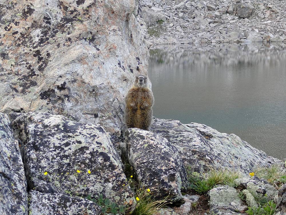
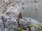 Indian Basin Touring - The next morning dawned clear and sunny. The tent spot I had chosen in the rainy dark the night before was less than stellar, and I awoke to a strange sound outside. Then it occurred to me, marmot! I sprung out of my tent just in time to grab the sleeve of my favorite hiking shirt that was disappearing down a marmot hole. I'd left in on a nearby rock the night before, and an opportunistic marmot had grabbed it and ate a few holes in it before I could grab it. Later, it climbed up out of its hole, stood up on its hind legs, and stared at me indignantly as if the ask for the shirt back. Sheesh, the nerve!
Chris got up soon after, and we contemplated our next move while our wet gear laid out in the sun to dry for a bit. In looking at the map, we couldn't see any good place to camp higher than the lake we were at, so we packed up and headed back down to find the campsite marker we must have missed in the dark the night before. Along the way, we asked a couple groups if they'd seen Mike or Ken, but no luck. Eventually we made it back down to the Indian Creek trail junction, but no sign of our partners. Since the junction seemed like the most logical centralized meeting point, we decided to wait there until they showed up. Indian Basin Touring - The next morning dawned clear and sunny. The tent spot I had chosen in the rainy dark the night before was less than stellar, and I awoke to a strange sound outside. Then it occurred to me, marmot! I sprung out of my tent just in time to grab the sleeve of my favorite hiking shirt that was disappearing down a marmot hole. I'd left in on a nearby rock the night before, and an opportunistic marmot had grabbed it and ate a few holes in it before I could grab it. Later, it climbed up out of its hole, stood up on its hind legs, and stared at me indignantly as if the ask for the shirt back. Sheesh, the nerve!
Chris got up soon after, and we contemplated our next move while our wet gear laid out in the sun to dry for a bit. In looking at the map, we couldn't see any good place to camp higher than the lake we were at, so we packed up and headed back down to find the campsite marker we must have missed in the dark the night before. Along the way, we asked a couple groups if they'd seen Mike or Ken, but no luck. Eventually we made it back down to the Indian Creek trail junction, but no sign of our partners. Since the junction seemed like the most logical centralized meeting point, we decided to wait there until they showed up.
 After much deliberation over then next 90 minutes, we eventually decided to leave a note at the junction and head back up into Indian Basin. Climbing the hill again was not high on my wish list, but we figured they must have camped further up the trail. Soon we ran into some hikers who had seen them, what a relief. We continued up the trail, and found them in a basin below Fremont Peak, less than a quarter mile beyond where we had camped the night before. So close. We all came out of the deal a good story, and no harm done. After much deliberation over then next 90 minutes, we eventually decided to leave a note at the junction and head back up into Indian Basin. Climbing the hill again was not high on my wish list, but we figured they must have camped further up the trail. Soon we ran into some hikers who had seen them, what a relief. We continued up the trail, and found them in a basin below Fremont Peak, less than a quarter mile beyond where we had camped the night before. So close. We all came out of the deal a good story, and no harm done.
 Indian Basin Point - After hanging around camp for a while fighting off marmots, we had dinner, and then still had some time to kill. So Ken, Chris and decided to hike up "Indian Basin Point" (Peak 11460'). It looked to be only about a mile and a half round trip, and promised some great views of Indian Basin and the surrounding peaks. So back down the trail we went, then up the south side of the peak to the summit, where we found a small cairn. We had a great vantage point to take in the views, and could also see some big black storm clouds coming in from the south. So we scampered down the peak and back to camp, just in time for a huge storm to roll in. Thunder and lightning, wind and rain surrounded us for several hours, but I had the best night of sleep the entire trip, warm inside my tent.
Day 6 Indian Basin Point - After hanging around camp for a while fighting off marmots, we had dinner, and then still had some time to kill. So Ken, Chris and decided to hike up "Indian Basin Point" (Peak 11460'). It looked to be only about a mile and a half round trip, and promised some great views of Indian Basin and the surrounding peaks. So back down the trail we went, then up the south side of the peak to the summit, where we found a small cairn. We had a great vantage point to take in the views, and could also see some big black storm clouds coming in from the south. So we scampered down the peak and back to camp, just in time for a huge storm to roll in. Thunder and lightning, wind and rain surrounded us for several hours, but I had the best night of sleep the entire trip, warm inside my tent.
Day 6
 Fremont Peak Climb - We awoke to blue skies and sunshine, and with plans for all four of us to climb Fremont Peak, the third highest peak in Wyoming. After a warm breakfast, we were on the move by 8am, on our way to the 12000' saddle on Fremont's south ridge. We made good time up to the saddle, where we were greeted by good views of Titcomb Basin on the other side of the ridge. From here the scrambling began, and we picked our way up through the rock. There were lots of route possibilities, but in general we just took the path of least resistance. Minimizing resistance was key given all the miles we had covered so far during the trip. Slow and steady was the mode for the day. One of the highlights of the week was a Pine Marten we found scampering around on the rocks at about the 13200' level. It seemed little strange to see it up so high, but there it was. Fremont Peak Climb - We awoke to blue skies and sunshine, and with plans for all four of us to climb Fremont Peak, the third highest peak in Wyoming. After a warm breakfast, we were on the move by 8am, on our way to the 12000' saddle on Fremont's south ridge. We made good time up to the saddle, where we were greeted by good views of Titcomb Basin on the other side of the ridge. From here the scrambling began, and we picked our way up through the rock. There were lots of route possibilities, but in general we just took the path of least resistance. Minimizing resistance was key given all the miles we had covered so far during the trip. Slow and steady was the mode for the day. One of the highlights of the week was a Pine Marten we found scampering around on the rocks at about the 13200' level. It seemed little strange to see it up so high, but there it was.
 When we finally crested the summit ridge, we were astounded by the awesome views. With the Upper Fremont Glacier spread out before us, it was an amazing vantage point. And the exposure was enough to keep our attention too. Of course you wouldn't know it by the way Chris strolled around the ridgeline. Ken was a little less comfortable on our perch, but enjoyed the experience anyway. After photos, a snack, and even a couple calls back home (yes, we had 3G coverage), it was time to head down. The downclimb was uneventful, and we made good time thanks to the fact we didn't have to stop and catch our breath every four steps like we had on the way up. We made it back to the campsite by about 1:30pm, and enjoyed a well deserved lunch. When we finally crested the summit ridge, we were astounded by the awesome views. With the Upper Fremont Glacier spread out before us, it was an amazing vantage point. And the exposure was enough to keep our attention too. Of course you wouldn't know it by the way Chris strolled around the ridgeline. Ken was a little less comfortable on our perch, but enjoyed the experience anyway. After photos, a snack, and even a couple calls back home (yes, we had 3G coverage), it was time to head down. The downclimb was uneventful, and we made good time thanks to the fact we didn't have to stop and catch our breath every four steps like we had on the way up. We made it back to the campsite by about 1:30pm, and enjoyed a well deserved lunch.
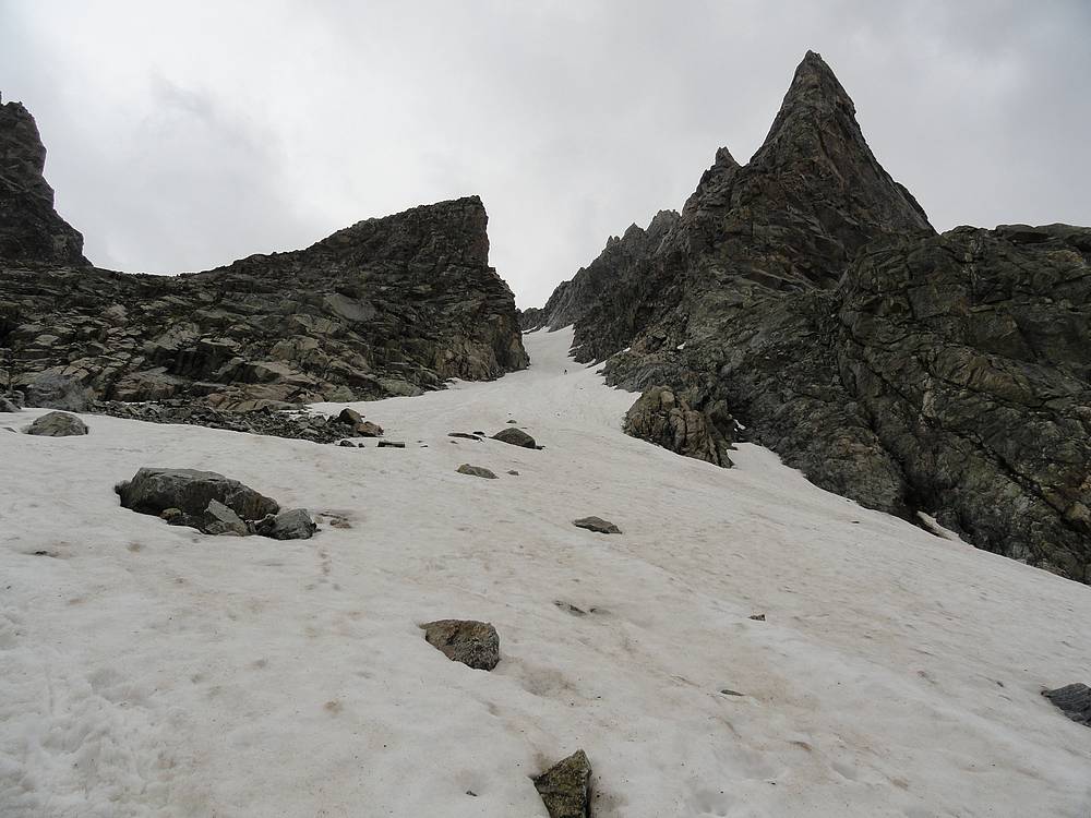
 Jackson Peak Climb - Our trip was nearing its end, but there was still enough time to climb another peak! So after lunch, Chris and I headed further up Indian Basin to climb Jackson Peak. We would meet back up with Ken and Mike later, who were going to break camp and head down the trail a few miles to get a head start on the hike out. The trail up got progressively fainter as we headed toward Indian Pass. But it was open country so navigating wasn't bad. I'd read about a class 2 ramp that angled up Jackson's south face to give access to the broad saddle above. Finding the ramp was a riddle though, and we couldn't spot any easy way up. Eventually we just picked a line and went for it. Luckily, we guessed right, and the ramp became more obvious as we got closer. The rock was a bit loose, and we were careful not to kick any rock down on each other. We climbed for a while, then turned right sharply at the top of the ramp and scramble up into the broad saddle. It was a large field of boulders and talus up to the saddle, then more boulders and talus as we made our way up the slopes toward the summit. We stayed to the south as much as possible to avoid snowfields. Jackson Peak Climb - Our trip was nearing its end, but there was still enough time to climb another peak! So after lunch, Chris and I headed further up Indian Basin to climb Jackson Peak. We would meet back up with Ken and Mike later, who were going to break camp and head down the trail a few miles to get a head start on the hike out. The trail up got progressively fainter as we headed toward Indian Pass. But it was open country so navigating wasn't bad. I'd read about a class 2 ramp that angled up Jackson's south face to give access to the broad saddle above. Finding the ramp was a riddle though, and we couldn't spot any easy way up. Eventually we just picked a line and went for it. Luckily, we guessed right, and the ramp became more obvious as we got closer. The rock was a bit loose, and we were careful not to kick any rock down on each other. We climbed for a while, then turned right sharply at the top of the ramp and scramble up into the broad saddle. It was a large field of boulders and talus up to the saddle, then more boulders and talus as we made our way up the slopes toward the summit. We stayed to the south as much as possible to avoid snowfields.
 The climbing wasn't as enjoyable as the other peaks on the trip, but the summit views were excellent. From the top of Jackson, we had a great vantage point the check out Fremont Peak, which we had climbed earlier that day. We could also make out Helen and Gannett to the north. So after lounging around on the summit for a while, it was time to head down. Our pace wasn't particularly quick, even heading downhill, and it was about 7:30pm by the time we wandered back to camp.
Upper Indian Basin to Little Seneca Lake - Since we were 16 miles from the trailhead, it seemed like a good plan to get a head start and hike out about six miles that night. Ken and Mike had left earlier in the afternoon, and would set up camp at Little Seneca Lake. Chris and I got back from our Jackson Peak climb a little later than expected. (I gotta remember to allot for "summit lounging" time.) So by the time we packed up camp and had dinner, it was 9pm before we hit the trail. A bit later start than most would prefer, but at least we had maximized usage of the daylight hours. Unfortunately, that meant quite a bit of hiking in the dark. At one point around the outlet stream of the largest Indian Basin Lake, I managed to tweak my ankle. Hard to believe I would step wrong on some rock in the dark, right? Needless to say, our pace was slowed considerably from that point on. Chris was very patient though, and loaned me his trekking poles, which helped a ton. It was unique experience, and we paused a couple times to check out the alpine scenery in the moonlight. It was 12:30am by the time we reached the campsite, and hastily set up our tents in the dark before turning in for the night.
Day 7
Little Seneca Lake to Elkhart Park Trailhead - Our final morning was blue skies and sunshine once again. We weren't moving too quick and it was 9:30am before we started the ten mile hike out. My ankle felt much better, but was still a bit tender so our pace wasn't very fast. Thankfully we only had to cover ten miles. Lot's of ups and downs the first half of the day, but checking out elk tracks on the trail kept our spirits up. Soon enough, we caught up with the source of tracks, The climbing wasn't as enjoyable as the other peaks on the trip, but the summit views were excellent. From the top of Jackson, we had a great vantage point the check out Fremont Peak, which we had climbed earlier that day. We could also make out Helen and Gannett to the north. So after lounging around on the summit for a while, it was time to head down. Our pace wasn't particularly quick, even heading downhill, and it was about 7:30pm by the time we wandered back to camp.
Upper Indian Basin to Little Seneca Lake - Since we were 16 miles from the trailhead, it seemed like a good plan to get a head start and hike out about six miles that night. Ken and Mike had left earlier in the afternoon, and would set up camp at Little Seneca Lake. Chris and I got back from our Jackson Peak climb a little later than expected. (I gotta remember to allot for "summit lounging" time.) So by the time we packed up camp and had dinner, it was 9pm before we hit the trail. A bit later start than most would prefer, but at least we had maximized usage of the daylight hours. Unfortunately, that meant quite a bit of hiking in the dark. At one point around the outlet stream of the largest Indian Basin Lake, I managed to tweak my ankle. Hard to believe I would step wrong on some rock in the dark, right? Needless to say, our pace was slowed considerably from that point on. Chris was very patient though, and loaned me his trekking poles, which helped a ton. It was unique experience, and we paused a couple times to check out the alpine scenery in the moonlight. It was 12:30am by the time we reached the campsite, and hastily set up our tents in the dark before turning in for the night.
Day 7
Little Seneca Lake to Elkhart Park Trailhead - Our final morning was blue skies and sunshine once again. We weren't moving too quick and it was 9:30am before we started the ten mile hike out. My ankle felt much better, but was still a bit tender so our pace wasn't very fast. Thankfully we only had to cover ten miles. Lot's of ups and downs the first half of the day, but checking out elk tracks on the trail kept our spirits up. Soon enough, we caught up with the source of tracks,  which was a llama pack train. It felt good to finally reach Photographers Point in early afternoon, and stop for a snack break. It was downhill from there. And even though there wasn't much in the way of views for the last few miles, we did appreciate the shady forest keeping us cool. We arrived back at the Elkhart Park trailhead at just before 4pm, excited to be free of our heavy packs, but still not wanting the trip to be over. After sorting out gear, we hustled back into town for a $5 shower at the Pinedale Aquatic Center and an excellent bacon cheeseburger at the Wind River Brewing Company. Both were well worth the price. which was a llama pack train. It felt good to finally reach Photographers Point in early afternoon, and stop for a snack break. It was downhill from there. And even though there wasn't much in the way of views for the last few miles, we did appreciate the shady forest keeping us cool. We arrived back at the Elkhart Park trailhead at just before 4pm, excited to be free of our heavy packs, but still not wanting the trip to be over. After sorting out gear, we hustled back into town for a $5 shower at the Pinedale Aquatic Center and an excellent bacon cheeseburger at the Wind River Brewing Company. Both were well worth the price.
I can't say enough about how much I enjoyed this trip. The scenery was truly spectacular. Everything in the area is just plain BIG. And accomplishing a long time goal of climbing Gannett Peak was very rewarding and even better than expected. Throwing in a couple other 13000-foot peaks was the icing on the cake. Of course it wouldn't have been half as enjoyable without such great hiking partners. The other three guys had never met before the trip, but I think we all gelled together very well as a group. Now when are we going back???

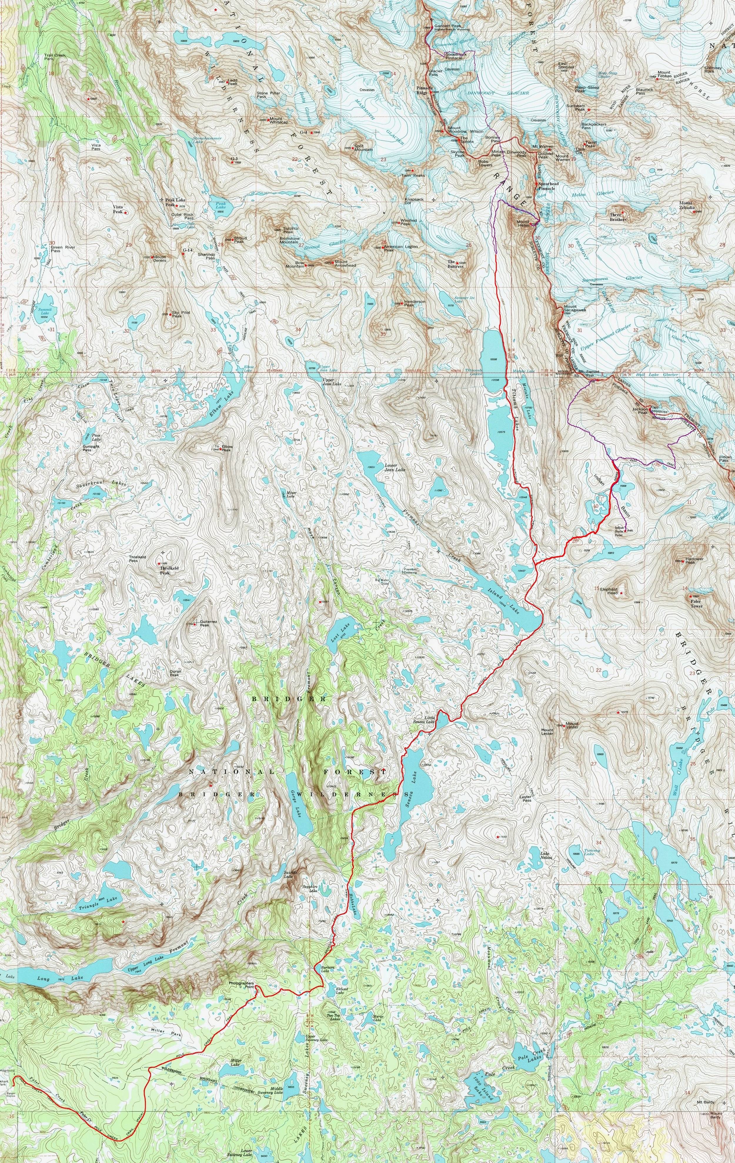
Map of the route, about 65 miles round trip. |

View from Photographer's Point. |
Clouds reflecting in Hobbs Lake. |

Great sunset at Hobbs Lake. |
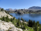
Seneca Lake. |
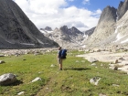
On the trail, nearing Island Lake. |
Chris soaking in the sun above Island Lake. |

Lots of wildflowers as we near Titcomb Basin. |
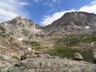
Titcomb Basin. |
Ken gawking at the views. |
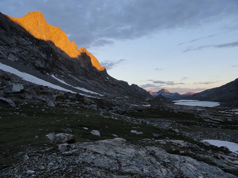
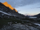
Sunset alpenglow on Mount Sacagawea above Titcomb Lakes. |
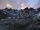
Sunset view from our basecamp at upper Titcomb Basin. |
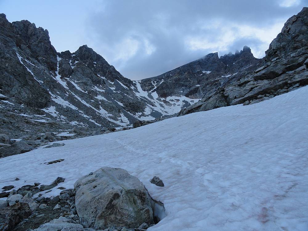
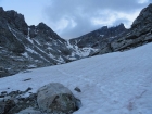
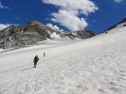
Heading toward Bonny Pass in the morning. |
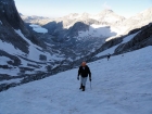
Chris and Mike climbing the snowfield below Bonny Pass. |
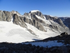
Our first view of Gannett Peak, from Bonny Pass. Wow! |

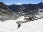
Crossing the Dinwoody Glacier. |
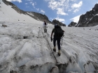
Mike and Chris on the lower section of the Gooseneck Glacier. |
Crossing the bergschrund, still a healthy snowbridge in place. |
Nearing the upper snowfield on Gannett Peak. |
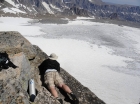
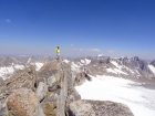
Victory shot of Chris, Dave, and Mike on Gannett Peak. |

Leaving the summit of Gannett Peak. |

Descending the summit ridge on Gannett Peak. |

View back across the Dinwoody Glacier of Bonny Pass. |
Crossing the Dinwoody Glacier on the way back. |
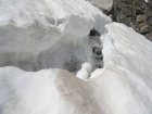
We had to hop over a couple small crevasses on the way back. |
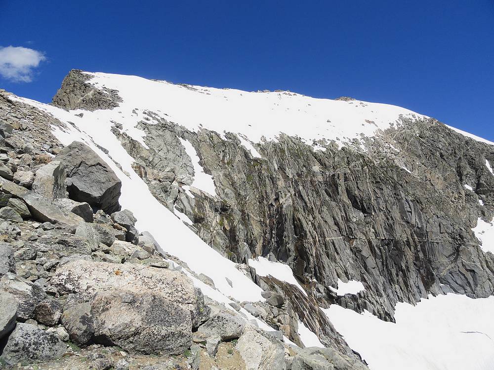
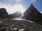
Looking up the 1500' northwest gully on Mount Helen. |

Chris climbing Mount Helen's northwest gully. |
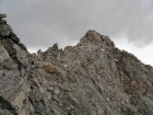
Chris contemplating Mount Helen's class 4 ridge. |
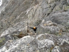
Chris in the crux chimney just below the summit of Mount Helen. |

Victory shot of Chris and Dave on Mount Helen. Gannett Peak in the background. |
Mount Helen summit view looking south to Jackson Peak, Fremont Peak, Mount Sacagawea, and Titcomb Basin. |
Looking down the 1500' northwest gully on Mount Helen. |

Chris descending Mount Helen's northwest gully. |
This indignant marmot ate my favorite hiking shirt! |
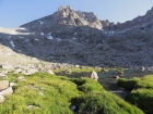
Fremont Peak and Jackson Peak from our campsite. |
Camp below Fremont Peak. |
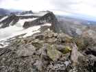
Splattski style shot of Dave, Chris, and Ken on the summit of Indian Basin Point. |
Fremont Peak in the morning. |

Lots of wildflowers as we climb the to saddle on the south ridge of Fremont Peak. |
We saw this Pine Marten at around 13200' on Fremont Peak. |
Boulder and slabs were plentiful on the way up Fremont Peak. |
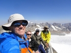
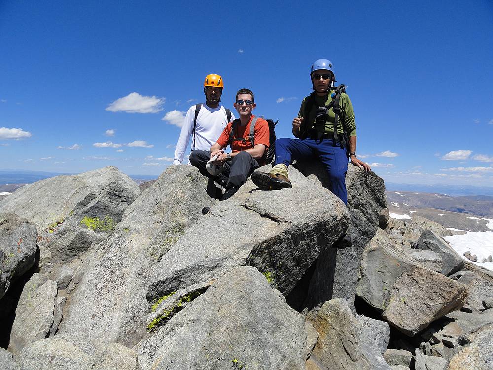
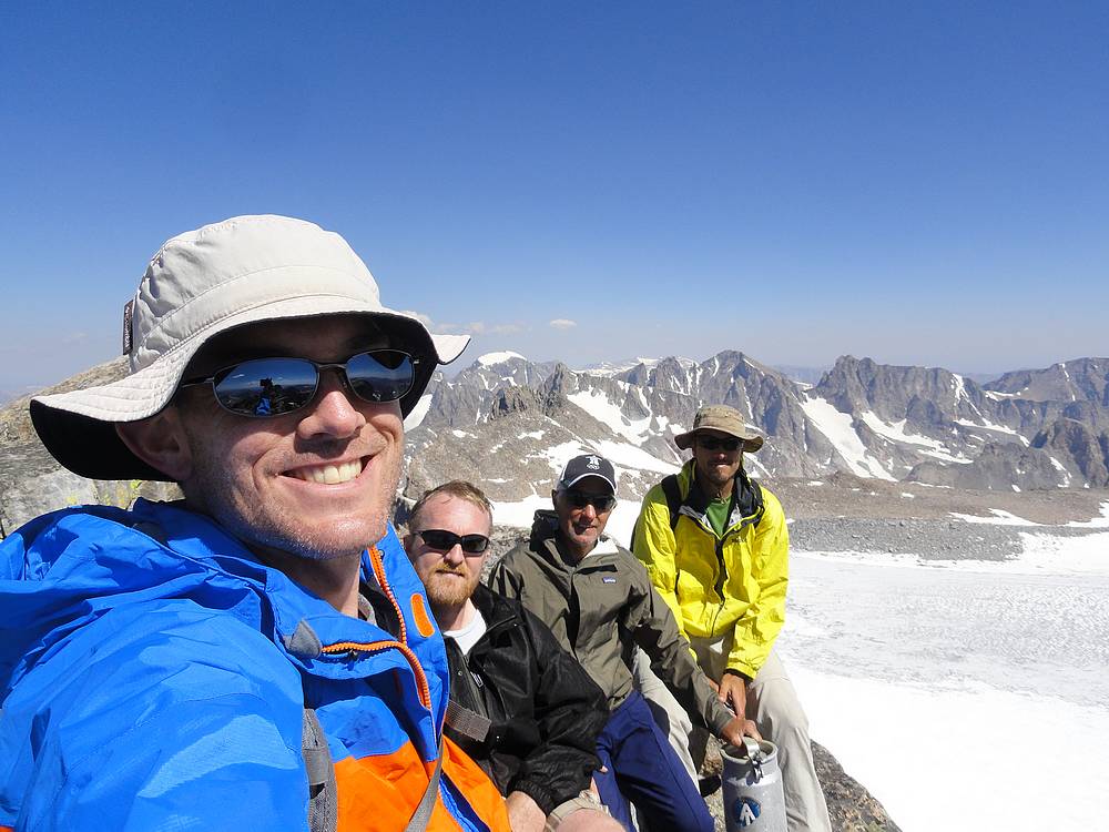
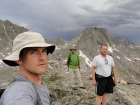
Victory shot of Dave, Ken, Mike, and Chris on the summit of Fremont Peak. |
Ken doesn't like exposure, but did lean out to check out the view of the Upper Fremont Glacier. |
Chris on the summit ridge of Fremont Peak. Gannett Peak in the background. |
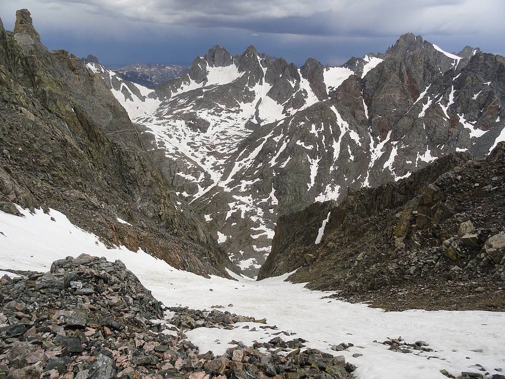
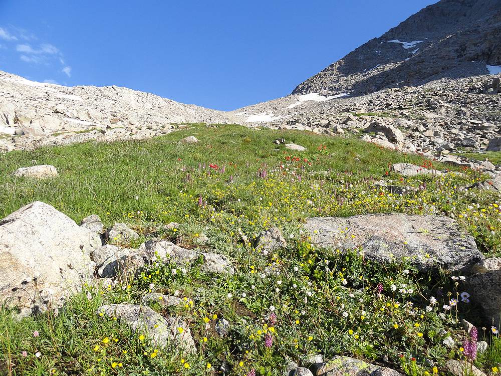
Upper Indian Basin. |
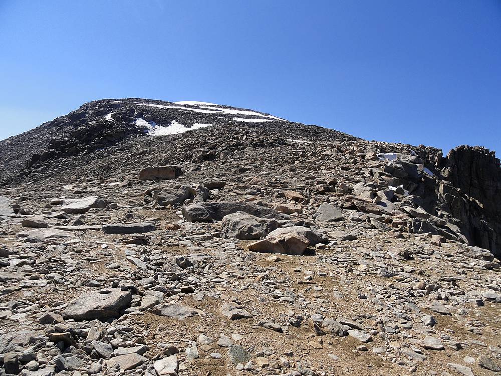
Our route up Jackson Peak. |
Ramp leading up the south face of Jackson Peak. |

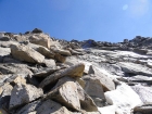
Tedious boulder fields guard the summit of Jackson Peak. |
Chris on the summit of Jackson Peak. Fremont Peak on the left, Mount Helen and Gannett Peak visible in the distance. |
Back at the Elkhart Park trailhead after a great seven day trip. |
 |
|