|
White Cloud Tour
Patterson Peak (10872') - Mount Frank (10857') - Blackmon Peak (10307')
June 28, 2013
The White Cloud Mountains of central Idaho are highly scenic, but are relatively unknown, even to those who live in Idaho. The most popular trailhead for the range is on Fourth of July Creek, at almost 8800 feet in elevation. This high starting point gives great access to alpine lakes, high peaks, and some of the most beautiful scenery you will find anywhere. Our plans for the day included three peaks, Patterson Peak, Mount Frank (el 10857') and Blackmon Peak.
Constantyn is a mountain addict who lives in Houston surrounded by flat land. Needless to say anytime he travels to Idaho for work, he's always looking for a chance to get into the backcountry. And of course I'm happy to help him feed his addiction. After suggesting a few options, I was stoked when Constantyn chose the White Clouds, my favorite range.
We got a late start leaving Boise, so it was almost 11:30pm Friday night before we rolled out our sleeping bags at the Fourth of July trailhead, ready for a night under the stars. The weather forecast called for a hot day, but it was a chilly forty-something degrees when we hit the trail at 6:45am. So we walked fast to keep warm, and it took us less than 45 minutes to reach Fourth of July Lake. We stopped there for couple minutes to put on sunscreen, then jumped back on the trail leading to Antz Basin Divide.
Cresting the ridge at the divide is one of the best views I've seen anywhere. Looking out over the verdant Antz Basin, with the alabaster David O Lee Peak in the background, is very memorable. But we didn't linger long, and hung a right up the ridge toward Patterson Peak. It was easy going, never too steep, and we were on the summit by 9am. I was looking forward to ready my entries in the register from my prior two visits, but someone had removed it. I'm still at a loss to understand why someone(s) is stealing registers.
The views from Patterson are excellent in all directions, highlighted by the massive Castle Peak hulking above Four Lakes Basin. From the summit, we could see the connecting ridge to our next objective, Mount Frank. Down climbing the ridge was more challenging and more fun than the ridge we had climbed, with a little exposure and a couple short knife edge sections. But the rock was stable and all moves were class 3 or easier so not too difficult.
After a snack break on the broad saddle between the two peaks, we started up the southwest ridge of Mount Frank. The ridge itself was jagged in several places, and the north side was steep, but fortunately we were able to cheat over to the south side of the ridge for a while to find a way up. The route finding made for slow going at times, and it took us almost an hour to reach the summit at about 11:15. Mount Frank is very centrally located, with great views of Castle Peak, Serrate Ridge, Quiet Lake, Cardiac Peak, Lonesome Peak, Boorn Lakes, and many others.
With the complexity of the ridge leaving Mount Frank, it took us almost as long to descend as it had taken us to climb up. By the time we reached the shores of the largest of the Boorn Lakes, it was nearly 1pm and we were ready to refill out water bottles and take a break for some well deserved lunch. Some other hikers arrived while we were there, including Deb R from the message board who I got to meet for the first time. But the clock was ticking and we had more ground to cover so we hit the trail. We enjoyed wandering across Antz Basin, but the hot sun slowed our progress as we climbed the steep trail back up toward the divide. But the views kept our minds occupied and we made steady progress up and out of the basin.
Once on the ridge, we set our sights on Blackmon Peak. The ridge leading to Blackmon is actually pretty flat most of the way, with a faint trail that fades in and out. This made for easy going, and we soaked in the awesome views that surrounded us. There was one last steep 300 foot section at the base of Blackmon's summit block. A steep climb late in the day always takes a lot out of me, but we powered our way up, reaching the summit by 3:30pm. Again, the summit register was gone, so there would be no reminiscing about past climbs.
Now it was decision time. We had hoped to extend the day and climb a couple of the peaks on the far side of Strawberry Basin. It was a little later in the day than expected, our dogs were barking, and our motivation levels were fading in the hot afternoon sun. But the temptation to explore new terrain was more than we could resist, and we decided to descend Blackmon's north ridge anyway. The ridge was straightforward and with great views, but by the time we reach the old mining road at the saddle our better judgment had kicking in. We did the math on how long it would take to reach the peaks, and how tired we would be hiking back to the car with headlamps on. So we decided to stop there. Strawberry Basin looked very pretty, so I know I'll be back.
The map shows the jeep trail, which was an old mining road, leading all the way back to trailhead. But much work was done a few years ago to obliterate the road and help provide more of a wilderness experience. So the road was tilled up, and a single track trail left in its place. We followed this trail that contoured around to the saddle southwest of Blackmon Peak. The newly constructed trail continued for a while down the slopes toward the trailhead before mysteriously ending. We did our best to follow the tilled up road, but eventually gave up and headed cross country down to the trailhead. Hopefully they will soon extend the new trail all the down to the trailhead. Cross country travel in the area is fairly easy with minimal brush, but most folks will likely miss out on Strawberry Basin without a trail.
It was nearly 5pm by the time we got back to the car. We had spent 10 hours enjoying some of Idaho's best scenery, and it was hard to leave. But bacon cheeseburgers in Stanley were calling us, so we reluctantly hit the road.
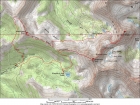
Map of the route, 12 miles round trip with 4000' elevation gain.
|
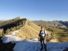
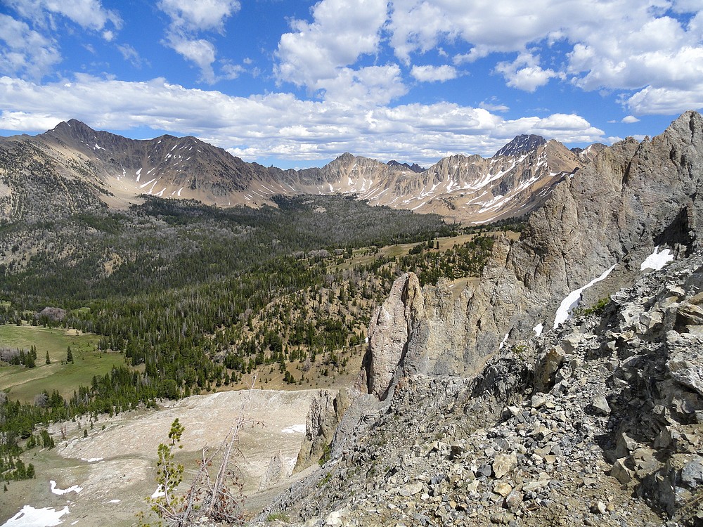
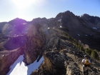
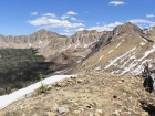
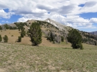
Leaving the trail at Antz Basin Divide, Blackmon Peak in the background.
|
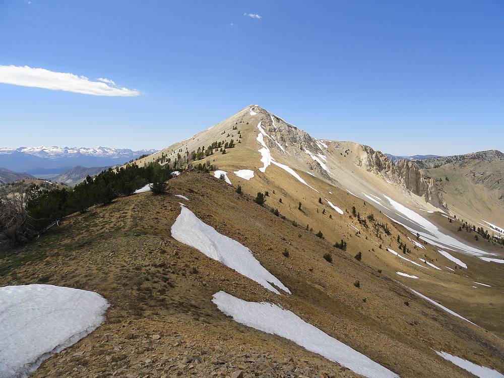
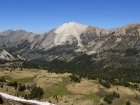
Heading up the west ridge of Patterson Peak, Mount Frank on the left.
|

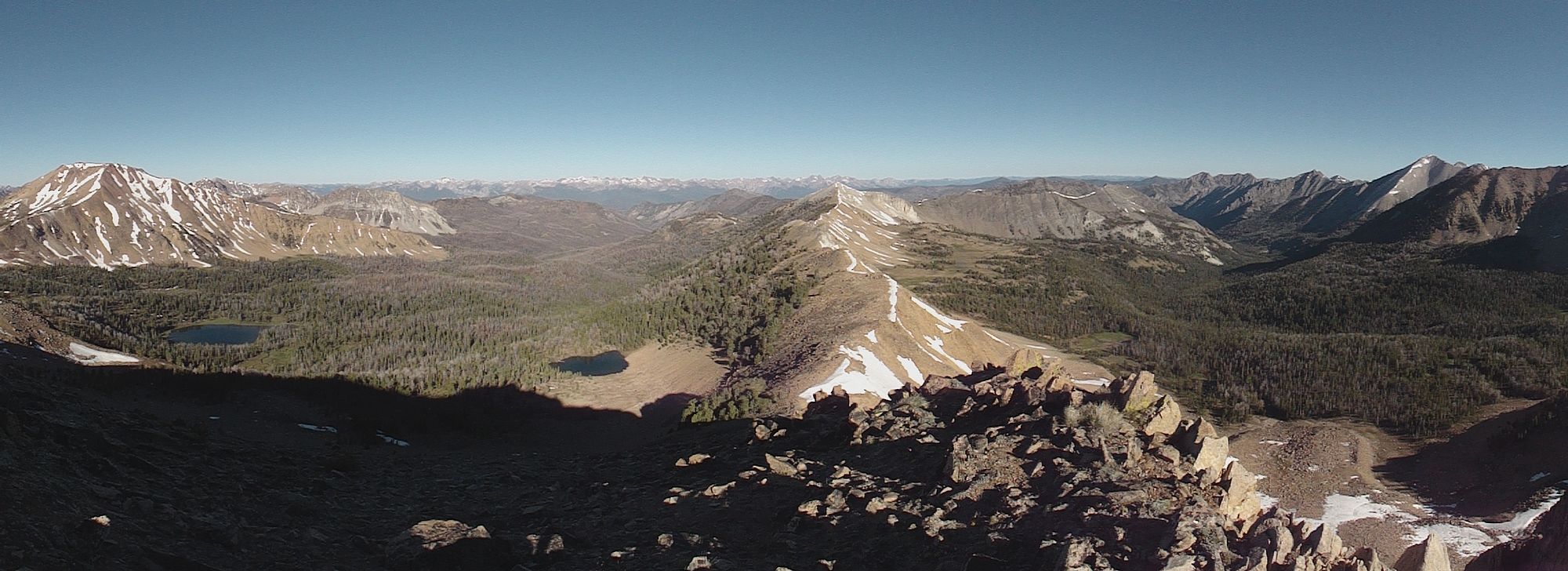
Panoramic view looking back, Sawtooths in the distance.
|
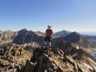
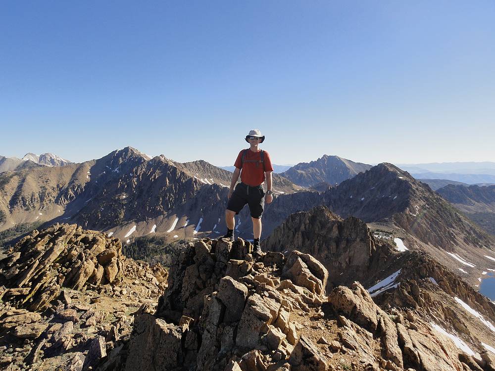
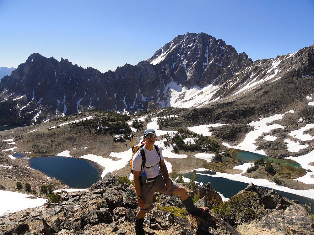
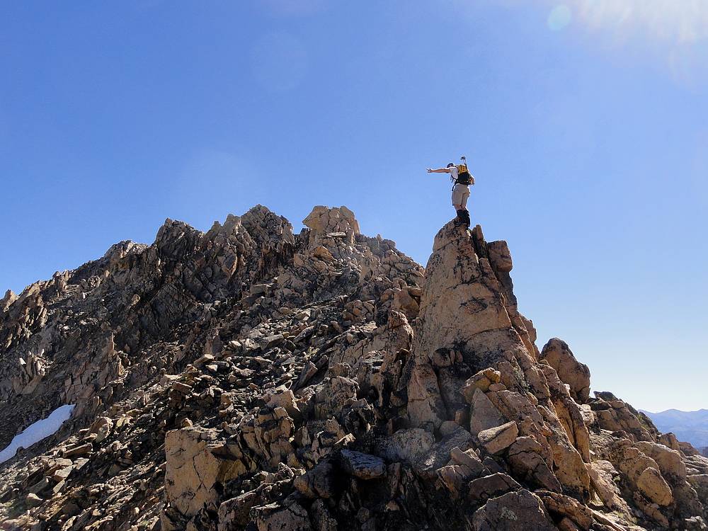
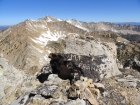
Dave on the summit of Patterson Peak, ridge to Mount Frank on the right.
|
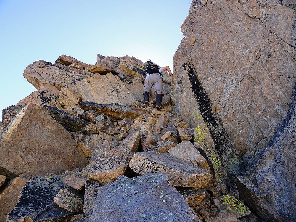
Downclimbing Patterson's northeast ridge.
|

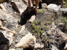
Short chimney we climbed along the ridge.
|

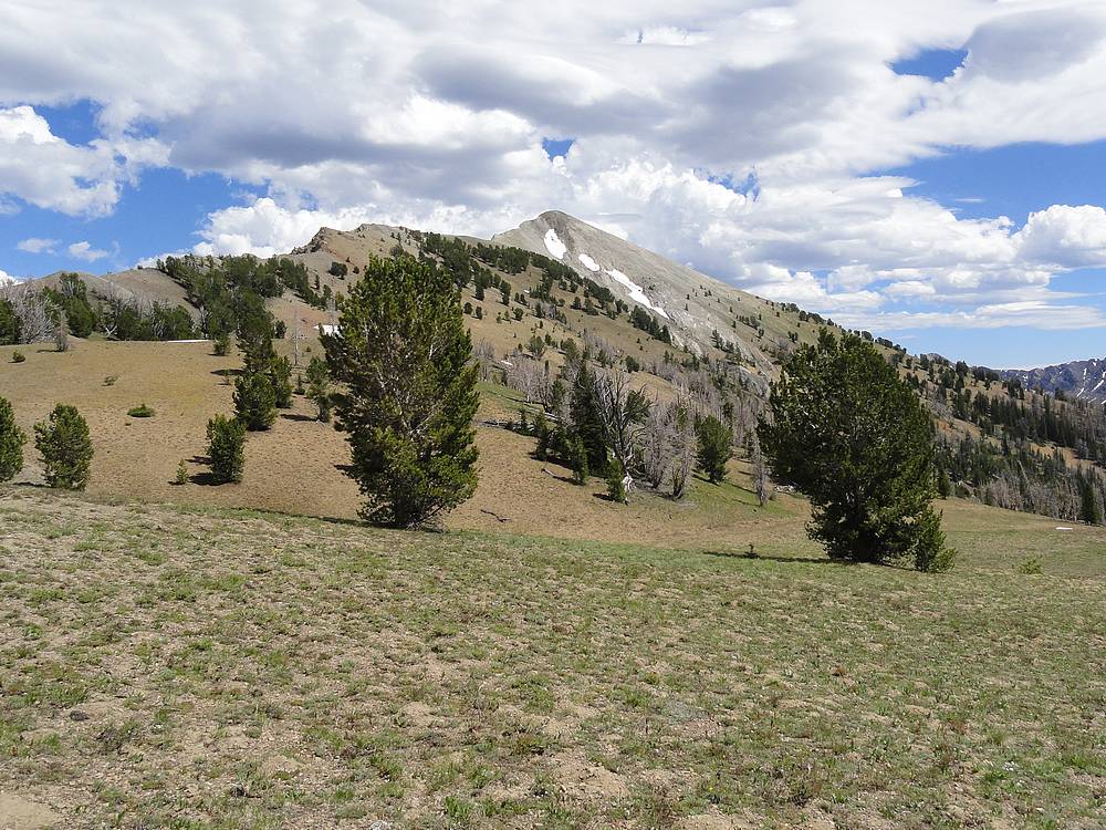
Looking back toward Patterson Peak.
|

Castle Peak & Serrate Ridge above Four Lakes Basin.
|
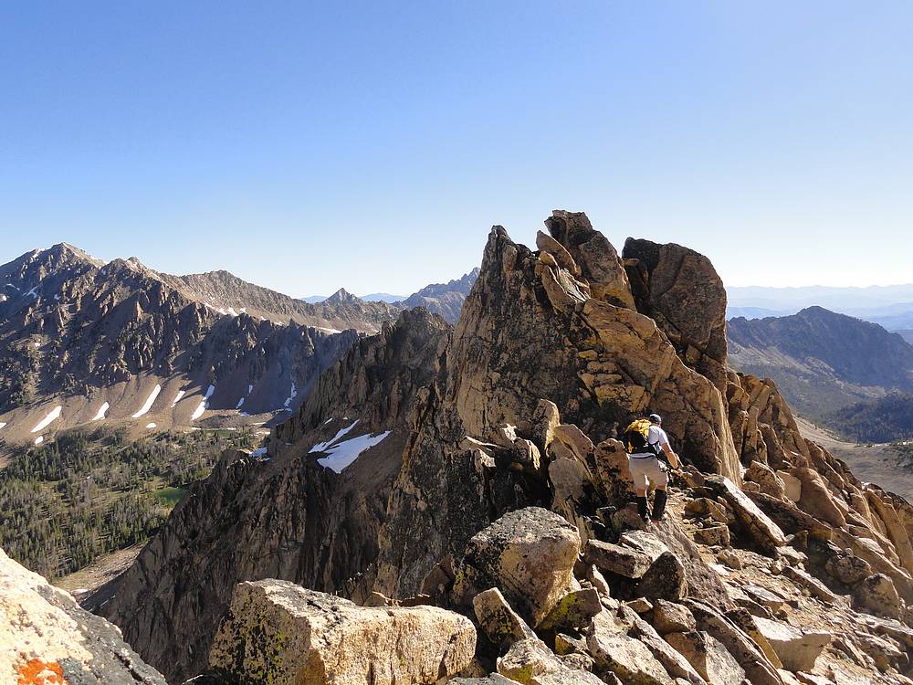
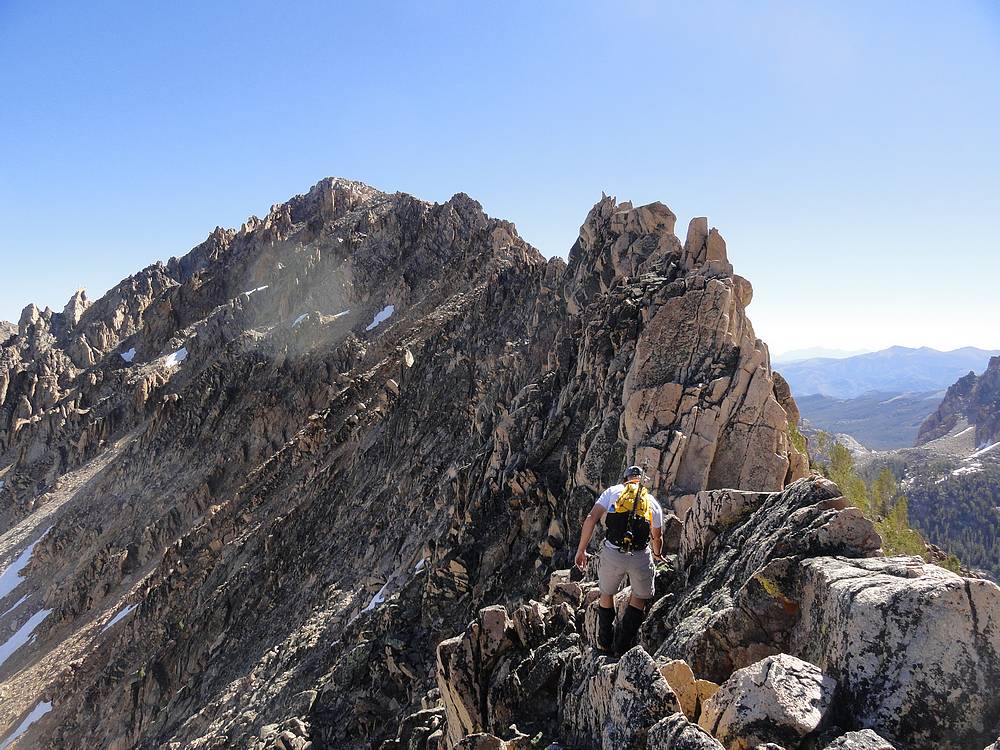
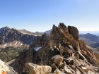
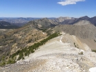
The complex southwest ridge of Mount Frank.
|
If you find this huge pile of goat poop, you'll know you’re on route.
|

Finger of Constantyn.
|

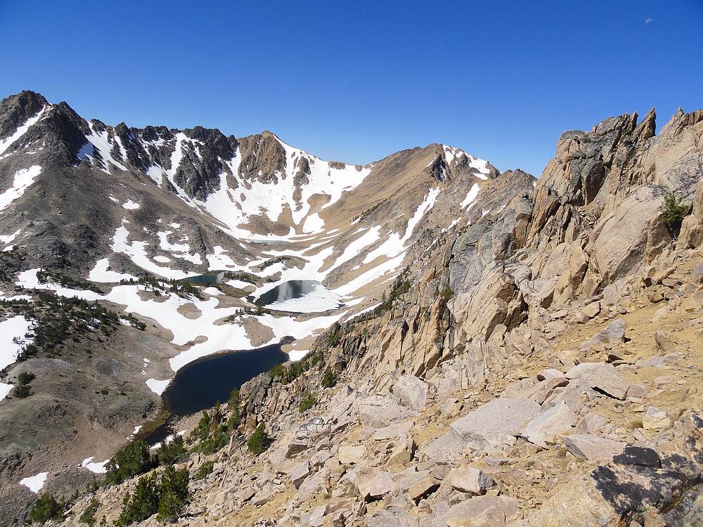
Looking back at Patterson Peak above Four Lakes Basin, from Mount Frank.
|

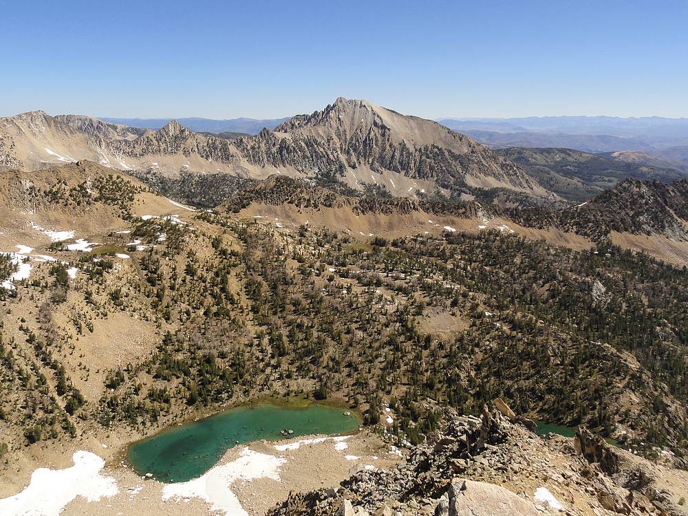
Cardiac Peak to the northwest, from Mount Frank.
|
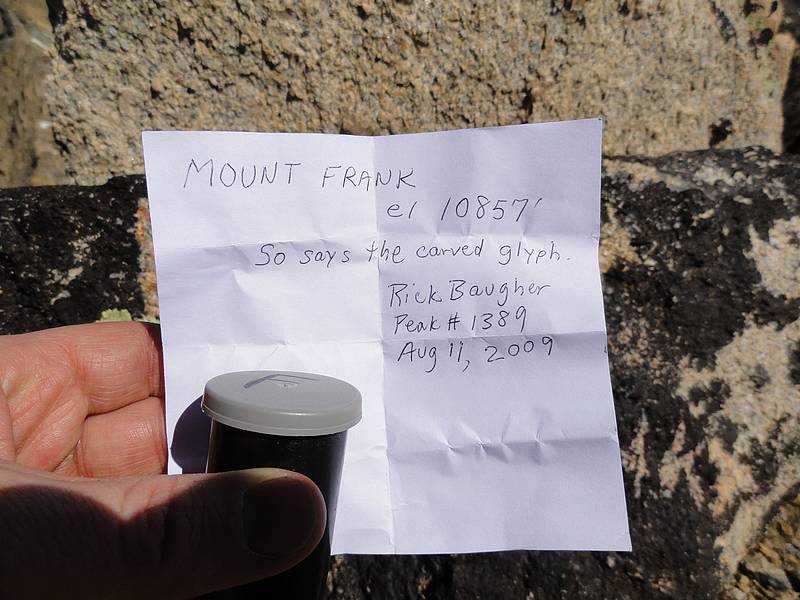
Mount Frank summit marker.
|

Rick B's signature film canister.
|
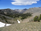
Lonesome Peak above the descent route to Boorn Lakes.
|

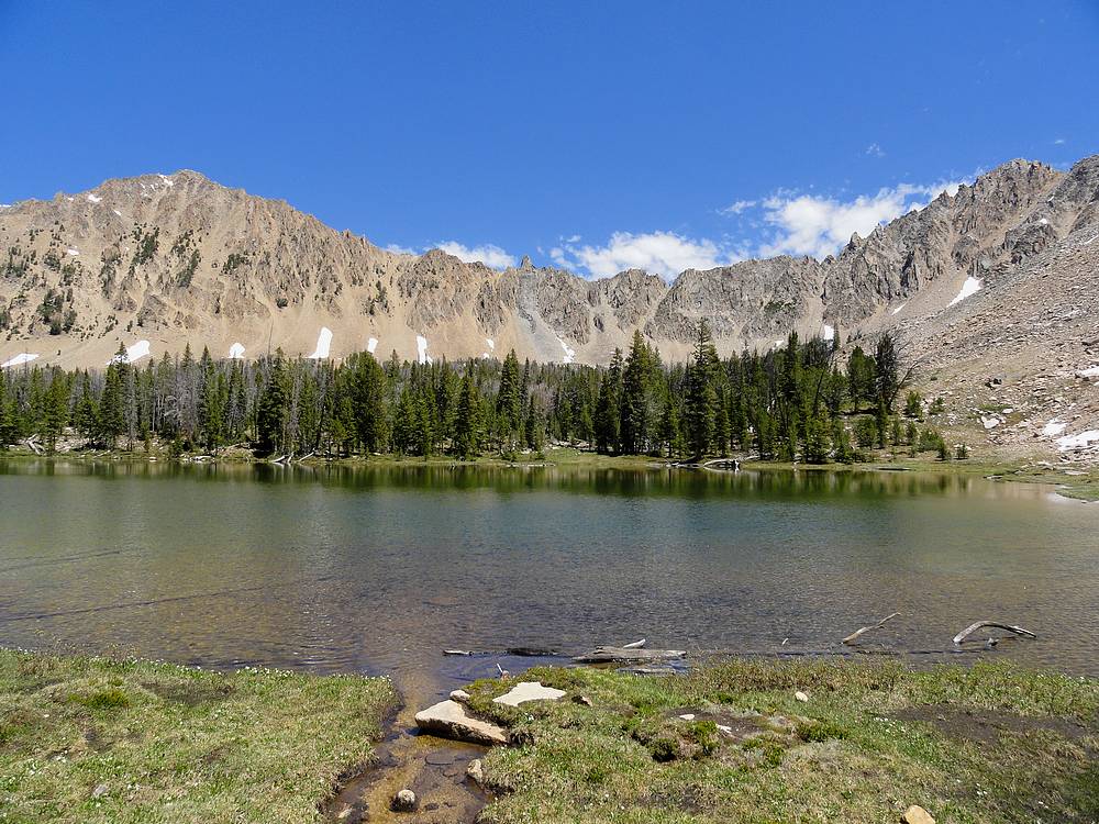
The beautiful Boorn Lakes. (Misspelled on maps as Born Lakes.)
|
Mount Frank in the distance, Antz Basin below. (Misspelled on maps as Ants Basin.)
|
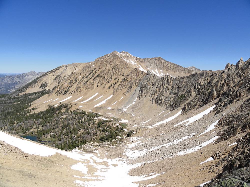
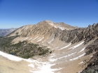
Mount Frank (left) and Patterson Peak (right). We traversed the connecting ridge earlier in the day.
|
David O Lee Peak above Antz Basin.
|

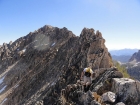
Hiking along the ridge toward Blackmon Peak.
|
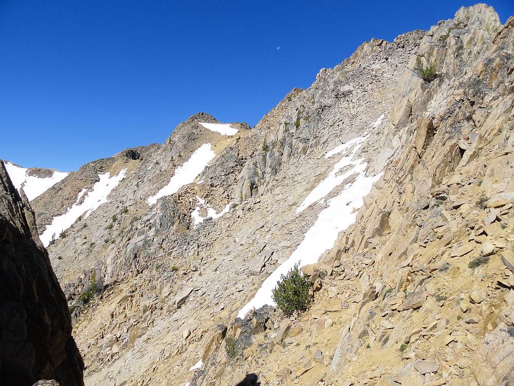
Looking down the north ridge of Blackmon Peak toward Strawberry Basin.
|
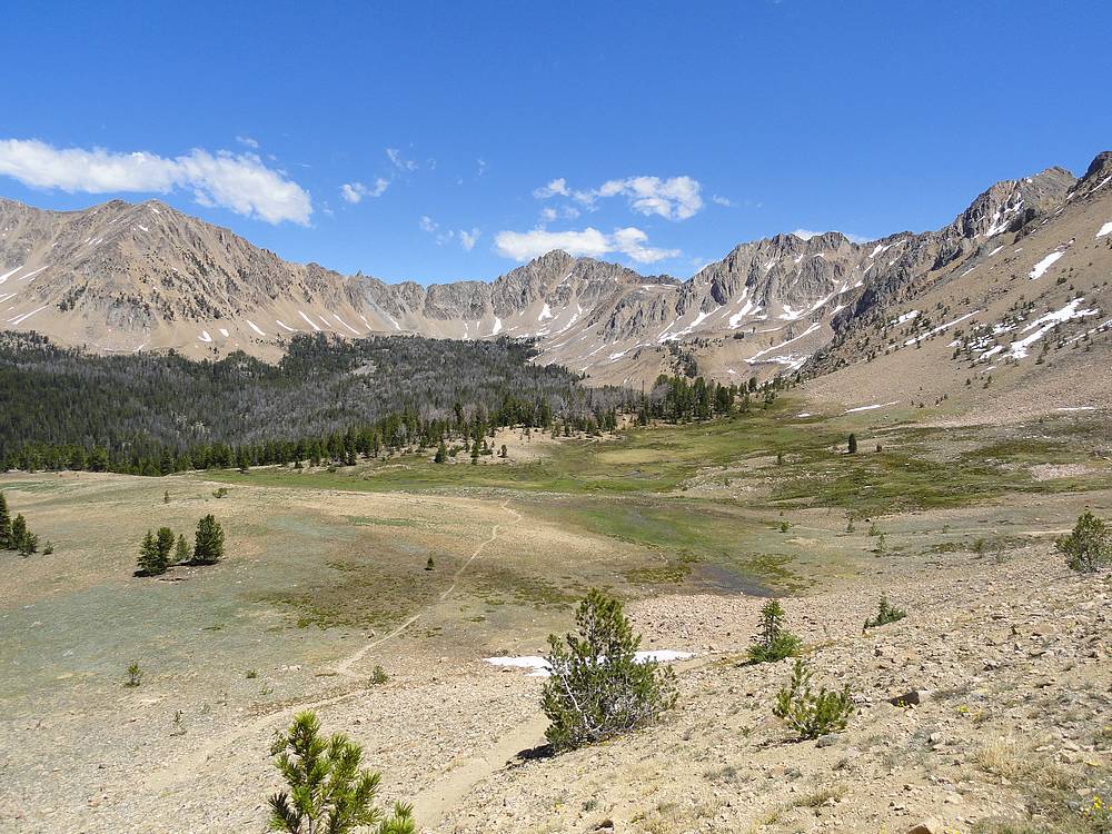
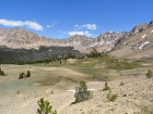
Strawberry Basin.
|
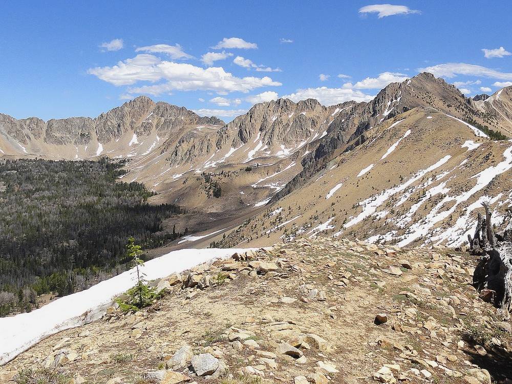
Blackmon Peak from the northwest.
|
|