|
Goat Mountain is the second tallest peak in the Pioneer Mountains, located east of Sun Valley. It is also the fifthteenth tallest mountain in all of Idaho. But in spite of this lofty status, it’s only climbed a couple of times each year, probably because it requires a pretty long approach hike culminating with a short by airy ridge traverse to reach the summit. Goat is a very worth objective, highlighted by a very scenic approach up the North Fork of Hyndman Creek, with great views of many of the other tall and rugged peaks in the Pioneers.
I had become acquainted with Constantyn through work, and when we found out we shared a mutual love of mountain climbing, it was agreed that we needed to schedule a climb the next time he came to Idaho. I probably couldn’t match some of his prior adventures like a Grand Teton winter ascent, Aconcagua, or The Matterhorn for his bachelor party, but I did hope to show him some terrain that was uniquely Idaho. So we made plans a few weeks in advance, with the intent of finding something challenging and scenic. Goat Mountain fit that requirement nicely, and there were a couple other peaks in the area that could be added to the mix if things went well. The original plan was to hike in and set up base camp, climb a peak or two, and then hike out the next morning in time for Constantyn to catch his 2pm flight back to Houston.
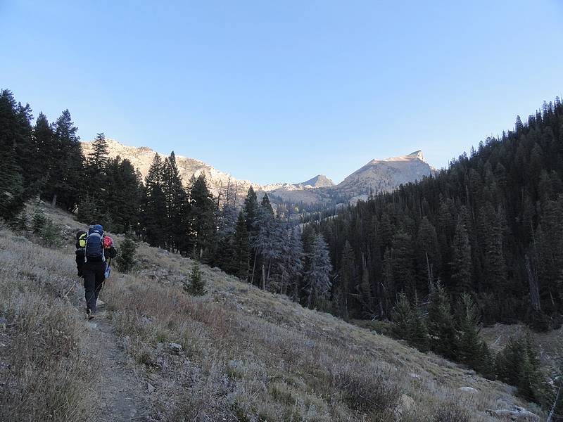
 After a three-hour drive from Boise to the Hyndman Creek trailhead, we were on our feet and hiking by 8am. We had full packs with overnight gear, but still managed to set a brisk pace on our way up the trail. It only took us an hour to cover the first three miles to the fork in the trail leading to Pioneer Cabin. The scenery was great, with the leaves on the Aspen and underbrush showing off their fall colors. Plus it was shaping up to be great weather for the day too, with sunny skies, almost no wind, and mild October temperatures. The trail faded out over the next mile, and we chose a great base camp location at about 9100’, at the foot of Handwerk Peak. Constantyn set up the tent, I filtered some water, and soon we were up and moving again. It was nice to be hiking with lighter packs on our backs after dropping off the overnight gear. After a three-hour drive from Boise to the Hyndman Creek trailhead, we were on our feet and hiking by 8am. We had full packs with overnight gear, but still managed to set a brisk pace on our way up the trail. It only took us an hour to cover the first three miles to the fork in the trail leading to Pioneer Cabin. The scenery was great, with the leaves on the Aspen and underbrush showing off their fall colors. Plus it was shaping up to be great weather for the day too, with sunny skies, almost no wind, and mild October temperatures. The trail faded out over the next mile, and we chose a great base camp location at about 9100’, at the foot of Handwerk Peak. Constantyn set up the tent, I filtered some water, and soon we were up and moving again. It was nice to be hiking with lighter packs on our backs after dropping off the overnight gear.
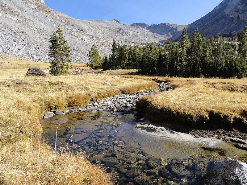
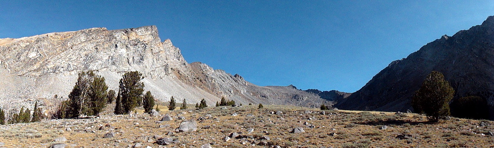
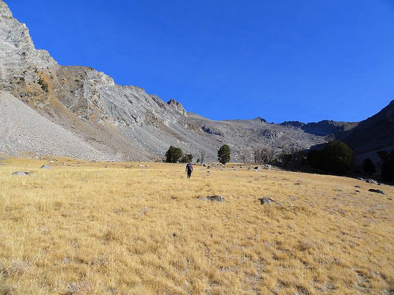
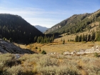
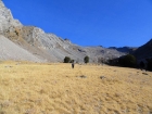
 We hiked through open terrain, and entered the wide-open tundra covered valley between Handwerk Peak and Duncan Ridge. It was highly scenic to say the least, with rugged peaks on both sides and a gurgling creek meandering through the meadows. We took a somewhat leisurely pace through this section while taking photos and gawking at the scenery. We hiked through open terrain, and entered the wide-open tundra covered valley between Handwerk Peak and Duncan Ridge. It was highly scenic to say the least, with rugged peaks on both sides and a gurgling creek meandering through the meadows. We took a somewhat leisurely pace through this section while taking photos and gawking at the scenery.
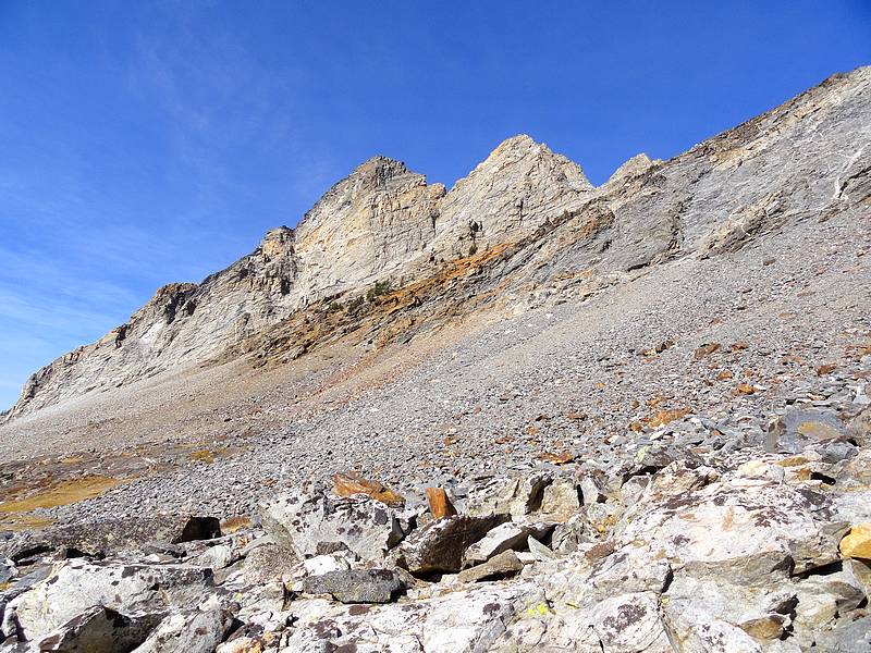
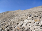
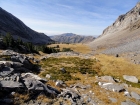
Coming up the valley, we had a good view of large boulder field that we’d have to climb to reach the ridge. As we got closer, we decided on a direct line toward Florian’s Nudl, a point on the ridge above us. The next thousand feet of climbing up the boulder field was quite the grind, so our pace slowed through that section, then we hung a left and headed toward the talus covered south face of Goat Mountain. Next we stopped for short lunch break on the ridge, with good views of Wildhorse Canyon to the east. I had my normal PB&J, and Constantyn had a moon-pie. Not sure which was the better meal choice.
After lunch, we continued up through the talus, and eventually got high enough for a good view to the north. We had originally hoped to do a ridge traverse from Goat Mountain to the Salzburger Spitzl, which was the next peak to the west. But the mile-long ridge looked pretty technical, and it was nearing 2pm, and we decided it would take too long to do the traverse if we wanted to be back down to safe terrain before it got dark. So we turned our attention back to the main objective for the day, which was to reach the higher northern summit of Goat Mountain.
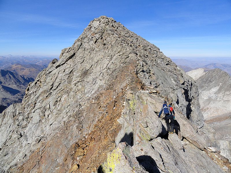
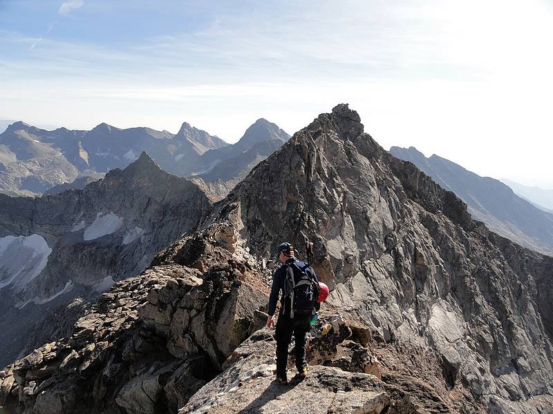
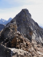
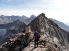
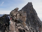 Once on Goat’s lower southern summit, we had a bird’s eye view of the airy connecting ridge leading to the higher northern summit. The drop offs were steep on both sides, but fortunately there were enough granite slabs and ledges to provide safe passage over mostly stable rock. We made the steep descent to the saddle between the two summits, did a fun step-across move, then scrambled up to the highpoint. It was a great vantage point to check out Kane Lake, almost three thousand feet below us. We took some photos, and then retraced our steps back across the ridge. This section was fun scrambling, and the highlight of the day. Once on Goat’s lower southern summit, we had a bird’s eye view of the airy connecting ridge leading to the higher northern summit. The drop offs were steep on both sides, but fortunately there were enough granite slabs and ledges to provide safe passage over mostly stable rock. We made the steep descent to the saddle between the two summits, did a fun step-across move, then scrambled up to the highpoint. It was a great vantage point to check out Kane Lake, almost three thousand feet below us. We took some photos, and then retraced our steps back across the ridge. This section was fun scrambling, and the highlight of the day.
 We took a leisurely pace back down through the boulder field, trying to take it easy on our knees and hoping to avoid a twisted ankle or other injury. Once down to the tundra section of the valley, we continued to take our time since enjoying the scenery. It wasn’t until we neared the campsite at almost 6pm that we started doing the math and realized that if we hustled, we could actually hike out and drive back to town instead of spending a cold night sleeping on the hard ground. So we packed up the would-be base camp, and started making our way down. The sun was beginning to set behind the ridge to the west, where Pioneer Cabin was visible high above the valley. We also got a glimpse of a group of mountain goats scampering away from us through the trees. We took a leisurely pace back down through the boulder field, trying to take it easy on our knees and hoping to avoid a twisted ankle or other injury. Once down to the tundra section of the valley, we continued to take our time since enjoying the scenery. It wasn’t until we neared the campsite at almost 6pm that we started doing the math and realized that if we hustled, we could actually hike out and drive back to town instead of spending a cold night sleeping on the hard ground. So we packed up the would-be base camp, and started making our way down. The sun was beginning to set behind the ridge to the west, where Pioneer Cabin was visible high above the valley. We also got a glimpse of a group of mountain goats scampering away from us through the trees.
Soon enough we were back on the trail section, making steady pace in spite tired feet and knees, and some short but annoying uphill sections along the way. By 7:30 it was dark enough that we needed headlamps to see. It was getting a little chilly by the time we got back to the trailhead at just before 8pm, but not as chilly as it would have been up at the campsite. At least we got an extra workout carrying the overnight gear up and down the trial. So after almost 12 hours, 15 miles, and 5000’ elevation gain, we were both looking forward to some McDonald’s french fries. Not bad for a Tuesday…
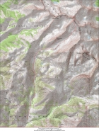
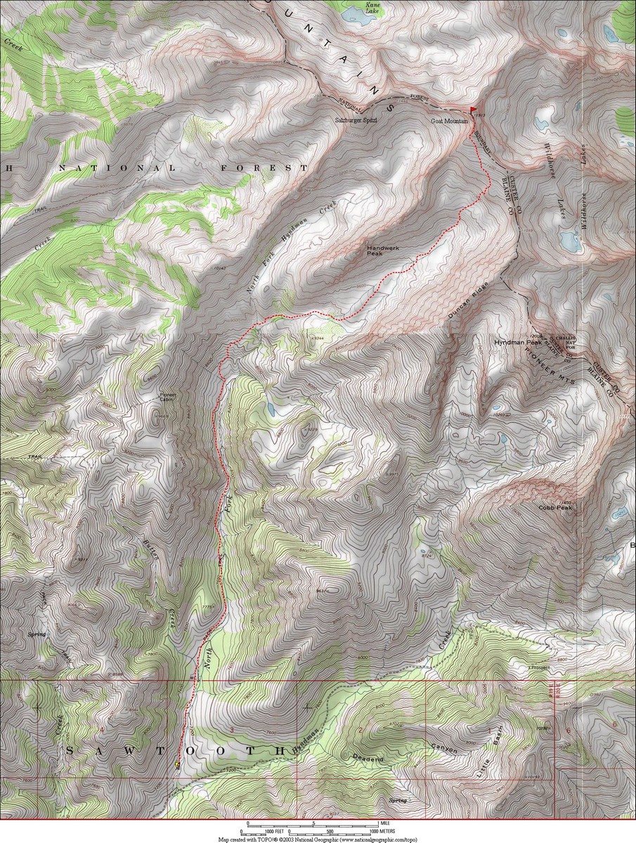
Map of the route, 15 miles round trip with 5000 elevation gain. |
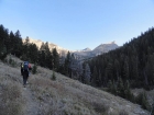
Hiking up the North Fork Hyndman Creek valley. |
Looking back down the valley we hiked up. |
Ice starting to form in the creek. |

Upper valley between Handwerk Peak and Duncan Ridge. |
Crossing some open tundra in the valley. |
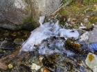
Still quite a bit of water in the creek, even in October. |

The dual fangs of Handwerk Peak from the east. |
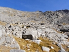
Looking back on the upper valley. |
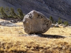
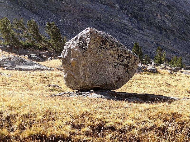
Very cool glacial erratic boulder high in the valley. |
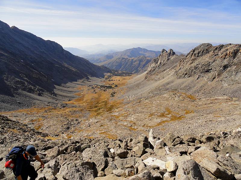
The 1000 foot climb up this boulder field is quite a grind. |
Climbing the boulder field, with the big u-shaped glacier carved valley behind us. |
Looking up at the false summit, CC is on the left. |
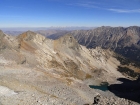
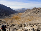
The Lost River Range in the distance to the east, Wildhorse Lakes below. |
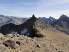
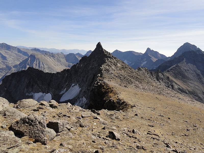
Florians Nudl, with the big Pioneer peaks in the background. |
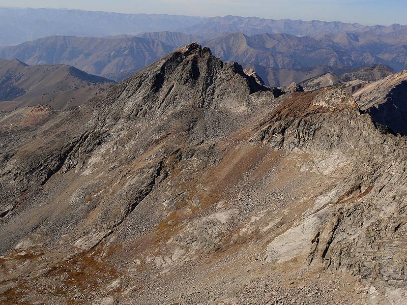
The west face of Salzburger Spitzl from just below the false summit. |

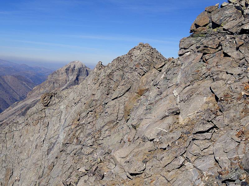
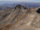
Looking across the west face of Goat Mountain at the higher northern summit. |

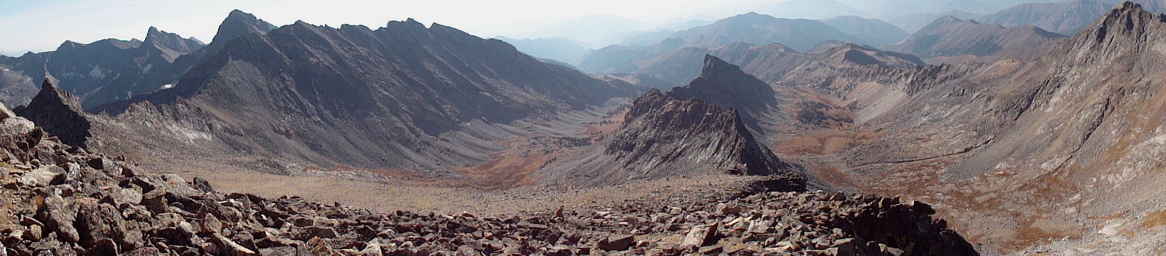
Panoramic view looking down on the two hanging valleys, Handwerk Peak in the center. |
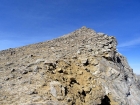
Looking back at the lower south summit of Goat Mountain. |
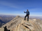
Hero shot on the summit of Goat Mountain. |
Starting to retrace our steps back over the south summit. |
Scrambling along the ridge between the two summits. |
Descending through the boulder field with the false summit in the background. |
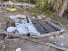
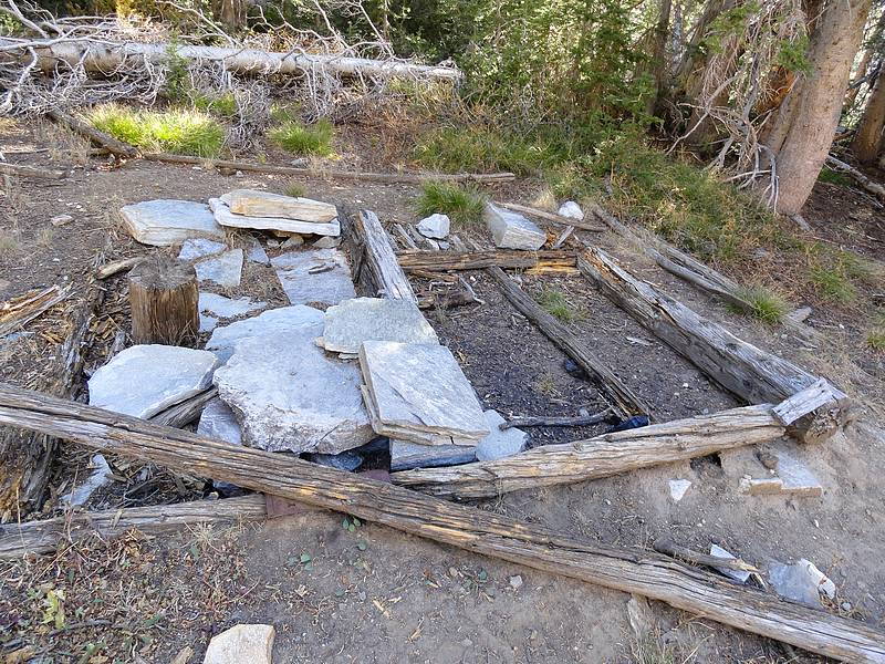
Foundation of an old miner's cabin, located at about 9000' elevation. |
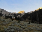
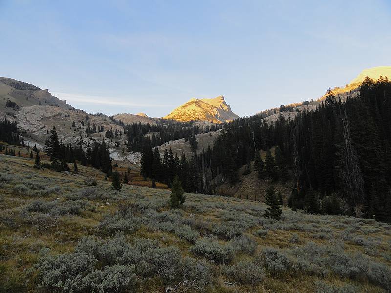
Alpenglow sunset on Handwerk Peak during the hike out. |
|