|
Triple Peak
Elevation 11,310'
Triple Peak is a big, remote, and complex mountain located in eastern Idaho’s Lost River Range. This distinctive summit is located on a divide that extends north from Mount Breitenbach, and separates Dry Creek from the East Fork Pahsimeroi River. It’s a challenging climb, and was long thought to be the most difficult 11er in Idaho. And even though the standard “keyhole route” is now well documented, exposure and an abundance of loose rock still make this a tough summit to reach.
|
|
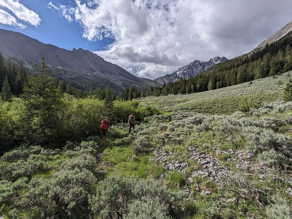
George and John invited me to join them for a few days of base camping on the East Fork Pahsimeroi River. Our first objective together would be Triple Peak, seen here in the upper left as we made our way up the valley.
|
|
|
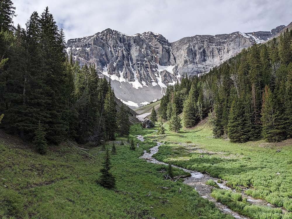
The approach trail passes right by the massive north face of Mount Breitenbach. Wow!
|
|
|
After a few miles, we neared Dry Creek Pass. Mount Corruption in the background.
|
|
|
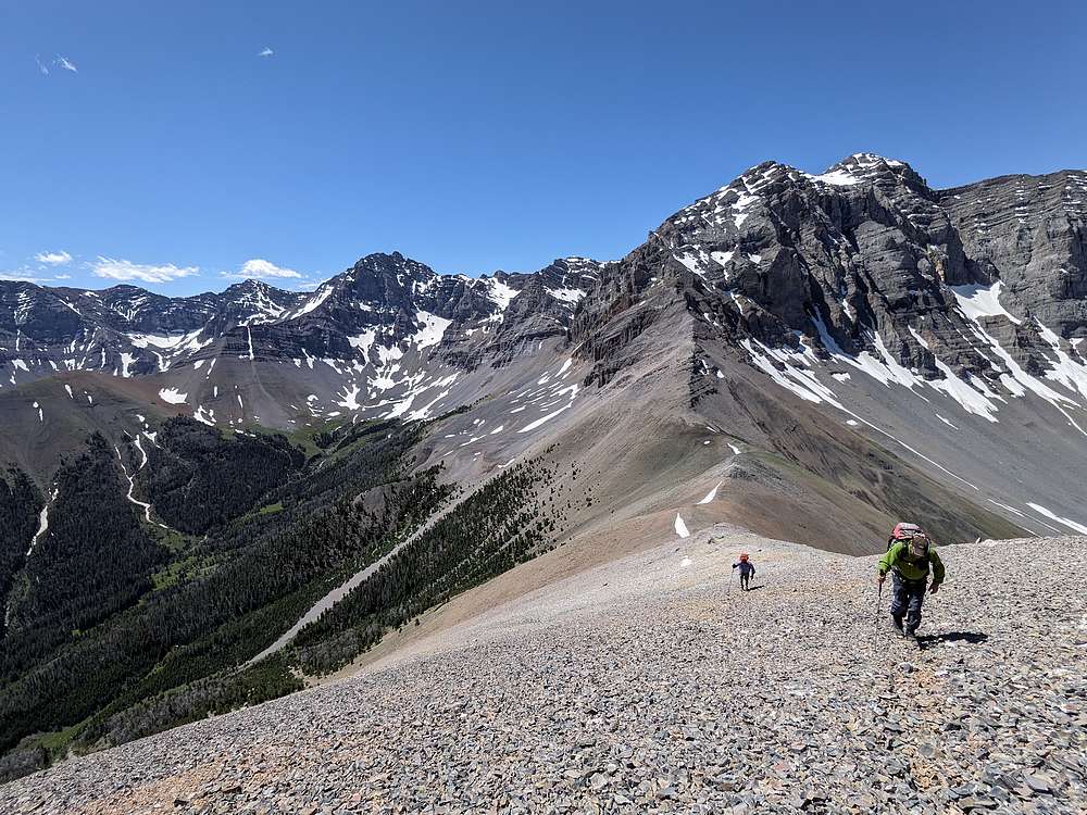
From Dry Creek Pass, we did a ridge walk to the base of Triple Peak.
|
|
|
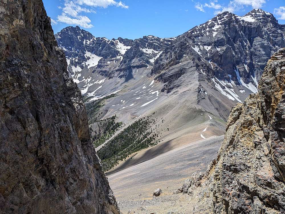
Amazing backdrop as we hiked up the ridge from the pass.
|
|
|
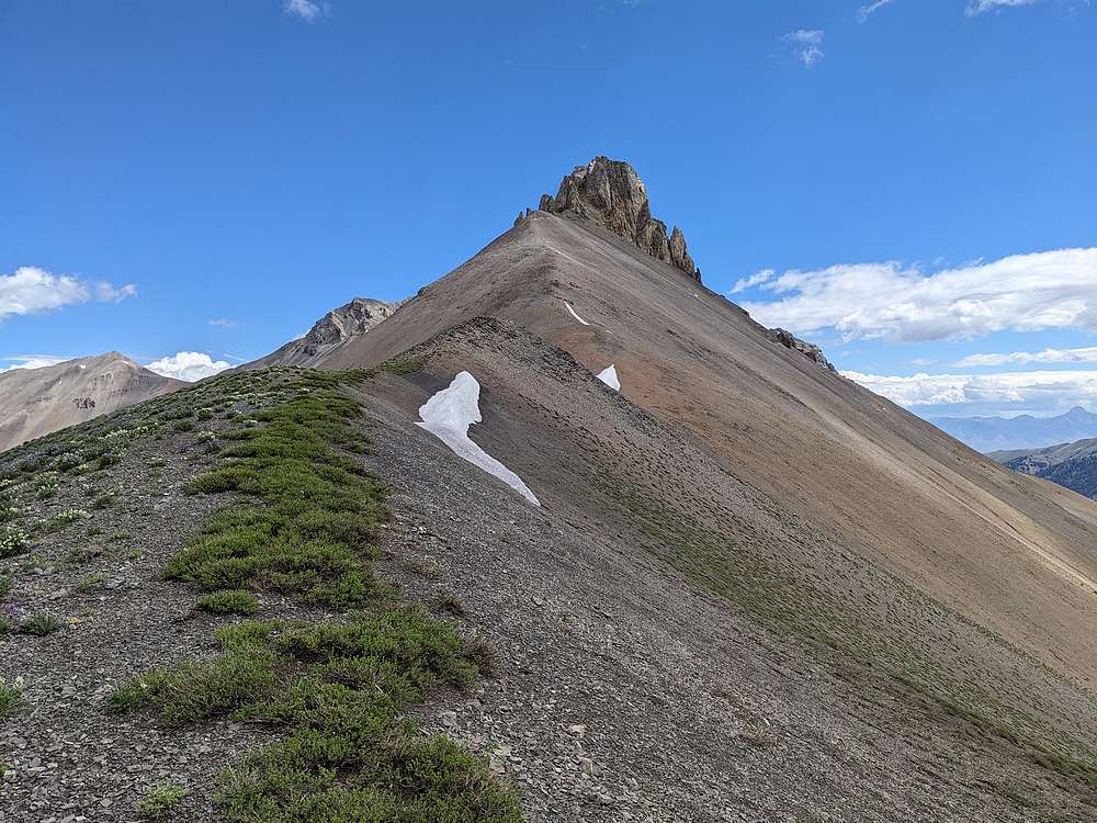
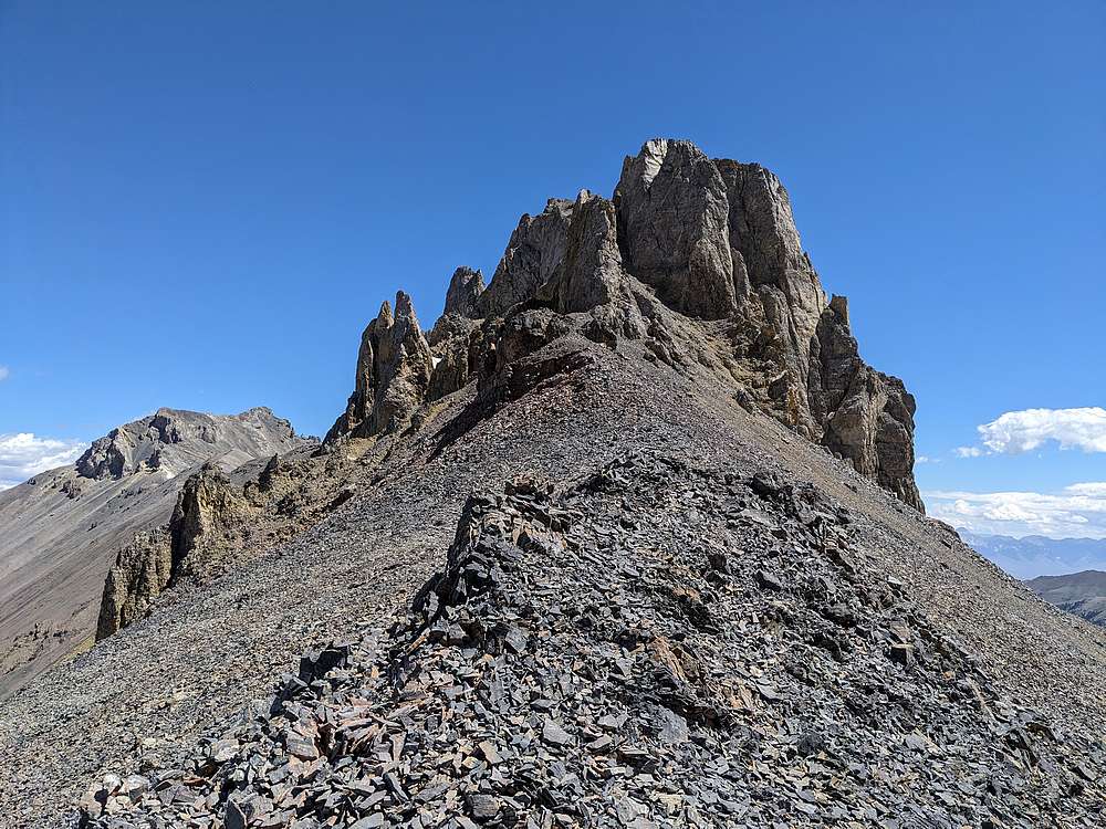
Triple Peak has a super funky summit block, and I was glad to be with Team R&R who had climbed the peak previously. Our target was the steep gully on the left side of the face.
|
|
|
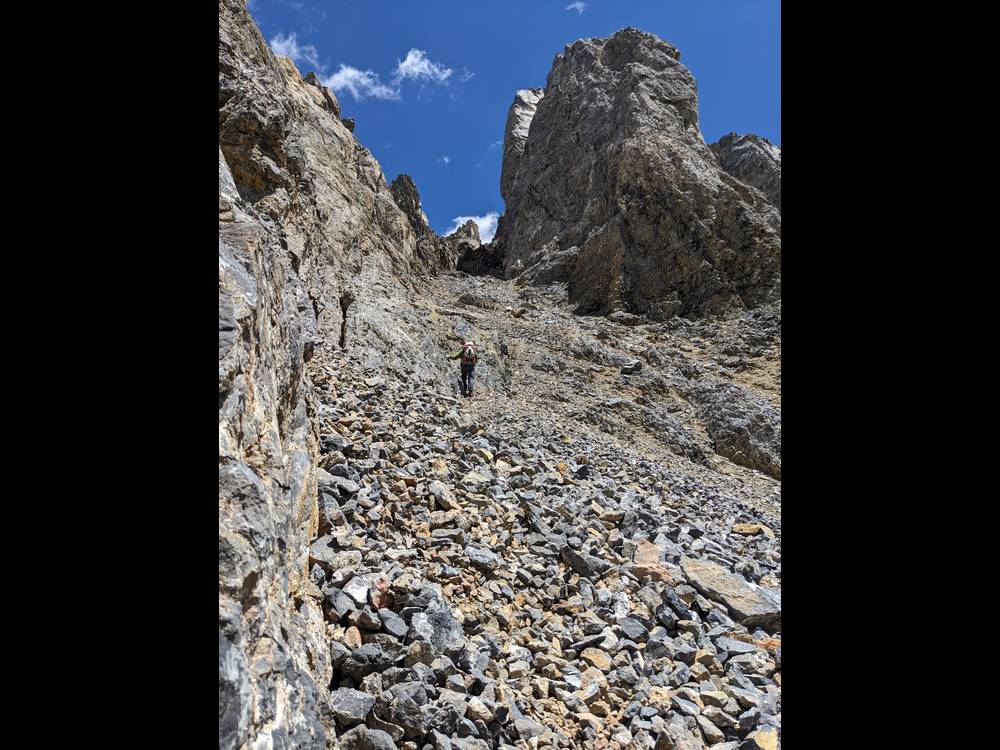
Here we are heading up the gully. Helmets highly recommended, this rock is very loose.
|
|
|
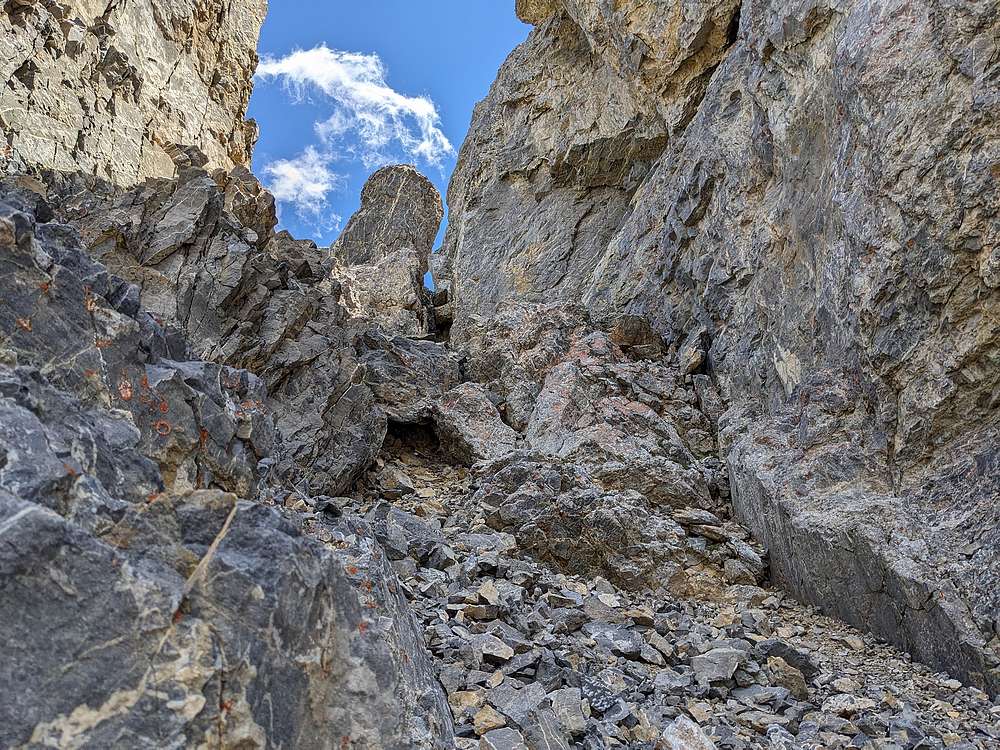
The keyhole comes into view as we near the top of the gully.
|
|
|
I snapped this photo looking back from the gully. Amazing terrain.
|
|
|
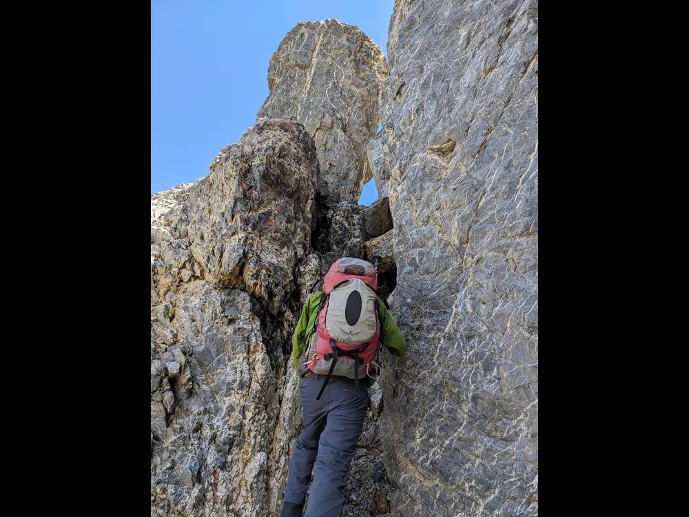
Here's George about the shimmy up the headwall chimney below the keyhole.
|
|

|
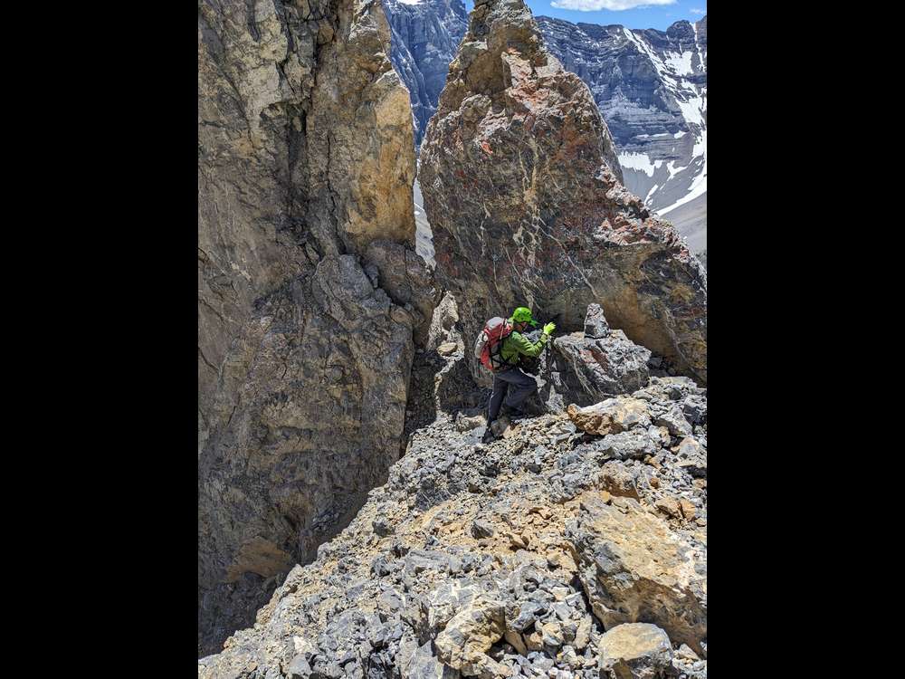
Once above the keyhole, the route crosses this loose and dirty short section of ridge. This section has John's full attention.
|
|
|
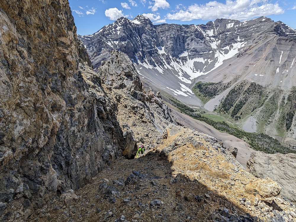
We made our way across the ledge system that bypasses the west side for the south summit. The route here is straightforward, but the amount of loose rock above exposed cliffs, demanded our focus.
|
|
|
Past the ledge system, its smooth sailing up the final slope to the summit.
|
|

|
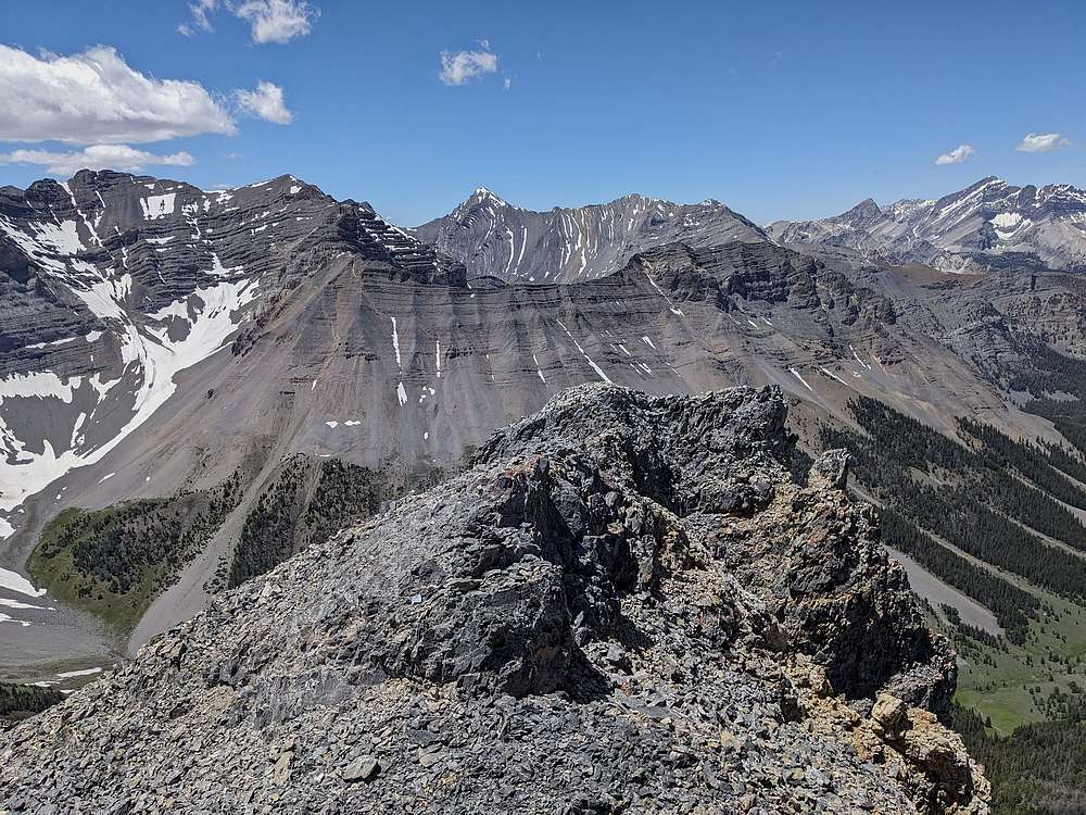
The middle summit is just slightly higher than the north summit, shown here. Cleft Peak in the distance, True Grit to the right.
|
|
|
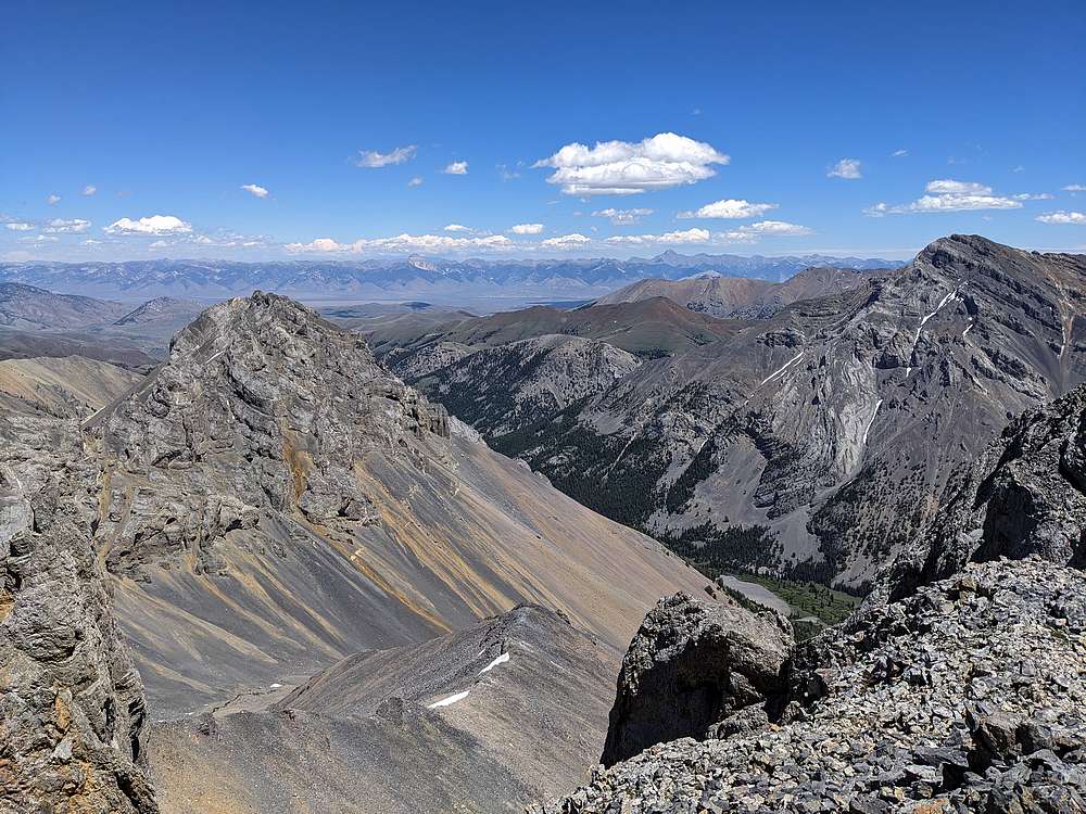
Summit view looking west. Highlighted by No Regret Peak, Leatherman Peak, and Mount Borah.
|
|
|
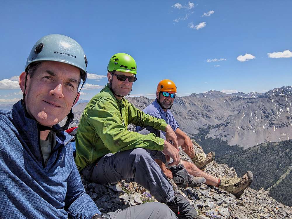
Group shot on the summit of Triple Peak. I'm grateful for these guys re-climbing this monster peak with me.
|
|
|
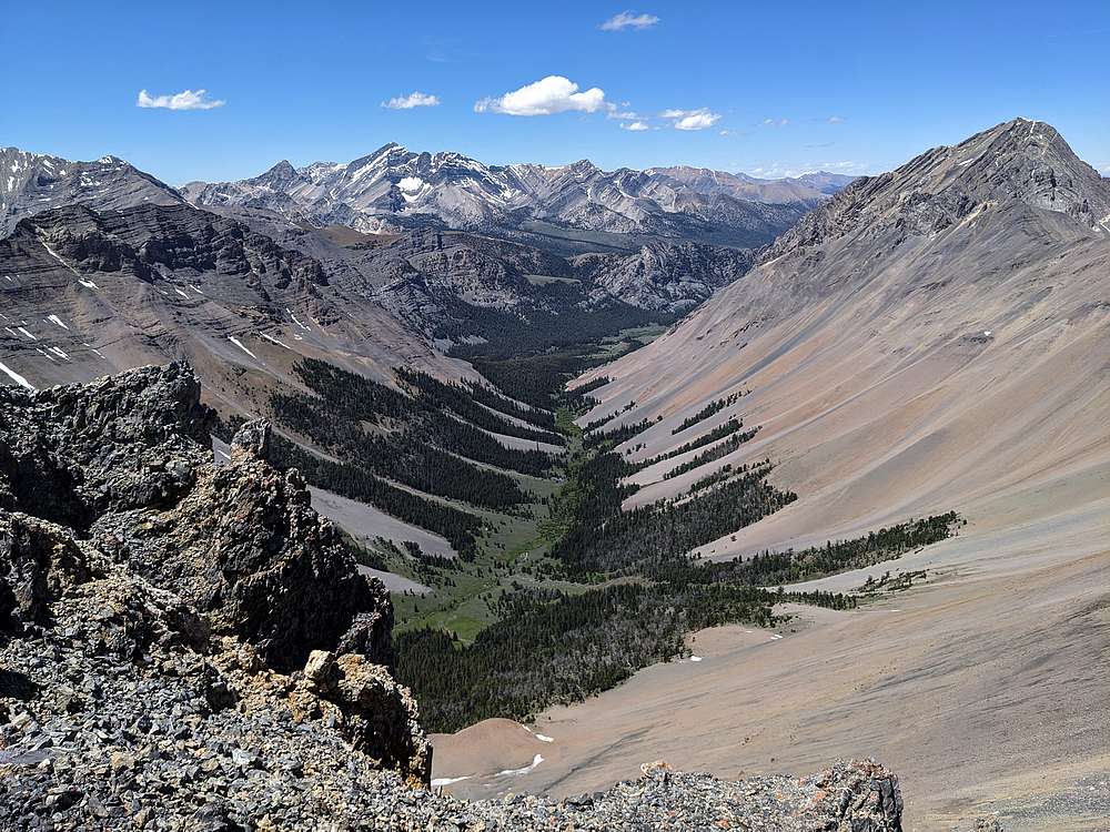
Summit view looking east. Lemhi's in the distance, highlighted by Bell Mountain and Diamond Peak. True Grit on the left, Ferguson Peak on the right.
|
|
|
Summit view looking northwest toward our campsite on the East Fork Pahsimeroi River. Borah in the distance, Mount Corruption on the right.
|
|
|
After soaking in the summit views for awhile, we still had some work to do. Here's George making his way back to the keyhole.
|
|
|
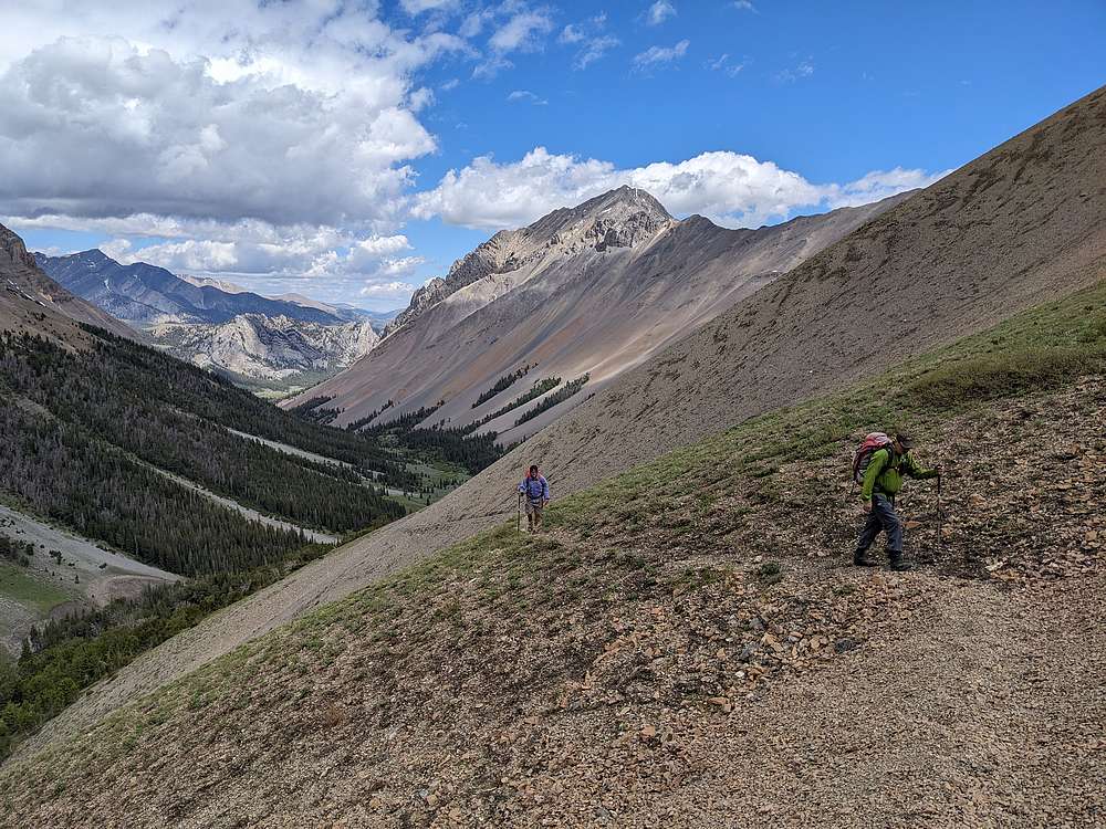
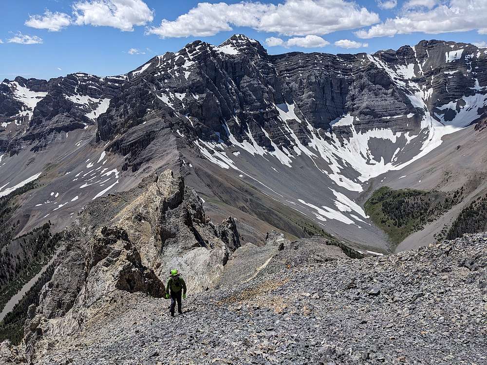
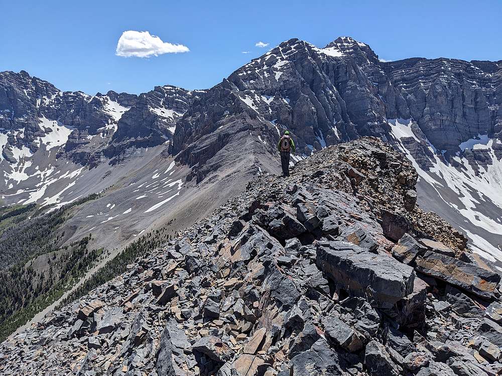
Once the hard stuff was done, we enjoyed a highly scenic ridge walk back toward the pass. Not long after this, we hung a right for some good scree skiing back down to the trail.
|
|
|
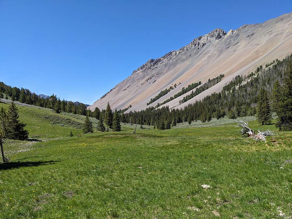
The verdant valley floor made for a nice hike back to the trailhead.
|
|
|
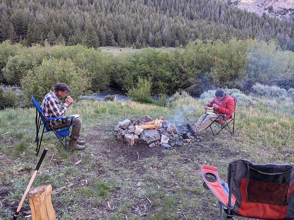
That night we enjoyed burgers and brats for dinner. These guys know how to camp!
|
|
|
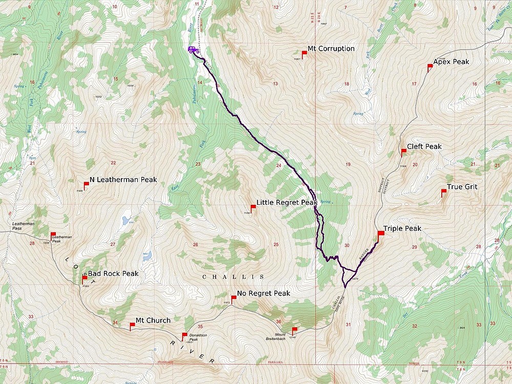
Map of our route. A total of 10 miles and 3300' elevation gain round trip, in about 9.5 hours of hiking.
|
Related Links
|