|
Box Canyon Peaks
|
Related Links:
- Trailhead Location
- My GPS Tracks
- The Box: JP, TL, SP, PB, LOJ, Map
- Long Ridge Peak: TL, LOJ, Map
- Lower Box Peak: LOJ, Map
- Iron Mountain: JP, TL, PB, LOJ, Map
|
Box Canyon is located in the Pioneer Mountains of central Idaho. Box Canyon drains into the Little Wood River, but is more easily accessed via the East Fork Wood River, and Johnstone Pass. But beware that the steep trail leading to the pass is washed out, so expect some challenges with that! There are four peaks that “box in” Box Canyon, the most well-known of these is 11er “The Box”. It is possible to visit all four peaks while exploring the highly scenic canyon.
The weather forecast was looking great, and it had been several years since I’d last visit the East Fork. The Box seemed like a good objective, and after scanning maps and charting routes, I thought I might have a chance to tag four summits if things went well.
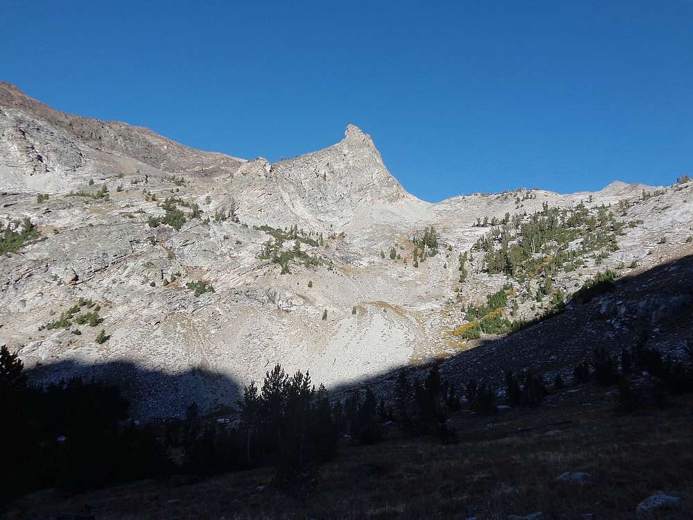
After a 3.5hr drive from Boise, I arrived at the end of the bumpy road on the East Fork by just after 8:30am. The sun was already peeking over the mountains as I started hiking up the valley. I left the trail where it headed up to Johnstone Pass, and continued north up the valley. The Little Matterhorn standing at the head of the valley made for a good distraction as I made my way up through boulders and talus fields.
As I neared the head of the valley, I turned right and headed up a gully which appeared to have stable rock. That worked for a while, but soon enough I was in loose stuff making slow progress. I reached the ridge just below the summit, which was a welcome relief from the loose rock.
Summit views from The Box were nothing short of spectacular. Box Canyon, Wildhorse, and of course the main crest of the Pioneers with Hyndman and company looming to the west. After a snack and some gawking at the views, my attention turned toward “Long Ridge Peak” (Pk 10,840’) to the east. The connecting ridge looked like it could be tricky, but others had done it so I knew it should work out.
There was massive exposure to the north side of the ridge. The south side of the ridge was still pretty steep, but there were areas that allowed safe down-climbing. Soon enough I was down to the saddle, and made my way up to the summit of Long Ridge Peak, highpoint #2 of the day. Here I took a lunch break for a well-deserved PB&J, and studied the route Michael and I had followed up Brocky Peak a month earlier. Brocky is a monster peak!
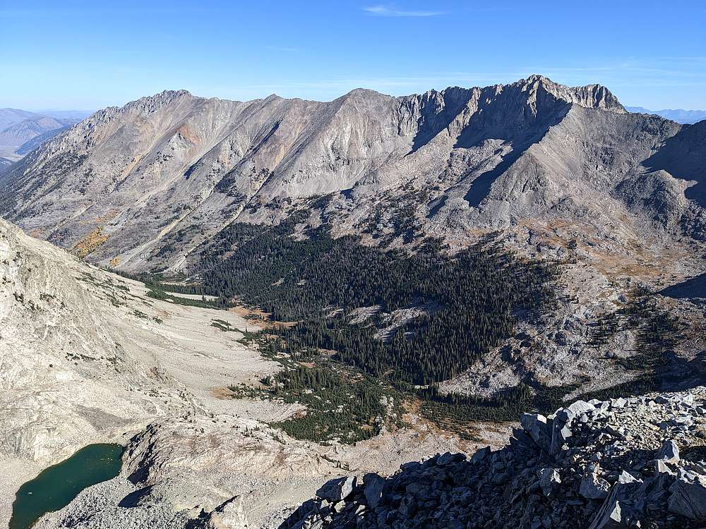
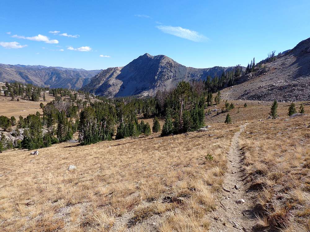
After lunch, I descended the southwest face of Long Ridge Peak, and curled around for a visit to Upper Box Canyon Lake. It would have a made a great place to stop and relax, but I still had a lot of ground to cover. After finding the trail near the southwest corner of the lake, I then made my way down the open and highly scenic terrain in Box Canyon. I even heard a couple elk bugles along the way.
I continued on the Box Canyon trail down to about 9100’, where I turned right and headed up into the cirque north of Iron Mountain. From earlier in the day, this appeared to be the easiest route up to the ridge south of Box Canyon. And thankfully the route worked out pretty well.
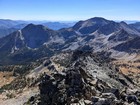
Once on the ridge just west of Pt 9910’, I dropped my pack and headed east toward Peak 10,391’ (Lower Box Peak). There were no real obstacles on the ridge other than my own fatigue. The views were great along the way, and I even scared up a buck mule deer high on the ridge, possible the highest I’ve ever encountered deer in Idaho. The summit of Lower Box Peak made for a great vantage point to check out Box Canyon and the surrounding peaks. After a snack, I then retraced my path back along the ridge.
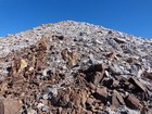
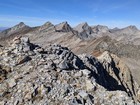
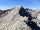
The northeast face of Iron Mountain looked like it would be a lot of work thanks to a ton of steep talus to deal with between me and the summit. Fortunately, the rock was more stable than it looked. In spite of fatigue setting in, I made slow but steady progress up the face, and eventually to the summit of Iron Mountain.
It was after 5pm by the time I reached the summit of Iron Mountain, my 4th highpoint of the day. I figured I had about 2 hours before sundown, and debated a couple decent options before deciding to take the ridge toward PK Pass. Route=finding along the ridge was pretty fun, but in the interest of time I eventually decided to take a more direct route back down to the East Fork.
Progress was slow as I descended into the valley. Occasional boulder hopping, lots of talus and scree, and then some grassier slopes amongst the trees all made for slow going. So it was a welcome sight when I finally reached the trail, and made the short hike back to the trailhead.
What a great day in the mountains. Round trip was 10 miles and 5600’ of elevation gain in 10.5 hours of hiking. I was plenty tired, but felt very satisfied with this 4-peak day in a highly scenic area. Hard to beat!
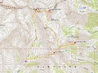
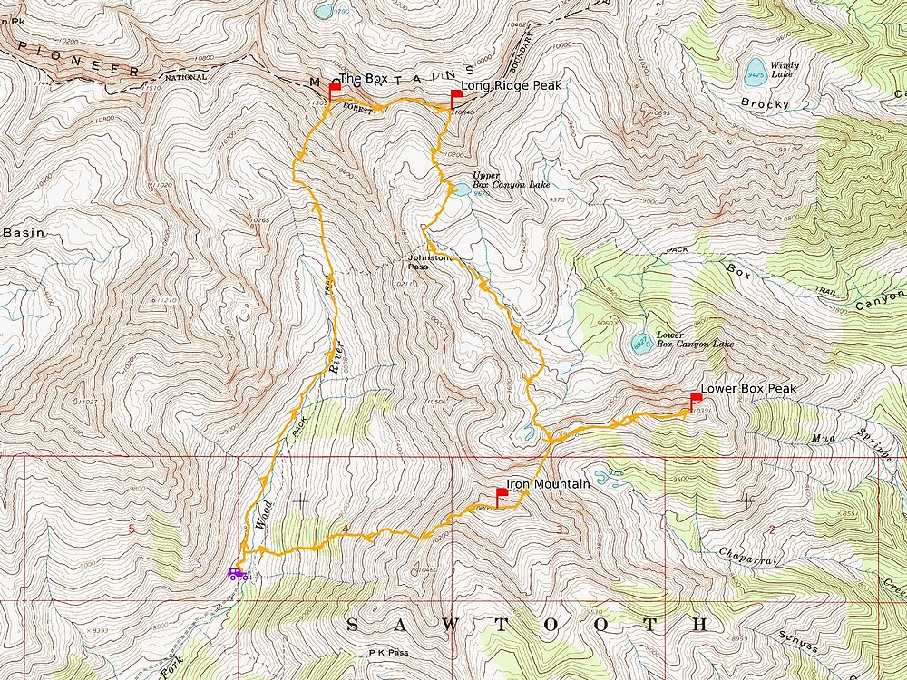
Map of the route, 10 miles and 5600' gain round trip. I went clockwise. |
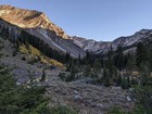
First view of The Box from the East Fork Wood River. |
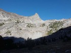
The Little Matterhorn stands at the head of the valley. |
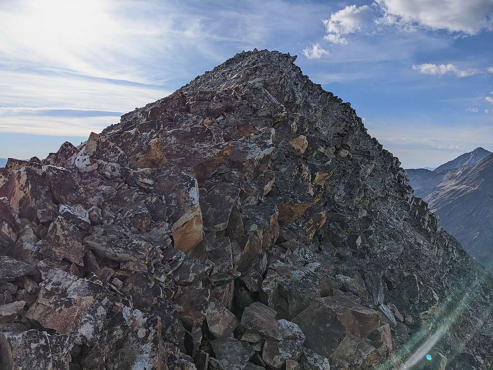
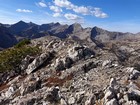
Nearing the summit of The Box. |

Left Fork Wildhorse Creek, and Brocky Peak, from the summit of The Box. |
Main Pioneer Crest from the summit of The Box. |
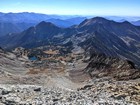
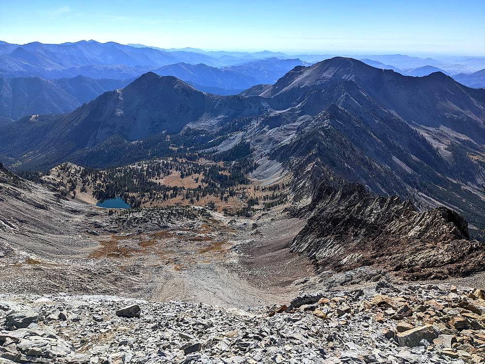
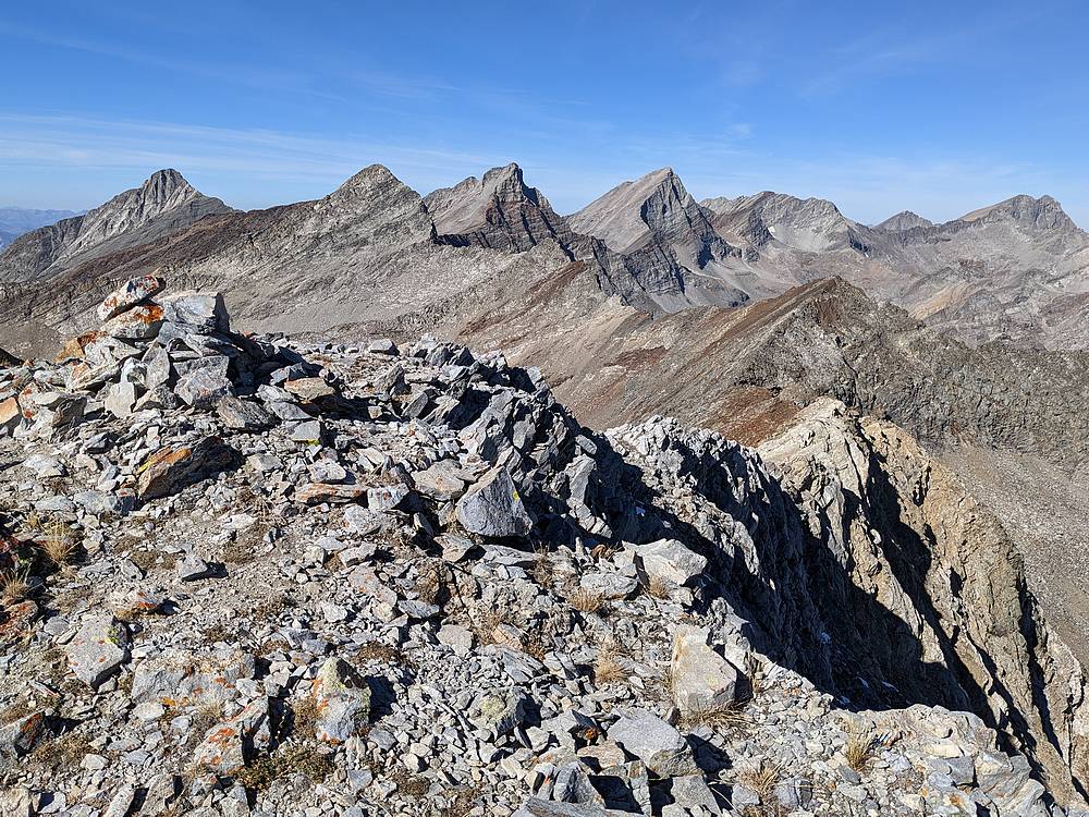
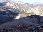
Box Canyon from the summit of The Box. |
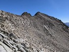
Heading toward Long Ridge Peak. |
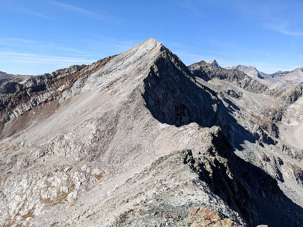
Looking back on The Box from Long Ridge Peak. |
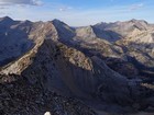
Box Canyon from the summit of Long Ridge Peak. Lower Box Peak, and Iron Mountain in the background. |
Descending to Upper Box Canyon Lake. |

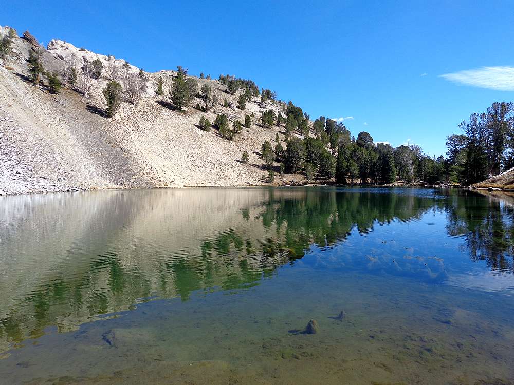
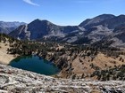
Upper Box Canyon Lake. |
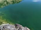
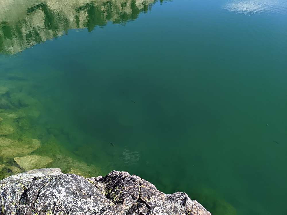
Trout swimming in the lake. |
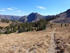
Descending into Box Canyon, Lower Box Peak in the distance. |
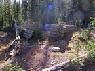
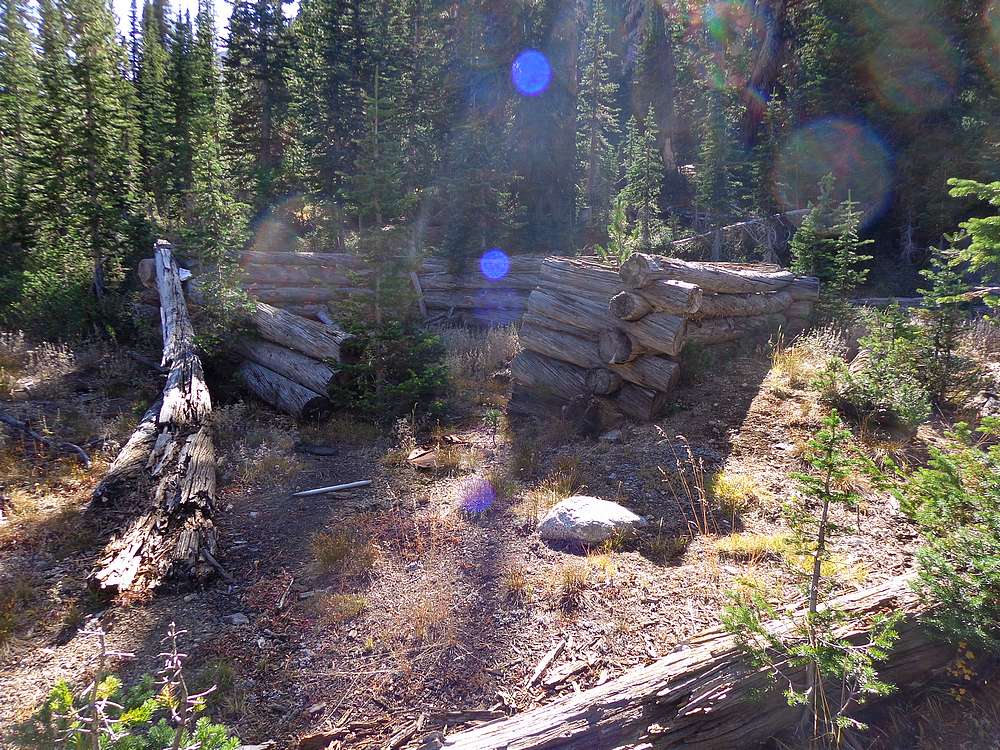
Remains of an old mining cabin in Box Canyon. |
The Pioneer Crest and The Box from Lower Box Peak. |
Looking back on the northeast face of Iron Mountain. |
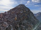
Nearing the summit of Iron Mountain. |
Box Canyon from the summit of Iron Mountain. |
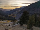
Final descent to the trailhead, just before sunset. |
|
|
|