|
Pahsimeroi Ridge Walk
|
Related Links:
- Judi & Carl Trip Report
- Trailhead Location
- My GPS Tracks
- Hope Peak: TL, IS, PB, LOJ, Map
- Trinity Peak: TL, PB, RB, LOJ, Map
- Grouse Creek Mountain: TL, JP, PB, LOJ, Map
- Sheep Pen Peak: TL, RB, LOJ, Map
|
Eastern Idaho’s Lost River Range is home to many of the state’s tallest peaks, a few of which see a fair amount of traffic. But the northern section of the range, referred to as the Pahsimeroi Mountains, see’s almost no human visitors. At the heart of the area is the particularly remote Christian Gulch, which provides access to three 11,000’ peaks. Back in 2006, Judi and Carl had completed the 3 11ers in a single outing they called the “Pahsimeroi Ridge Walk”. It had been on my wish list ever since. Splattski and team had discussed this trip numerous times over the years, but we never quite got it done. So not long after John’s memorial service, as late June came around, with lots of daylight and a perfect forecast, I decided to tackle it solo.
I left Boise Friday evening and made the 4.5 hour drive to the end of the road at 8100’ in Christian Gulch. As I rolled my bedroll out and organized my gear, I came to the horrible realization that I’d forgotten my daypack. Oh no!!!!! So after a bit of painful deliberation, I determined I had no choice but to drive all the way back home. It was 2am by the time my head hit my pillow. When I awoke a few hours later, my first thought was “I think I’m going to drive back over tonight, and do the trip Sunday.”
I’m sure my wife wasn’t too keen on this plan, but I think she knew how much this one meant to me, and the connection to Splattski. So after a morning of chores, and my nephew’s birthday party in the afternoon, I was back on the road Saturday evening. Unfortunately, I’d been driving too fast going over Trail Creek Summit, and unbeknownst to me, I had punctured 3 tires! One blew out just after Doublespring Pass, so I had to do a tire change just before dark. The other two I later found after my climb had slow leaks, but I was able to fill up with air in Mackay and made it safely home Sunday night. But I digress…
So once finally at the trailhead again, this time with my pack, I actually got a great night of sleep, and awoke Sunday morning chomping at the bit. From my parking spot, I headed immediately uphill along the southeast ridge of Hope Peak. It was a beautiful morning, and I made steady pace climbing the ridge. The views opened up above tree-line, and after about 2 hours of climbing, I arrived at the summit of Hope Peak.
The summit of Hope Peak was a great vantage point to check out Mount Borah in the distance to the south, and the rest of the ridge walk route to the north. Next up was the descent of Hope Peak’s northwest ridge. It looked steep and rugged from above, but I just took my time descending and made it down to the saddle soon enough. The ridge walk was now in full effect, and made for great views in all directions as I rounded the corner at Pt 10721’ and began climbing the sheep trails heading up Trinity Peak.
Climbing the south ridge of Trinity Peak was straightforward. I deemed the middle summit to be the highpoint, and stopped there for a snack and to soak in the views. Looking back on the impressive north face of Hope Peak was amazing, as well as all the other rugged peaks that surrounded me.
I then headed north from Trinity Peak, then hung a right (east) at the head of Christian Gulch, descending to the saddle, and climbing up to Pt 10402’ for a lunchbreak. My PBJ was excellent, and I got to enjoy it while watching 15+ bighorn sheep wandering around below the south ridge of Grouse Creek Mountain.
After lunch, I headed toward Grouse Creek Mountain, with the sheep leading the way along the ridge. This section of the climb was easy going, and I made it to the summit without issue. It felt good to have reached the summit of 3 11ers, but I had one more peak in mind. Michael had recently educated me that Sheep Pen Peak to the north was one of Idaho’s tallest 200 tallest peaks. I did a quick time check, and decided I could tackle this fourth peak, and still hopefully get home at a somewhat reasonable hour.
From the summit of Grouse Creek Mountain, I could see the ridge leading north to Sheep Pen Peak was no gimme. But the herd of bighorns from earlier had done it, so….. I took my time descending carefully from Grouse Creek Mountain, following sheep trails where I could. Then made the class 2 climb to the summit of Sheep Pen Peak.
Sheep Pen Peak offered up some great views of all the terrain I’d covered along the way, with the north face of Grouse Creek Mountain standing out as particularly impressive. With a lot of ground covered, but still a long way to go, I started making my way back along the ridge. Re-climbing Grouse Creek Peak at the end of a long day took some effort, so it felt good to be back on its summit with mostly downhill to go after that.
I headed south along the ridge. Then instead of descending at the head of the valley, I continued almost to Pt 10737’, where I headed down a promising looking scree slope I’d spotted from the other side of the valley earlier in the day. After ~1500’ of steep downhill boot-skiing in mostly loose scree, I arrived at the valley floor, and made a fairly enjoyable forest walk back to the trailhead.
What a fantastic adventure! Round trip was around 15 miles and 6400’ of elevation gain in 10.5 hours of hiking and ridge walking. I’d summited 4 peaks total, 3 of which were 11ers. A longtime goal accomplished, and many thoughts of Splattski throughout the day. And an added bonus was making it back home without any more flat tires!
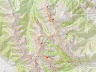
Map of the route, around 15 miles and 6400' gain round trip. |
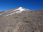
Climbing the west face of Hope Peak. |
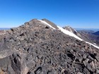
Nearing the summit of Hope Peak. |
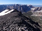
Hope Peak summit view, Borah in the distance to the southeast. |
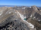
Descending Hope Peak, heading toward Trinity Peak. McGowan Peak the next ridge over. |
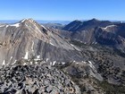
Trinity Peak, Sheep Pen Peak, Grouse Creek Mountain from Hope Peak. |
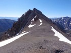
Looking back on the northwest ridge of Hope Peak. |
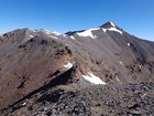
View from the saddle south of Trinity Peak. |
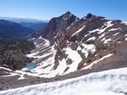
Looking back on Hope Peak from Trinity Peak. |
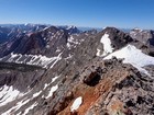
Trinity Peak summit view looking southeast, including the impressive north face of Hope Peak, and Borah in the distance. |
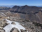
Sheep Pen Peak and Grouse Creek Mountain from Trinity Peak. |
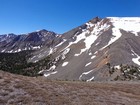
Hope and Trinity from the saddle at the north end of Christian Gulch. |
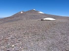
Wildlife guzzler, not a UFO, on south ridge of Grouse Creek Mountain. |
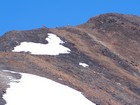
Bighorn sheep near the summit of Grouse Creek Mountain. |
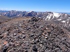
Grouse Creek Mountain summit view looking southeast. |
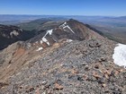
Ridge leading north from Grouse Creek Mountain to Sheep Pen Peak. |
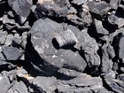
Fossils along the ridge to Sheep Pen Peak. |
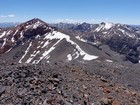
Sheep Pen Peak summit view looking south at the impressive north face of Grouse Creek Mountain. |
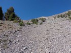
Bottom of 1500' screen descent back into Christian Gulch. |
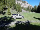
Back at the trailhead, end of the road at 8100' in Christian Gulch. |
|
|
|


