|
|
Related Links:
- Splattski Trip Report
- Tom Lopez USGS Trip Report
- Little Lost Peak: RickB, LOJ, Map
- Massacre Mountain: LOJ, Map
- North Massacre: RickB, LOJ, Map
- The Moat: RickB, LOJ, Map
- USGS Peak: RickB, SP, LOJ, Map
|
The Lost River Range in Eastern Idaho is known for towering peaks and rugged terrain. But it is not known for backpacking or multi-day loop options. After reviewing some guidebooks and internet research, I was able to piece together information to create a loop starting at Loristica Campground trailhead, climbing up and over to Shadow Lakes, descending Hell Roaring Canyon, following Long Lost Creek to its headwaters, crossing the pass above Nolan Lake, then descending Wet Creek back to the trailhead. The route also put many summits within reach, highlighted by USGS Peak, the tenth highest mountain in Idaho.
Day 1
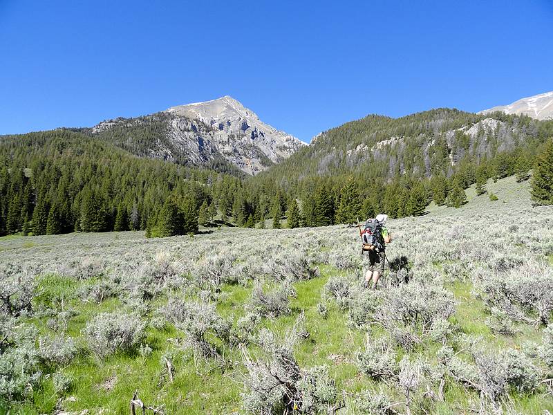
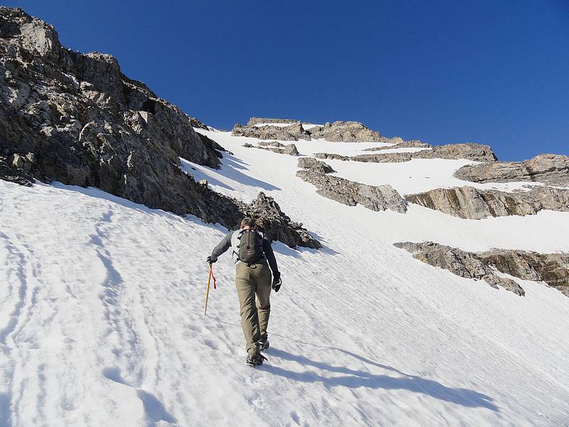
Big Creek and Little Lost Peak: After leaving Boise at just after 6am, Splattski and I were on our feet and hiking by 10am. We dropped down the trail to Wet Creek, crossed the creek on a log, and then wandered through a sagebrush meadow before picking up the trail heading to Big Creek. The trail isn’t on the map, but it is in good shape and is very easy to follow to the saddle above Big Creek. From the saddle, we wandered west and stopped for a lunch break on the ridge with great views in both directions. It was a good spot to survey out options for getting across the valley, to the saddle southwest of Little Lost Peak (Peak 10202’).
We decided to traverse along the hillside toward the headwaters of Big Creek, cross the creek, then angle up toward Little Lost Peak. Along the way, we picked up a well-constructed trail that switchbacked it’s way up to the ridgeline. As we neared the saddle we met a Bighorn Ram who posed for photos before we dropped our packs and headed toward Little Lost. After a quick climb, we were on our first summit of the day. After a short break, we returned to our packs and resumed the climb up to the large and very scenic tundra plateau above Shadow Lakes.
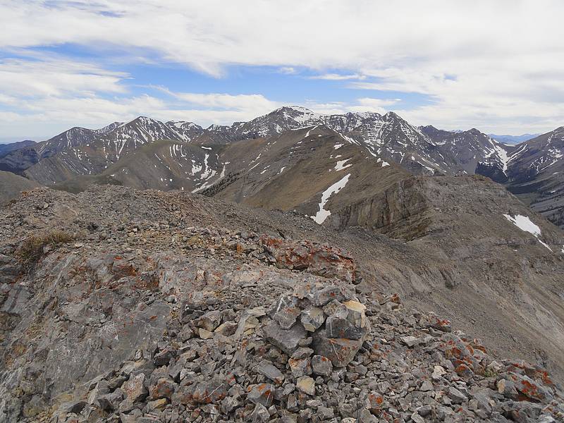
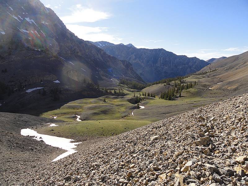
Massacre Mountain Traverse: Once on the tundra plateau, we dropped our big packs and began the ridgewalk to Massacre Mountain (10924’). John had a weak moment and agreed to extend our ridgewalk to North Massacre (10824’). The route was straightforward and very scenic, but all the ups and downs along the way had taken a lot out of us. By the time we got back to our packs on the plateau, we were pretty tuckered out. Fortunately, it was mostly downhill from here. Unfortunately, the trail through the talus leading down to Shadow Lakes was almost non-existent, which made for slow going down the steep hillside. Once down the talus slope, we excitedly made the final climb of the day up to our very scenic campsite at upper Shadow Lake. Stats for day one were over 14 miles and 5600 feet of elevation gain.
Day 2
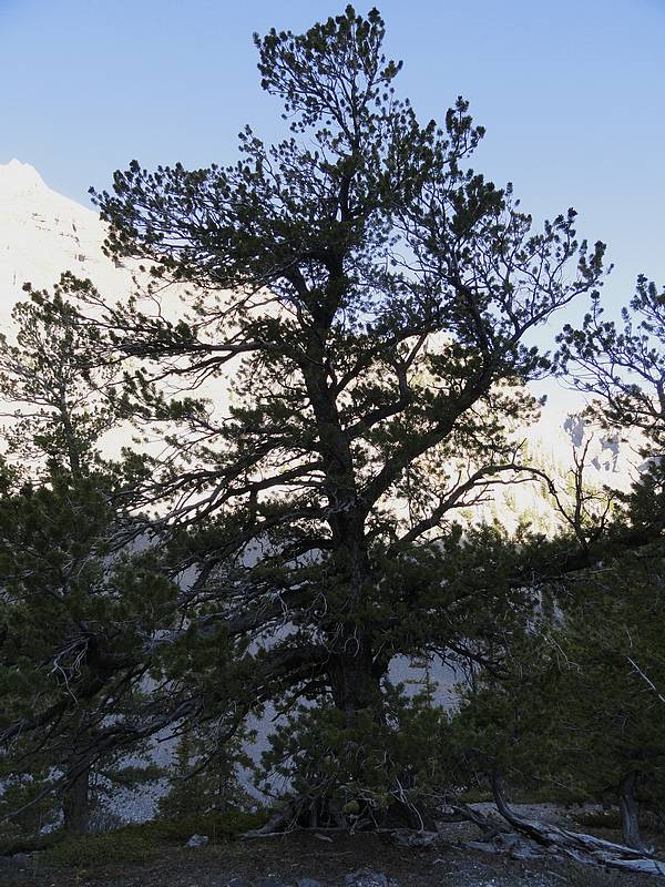
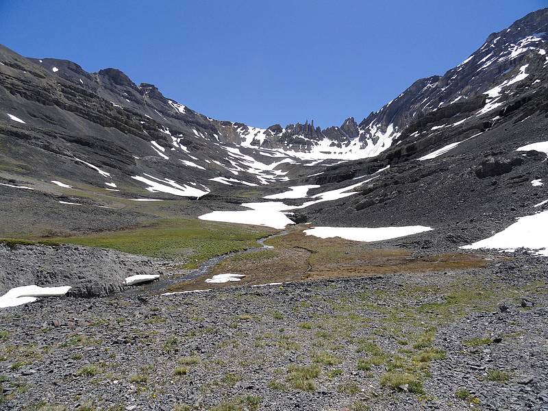
Shadow Lakes to Long Lost Creek: We were determined to make our second day a more leisurely day. We slept in to 6am, then packed up camp, had breakfast, and made the easy hike down the good trail in Hell Canyon. It is one of the few places I’ve seen in recent years that has a healthy White Bark Pine forest. These big trees are dying out fast elsewhere. Soon enough we made it to the bottom, and a trail junction. We headed southwest up Long Lost Creek. It was very pretty, and only got prettier the higher we went. We hiked for about two miles, and then dropped our packs in a nice meadow. Our next objective, a peak called The Moat (11477’) was in sight.
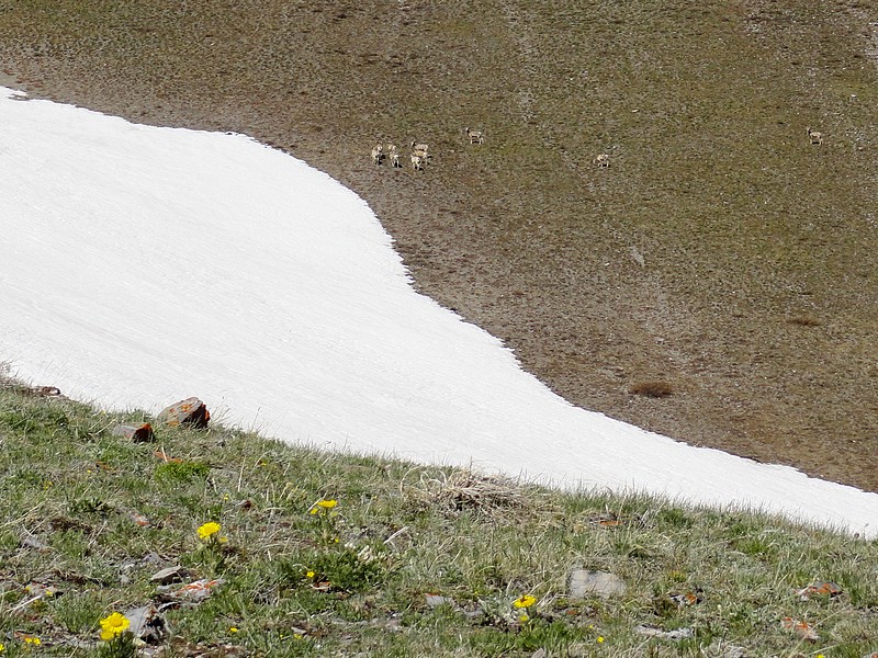
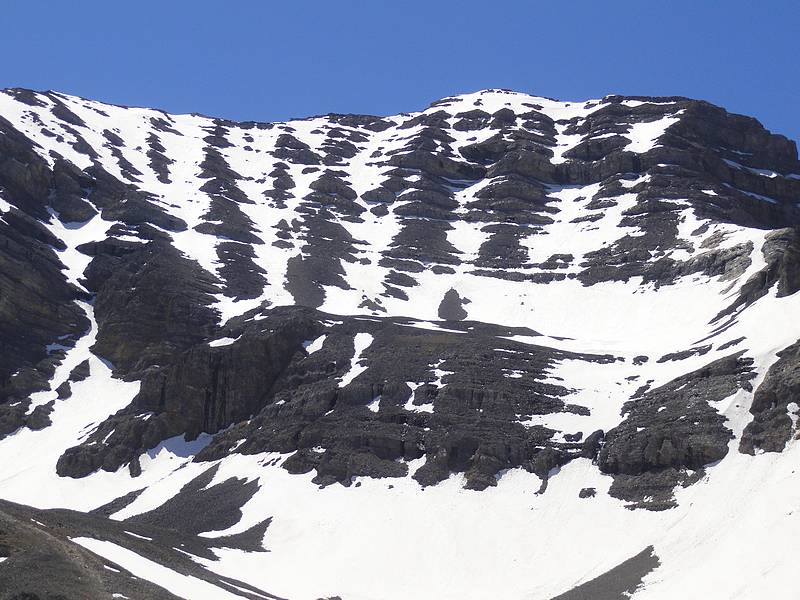
Climb of The Moat: From the meadow, we headed up the forested slopes, and eventually found pieces of a very old trail heading up to the saddle north of Castle Peak. In the distance we could see about a dozen bighorn grazing below the saddle. We watched them traverse north, and then we headed up to the saddle, where we were met with a stiff breeze. The route up The Moat didn’t look too bad, so up we went. The rock was loose in places and cliffy in others, so we had fun route finding along the way to the top. Views from the summit were excellent. Of particular interest was the north face of USGS Peak, in plain view to the south. After a lunch break, we made a careful descent down the ridge, and then pieced together the trail back to our big packs.
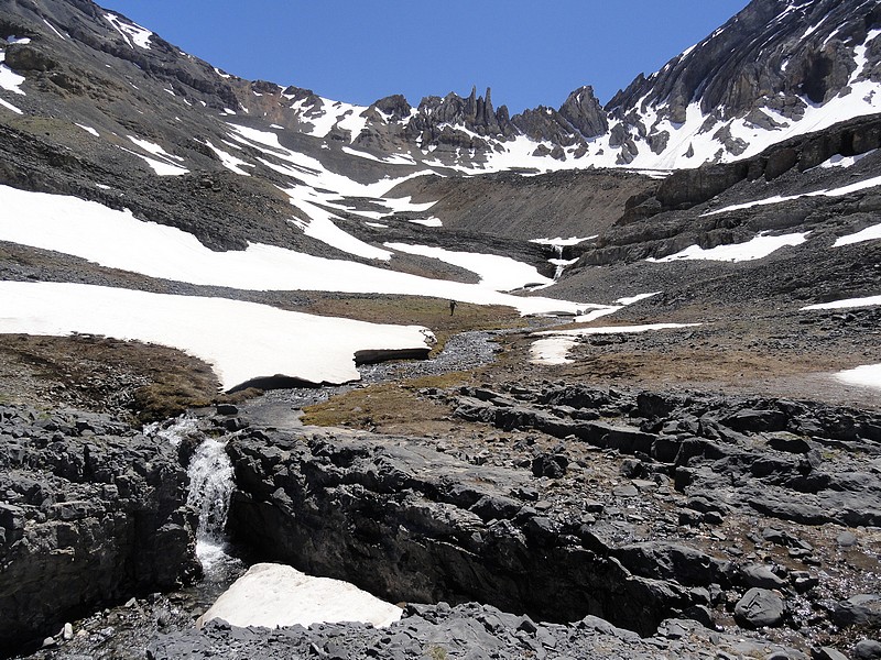
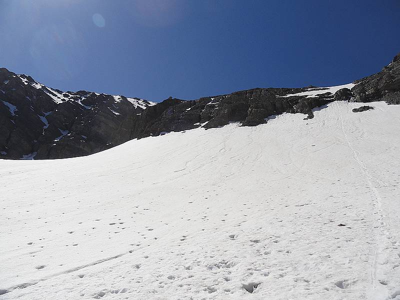
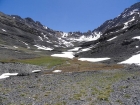
Campsite in the USGS Cirque: We continued up Long Lost Creek. Initially there was a trail, but then a tight spot on the valley pushed us west above some cliffs for some painful bushwhacking. When we finally made it to the mouth of the drainage leading to USGS Peak, our motivation levels were drooping. But I was determined to get up into the cirque below USGS, and John excitedly joined me. The drainage was initially loose rock, but then we lucked out and soon had firm snow coverage to make for easy going up into the cirque.
Once in the cirque, the impressive north face of USGS Peak had our full attention. We set up camp on a gravely knoll, and gawked at the peak for most of the rest of the evening. It was a dramatic setting, highly recommended. Stats for day two were over 10 miles and 4400 feet of elevation gain.
Day 3
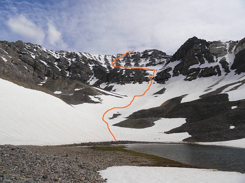
Climbing the North Face of USGS Peak: We knew that our third day was to be the biggest day of the trip. We had our crampons on by 6am, climbing the lower snow bowl. We had intended to climb a snow vein on the far left-hand side of the face, but that lead to a hidden cliff that wasn’t climbable. Next we tried a rock rib, but the rock was too loose and steep, so we contoured back to the right. Splattski climbed the snow to the base of a frozen waterfall, and then worked his way around it. He made it up in spite of some verglass ice coating the rock. I had started up a rocky ledge and stopped at a spot I knew I didn’t want to down climb later. But when John yelled that he’d made it above the waterfall, I headed up, with the plan to down climb his route.
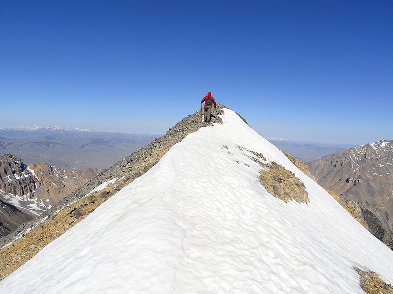
John and I were reunited on the large shelf at 10800’. We angled up the gradual snow to the left side of the face, and then chose an open snow chute to begin our climb. It got steeper as we got higher, with the slope maxing out at about 45 degrees. At around 500 feet above the shelf, we started angling to the right, and found a line that took us most of the way to the top. It was a great feeling to reach the summit. This peak had been near the top of my list for several years, ever since having read the Tom Lopez trip report. The views were great, but we still had a big day in front of us, so we couldn’t linger for long.
I took a very cautious approach to our descent since my lightweight aluminum crampons weren’t giving me as much confidence as I would have liked while down climbing the steep snow. But we made slow and steady progress back down to the bench, and then made it back to the waterfall. Thankfully the verglass had melted, and we were past the crux after a few careful moves to get down the rock and past the moat at the top of the snowfield. Next the crampons came off and we made a quick glissade down the snow and a short walk back to our campsite.
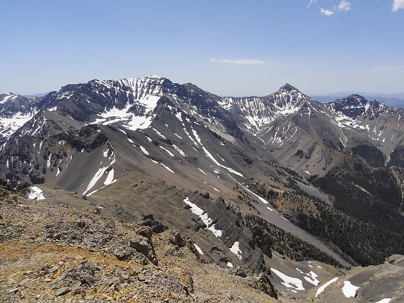
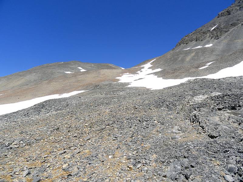
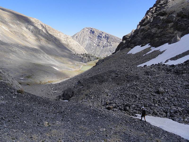
Upper Long Lost Creek: It was noon by the time we broke camp and began retracing our steps back down to Long Lost Creek. Once back in the valley, we followed occasional game trails up the valley. It was extremely scenic, with a number of waterfalls and the unique “goal posts” formation as a backdrop. I would put this up there with some of the most scenic places I’ve ever visited. Near the headwaters of Long Lost Creek, we began angling up the scree and talus slopes to the east and then north toward the saddle above the Nolan Lake drainage. We set a steady pace and made to the saddle by 3pm. After a brief debate, we elected to bypass Ross Peak and Last Lost Peak, and descend to Nolan Lake. We just didn’t have time to climb the peaks and still get back to the trailhead before dark.
Nolan Lake & Wet Creek Drainages: The scenery on the way down was spectacular, and we marveled at the climbers we knew who had summitted Limestone Mountain (11332’) as it towered high above us. The cliffs that surrounded the drainage were very impressive, and we took a very scenic break at Upper Nolan Lake (~10100’) before heading down to the Wet Creek drainage. From here on, we were in familiar territory (see the IdahoSummits 2006 Fall Outing). This drainage had an occasional trail, but plenty of brush and talus. Our feet hurt and our gas tanks were nearing empty, but we were encouraged knowing that the trailhead wasn’t much further now. Stats for day three were over 10.5 miles and 3700 feet of elevation gain.
We made it back to the car by about 6pm, very tired but very satisfied with what we had accomplished over the prior three days. USGS Peak had been the highlight of a trip that had taken us through some very wild and rugged terrain, with almost no sign of man. It was an excellent trip, and I’m very appreciative to John for joining me. Next stop, Arco for some greasy bacon cheeseburgers, french fries, and extra thick milk shakes.
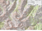
Map of our trip, we went counter clockwise. Base route was 22 miles and 7000' gain, or 35 miles and 14000' gain with side trips to climb peaks. |
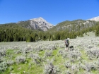
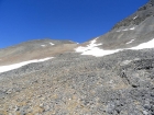
Wet Creek drainage, about a half mile from the trailhead. |
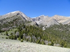
Ross Peak (center) and the headwaters of Big Creek. |
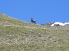
Bighorn ram on the ridge near Little Lost Peak. |
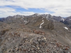
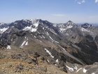
The view south from the summit of North Massacre Mountain. |
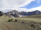
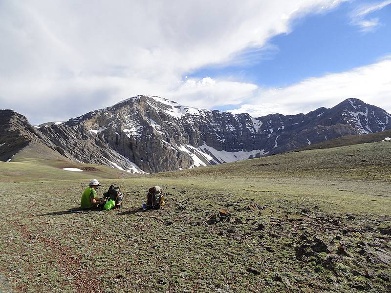
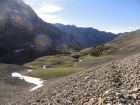
Taking a break on the tundra above Shadow Lakes. |

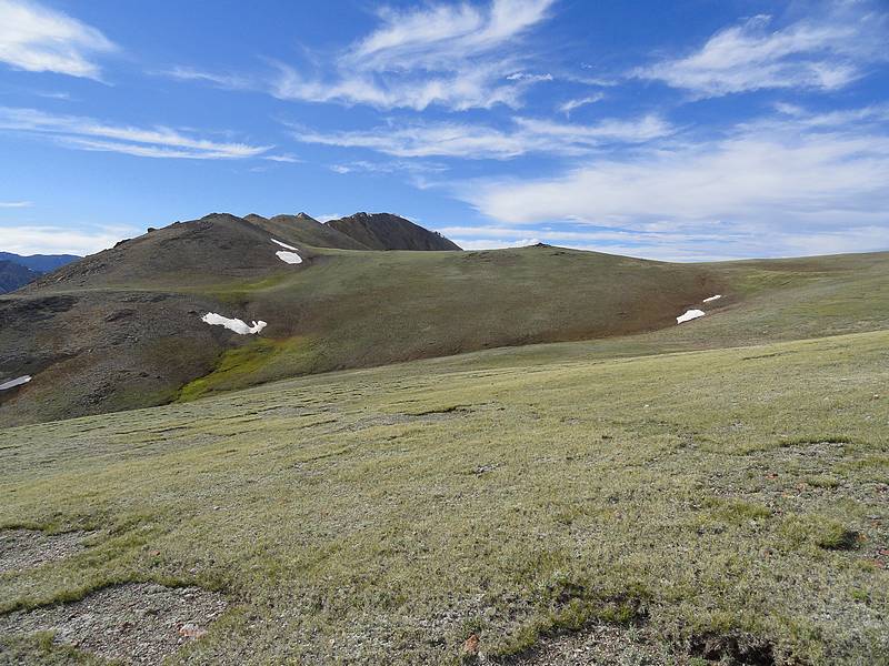
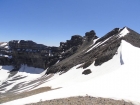
Looking back on Massacre Mountain from the tundra plateau. |
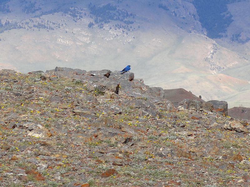
Bluebird at 10400' on the plateau. |
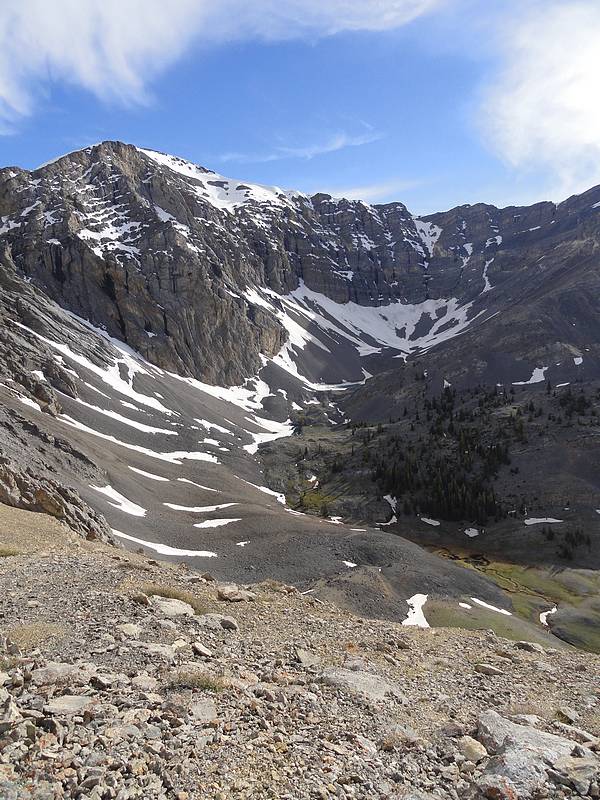
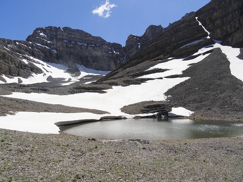
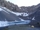
Shadow Lakes below the north face of Ross Peak. |
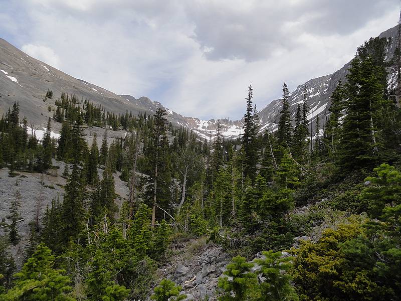
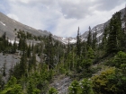
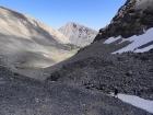
Looking down Hell Roaring Canyon. |
Our campsite at the upper Shadow Lake. |
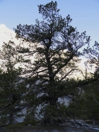
Huge whitebark pine tree in Hell Canyon. |
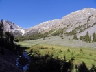
Long Lost Creek from around 8700'. |

Herd of bighorn in the distance, wildflowers up close. |
The Moat (11477') from the saddle below Castle Peak. |
USGS Peak & Mount McCaleb from The Moat. |

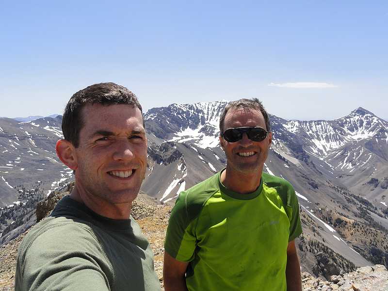
Dave and John on the summit of The Moat. |
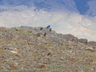
Some bushwhacking on the way up Long Lost Creek. |

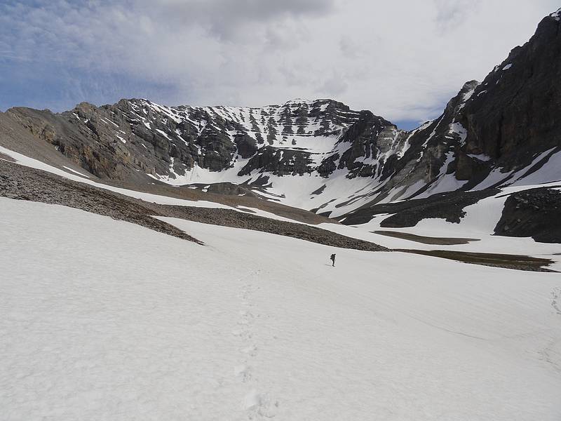
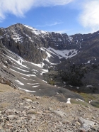
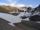
The dramatic cirque below the north face of USGS Peak. |
Our campsite below the north face of USGS Peak. |

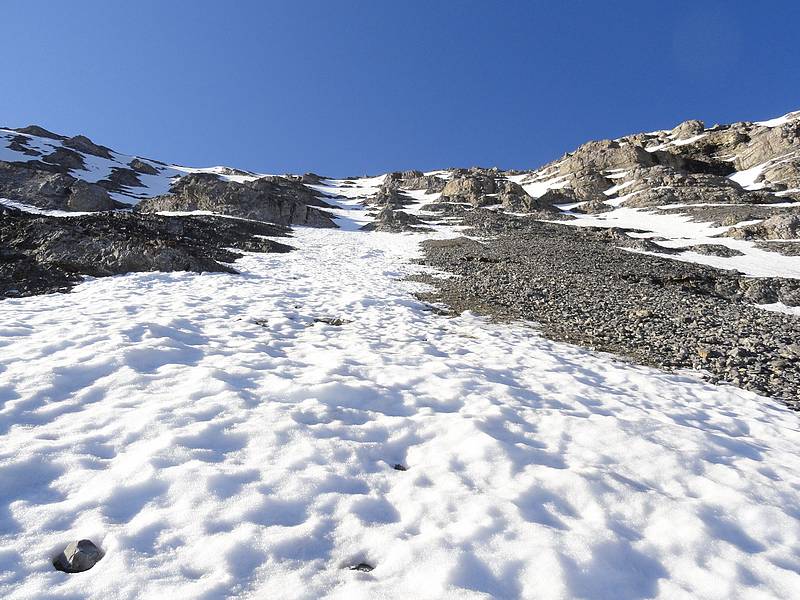
Starting the steep section on the USGS north face. |

John angling up across the face. |
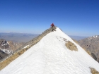
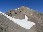
Nearing the summit of USGS Peak, Idaho's 10th highest. |

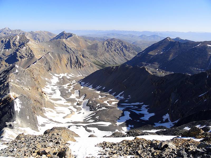
Looking down on the USGS cirque. |
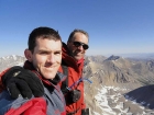
Dave and John on the summit of USGS Peak. |

Lower section of the face, our glissade path on the right. |

Our route up the north face of USGS Peak. |
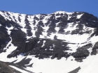
Close-up of the north face of USGS Peak. |
Upper Long Lost Creek, goal posts in the background. |
Angling up the scree to reach the saddle south of Ross Peak. |
Limestone Mountain from the saddle. |

Massive cliffs above upper Nolan Lakes. |
Heading down the valley to Nolan Lake, Octoberfest Peak in the background. |

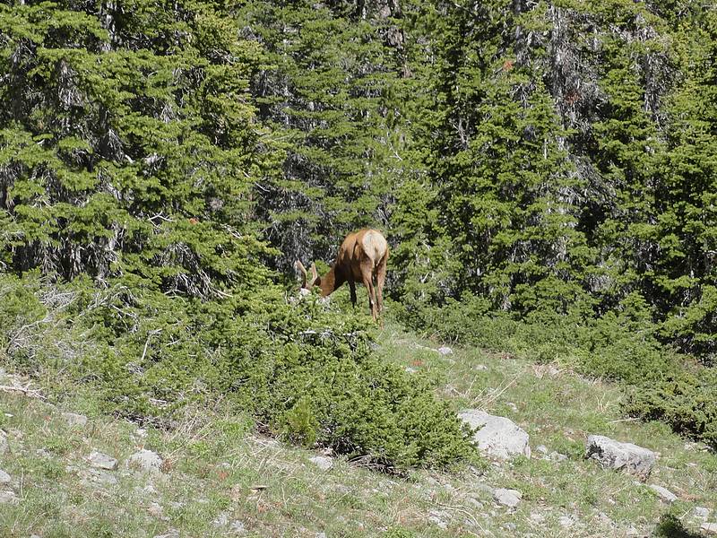
Elk above Wet Creek. |

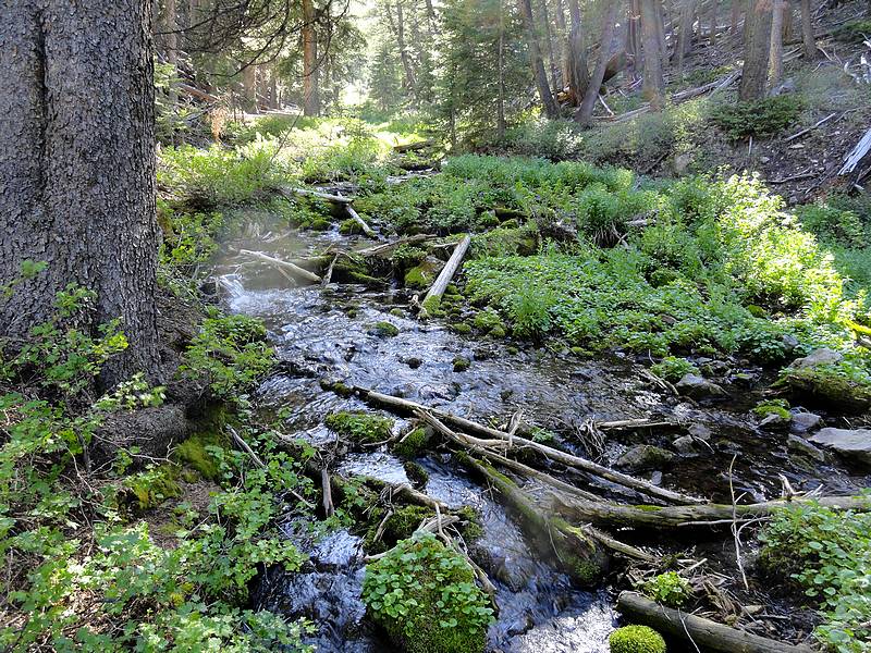
Wet Creek, not far above the trailhead. |
 |
|