|
Rabbit Peak
Elevation 6428'
Rabbit Peak is an unofficially named summit located in central Idaho, east of Idaho City. It’s the highpoint of an undulating ridge between German Creek and North Fork Rabbit Creek. The ridge makes for great views along the way. There are three points on the ridge of very similar elevation. The center point seems to be ever so slightly higher, but it’s hard to tell for sure. The peak can be accessed via single track trail from either the north or south, with the north approach being a bit shorter. The trail is open to motorcycles, but as of summer 2020, it is seeing very little use so your chances of solitude are high.
After a 90 minute drive from Boise, and some high clearance driving, I arrived at the trailhead on the North Fork Rabbit Creek and hit the trail. It was a nice morning, a little smoky, but not too bad. The trail followed a long since abandoned road bed up to a saddle, where I hung a right and headed south up the ridge.
The trail was narrow in places due to brush, but easy to follow. I made good time hiking up and down over various bumps on the ridge. The trail stays close to the ridgeline for the most part, which makes for great views of the Rabbit Creek drainage to the south, and Hungarian Ridge to the east.
Since there are three points similar in elevation, like any good peak bagger, I decided to tag all three. I checked my altimeter on each, and the center point seems to be the highest, but not by more than about ten feet. I enjoyed my PBJ in the shade while checking out the views, and decided it was time to head back to the truck since it was starting to get hot. Round trip was just under 7 miles and 2000’ elevation gain.
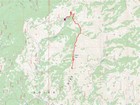
Map of the route, just under 7 miles and 2000' gain round trip. |
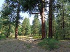
Ponderosa Pines at the start of the hike. |
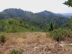
First view of the Rabbit Peak ridge. |
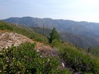
Hungarian Ridge to the east. |
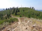
Southernmost summit. |
|
|
|
