|
Deadman Peak
Elevation 5180'
Deadman Peak (aka “Plan B Peak”) is located in the Danskin Mountains, just east of Boise. The peak is accessible year round via Blacks Creek Road. Being a short hike of around 5 miles round trip, makes this peak a good option for a quick hike close to home.
A New Year’s Day snowshoe outing has become somewhat of a tradition. But when we got the trailhead at the mouth of Deadman Creek, we decided there wasn’t enough snow to warrant bringing snowshoes. We were a group of 5, making a pretty good pace to start. Then it started drizzling. And pretty soon it was raining hard and blowing sideways. John, Tam, and Michael decided to head back to the truck, while Brett and I opted to continue onward through the storm.
I won’t lie, we were pretty miserable for a while. But as we got higher the rain switched to snow and then stopped altogether. At this point, conditions would have been pleasant if we weren’t pretty much soaked. We continued up toward the ridge, high-stepping through a couple inches of recent snow. The scenery around us was nice, although distant views were blocked by low clouds.
We made it to the summit a little wet, but feeling good. The views of the surrounding Danskins were nice, but we didn’t linger long before heading back down and retracing out path back to the truck. Round trip was about 5 miles of hiking and 2100’ of elevation gain in just over 3 hours. I may need to come back and do this one again in better conditions.
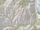
Map of the route, 5 miles and 2100' gain round trip. |
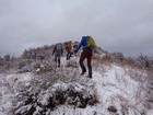
Heading up the slopes above Deadman Creek. |
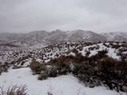
Deadman Peak is the highpoint on the left. |
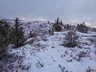
Deadman Peak summit area. |
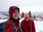
Summit celebration? |
|
|
|
 |
IdahoAlpineZone is unofficially sponsored by Skippy Peanut Butter.
