|
Dry Buck Mountain
Elevation 6507'
Dry Buck Mountain is located above the confluence of the North Fork and South Forks of the Payette River, not far northeast from Banks. This area is at the southern end of the West Mountains. The summit is home to the foundation of an old lookout building, and offers great views on clear day. The highpoint is labeled “Cook Knob” on some maps.
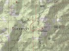
I had never been in the area and was curious to explore. My wife and I made the interesting drive to Dry Buck summit. Steep road, but in good condition. Depending on which map you check, there are trails shown maps that don’t exist, and others that exist but don’t show on any maps. So half the challenge of the hike was figuring out which trail to take.
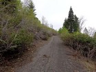
We ended up on an ATV trail that curled around the west side of the mountain. At the point where a small stream met the trail, we followed another trail north briefly, and then met the final trail heading east to the highpoint. So ultimately, no off-trail travel required.
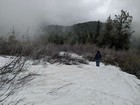
With a heavy snow year the prior winter, there were a number of snowy areas to wander through. Also, weather for the hike was a bit unsettled, so we experienced light rain a couple times. And there was enough clouds around the summit that we didn’t have much in the way of views. But it was still neat to watch the clouds gently waft through the trees around us.
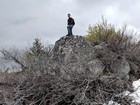
After reading the summit log and snapping a few photos, I scrambled up a rock that was just barely higher than the lookout foundation, and then we retraced our path back to Dry Buck Summit. Round trip was about 2.5 miles and 600’ of elevation gain. Fun morning exploring a new area with my Sweetie Pie. Fresh air, nice hike, and plenty of trilliums in bloom!

Map of the route, 2.5 miles and 600' gain round trip. |

Early in the hike. |

Summit shot! |

The highpoint. |

Heading back down. |
|
|
|
