|
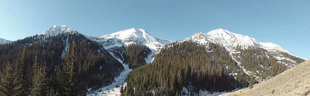
The Trail Creek drainage defines the southeast edge of the Boulder Mountains, forming the dividing line between the Boulders and the Pioneer Mountains. The headwaters of the West Fork of Trail Creek are located within a beautiful basin that is surrounded by five peaks, all reaching over 10,500’ in elevation. There is a seldom maintained trail that forms a nice loop through the area, or a more adventurous option is to climb up to the ridge that surround the basin for a highly scenic traverse.
Sean and I bounced around a few ideas for climbs we thought would be doable in November with an unknown amount of snow coverage. The idea we liked best was to head up to the Trail Creek Summit area, and try to climb Mallory Peak and Murdock Peak. If conditions were good, we thought we may have a chance to climb three other nearby peaks too. We started hiking from the West Fork Trail Creek trailhead around 8:45am. Very soon we were faced with an icy creek crossing. The ice looked thick, but we could hear the creek flowing underneath. We took our chances, and scampered across the ice without incident. If we hadn’t been so close to the comfort of a warm car, I’m not sure we would have been so daring.
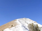
After the creek crossing, we hustled up the trail in an attempt to stay warm in the cold morning shade. There was an inch or two of snow on the trail, but not enough to slow us down. After about a mile and a half, we left the trail and headed up a prominent south-facing gully that angled its way up toward Point 10461’. We stayed on the edge of the trees on the right side of the gully, following game trails where possible. Farther up, we had to deal with some pretty nasty talus fields just below 9600’. But from that point on, there was better snow coverage to protect us from the loose rock. Around this time we took a break to watch a huge flock of large white geese honking and flying south in v-formation. Very cool.
It took us around two hours to reach Point 10461’, which anchors the south end of Mallory Peak’s summit ridge. We had great views from this point on, with snow-capped peaks in the Boulders, Pioneers, and Lost River Range visible all around us. As we covered the half-mile to the summit of Mallory Peak (10589’), there were already cornices forming on the ridge, but the route was straightforward. Things were going well, and we were starting to like our chances of completing all five peaks. We made the somewhat steep descent down Mallory’s north ridge, pausing for occasional sneak peeks down the impressive north face. There were a couple patches where the snow was frozen very hard. We had crampons along, but the patches were small enough that we didn’t have to put them on. After descending from Mallory, we made our way up the south ridge of Murdock Peak (10564’). The ridge was easy class 2, even with partial snow, so we made our way to the summit pretty quickly.
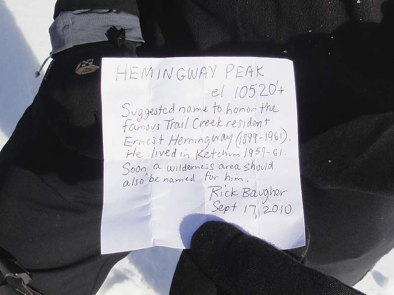
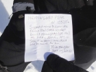
Once at the summit of Murdock Peak, it was almost 12:30, so we stopped for a lunch break. The weather was great, with barely a cloud in the sky, and the view of the surrounding peaks was awesome. We layered up to keep warm, and I wolfed down a PB&J along with a thermos full of homemade hot apple cider that my wife had made. Pretty hard to beat if you ask me. Next we headed north along the ridge toward our third peak of the day. There were some tricky spots as we made our way down, and it actually took us longer to descend to the saddle than it did to climb up to the next peak. The peak stood at the west of the basin. On top we found a cairn and a familiar film canister and a note from Rick Baugher suggesting that the mountain be named Hemingway Peak (10520’+). The views continued to be excellent, and Hemingway’s summit was a great vantage point to eyeball the last two peaks of the day, located due east of us.
With the clock ticking, we headed down Hemingway’s east ridge, and then angled across the talus slopes on the south facing slopes below Point 10270’. Next we made our way up the west ridge of Peak 10598’, staying on the south side of the ridge to avoid the steep drops on the north face. We had the most enjoyable climbing of the day scrambling up some blocky gullies on the final section of the ridge to the summit of Peak 10598’. From here we had stellar views of Mystery Peak to the north, and the Lost River Range further in the distance. The high peaks in the Pioneers were also very impressive.
Four down, and one last peak to go. It was less than a half a mile to our fifth and final summit, but the descent to the saddle was the crux of the entire day. There was a steep section that probably would not have been hard in dry conditions, but the shady northwest ridge had some icy spots that made for some tricky down-climbing and slowed our progress quite a bit. Once at the saddle, it was a quick climb up the talus to the summit of Peak 10566’. We paused for high-fives and a snack, but it was now after 4pm, and the shadows were getting pretty long as the November sun was beginning to set. So we hustled down the east ridge, dropping off to the south at first to avoid some rock towers, and then made our way through some nasty talus fields before finally reaching the trees. On the way down, we saw a deer and scared up several grouse along the way. After winding through the trees, we eventually found the trail, which lead us back to the trailhead.
We made it back to the car in just under nine hours round trip, with about 15 extra minutes of daylight to spare. Sean and I were very happy with the outcome of the day. We had great weather, great views, and pretty good snow conditions. Any chance to climb five peaks in a single day is outstanding, but to pull that off in November is even more satisfying.
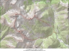
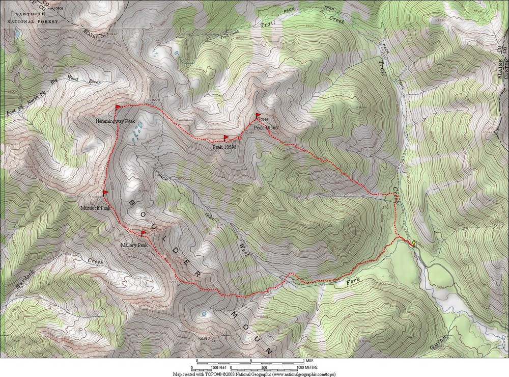
Map of our route. We went clockwise covering just over 9 miles and 4800' total elevation gain trip. |
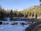
West Fork Trail Creek trailhead.
|
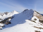
This is the gully we climbed, Mallory Peak on the far right.
|
Huge flock of snow geese flying above us in v-formation.
|
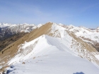
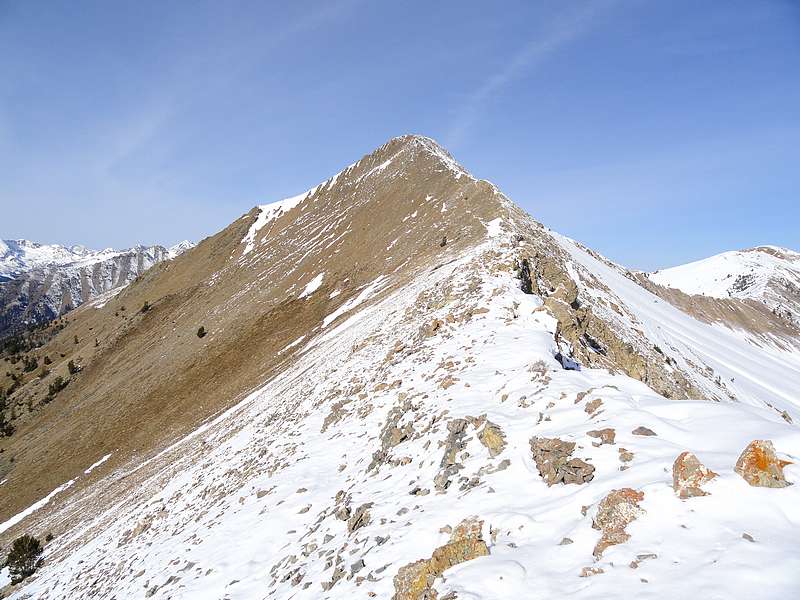
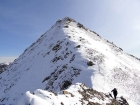
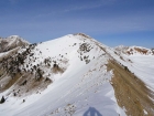
View northwest along the ridge to Mallory Peak.
|
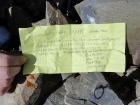
Note placed by Rick Baugher on the summit of Mallory Peak. |
Looking back on the steep north ridge of Mallory Peak. |
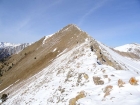
South ridge of Murdock Peak.
|
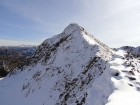
Impressive north face of Mallory Peak.
|

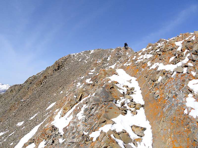
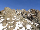
Sean climbing the south ridge of Murdock Peak. |
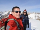
Splattski style shot of Dave and Sean on the summit of Murdock. |
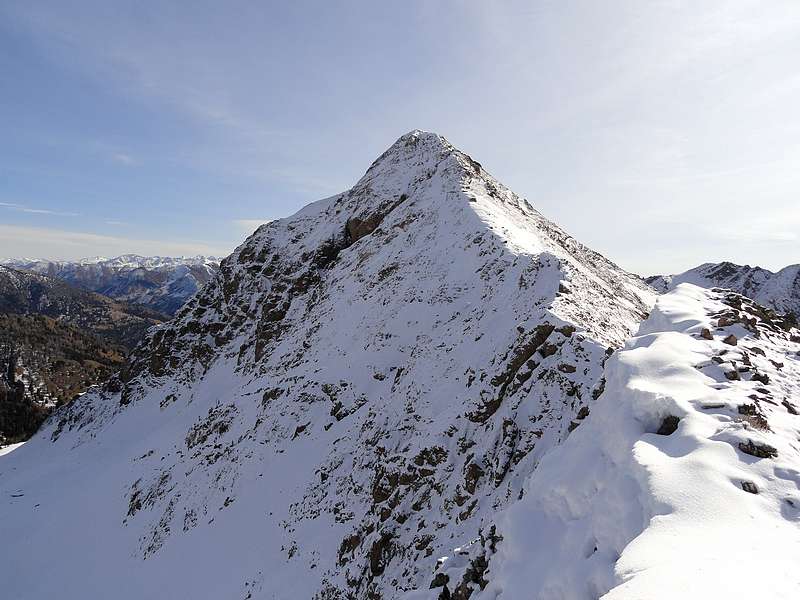
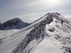
View north to Hemingway Peak.
|
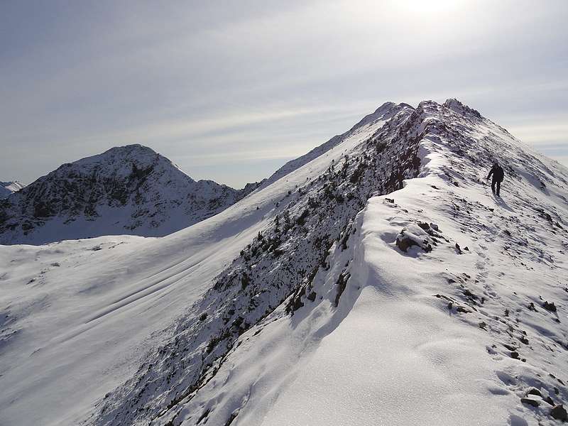
Sean descending Murdock's north ridge, Mallory on the left. |
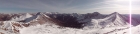
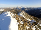
Panoramic view looking east from the summit of Hemingway Peak.
|
Note placed by Rick Baugher on the summit of Hemingway Peak. |
View east to Peak 10566' and Peak 10598'.
|
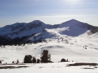
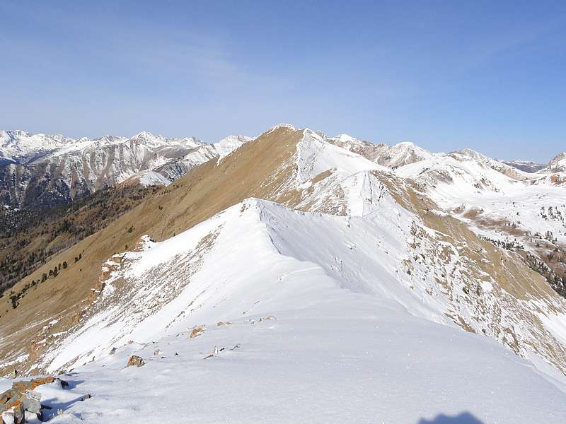
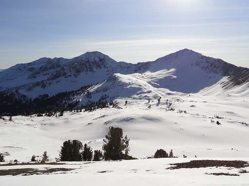
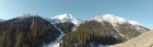
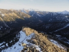
Looking south across the basin at Mallory and Murdock.
|
Fun scramble section on the west ridge of Peak 10598'.
|
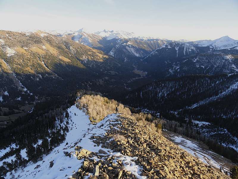
View of the Pioneers, looking east from the summit of Peak 10566'. |
Sean making his way down through the talus on the east ridge of Peak 10566'. |
|