|
Williams Peak
Elevation 10740'
Williams Peak is located in the ruggedly beautiful Lost River Range of eastern Idaho, near some of the tallest mountains in the state. Standing at “only” 10,740’ in elevation, Williams feels much shorter than the nearby 12ers, but it still ranks as the 185th tallest mountain in Idaho. Probably the best part of a climb of Williams Peak is the in your face views of the much taller neighbors.
I was looking for a challenging, but not too challenging climb after back surgery a few months ago. Michael, John F, and Splattski were nice enough to join me. We were up bright and early (at least early) for a 5am departure from Boise. Drive time to the “north Jones Creek” trailhead was just under 4 hours, and we were on our feet and hiking before 9am.
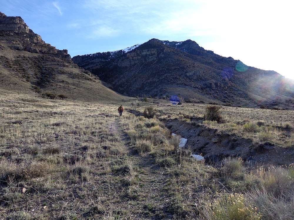
The Lost River Range is known for nasty creek bottoms, but the north (west?) fork of Jones Creek is actually a pretty tame approach, with a lightly cairned trail making its way up the valley. The route starts at 7400’ and gets a few visitors each year, since it’s the preferred approach for 12ers Mount Church and Donaldson Peak.
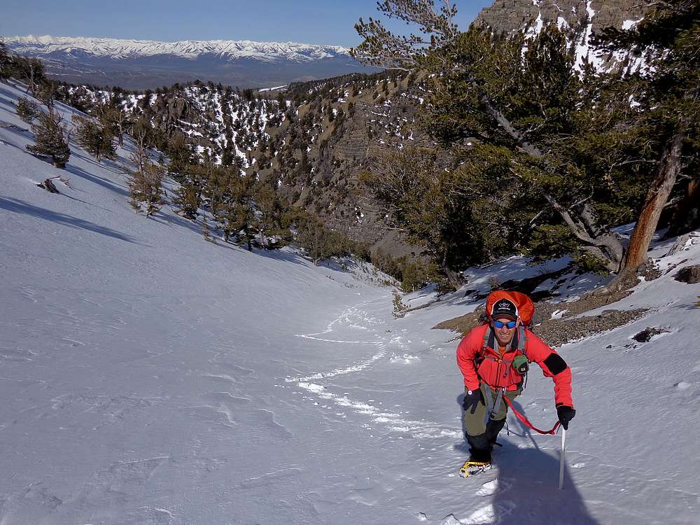
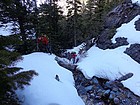
The plan was to head for the 10k saddle below Donaldson Peak. But at about 8900’ we spotted at good looking snow gully that we couldn’t resist. The map said the gully would take us straight to the summit, and it had been “pre-disastered” (Splattski term) by an earlier avalanche. And the snow was firm, so we left our snowshoes behind, and started up the gully with crampons and ice axes in all their glory. Steepness ranged from 35-45 degrees.
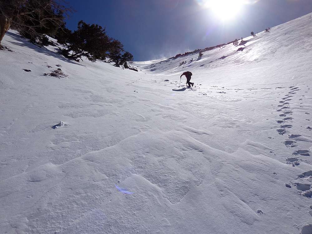
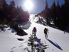
As we made our way up the gully, we all marveled at the fantastic weather and amazing views as we climbed up and out of the valley. I took a lot of photos on the way up, which gave me an excuse to rest often along the way. We could see spindrift blowing off the ridge above us, but the wind in the gully was minimal. The wind picked up as we crested the ridge, but I think we were distracted enough by the views that it didn’t bother us much. At that point, we added layers to stay warm and made the final push to the summit.
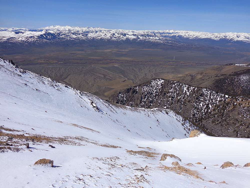
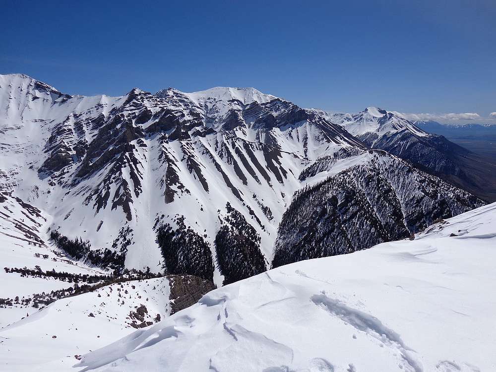
The views from the top were spectacular, with the south sides of Church and Donaldson staring us in the face. We had great views all along the main Lost River Range crest from Mount Borah to Mount McCaleb. To the south, the White Knobs, Pioneers, Boulders, and White Clouds were all in view. It felt amazing to be up in the mountains again after several months of recovery. It was an emotional moment for me. I live a truly blessed life.
After some photos, we decided to make a loop out of the day, and continued north down toward the 10k saddle, and the in your face views were ongoing. The snow was mostly firm, with just a few occasional post-hole steps, and then a nice glissade down into the valley.
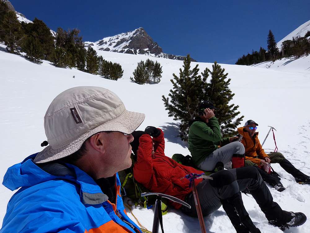
We stopped for an extended lunch break at a safe spot in the valley, enjoying the great views, nice weather and good banter with good friends. Reluctantly, we eventually headed back down the valley to the truck. Round trip was just over 5 miles and 3400’ gain in 5.5 hours. Nothing but good to say about a day like today.
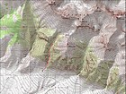
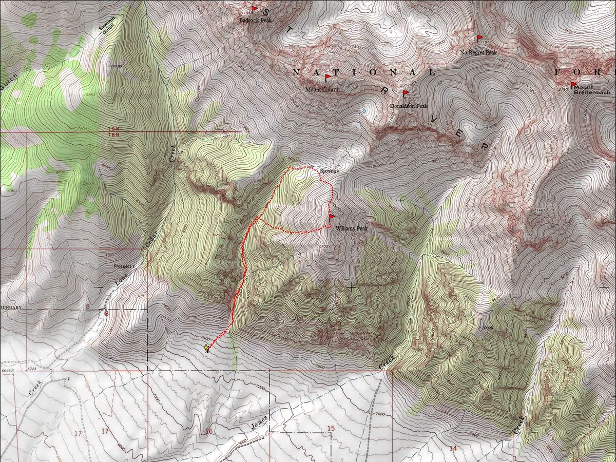
Map of our route, just over 5 miles and 3400' gain round trip. |
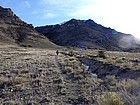
Hiking toward the mouth of north Jones Creek. |
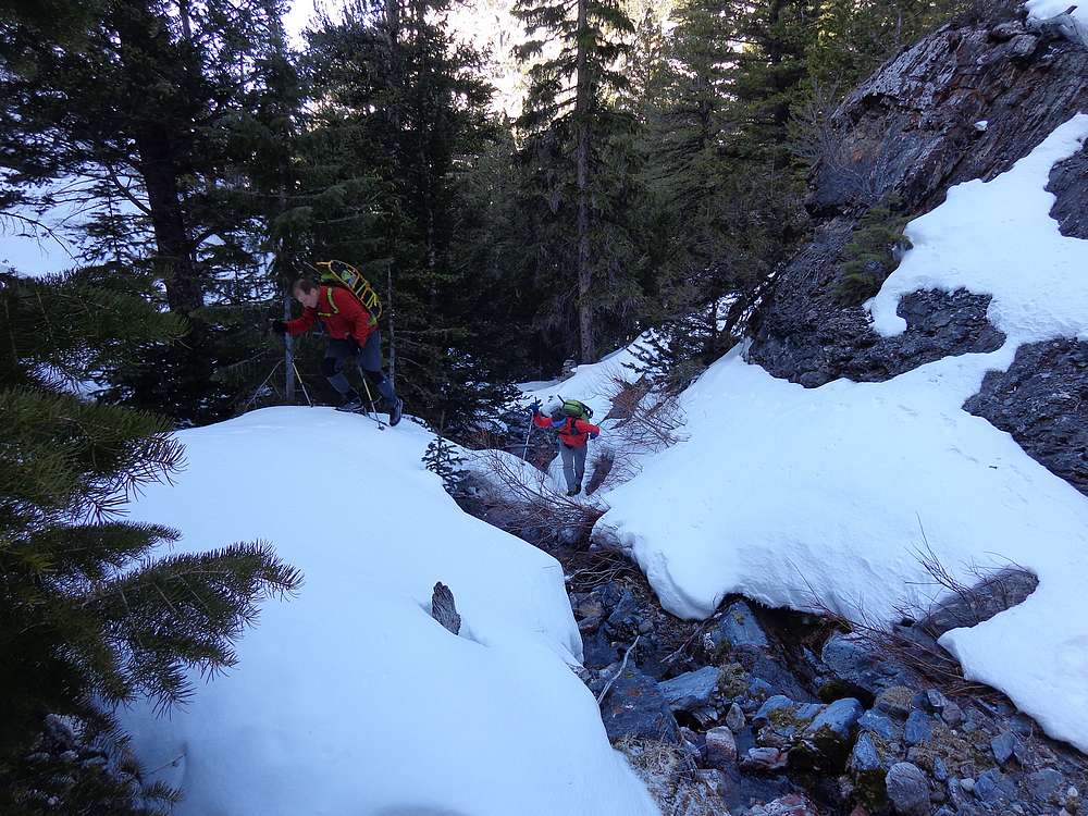
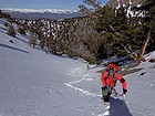
One of the more challenging sections in the valley. |
At the start of a ascent gully, pre-disastered. |
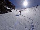
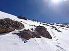
Early part of the gully, spindrift above. |
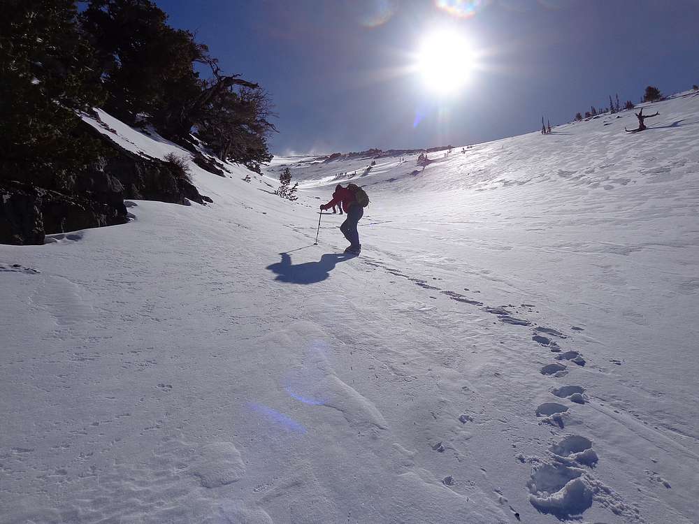
Taking a break on the way up. |
The gully gave us 1800' of snow climbing. |
The slope gets steeper up high. |
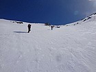
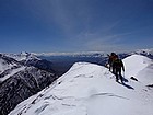
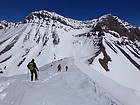
Nearing the ridge. |
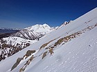
White Cap Peak to the northwest. |
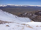
Looking back at our route. Pioneers, Boulders, White Clouds in the distance. |
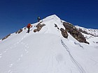
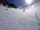
Final climb to the summit of Williams Peak. |
Great views from the summit. |
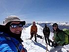
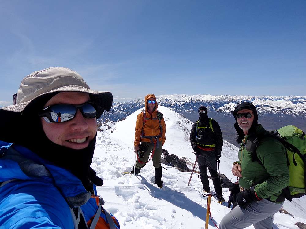
Group shot on the summit. |
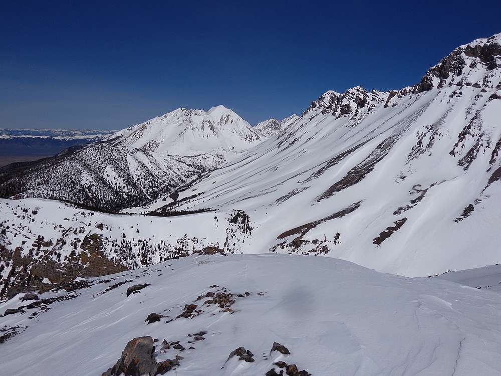
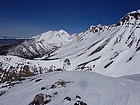
View southeast to Lost River Peak & Mount McCaleb. |
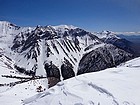
View northwest of White Cap, Borah, Leatherman, Badrock, Church. |
Heading north toward the 10k saddle, Church and Donaldson tower above. |
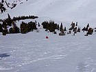
Glissade slope. |
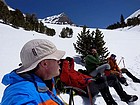
Extended lunch break. |
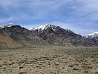
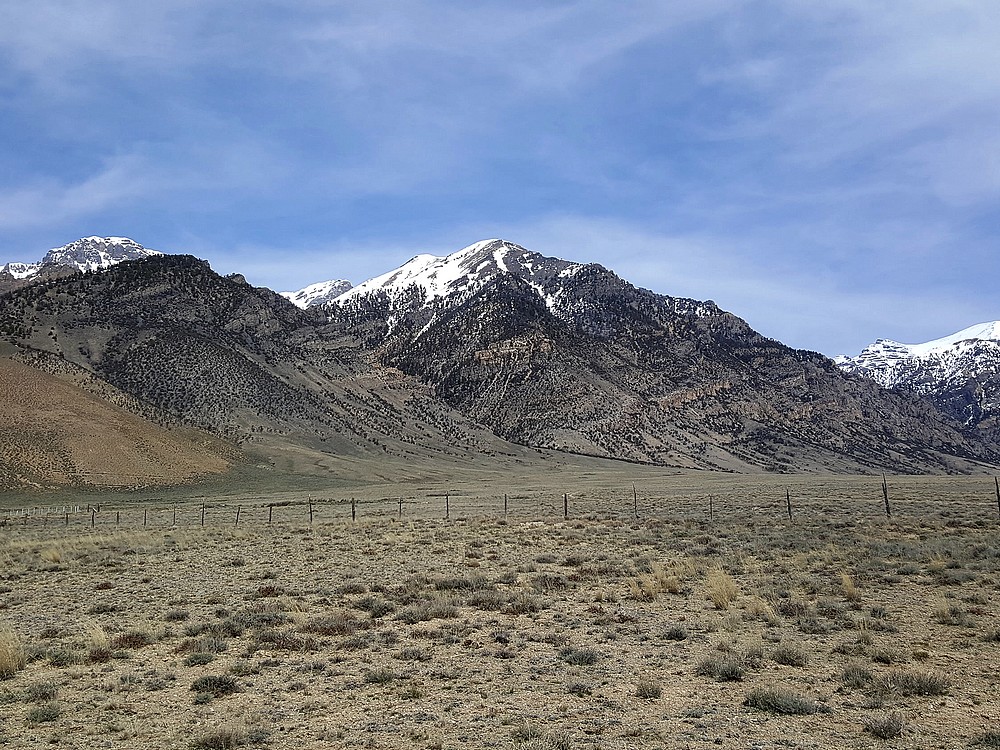
Williams Peak from the highway afterward. |
|
|
|