|
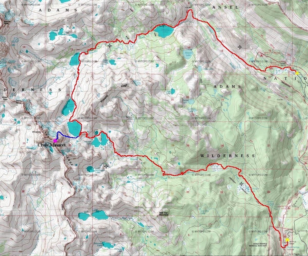
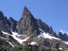
Clyde Minaret is an impressive spire located in the Ritter Range, within California’s Ansel Adams Wilderness. Clyde is the highpoint of the Minarets, one of the most impressive features in the entire Sierra Nevada. This part of the range is metamorphic rock, and isn’t as solid as the typical Sierra granite. The most popular routes on Clyde Minaret are the classic South East Face (a 5.8 grade IV climb) and the popular “Rock Route”. The Rock Route was our choice. It’s considered to be the easiest route on Clyde, and is a long sustained exposed Sierra Class 3-4 scramble.
 After an awesome but long outing doing the Carillon-Russell-Whitney-Muir Traverse the day before, Sean and I grabbed a room at Motel 6 in Mammoth Lakes and decided to sleep in before making our way toward the Minarets. We caught the shuttle bus from the Mammoth Mountain ski resort to the Devils Postpile trailhead and were hiking by about 11am. Not exactly an alpine start, but the extra sleep was probably a good choice. At the start of the hike the scenery was nice, but the trail was kind of dusty. It was heating up, so I think we were both anxious to get up to the high country. After a couple hours of hiking, we made it to a very scenic waterfall on Minaret Creek, and just above that was an open meadow that gave us our first good view of Clyde and the other Minarets. Clyde was an amazing looking peak, and seeing it gave me a boost of energy. Sean had plenty of energy as usual. After an awesome but long outing doing the Carillon-Russell-Whitney-Muir Traverse the day before, Sean and I grabbed a room at Motel 6 in Mammoth Lakes and decided to sleep in before making our way toward the Minarets. We caught the shuttle bus from the Mammoth Mountain ski resort to the Devils Postpile trailhead and were hiking by about 11am. Not exactly an alpine start, but the extra sleep was probably a good choice. At the start of the hike the scenery was nice, but the trail was kind of dusty. It was heating up, so I think we were both anxious to get up to the high country. After a couple hours of hiking, we made it to a very scenic waterfall on Minaret Creek, and just above that was an open meadow that gave us our first good view of Clyde and the other Minarets. Clyde was an amazing looking peak, and seeing it gave me a boost of energy. Sean had plenty of energy as usual.
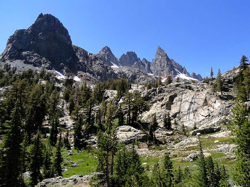
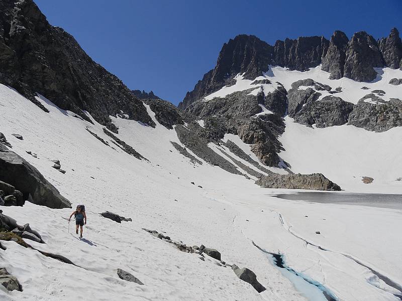
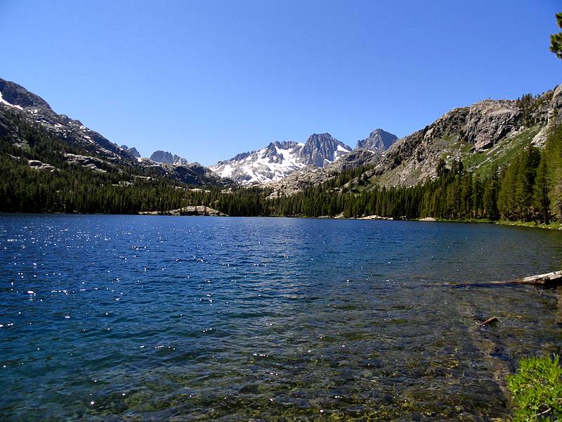
Soon enough we reached Minaret Lake. This area was stunning, with the Minarets forming an impressive backdrop. Clyde Minaret dominated the area. We next made our way up to Cecile Lake. It was after three o’clock at this point, and we were starting to run short on time. So we decided to drop our packs on the east side of Cecile Lake, and come back and set up camp after the climb.
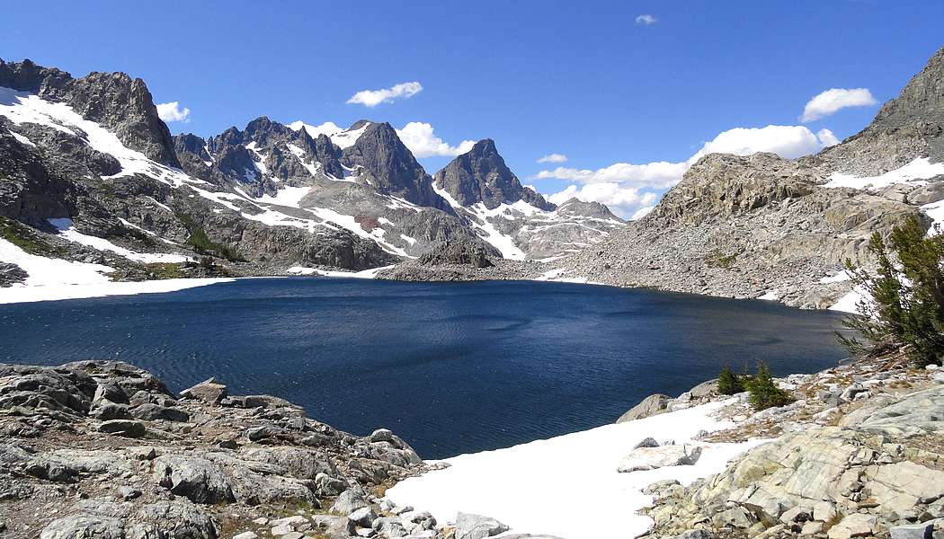
 So off we went, circling around the south side of the lake, up some rock ledges, and then made a long traverse across a large snowfield. This section would have been impossible without crampons, and we took our time being very careful on the snow traverse. Apparently in most years you have to cross a bergschrund at the top of the larger lower snowfield, but there was more lingering snow this year which created a partial berg with an ominous crack to cross. This section had our full attention, and we made it up and over without incident. From there we climbed the steep snow to the base on the Rock Route. So off we went, circling around the south side of the lake, up some rock ledges, and then made a long traverse across a large snowfield. This section would have been impossible without crampons, and we took our time being very careful on the snow traverse. Apparently in most years you have to cross a bergschrund at the top of the larger lower snowfield, but there was more lingering snow this year which created a partial berg with an ominous crack to cross. This section had our full attention, and we made it up and over without incident. From there we climbed the steep snow to the base on the Rock Route.
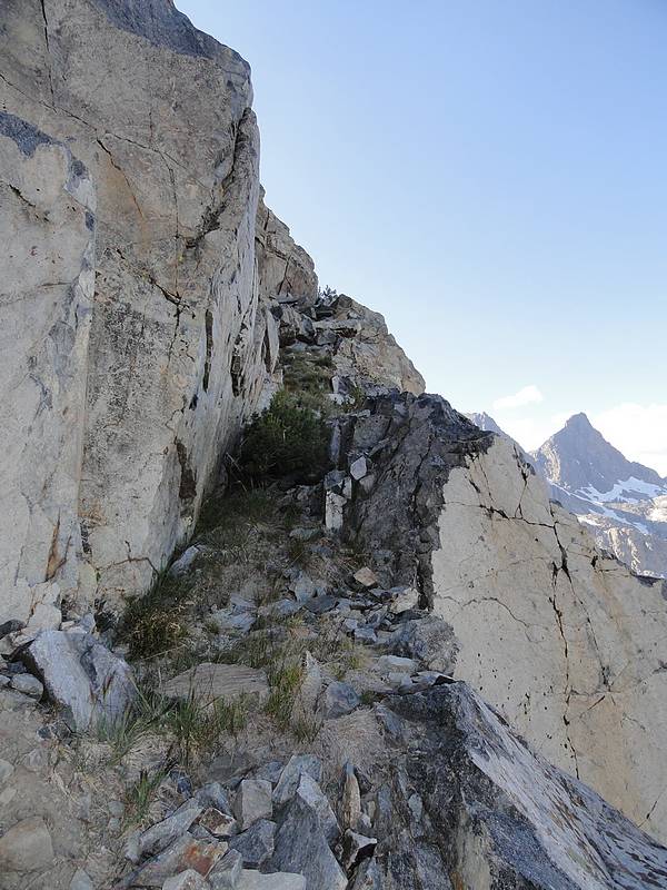
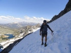
 It had taken over an hour and a half to climb the 1000’ feet from the lake to the start of the Rock Route. There is a nice long ledge that went up and to the right (west), and we scampered up this section over to the base of a steep gully. The climbing was fun and steep class 3 as we made our way up to the right side around a cool looking gendarme. Once above the gendarme, we made an awkward move to the left and continued our way up the steep face. The climbing went on and on. It was a blast. Occasionally I looked down in amazement at the length of the route we would have to down-climb later. It had taken over an hour and a half to climb the 1000’ feet from the lake to the start of the Rock Route. There is a nice long ledge that went up and to the right (west), and we scampered up this section over to the base of a steep gully. The climbing was fun and steep class 3 as we made our way up to the right side around a cool looking gendarme. Once above the gendarme, we made an awkward move to the left and continued our way up the steep face. The climbing went on and on. It was a blast. Occasionally I looked down in amazement at the length of the route we would have to down-climb later.
 As we neared the top of the ridge, it was nearly six o’clock and we still had some tricky moves to work through. First we had to contend with an exposed angled block just below the ridgeline. The next move was the spookiest to me, as we had to straddle an awkward vertical slab, and drop immediately into a very exposed layback section on the opposite side of the ridge, which finally led to some more protected terrain. Not long after that was the well-documented class 4 down climb. Even with knowing the required move, it was still very intimidating with a killer drop down the north face. Sean led all of these sections, and did an awesome job of coaching me through the trickier moves. Once past the crux, it was a quick boulder hop to the summit. As we neared the top of the ridge, it was nearly six o’clock and we still had some tricky moves to work through. First we had to contend with an exposed angled block just below the ridgeline. The next move was the spookiest to me, as we had to straddle an awkward vertical slab, and drop immediately into a very exposed layback section on the opposite side of the ridge, which finally led to some more protected terrain. Not long after that was the well-documented class 4 down climb. Even with knowing the required move, it was still very intimidating with a killer drop down the north face. Sean led all of these sections, and did an awesome job of coaching me through the trickier moves. Once past the crux, it was a quick boulder hop to the summit.
 Rarely have I ever been more stoked to reach a summit. It was an awesome climb. Of course now we had a serious down-climb to deal with. It was 6:30 by the time we started back. We knew it would be very important to get off the route before dark. Retracing our steps back along the ridge and starting down the face was a little easier now that we knew the tricks, but still painstakingly slow. From this point on, we made steady progress down the Rock Route. I again looked down a few times in amazement of how far we had to go to get down, but it was just a matter of taking one step at a time. Sean and I zigzagged our way down, taking turns leading. This was some of the most serious scrambling I’d ever done, but with move after move, we got into a comfortable rhythm, which in turn brought calmness. Eventually we made it back down to our crampons at the top of the snowfield. There was just enough light left to get over the bergschrund without incident. Rarely have I ever been more stoked to reach a summit. It was an awesome climb. Of course now we had a serious down-climb to deal with. It was 6:30 by the time we started back. We knew it would be very important to get off the route before dark. Retracing our steps back along the ridge and starting down the face was a little easier now that we knew the tricks, but still painstakingly slow. From this point on, we made steady progress down the Rock Route. I again looked down a few times in amazement of how far we had to go to get down, but it was just a matter of taking one step at a time. Sean and I zigzagged our way down, taking turns leading. This was some of the most serious scrambling I’d ever done, but with move after move, we got into a comfortable rhythm, which in turn brought calmness. Eventually we made it back down to our crampons at the top of the snowfield. There was just enough light left to get over the bergschrund without incident.
 From this point on the sunlight was all but gone, and we were left in the dark on a moonless night. We elected to take a more direct route down the snow, toward the west end of the lake. Down the snow we went, then down various rock ledges toward the lake. We often couldn’t see beyond the beams of our headlamps to see where the next ledge would take us, but luckily things went smoothly as we made our way down to the lake. As we hike around the north side of the lake, we met a guy from Reno who had been watching our headlamp descent with great interest. Apparently it was quite the site to be seen. From this point on the sunlight was all but gone, and we were left in the dark on a moonless night. We elected to take a more direct route down the snow, toward the west end of the lake. Down the snow we went, then down various rock ledges toward the lake. We often couldn’t see beyond the beams of our headlamps to see where the next ledge would take us, but luckily things went smoothly as we made our way down to the lake. As we hike around the north side of the lake, we met a guy from Reno who had been watching our headlamp descent with great interest. Apparently it was quite the site to be seen.
It was pretty late when we eventually made it back to our packs. By the time we set up camp and had some dinner, it was after midnight. But in-spite of our long day, Sean and I stayed awake talking about the climb for quite a while. It would take some time for the adrenaline to wear off.
 The next morning we abandoned some previous grandiose plans of climbing Ritter and Banner Peaks. Instead we slept in and decided to take a more leisurely hike down the Shadow Lakes trail to the Agnew Meadows trailhead to create a loop. The next morning we abandoned some previous grandiose plans of climbing Ritter and Banner Peaks. Instead we slept in and decided to take a more leisurely hike down the Shadow Lakes trail to the Agnew Meadows trailhead to create a loop.
After breaking camp we made the descent to Iceberg Lake, making good use of our crampons along the way. We couldn’t help but spend time gawking at Clyde Minaret on the way down. From here we had good trail on the way back. Ediza Lake had great views of Ritter and Banner Peak, and Shadow Lake made for a crowded but scenic lunch spot. The temps go hotter as we dropped into the valley, which made a short uphill section back to Agnew Meadows kind of taxing. We made it to the trailhead by around 4pm, and caught the shuttle bus back to the ski area. Now all that remained was a 10-hour drive home back to Boise. It had been a totally awesome trip, one that I will not soon forget. I am truly indebted to Sean for inviting me to join him on this one.

Map of our route, covering about 21 miles round trip.
|
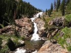
The impressive waterfall on Minaret Creek from the trail.
|
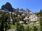
The Minarets from the Minaret Creek trail.
|
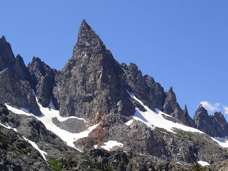
Zoomed in shot of Clyde Minaret. Our route climbed the right-hand skyline.
|
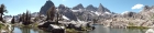
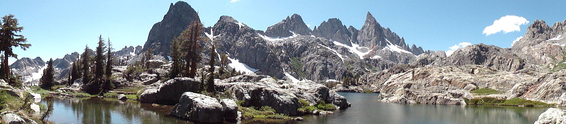
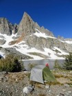
Panoramic view of The Minarets from very scenic Minaret Lake.
|
Sean making his way along the trail around Minaret Lake.
|
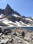
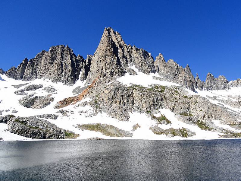
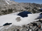
Nearing Cecile Lake, with Clyde Minaret towering in the background.
|

View of Mount Ritter and Banner Peak from our campsite at Cecile Lake.
|
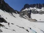
Sean crossing the snowfield at the base of Clyde Minaret.
|
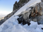
A look at the bergschrund near the base of the Rock Route on Clyde Minaret.
|
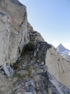
The ledge that leads to the base of the Rock Route.
|

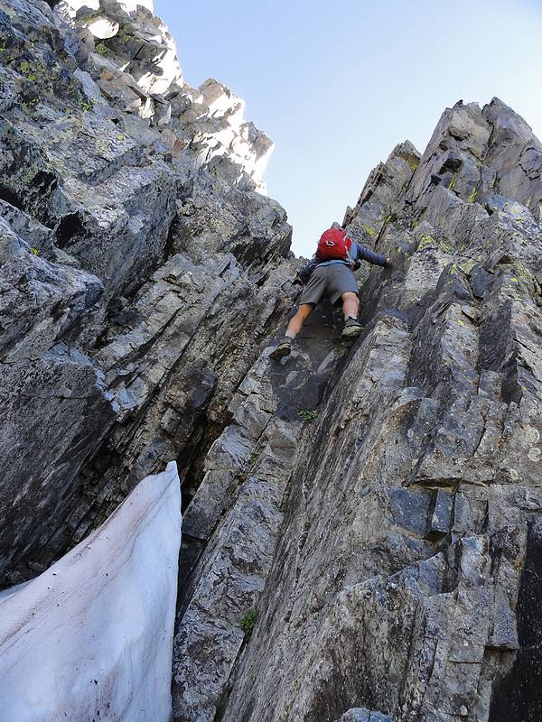
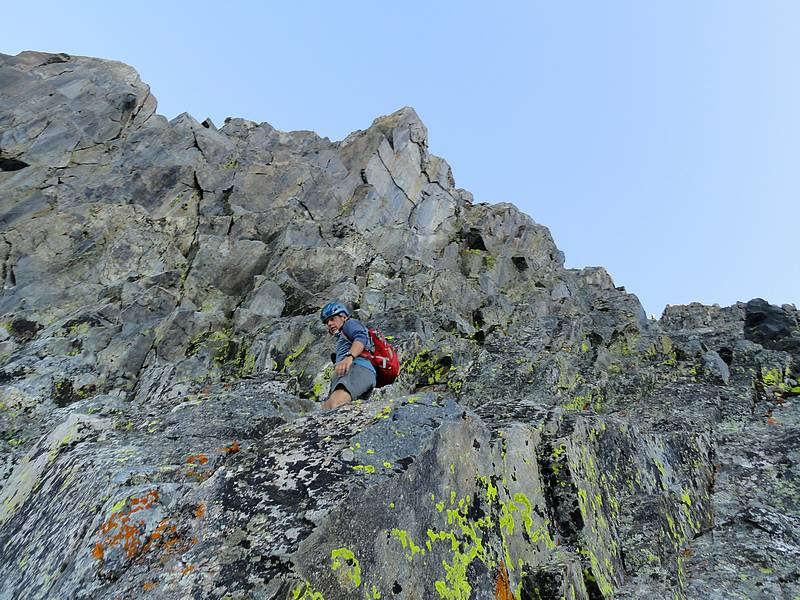
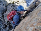
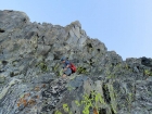
Sean in a steep section of a lower gully on the Rock Route.
|
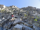
Making our way up steep but stable rock.
|
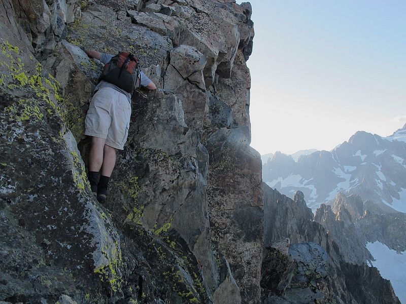
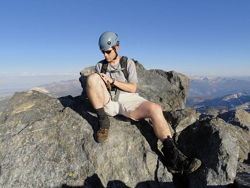
Dave pausing for a breather on the way up the Rock Route on Clyde Minaret. (SeanD photo.)
|
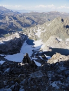
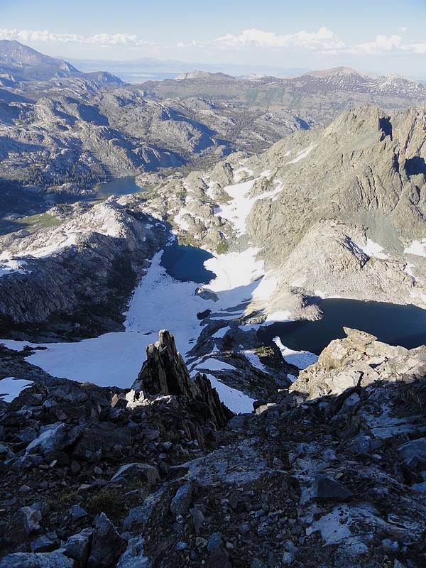
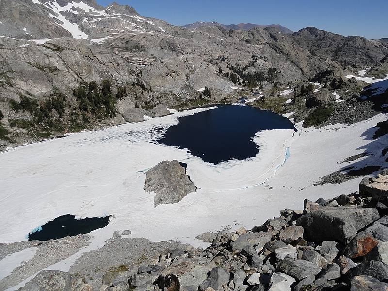
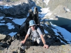
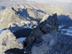
Looking down on the gendarme along with Iceberg Lake and Cecile Lake.
|

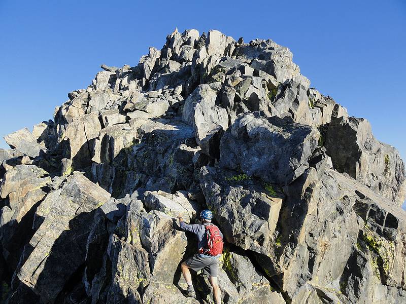
The final climb up the summit block.
|
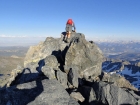
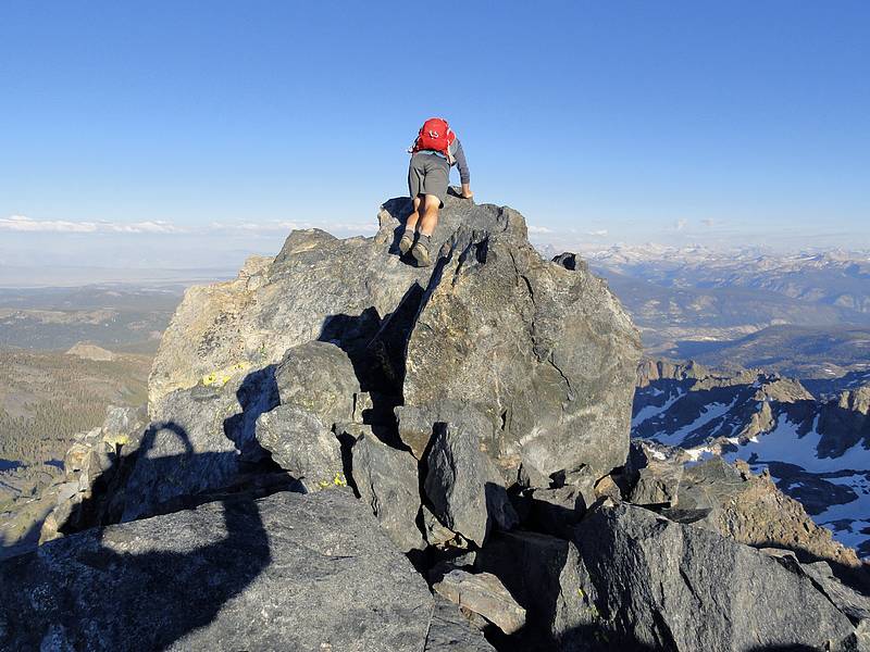
Sean peering off the summit of Clyde Minaret.
|
View of Cecile Lake from the summit of Clyde Minaret.
|

Dave signing the summit register on Clyde Minaret (SeanD photo.)
|
Sean re-climbing the class 4 section on the way back. Steep drop to his right.
|
Dave downclimbing a steep section just below the summit ridge. (SeanD photo.)
|
Downclimbing some steep stuff after leaving the summit ridge.
|
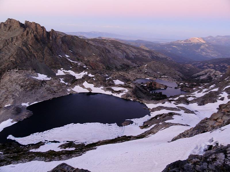
Dusk view of Cecile Lake and Minaret Lake from just above the snowfield.
|

Morning view of Clyde from our campsite at Cecile Lake. |

Looking across Cecile Lake at Clyde Minaret.
|
Making our way down to Iceberg Lake.
|
Sean crossing a large snowfield above Iceberg Lake.
|
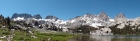
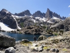
Panoramic view of The Minarets, Mount Ritter, and Banner Peak from Ediza Lake.
|
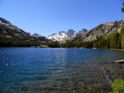
Mount Ritter and Banner Peak from Shadow Lake.
|
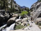
Cool waterfall next to the trail below Shadow Lake.
|
|