|
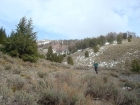
Located in the southwest section of central Idaho’s White Cloud Mountains, the three 10,000-foot Pole Creek Peaks form a north to south trending ridgeline that separates the Pole Creek drainage from the small Twin Creek drainage. The southernmost peak of the three, sometimes referred to as Mount Kelmer, is visible from the highway. But the other two are hidden behind the Horton Peak ridge.
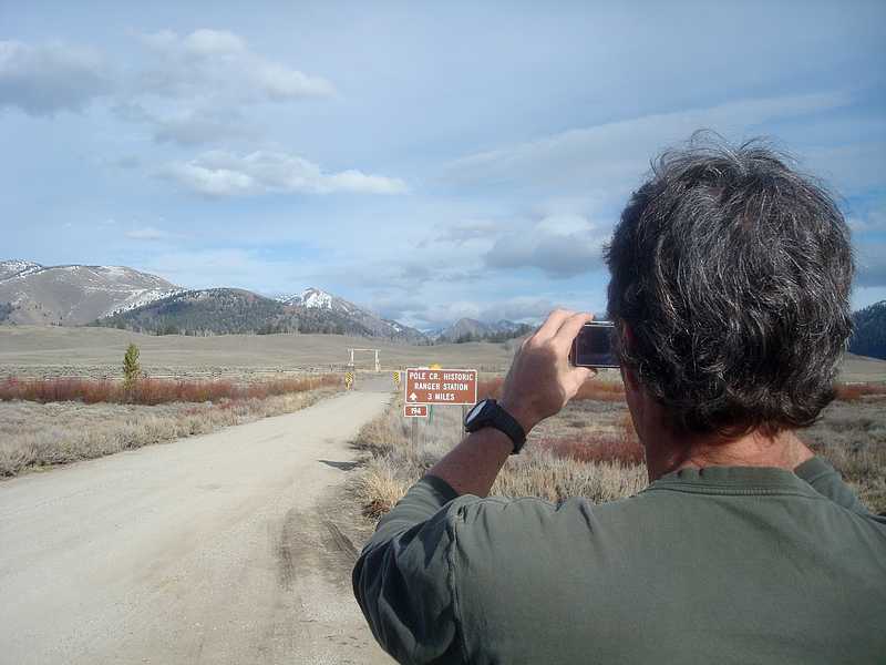
After swapping trip ideas with Splattski, Alex, and Steve, plans were set. We hit the road at 4am, and met Mariel at 7:15 where Pole Creek Road meets the highway. Thirty minutes later, we were on our way up Twin Creek. It wasn’t long before we hit the snow, but it was easy to make out the trail thanks to some recent hunter horse traffic. The trail was in good shape, and hiking along the creek was nice. After a couple miles, it was time to strap on the snowshoes, and we made our way towards the cirque in the north end of the drainage. The snow coverage and quality was good, so we elected to angle to the right instead of following the trail to the left. This allowed us to say on our snowshoes most of they way up to the ridgeline at around 9500’. From here we had a view into the heart of the range, and could also see a couple of our objectives for the day. We headed north from here, with a few easy rock sections to cover, then made the straightforward march to our first summit, Pole Creek Peak #1, at 10181’.
The weather conditions were great, especially for November. We lounged around on the summit for a while, dug up the Baugher register, snapped some photos, and enjoyed some apples that Alex had hauled in for us. It was good to have the first peak out of the way, but we could see the other two peaks to the south. It was clear that we still had some ground to cover. So back down the ridge we went to the 9500’ saddle. The ridge in front of us was a mixture of snow and rock. We elected not to put our snowshoes on, which worked out well for the most part, but there were a couple tricky spots where we slid around on the snow-covered rock a little to keep things interesting. Soon enough we made it to Pole Creek Peak #2, elevation 10041’.
We took a quick lunch break there on the second peak. The views from the summit were great, and we admired the scenery as well as a neat looking chute on the north face that might make for a good late spring snow climb. From here we could see the third peak of the day, due south. Most of the ridge looked pretty straightforward, but there was a steep section just below the summit that was guarded by the beginnings of a cornice. The consensus was that foreshadowing was probably making it look steeper that it really was. So down the ridge we went. Some sections were more conducive to snowshoes that others, so we got to practice our quick-change-over techniques. John and Mariel had a head start on us, so we were able to watch them climb the crux from a couple hundred feet below. It was a little steep, but no issues. We were now on our final highpoint of the day Pole Creek Peak #3, elevation 10166’. There was a flag on the summit, dubbing the peak “Mount Kelmer”, which was a combination of last-names for a couple guys that had climbed the peak a few times.
Our original plan had been to continue down the ridge back to the car, but the gentle snow filled-gully to the southwest was too much to resist. The snow was perfect for plunge stepping. We made good time on the descent, especially up high. It wasn’t long before we were back to the trail, which made for easy hiking back to the trailhead. It had been a great day in the mountains. Three ten-thousand foot peaks, awesome November scenery, and some new friends. Hard to beat.
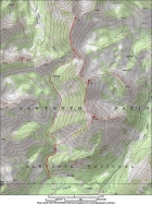
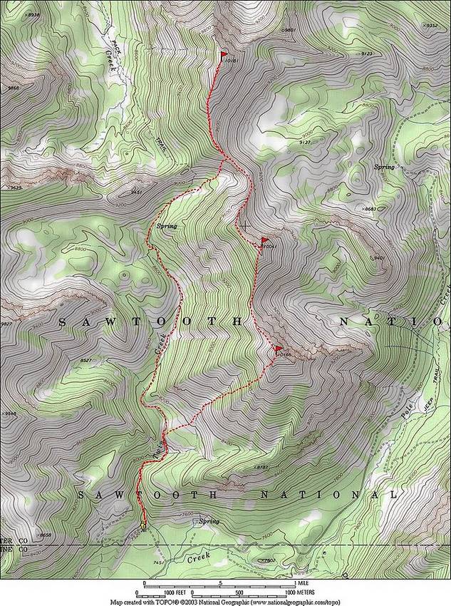
Map of the route, about 9 miles round trip with 3800' of elevation gain.
|

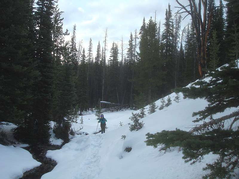
Alex on the way up Twin Creek.
|
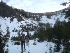
Snowshoeing in the cirque.
|
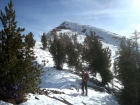
Alex beginning the climb, Horton Peak in the background.
|

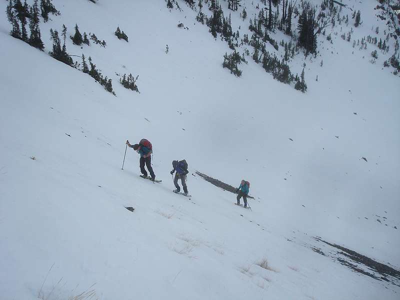
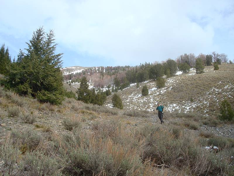
Working our way up the slopes.
|
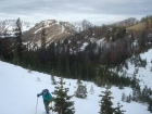
Looking up at our first objective to the north.
|
Climbing the ridge towards Pole Creek Peak #1.
|
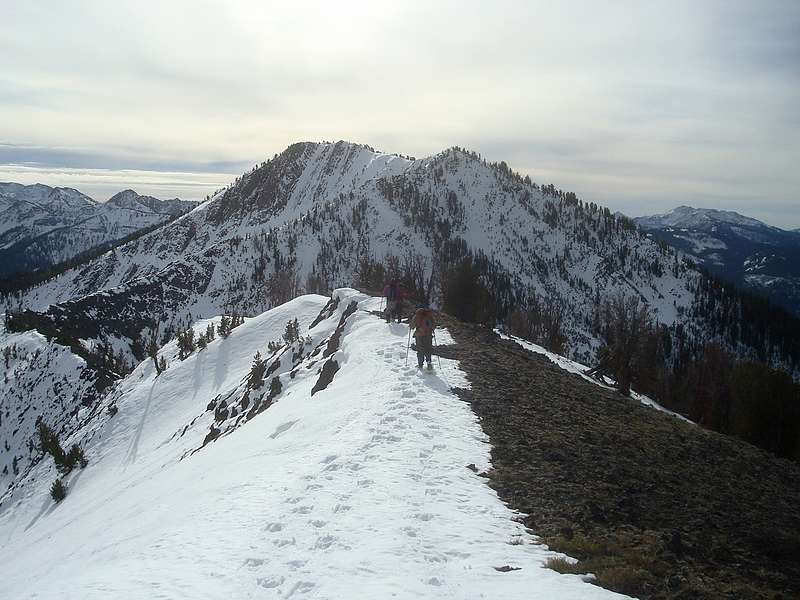
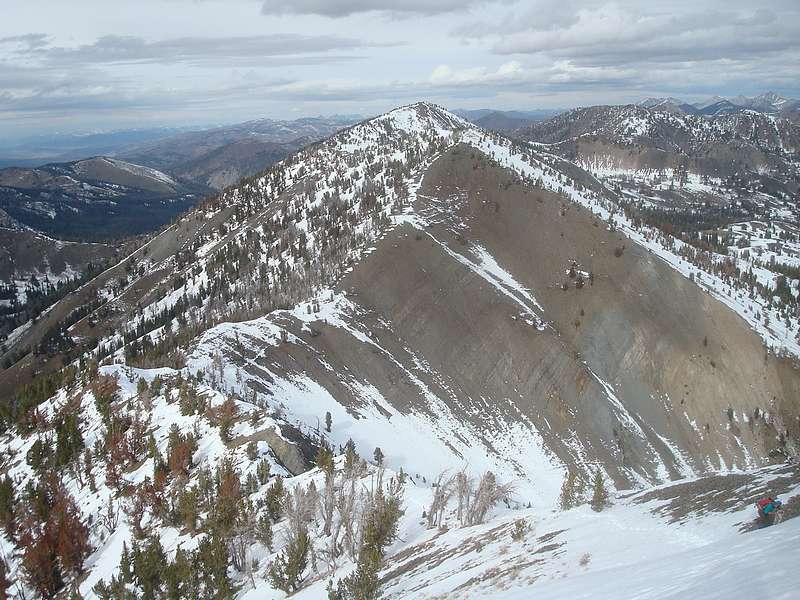
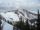
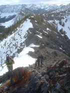
The view south down the ridge, our next two peaks visible.
|
Snowshoeing along the ridge.
|
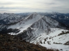
Pole Creek Peak #1 from the south.
|
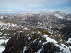
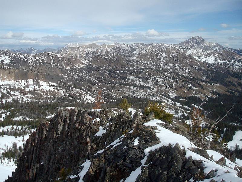
A view into the heart of the White Clouds from Pole Creek Peak #2. Castle Peak on the right.
|

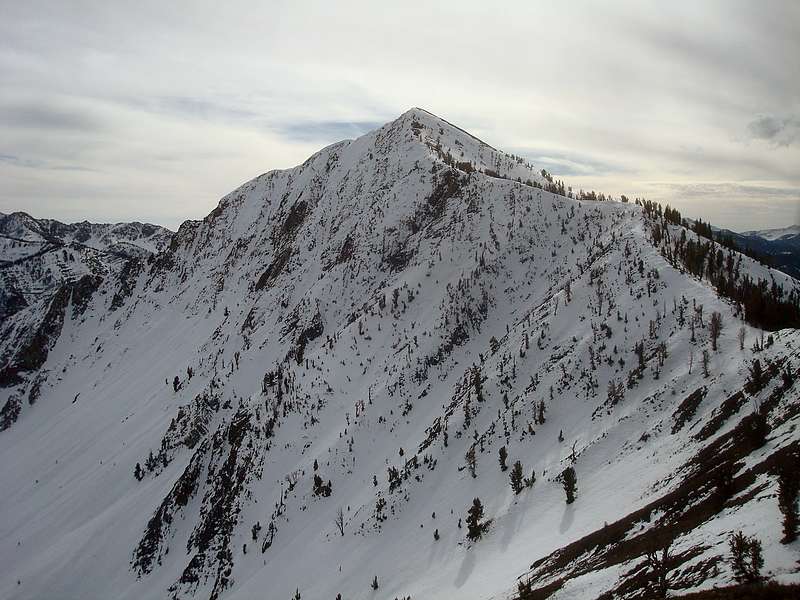
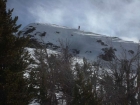
The northeast face of Pole Creek Peak #3.
|

Making our way up the ridge to Pole Creek Peak #3.
|
Steve taking a break. John and Mariel are nearing the crux on Pole Creek Peak #3.
|
Close up of Mariel on the ridge.
|
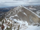
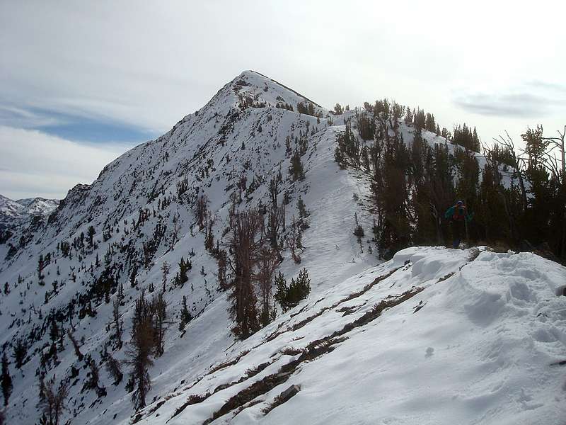
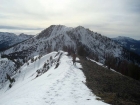
Looking back on Pole Creek Peak #2 from Pole Creek Peak #3.
|

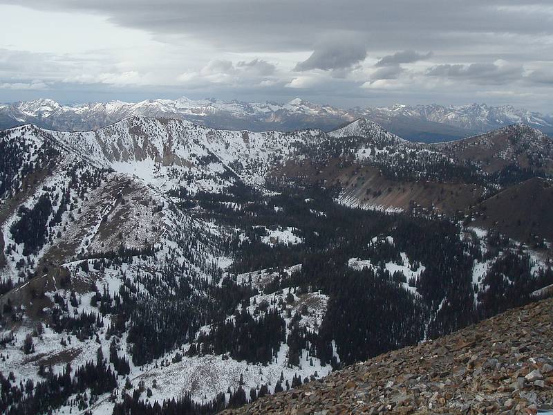
Summit view of the Sawtooths from Pole Creek Peak #3.
|
Steve leaving the gully, almost back to the trail.
|
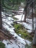
A neat mossy section of Twin Creek.
|

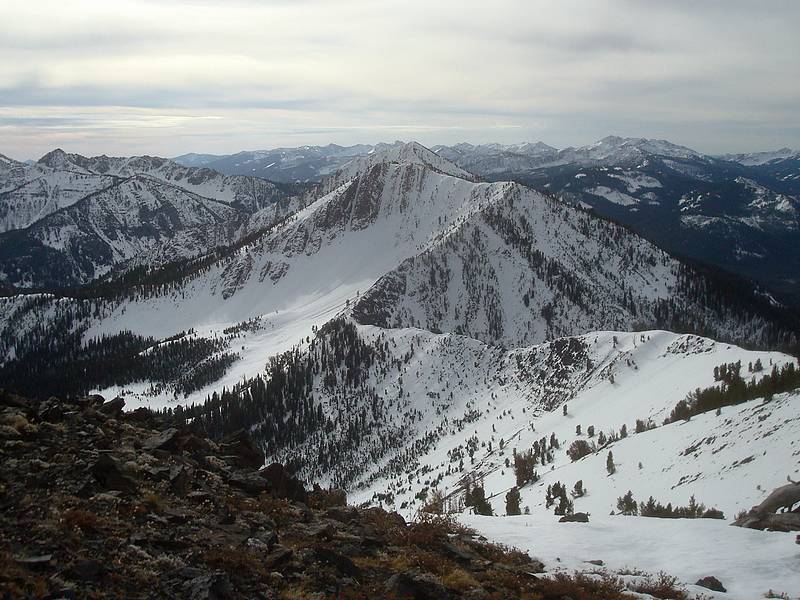
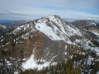
John taking advantage of a photo op. Pole Creek Peak #3 is the snowy one.
|
|