|
Kent Peak is located in the Boulder Mountains, not far north of Ketchum. The Boulders are known for big rugged peaks, and notoriously loose and lousy rock. Kent Peak is the second tallest mountain in the range, and typifies both of those characteristics. I was able to sneak out of work on a Friday, and join Michael and Splattski for a climb up the south ridge from the West Pass trailhead.
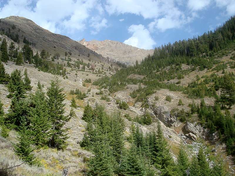
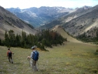
After a 3-hour drive from Boise, we hit the trail at a little before 8:30. It was a beautiful fall morning, and the weather was looking great. The trail initially “undulates” (which means we’d have some uphill on the way back) for a while along the hillside, and then settles in for some easy hiking next to the North Fork Big Wood River. We gained very little elevation for the first couple miles, but that changed quickly as we reached the trail junction where we headed northeast towards West Pass. The trail was well maintained, but plenty steep as we forged our way toward the upper valley. Once at about 9300’, we left the trail and began angling across the very scenic upper valley. We aimed for the saddle north of “The Cone”, and then paused there for a break to take in the scenery, which was excellent.
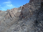
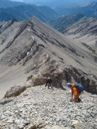
Next on the agenda was the most challenging part of the climb, which was getting up the loose scree and shale that guarded the southwest ridge of the peak. This section was not enjoyable, but we did our best to connect the dots offered up by occasional stable rock along the way. At one point, John and I made the mistake of thinking we could angle across the scree to gradually reach the ridgeline. But that didn’t work out, and eventually we had to climb upwards to rejoin Michael up on the ridge. There were a couple times in this section where I’d take a step and 10 square foot section of loose rock would slide a couple feet, with me in right in the middle of it. You gotta love it.
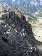
Fortunately, the rock was much more stable (but still not trustworthy) up on the ridgeline. The last portion of the climb from the flat section of the ridge to the summit was actually very enjoyable. We stuck to the crest of the ridge most of the way up, with only a couple excursions over to the west side of the ridge. The climbing was fun, and the occasional bits of exposure on the east side of the ridge were enough to keep us on our toes.
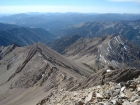
Once on the summit we snapped some photos, ate some lunch, and took in the views. We even got to check out some mountain goats wandering around on nearby Ryan Peak. Michael kept himself occupied by digging around in a recently formed snowdrift trying to find a summit register. Kent Peak is a great central location for checking out many surrounding ranges including the White Clouds, Salmon River Range, Lost Rivers, Pioneers, and Smokies. With views like this, I was in no hurry to head down. But the clock was ticking, so we reluctantly packed up for the descent.
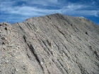
We took our time on the down-climb to keep from kicking loose rocks into each other. Sticking to the top of the ridge kept us away from a couple of the grungy gully’s we’d encountered on the way up. We also ended up going all the way to the end of the ridge before dropping to the saddle. This kept us out of quite a bit of the loose rock, but we still managed to fill our boots with scree on the way down. We then set a brisk pace the rest of the way down. It was definitely nice to have a trail to follow, even if the steepness did quite a number on my knees. After all the downhill, the undulating section almost felt good (not really) as we neared the trailhead. Our round trip time ended up being about 8 hours to cover the 11 miles round trip and 5k+ of elevation gain. It had been a great day. The weather was great, the company was great, and the climb gave us some excellent scenery and fun scrambling.
The climb down was uneventful. We went straight down the south ridge, enjoying the views and the weather along the way. The last mile along the flats seemed to take quite a while, but it was still only about 4pm when we made it back to the car. A day in the mountains like this one is hard to beat.
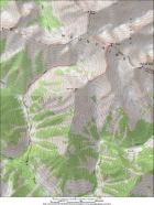
Map of our route, a round trip of 11 miles and 5200' gain.
|
Making our way up the valley.
|
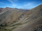
North face of The Cone from the head of the valley.
|
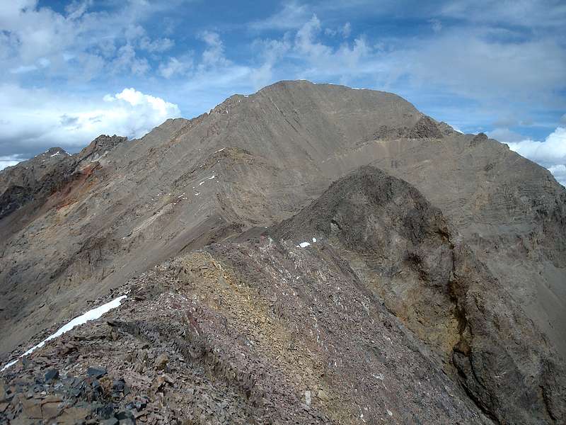
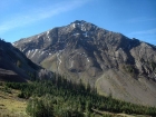
Kent Peak from the saddle.
|
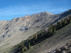
Looking down on West Pass, with Castle Peak in the distance. Glassford Peak is on the left.
|
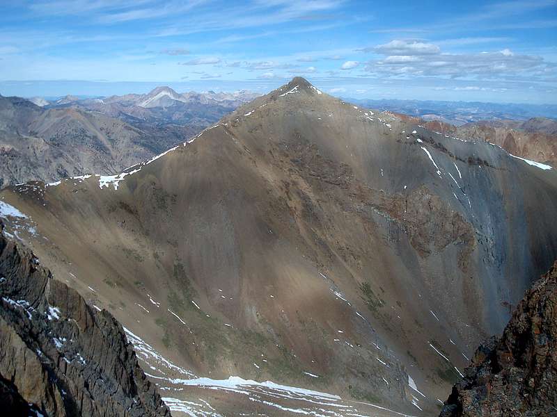
The west face of Perkins Peak, from Kent Peak's south ridge.
|

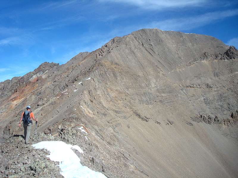
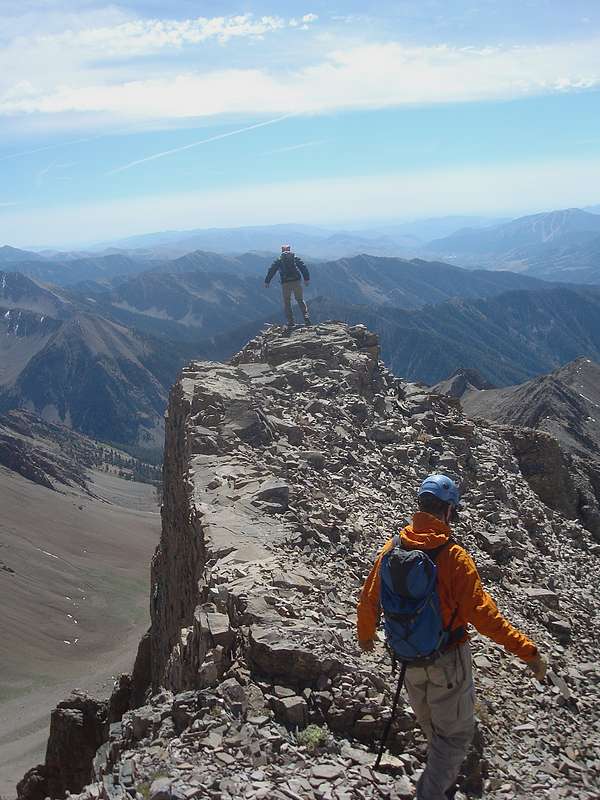
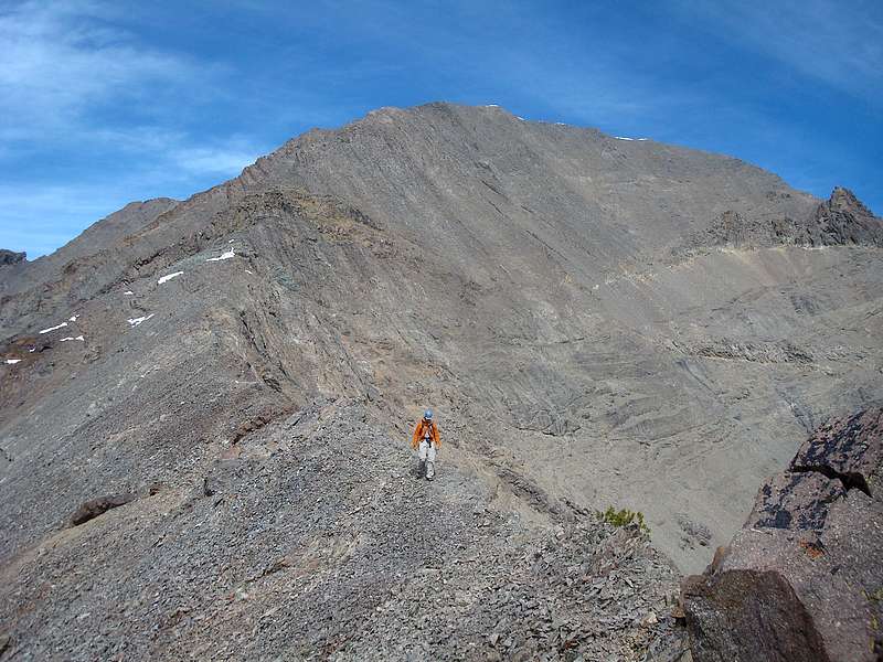
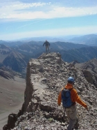
John on the flattish section of the south ridge.
|
This is John angling across the rubble.
|
Michael in a crumbly gully.
|
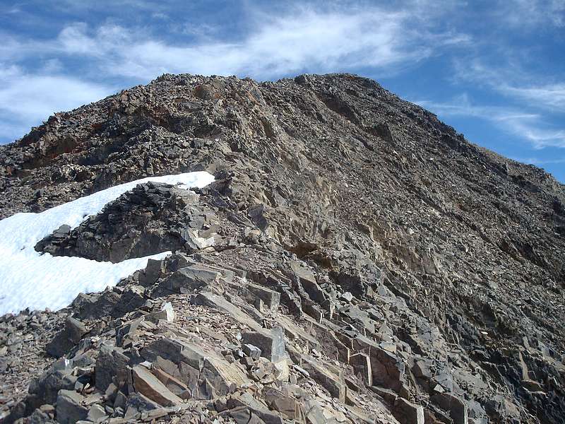
The upper portion of the south ridge.
|
Nearing the summit of Kent Peak.
|
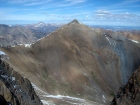
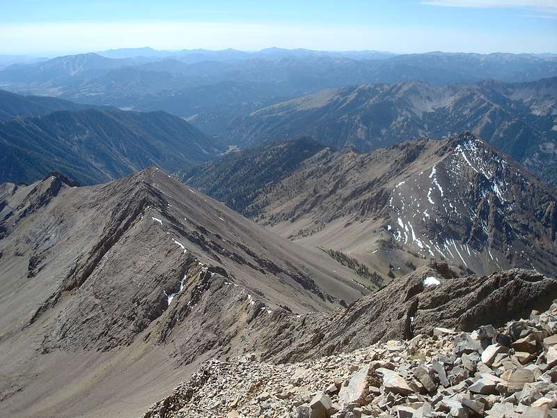
Looking northwest at Ryan Peak, with the White Clouds in the background.
|
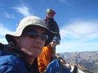
Splattski shot on the summit. No shortage of fashionable headgear.
|
The view back down the south ridge, with The Cone on the right.
|
Careful with that next step John.
|
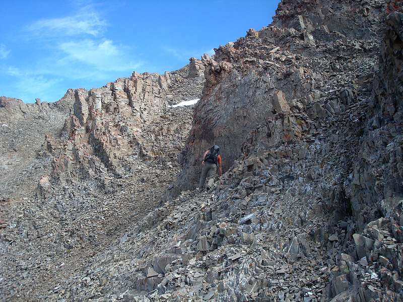
Down-climbing a loose section on the south ridge.
|
Michael descending.
|

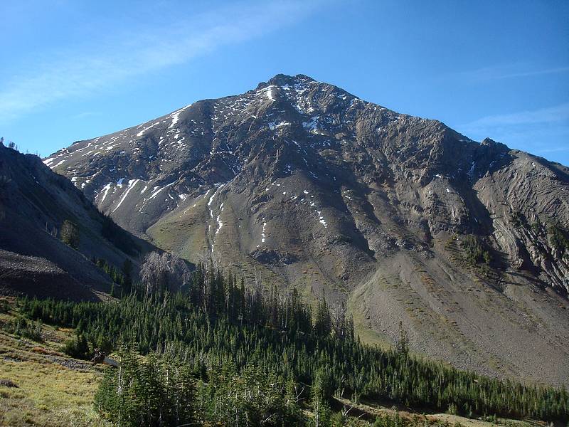
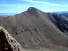
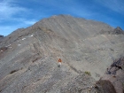
Kent Peak from the south ridge.
|
Wandering back to the trail.
|

One last view of Kent Peak.
|
|