|
The White Clouds offer some great multi-day backpacking options. One of the most popular areas in the range is the Boulder Chain of Lakes, which is a string of 12 alpine and sub-alpine lakes surrounded by fantastic views. We’d been in to check out the lakes a few years ago, but this time we would come in the more commonly used route from the Little Boulder Creek trailhead. Our four-day plan was to hike in the Hatchet Lake on day 1, then up the Boulder Chain on day 2. Day 3 would take us down Slickenside Creek to Baker Lake, then up to Castle Lake. For the fourth and final day we’d descend back to the trailhead. I naturally had aspirations of climbing a few peaks along the way.
 Day 1 Day 1
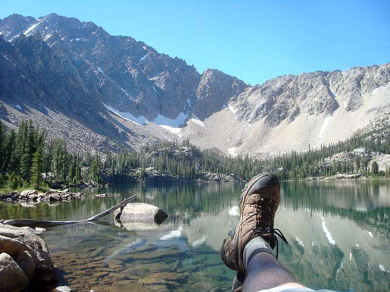
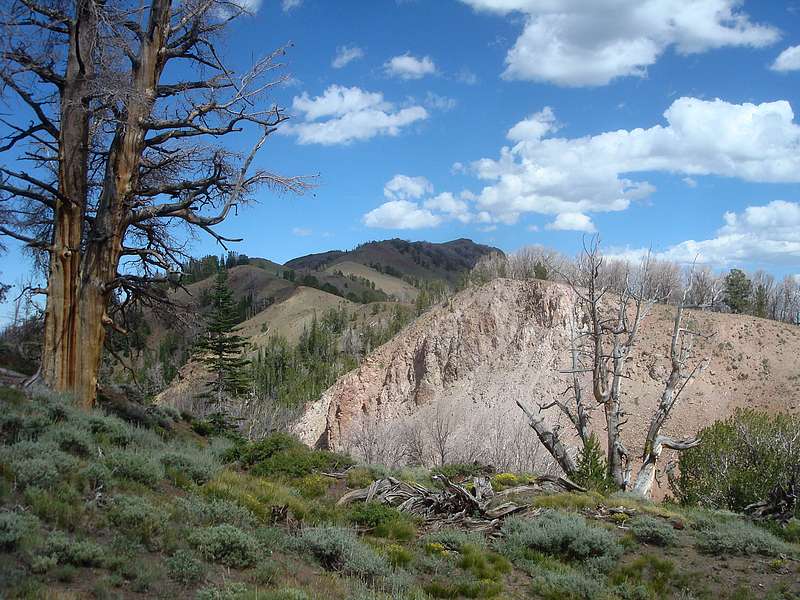
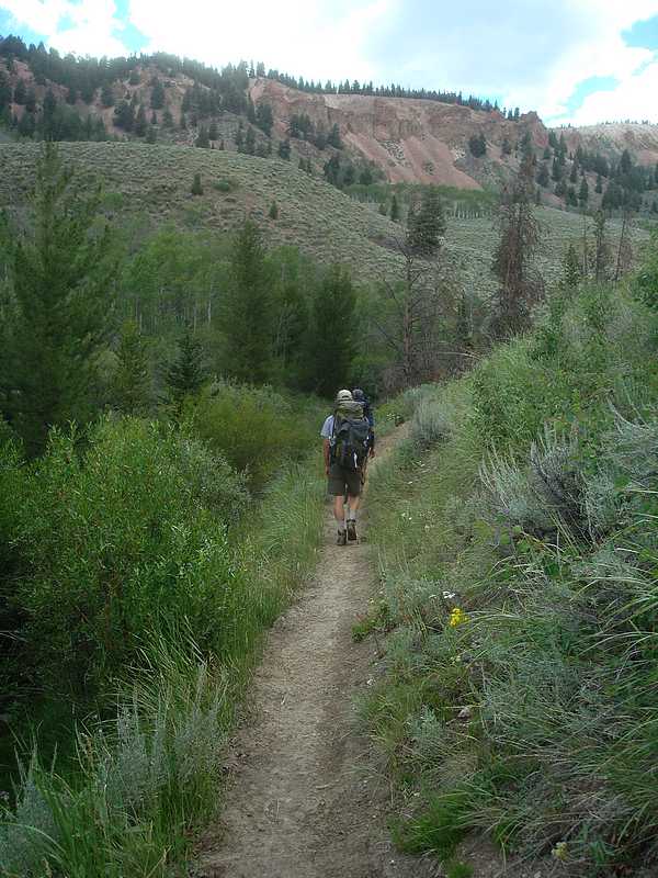
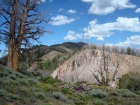
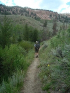
Little Boulder Creek to Hatchet Lake - JJ, Jordan, and I started hiking at around 10am, after the four-hour drive from Boise to the Little Boulder Creek trailhead, on the east fork of the Salmon River. Starting at 6200’ elevation, our day would consist of almost 2700 feet of elevation gain spread over 9 miles. The mixed-use trail (open to motorcycles) starts uphill in a hurry. There’s not much shade, so an early start is wise. The trail passes through several vegetative zones, starting with sagebrush covered slopes for the first couple miles. Not my favorite, but pretty in its own way as JJ is quick to remind me. That being said, it certainly doesn’t typify the alpine scenery we experienced during most of the trip. After a good workout the first few miles, the grade becomes more gradual and the trail undulates (guide book vernacular) along the hillside next to the creek. We stopped for a lunch break and then forged onward, anxious to get some of the famous east-side views of Castle and Merriam Peaks. Those views came soon enough, with the peaks coming into sight at round the 6-mile mark. We paused to take in the scenery for a while, and then continued on up to the trail junction where our route branched off and headed toward the Boulder Chain. There were a few motorcycles parked just above the junction. Their riders must have hiked up to the lakes from here, apparently stopped by a deepish creek crossing. On we went, winding through the lodgepole forest, past Willow Lake and then to Hatchet Lake. There were already several groups there by the time we arrived at 4pm, but we were able to find a spot on the northeast side of the lake.
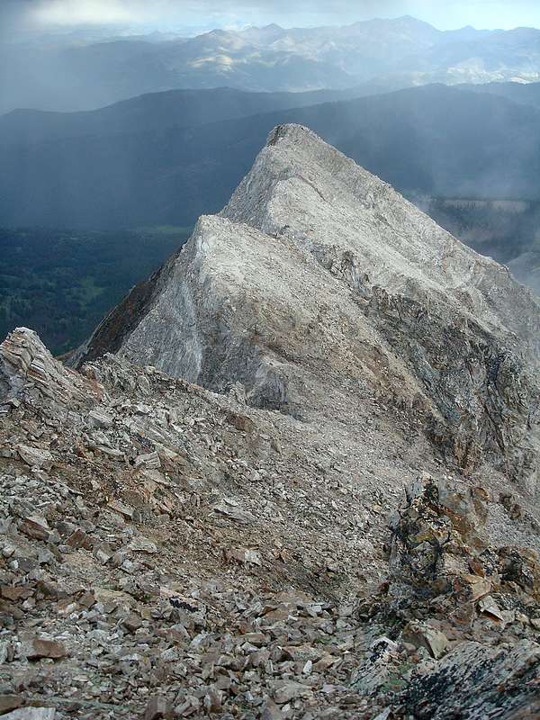
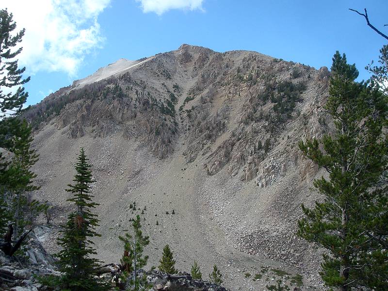
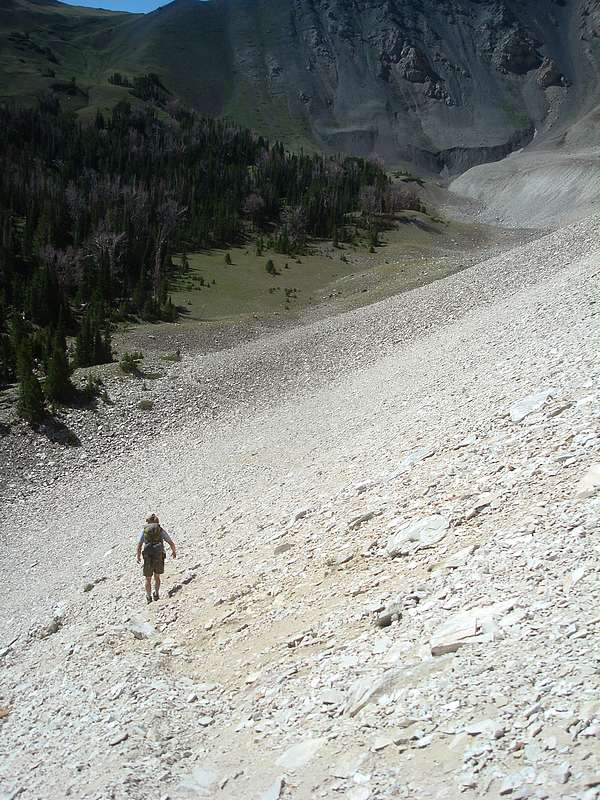
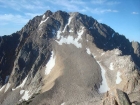
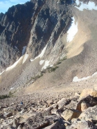
 Cardiac Peak (Peak 11202’) - After setting up camp, I left the others in hopes of climbing “Cardiac Peak”, the 7th highest peak in the range. After a quick jaunt up the trail to Shelf Lake, I headed up the toe of the ridge leading to point 9530’. The peak looked very steep from this angle, but doable. I wasn’t exactly setting a blistering pace, which was a concern since it was late afternoon and the summit was 2.5 miles and 2300’ elevation gain from Hatchet Lake. Then the rain clouds rolled in and slowed me even more. After about 30 minutes spent hunkered down amongst the trees, I finally decided there would be no thunder and lightning with this storm. So I donned my 79-cent emergency parka, and continued onward and upward through the drizzle. I was relieved when I finally reached the ridgeline, since that’s where the climbing got much less steep. The drop off to the north was huge, but fortunately there was a solid route most of the way that was just on the south side of the east ridge. The crux of the climb was about 100 feet below the summit, and a nasty loose class 4 section that I eventually got past after trying a few different options. Cardiac Peak (Peak 11202’) - After setting up camp, I left the others in hopes of climbing “Cardiac Peak”, the 7th highest peak in the range. After a quick jaunt up the trail to Shelf Lake, I headed up the toe of the ridge leading to point 9530’. The peak looked very steep from this angle, but doable. I wasn’t exactly setting a blistering pace, which was a concern since it was late afternoon and the summit was 2.5 miles and 2300’ elevation gain from Hatchet Lake. Then the rain clouds rolled in and slowed me even more. After about 30 minutes spent hunkered down amongst the trees, I finally decided there would be no thunder and lightning with this storm. So I donned my 79-cent emergency parka, and continued onward and upward through the drizzle. I was relieved when I finally reached the ridgeline, since that’s where the climbing got much less steep. The drop off to the north was huge, but fortunately there was a solid route most of the way that was just on the south side of the east ridge. The crux of the climb was about 100 feet below the summit, and a nasty loose class 4 section that I eventually got past after trying a few different options.
The rain let up just before I reached the summit, and I got to enjoy the views from this seldom climbed peak for a while before heading down. On the way back, I elected to avoid the crux and ended up descending a steep scree gully down the south face. It was time consuming to carefully make my way about 1500 feet down the loose gully, but it allowed me to bypass the crumbling and exposed rock on the crux of the ridge. Once off the steep portion of the face, I wandered through the trees and picked up the trail on the north side of Lodgepole Lake. I then hustled back down the trail, arriving at camp after 9pm. Just in time for some pepperoni quesadillas!
Day 2
 Hatchet Peak (Peak 10298’) - After 5000’ of elevation gain the prior day, it took some effort to get up and going in the morning. But I managed to roll out of the rack while the others were sleeping, and start making my way up “Hatchet Peak”. The peak has some dramatic cliffs that stand above its namesake lake, but the summit isn’t actually visible from below. I make my way around the east side of the lake, and then up onto the gradual east ridge. At the point where the ridge butts into the east face, the boulder hopping begins. I set a slow and steady pace up through the rocks, which were very stable for the most part. It was a beautiful morning, and I made it to the summit in about an hour and a half, after covering the 1.1 miles and 1400’ gain. This peak is centrally located with great views, so not a bad option for those looking for a side trip from the lower Boulder Chain Lakes. I didn’t linger long on the summit since I didn’t want to keep the others waiting too long, and made a quick descent back to the lake. Hatchet Peak (Peak 10298’) - After 5000’ of elevation gain the prior day, it took some effort to get up and going in the morning. But I managed to roll out of the rack while the others were sleeping, and start making my way up “Hatchet Peak”. The peak has some dramatic cliffs that stand above its namesake lake, but the summit isn’t actually visible from below. I make my way around the east side of the lake, and then up onto the gradual east ridge. At the point where the ridge butts into the east face, the boulder hopping begins. I set a slow and steady pace up through the rocks, which were very stable for the most part. It was a beautiful morning, and I made it to the summit in about an hour and a half, after covering the 1.1 miles and 1400’ gain. This peak is centrally located with great views, so not a bad option for those looking for a side trip from the lower Boulder Chain Lakes. I didn’t linger long on the summit since I didn’t want to keep the others waiting too long, and made a quick descent back to the lake.
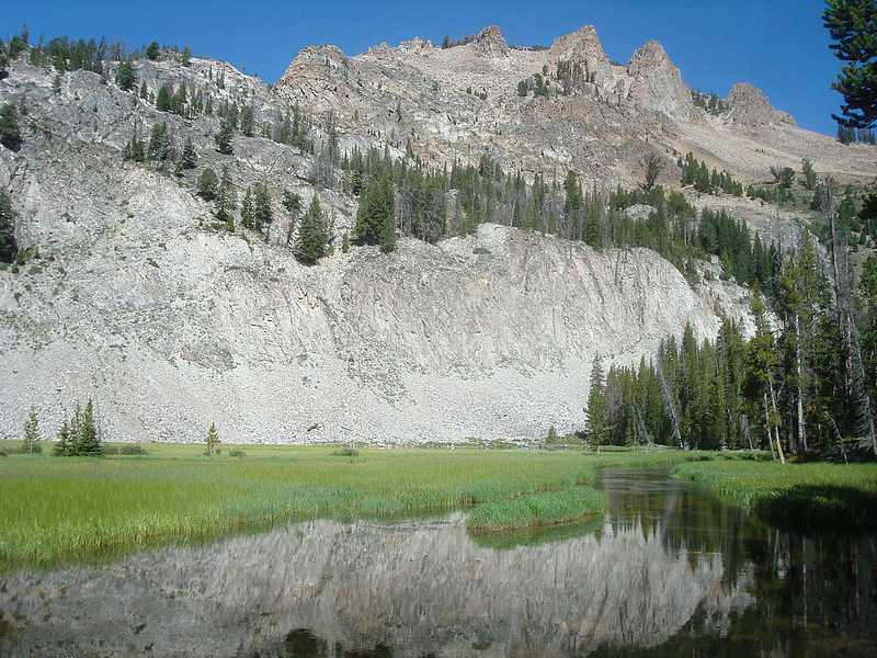
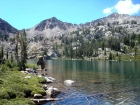
 Boulder Chain of Lakes - There were at least 20 other people camped at Hatchet Lake, so we were anxious to get on up the trail and away from the crowds. The lower lakes are the most heavily camped, and we hoped to find a bit more solitude at the upper lakes. So we made our way up the trail, passing various folks along the way. We stopped and had lunch at the very scenic Hourglass Lake, then continued on up to the equally scenic Hummock Lake for some fishing. We then hiked up to Scoop Lake for more fishing. Our next goal for the day was Lonesome Lake. We hadn’t invested the energy in visiting this lake during our last visit, so it was a key objective for this trip. After leaving our packs near Scoop Lake, we passed Headwall Lake and then made the scramble up through the rocks towards Lonesome. The effort was worth it, and the barren high-elevation lake made for a rugged setting. We ended up spending quite a bit of time at the lake, doing some fishing and watching the mountain goats explore the slopes above the lake. Boulder Chain of Lakes - There were at least 20 other people camped at Hatchet Lake, so we were anxious to get on up the trail and away from the crowds. The lower lakes are the most heavily camped, and we hoped to find a bit more solitude at the upper lakes. So we made our way up the trail, passing various folks along the way. We stopped and had lunch at the very scenic Hourglass Lake, then continued on up to the equally scenic Hummock Lake for some fishing. We then hiked up to Scoop Lake for more fishing. Our next goal for the day was Lonesome Lake. We hadn’t invested the energy in visiting this lake during our last visit, so it was a key objective for this trip. After leaving our packs near Scoop Lake, we passed Headwall Lake and then made the scramble up through the rocks towards Lonesome. The effort was worth it, and the barren high-elevation lake made for a rugged setting. We ended up spending quite a bit of time at the lake, doing some fishing and watching the mountain goats explore the slopes above the lake.
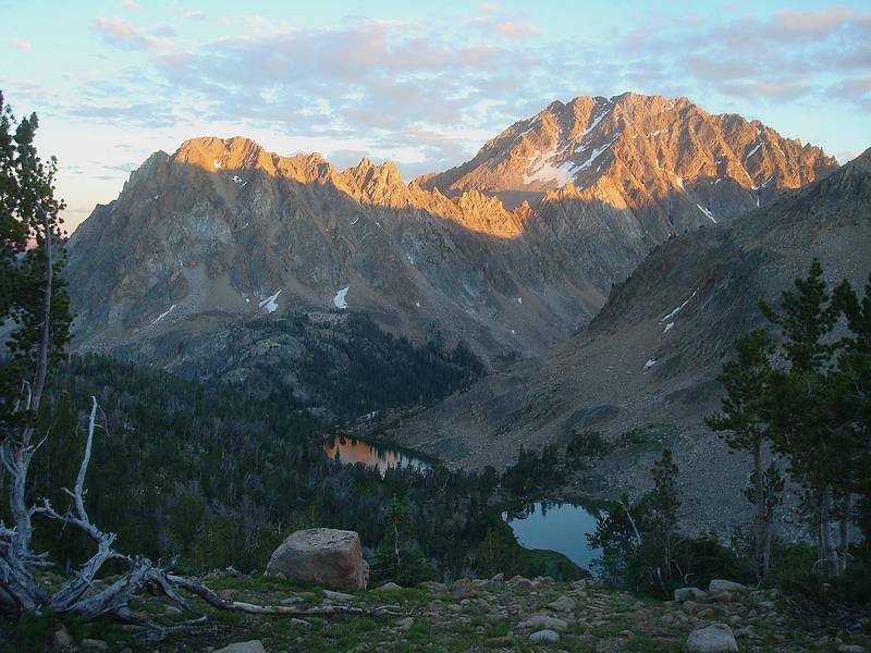
 It was almost 8pm by the time we made it back down to Scoop Lake. None of us like the idea of having to do the steep climb up to Windy Devil pass first thing the next morning, so we decided to tackle it in the evening instead. The switchbacking climb looked pretty daunting from below, but it only ended up taking us 20 minutes to reach the pass. The next thing was to decide where to camp. Dropping to Shallow or Scree Lakes was one thought. But that option was replaced by plans to camp at the 10k’ tarn just beyond Windy Devil. As we approached the tarn, we were amazed by the sunset reflection of Castle Peak and Serrate Ridge in the still glassy waters of the tarn. One of the most beautiful sights I’ve ever experienced. After snapping a ton of photos, we set up camp over in the trees south of the tarn, and had a late dinner. It was almost 8pm by the time we made it back down to Scoop Lake. None of us like the idea of having to do the steep climb up to Windy Devil pass first thing the next morning, so we decided to tackle it in the evening instead. The switchbacking climb looked pretty daunting from below, but it only ended up taking us 20 minutes to reach the pass. The next thing was to decide where to camp. Dropping to Shallow or Scree Lakes was one thought. But that option was replaced by plans to camp at the 10k’ tarn just beyond Windy Devil. As we approached the tarn, we were amazed by the sunset reflection of Castle Peak and Serrate Ridge in the still glassy waters of the tarn. One of the most beautiful sights I’ve ever experienced. After snapping a ton of photos, we set up camp over in the trees south of the tarn, and had a late dinner.
 Day 3 Day 3
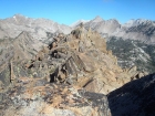
Quiet, Noisy, Baker, and Castle Lakes - The next morning, we broke camp and made the descent to Shallow and Scree Lakes for some fishing. Next up was the scramble down the cliffy outlet of Scree Lake, and a quick side trip to Quiet Lake. This is one of my favorite spots in the White Clouds. We stayed for a little while, but there was still quite a bit of ground to cover so we hiked down to Noisy Lake for our lunch break and some more fishing. The unmaintained trail was quite a bit more “broken in” that I remembered from our last visit, but still plenty steep in places. I wouldn’t want to hike up this section of trail. As we neared Baker Lake, we decided to go cross-country to the south to try and pick up the trail. This ended up being some steep bushwhacking until we eventually met up with an old mining road. (We’d later find that the road starts at Baker Lake and leads you right to the Castle Lake trail, but that’s another story.) The mining road was steep, and we (mainly I) kept looking for the right time to head east to pick up the trail. We did eventually leave the overgrown road at a point where it seemed to head downhill not far from Pt 9204’. We picked up the trail shortly afterwards. This ended up being very near the Wickiup Creek junction, where the others continued on to Castle Lake while I took a side trip to climb “Mount Ernie Day”.
 Mount Ernie Day (Peak 9942’) - With a potential long-term goal of climbing all of the peaks in the White Clouds, I decided to climb Peak 9942’ since it was fairly close. From the Wickiup trail junction, it was about 1.7 miles and 600’ gain to the summit. So I dropped my big pack, and then headed down the trail. Once at the saddle, I left the trail to head up the west ridge of the peak. It was an enjoyable ridgewalk, with a game trail much of the way and great views of Castle Peak and Merriam Peak to the west. After some steep climbing earlier in the trip, this was a nice change of pace. Then as I neared the summit, I crested a knoll and spotted another hiker. I think we were both surprised to see someone else on this obscure peak. As it turns out, the other hiker was Rick Baugher. We chatted for a while, and one of the things Rick mentioned was a suggestion to name the peak Mount Ernie Day, in honor of the well known Idaho conservationist who had recently passed away. Ernie’s iconic aerial photograph of Castle Peak had been instrumental in swaying public opinion and stopping a massive molybdenum mine at the base of Castle Peak, and eventually leading to the creation of the Sawtooth National Recreation Area. Needless to say, this is a fitting peak to bear Ernie’s name, since his photo was taken from a similar angle as the summit view from this peak. Mount Ernie Day (Peak 9942’) - With a potential long-term goal of climbing all of the peaks in the White Clouds, I decided to climb Peak 9942’ since it was fairly close. From the Wickiup trail junction, it was about 1.7 miles and 600’ gain to the summit. So I dropped my big pack, and then headed down the trail. Once at the saddle, I left the trail to head up the west ridge of the peak. It was an enjoyable ridgewalk, with a game trail much of the way and great views of Castle Peak and Merriam Peak to the west. After some steep climbing earlier in the trip, this was a nice change of pace. Then as I neared the summit, I crested a knoll and spotted another hiker. I think we were both surprised to see someone else on this obscure peak. As it turns out, the other hiker was Rick Baugher. We chatted for a while, and one of the things Rick mentioned was a suggestion to name the peak Mount Ernie Day, in honor of the well known Idaho conservationist who had recently passed away. Ernie’s iconic aerial photograph of Castle Peak had been instrumental in swaying public opinion and stopping a massive molybdenum mine at the base of Castle Peak, and eventually leading to the creation of the Sawtooth National Recreation Area. Needless to say, this is a fitting peak to bear Ernie’s name, since his photo was taken from a similar angle as the summit view from this peak.
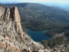
After some more mountain discussions, Rick headed down to his campsite and I continued to the summit. It was becoming late afternoon, so I only stayed long enough to snap a few photos then head back down the ridge to the trail. Once back at the main trail, I continued hiking uphill for a while, looking for a side path leading towards Castle Lake. Turns out that a path doesn’t exist, so I ended up climbing a bit higher than I needed to before leaving the trail and heading west into the cirque below Castle Peak. After a bit of cross-country work, I finally picked up the trail that angles it’s way up to Castle Lake. The lake was very beautiful, and I found the others and our campsite on the northeast side of the lake. It was a fantastic setting, with in your face views of the north side of Castle Peak.
 Day 4 Day 4
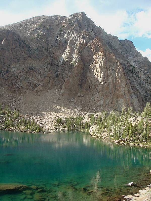
Merriam Peak (10920’) - Merriam Peak anchors the northern end of Serrate Ridge, and was my fourth and final peak goal for the trip. It stands 1 mile and 1500’ above Castle Lake. I was able to pull myself out of the tent at about 6:30am, and was greeted by a fantastic sunrise view of Castle Peak glowing orange in the day’s first light. Awesome. As I made my way around the south side of the lake, the crux appeared to be the cliffs above the lake at around 9800’. As I made my way up the cliffs, it turned out there were a series of strategically placed ledges that made for some fun climbing. After getting above the cliffs, all that was left was a talus and boulder hopping climb to the summit. The climb up the south side face of Merriam Peak provided great views of Castle Peak, and unique views of the backside of Serrate Ridge. Once on the summit, the views were very impressive. Tons of lakes and White Cloud Peak were visible in all directions. Highly recommended. As I made my way down, Rick was on his way up. We chatted again for a while and then parted ways. It was a treat to meet Rick in person.
Hiking down Little Boulder Creek - After returning to camp for some breakfast, it was time to break camp and head out. Jordan and JJ had determined that the upper trail actually connects directly to the mining road, so we had an easy hike down to Baker Lake. From there, we picked up the main trail and made our way down Little Boulder Creek. We stopped for a lunch break next to the trail with great views looking back on Castle and Merriam Peaks, then had to bid them farewell. I had not been looking forward to the hot sagebrush section near the trailhead, but the weather ended up being overcast and cool. This worked out great, and the hike out was pleasant. The trip had been a good mixture of some of our favorite scenery from past trips, and some new spots we’d been hoping to explore. All in all, a great trip!

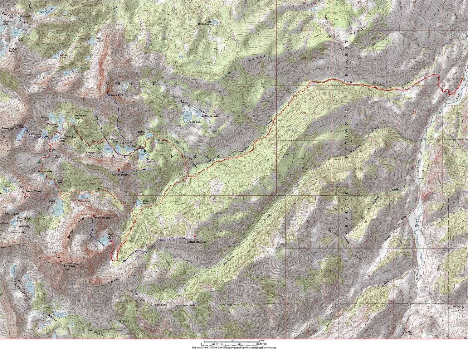
Map of our route. The base loop covers almost 29 miles and 5700' elevation gain. If you include all side trips, the grand total was 43 miles and 12,300' of gain. |
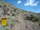
Little Boulder Creek trailhead. |
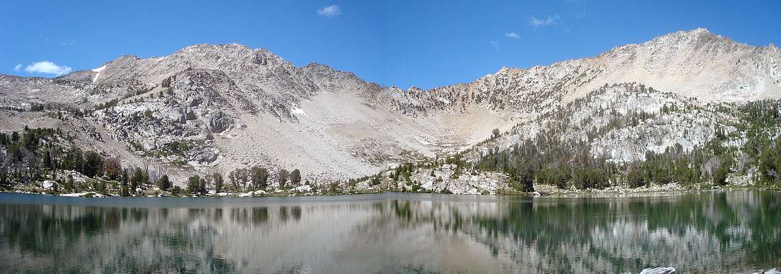
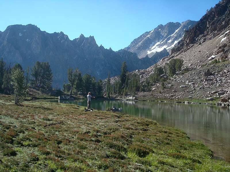
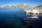
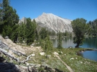
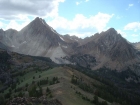
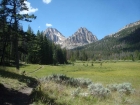
Excellent eastside view of Castle Peak and Merriam Peak. |

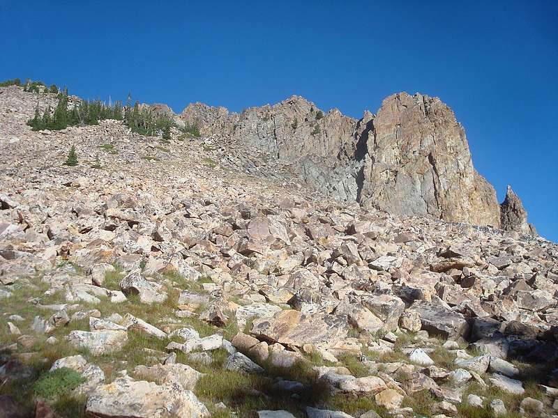
Cardiac Peak from the southeast. I climbed the left side through the trees, then up the east ridge. |
Looking back down on the class 4 crux of Cardiac Peak's east ridge. |
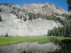
Morning view from Hatchet Lake. |
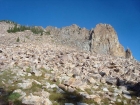
The boulder hopping section on the east face of Hatchet Peak. |

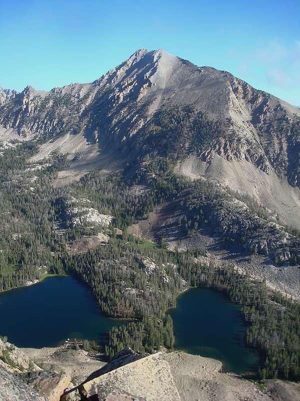
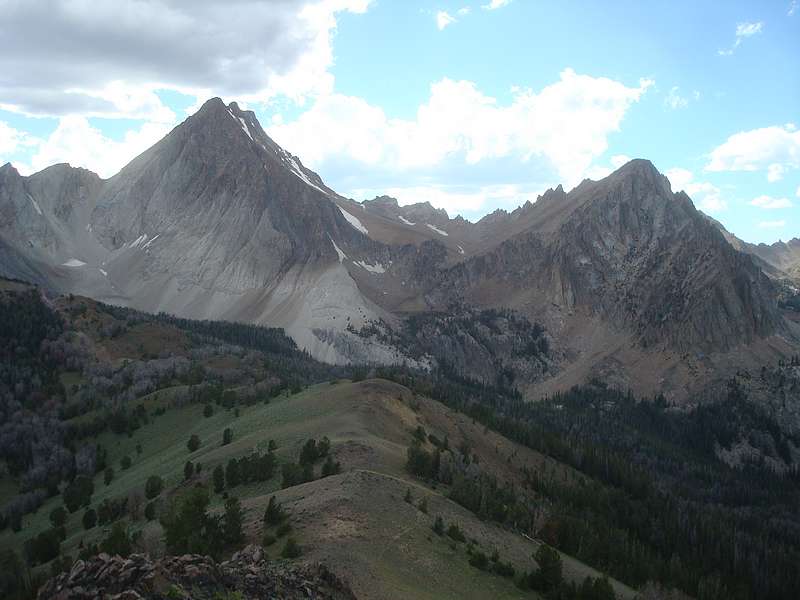
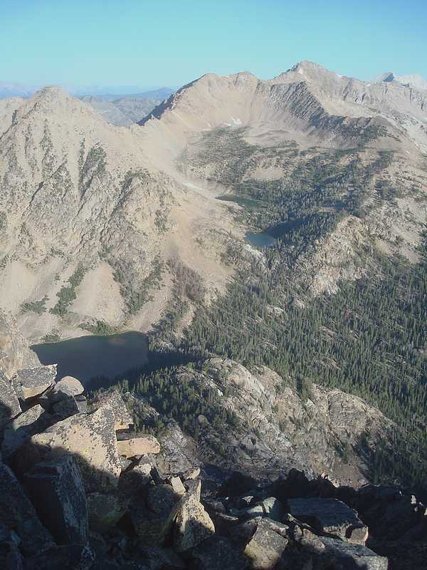
Cardiac Peak from Hatchet Peak, rising above Lodgepole Lake and Sliderock Lake. |
Summit cairn on Hatchet Peak, with four White Cloud 11ers visible in the background. |
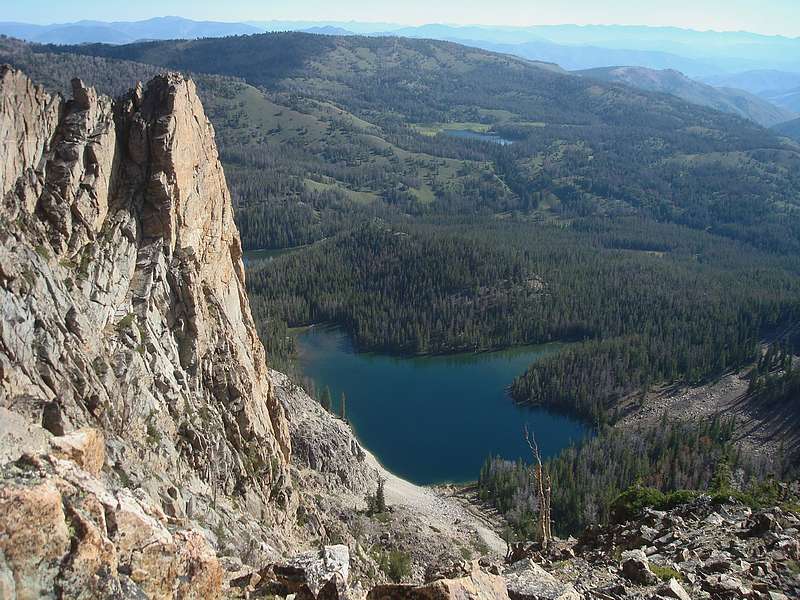
Hatchet Lake from Hatchet Peak, Frog Lake in the distance. |

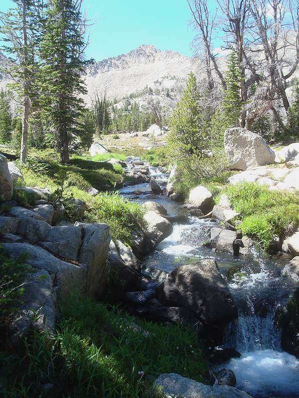
Stream flowing from Hummock Lake to Hourglass Lake. |
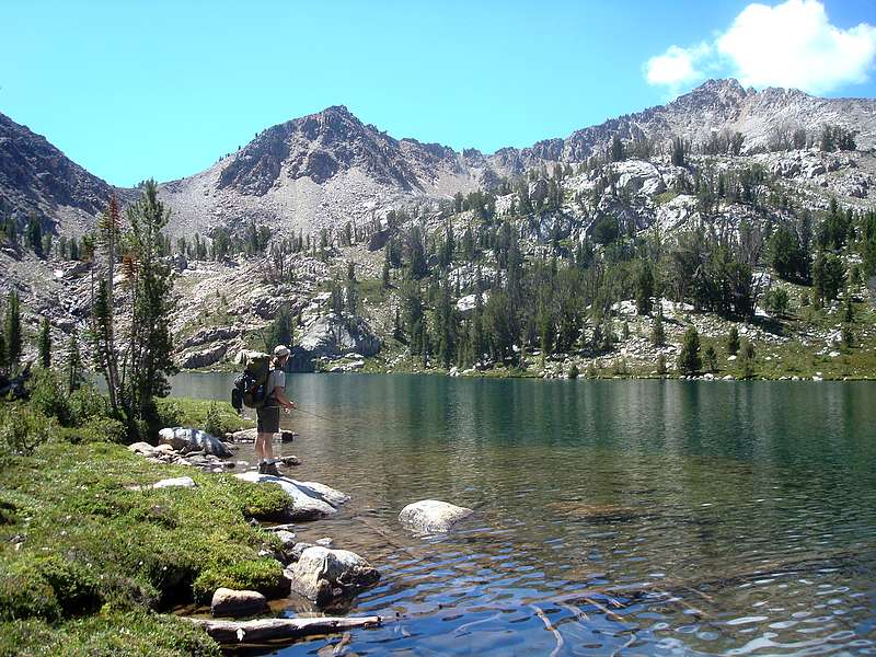
Hummock Lake panorama, with Lonesome Peak on the left. |
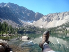
Jordan fishing at Hummock Lake, Windy Devil Pass on the left. |
Cardiac Peak from Scoop Lake. |
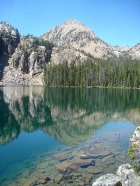
Looking across Lonesome Lake toward the outlet. |

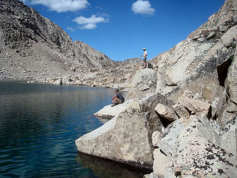
JJ and Jordan fishing on the rocks at Lonesome Lake. |
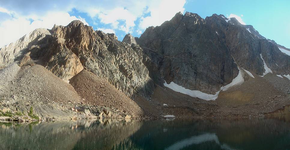
Dave at the 10k tarn, Serrate Ridge and Castle Peak in the background. |
Jordan standing on the rim of the 10k tarn. |

Final rays of sun reflecting in Scree Lake and Shallow Lake. |

Jordan fishing at Shallow Lake, Serrate Ridge in the background. |

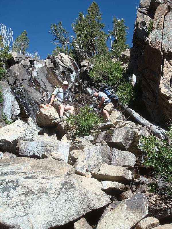
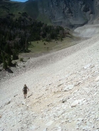
JJ and Jordan descending the cliffs below Scree Lake. |
Lounging at Quiet Lake. |
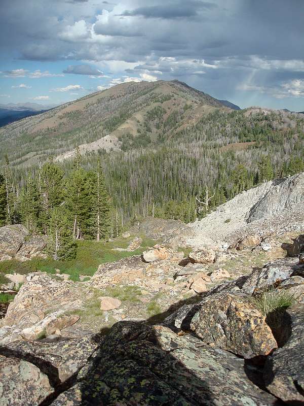
Mount Frank (Peak 10857') from Noisy Lake. |

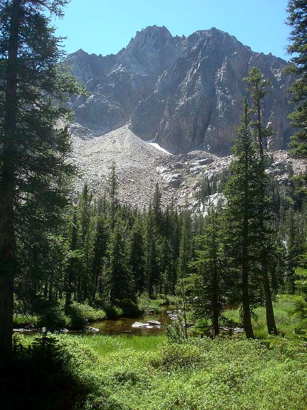
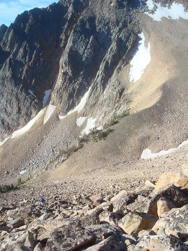
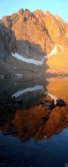
North face of Merriam Peak from Slickenside Creek. |
West ridge of Mount Ernie Day (Peak 9942') from the Wickiup Creek trail. |
Castle and Merriam from Mount Ernie Day. |
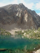
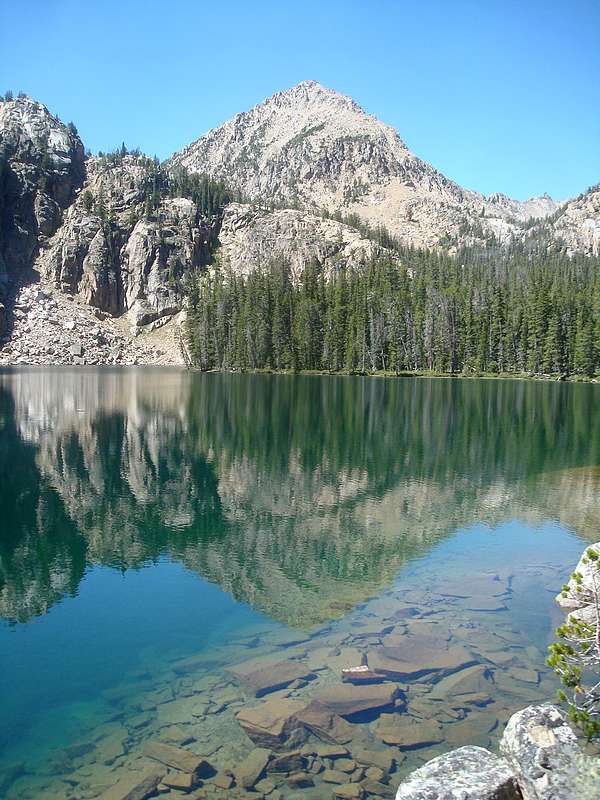
Merriam Peak from Castle Lake. |
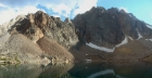
Mount Ernie Day from Castle Lake. |
Castle Peak panorama from Castle Lake. |
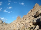
Serrate Ridge spires from the southern slopes of Merriam Peak. |
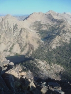
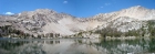
Merriam Peak summit view of Mount Frank, Lonesome Peak, & DO Lee Peak. Quiet Lake, Scree Lake, & Shallow Lake lie below. |
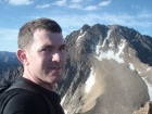
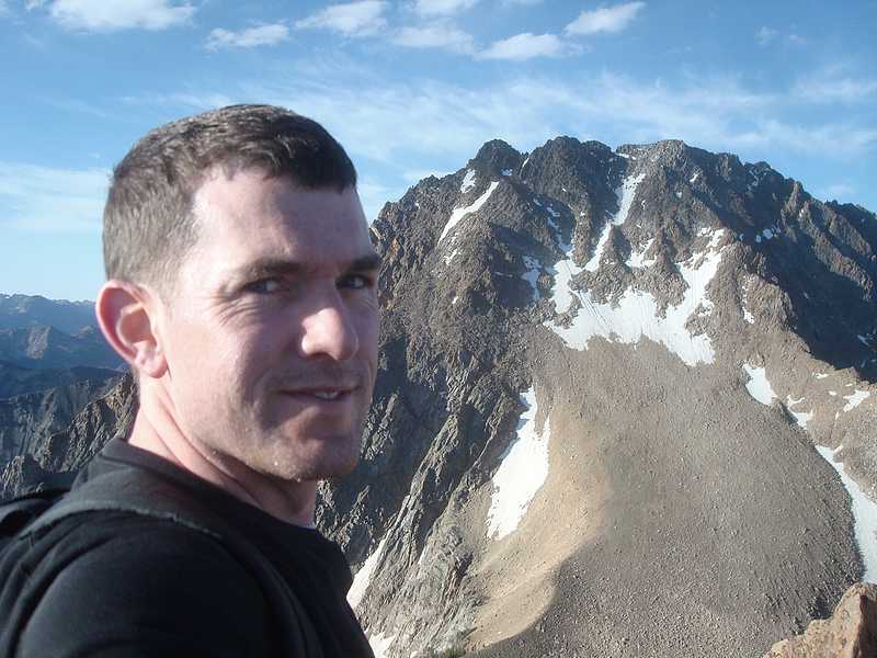
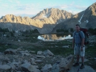
Dave on the summit of Merriam Peak, Castle Peak in the background. |
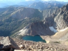
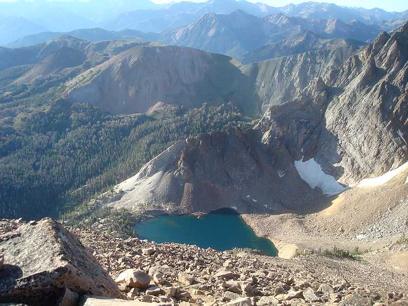
Looking down on Castle Lake from Merriam Peak. |
The massive north face of Castle Peak, from Merriam Peak. |
Rick climbing the south face of Merriam Peak. |
Jordan descending the Castle Lake trail. |
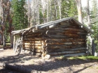
Miners cabin located where the mining road ends and the Castle Lake trail begins. |
Baker Lake from the south. |
Final view of Castle Peak and Merriam Peak. |
Hiking back down the Little Boulder Creek trail. |
|