|
The Sawtooths offer some of the most popular backpacking options in Idaho. Which is understandable since the range is packed with highly scenic alpine lakes and jagged peaks. Trails are abundant, but there are also cross-country options available for those seeking more adventure and solitude. This trip offered plenty of both of those. Our plan was to catch the boat at the Redfish lodge, and start our trip at the Redfish Inlet campground. From there we'd hike the popular trail up Redfish Canyon to Alpine Lake, and then head cross-country up and over the ridge into the Warbonnet Lakes cirque. On day two, we'd continue cross-country to Oreamnos Lake, to Packrat Lake, and finally up and over the Reward Peak saddle to Lake Kathryn. Day 3 would be a fun-filled bushwhack from Upper Redfish Lakes down to the main trail and back to the trailhead. This route isn't recommended for causal backpackers. Good navigation skills are required due to all the off-trail travel, and there are a couple of strenuous ridge crossings to deal with as well.
Day 1
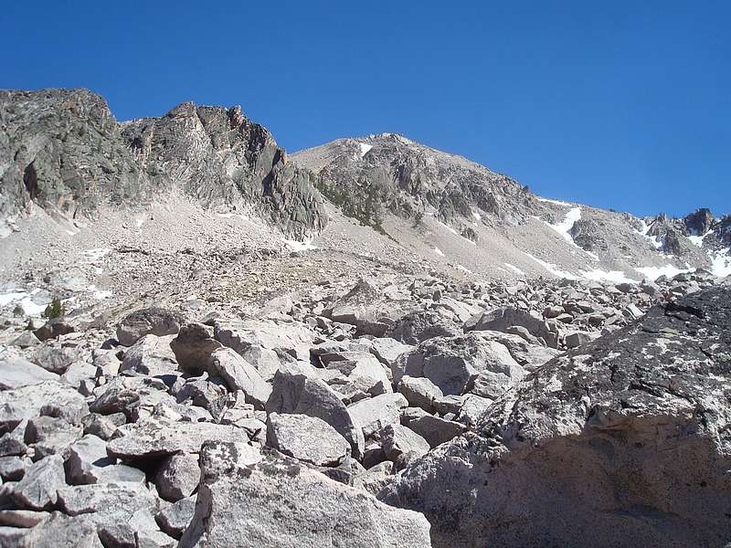
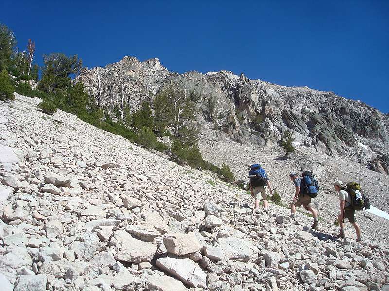
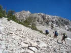
Redfish to Warbonnet Cirque - It was a beautiful morning, and we hit the trail at 10am after our $15 dollar (round-trip) ride across the lake. Ken, JJ, and I had hiked this section of trail previously, but it was new terrain for Jordan and Bill. We enjoyed the scenery and the gradual climb to Flatrock Junction. Next up was the climb up the switchbacks to Alpine Lake. I liked this section because of the great views and an abundance of wildflowers. Once at the lake we stopped for a lunch break and enjoyed the views and mosquitoes, both of which would be an ongoing theme during our trip. From here, we headed up the trail a while then headed cross-country towards the Warbonnet cirque. Our target was the saddle north of Pt 9769'. We wandered through the forest, then up the rocky slopes to the saddle, where we were rewarded with some great views of Baron Lakes and Big Baron Spire. Next we went south up the ridge, and used a climbers trail through the talus to traverse around to the saddle west of Pt 9769'. The views from this saddle were fantastic in both directions. To the south we could see a string of peaks including Thompson, Horstmann, and Braxon. To the north Packrat Peak and the Mayan Temple were very impressive, towering over the Warbonnet Lakes. The trail down to Warbonnet Lakes was steep and sandy, but we made it without incident. We fished at the lakes for a while, and then made our way down the very scenic string of lakes past Feather Lakes to Bead Lakes. Surprisingly, there were 3 other groups camped in the area, but we had the lowest Bead Lake to ourselves. The mosquitoes were abundant, but the stunning view of Warbonnet Peak made up for it.
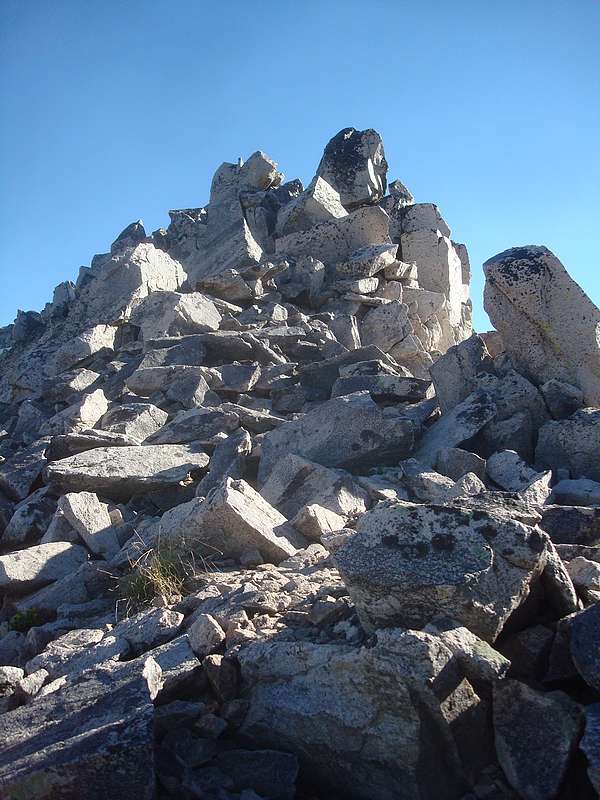
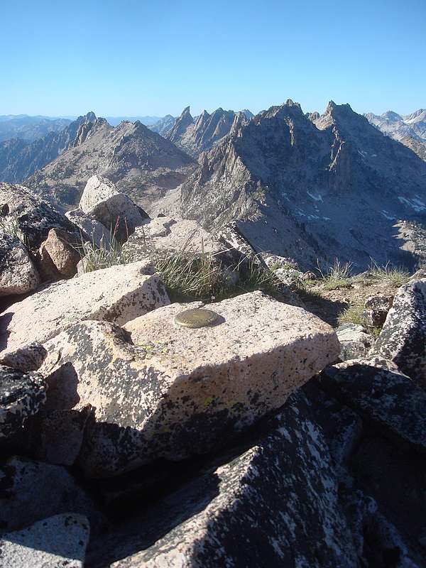
 Cirque Lake Peak climb - After getting camp set-up by about 6pm, I had to work up the motivation to go climb Cirque Lake Peak. I'd really been looking forward to checking out the views from this peak, but it was still an imposing 1500' climb in just over 0.8 miles from the lake. I eventually worked up the energy, and began the climb towards the Warbonnet saddle. I tried to set a quick pace, and eventually made it to the saddle after some huffing and puffing. I had in your face views of Warbonnet all the way up. It is an amazing peak. After a snack break, I headed east and scrambled up the slabs at the base of the "Cirque Lake Complex", a group of towers and spires next to Warbonnet. The bottom section was unexposed and low class 4. Higher up, it was a fun scramble up the pile of rocks that made up the highpoint of the complex. The summit views were spectacular. Warbonnet was up close and personal, and I also had a unique profile view of Big Baron Spire. Amazingly, I didn't have the views to myself, as there were plenty of mosquitoes on the summit to share the scenery with. I read through the register, which had averaged one entry each year since Greg Parker placed it in 2001. Several of the entries mentioned climbing this peak in order to scout out Warbonnet. I didn't want to head down, but my stomach was growling so I made the careful descent back to the lake. Round trip time of 2.5 hours. When I got back to camp, the others were turning in for the night. While I was cooking up my dinner, they shared stories of the tons of trout they'd been catching while I was away. Cirque Lake Peak climb - After getting camp set-up by about 6pm, I had to work up the motivation to go climb Cirque Lake Peak. I'd really been looking forward to checking out the views from this peak, but it was still an imposing 1500' climb in just over 0.8 miles from the lake. I eventually worked up the energy, and began the climb towards the Warbonnet saddle. I tried to set a quick pace, and eventually made it to the saddle after some huffing and puffing. I had in your face views of Warbonnet all the way up. It is an amazing peak. After a snack break, I headed east and scrambled up the slabs at the base of the "Cirque Lake Complex", a group of towers and spires next to Warbonnet. The bottom section was unexposed and low class 4. Higher up, it was a fun scramble up the pile of rocks that made up the highpoint of the complex. The summit views were spectacular. Warbonnet was up close and personal, and I also had a unique profile view of Big Baron Spire. Amazingly, I didn't have the views to myself, as there were plenty of mosquitoes on the summit to share the scenery with. I read through the register, which had averaged one entry each year since Greg Parker placed it in 2001. Several of the entries mentioned climbing this peak in order to scout out Warbonnet. I didn't want to head down, but my stomach was growling so I made the careful descent back to the lake. Round trip time of 2.5 hours. When I got back to camp, the others were turning in for the night. While I was cooking up my dinner, they shared stories of the tons of trout they'd been catching while I was away.
Day 2
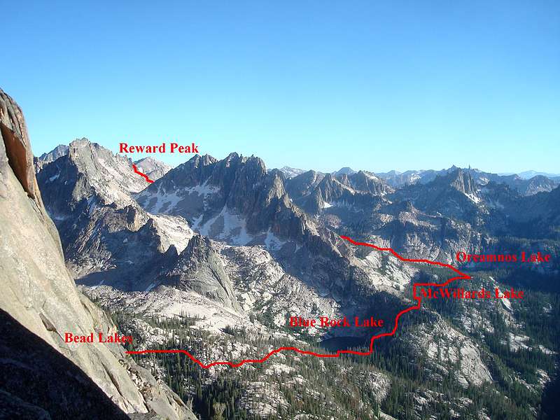
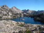
 Bead Lakes to Oreamnos Lake - The next morning we had a brief discussion about the best route option for the day, and decided to circle around to Blue Rock Lake, McWillards Lake, and Oreamnos Lake to check out some seldom visited fishing holes. This option did not disappoint. We made our way from Bead Lake to the shoulder overlooking Blue Rock Lake. The view was fantastic, highlighted by the impressive Blue Rock Buttress and the even more impressive La Fiamma formation. Next we headed down to the lake, where the fishing was pretty decent, and the views were even better. Our next step was to climb up and over a small ridge, then descend through a boulder field to McWillards Lake, where we caught some of the biggest trout of the entire trip. Oreamnos Lake was next up. It was also very scenic, with some cool cliffs as a backdrop, but the fishing didn't quite live up to what we'd experienced at our prior stops. Bead Lakes to Oreamnos Lake - The next morning we had a brief discussion about the best route option for the day, and decided to circle around to Blue Rock Lake, McWillards Lake, and Oreamnos Lake to check out some seldom visited fishing holes. This option did not disappoint. We made our way from Bead Lake to the shoulder overlooking Blue Rock Lake. The view was fantastic, highlighted by the impressive Blue Rock Buttress and the even more impressive La Fiamma formation. Next we headed down to the lake, where the fishing was pretty decent, and the views were even better. Our next step was to climb up and over a small ridge, then descend through a boulder field to McWillards Lake, where we caught some of the biggest trout of the entire trip. Oreamnos Lake was next up. It was also very scenic, with some cool cliffs as a backdrop, but the fishing didn't quite live up to what we'd experienced at our prior stops.
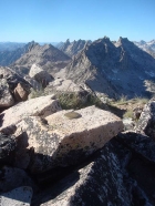
 Oreamnos Lake to Lake Kathryn - Since it was now 3pm, and we still had 1500 feet of climbing to do, it was time to get back on our feet. The Oreamnos inlet stream was flowing down the valley over slick rock granite slabs, which made for some neat hiking as we started up towards Packrat Lake. The valley was very scenic, but I think we were thinking more about the upcoming ridge crossing. It took us about an hour to reach the very pretty Packrat Lake. Ken, JJ, and Jordan fished their way along one side of the lake while Bill and I lounged in the shade on the other side. We peered up at the back of the cirque, looking for our exit route. From this vantage point we really couldn’t see any way over the ridge, which stood 1000’ above us. But we were too far to turn back, and we did our best to be optimistic as we began climbing up through the rock. Luckily our fears were relieved when we crested a pile of rock and were treated with a view of a diagonal gully with some trees growing in it. The gully was steep and loose, but would eventually lead us to the ridge after scratching and clawing our way up. Once atop the ridge, the mood lightened as the hard part of the day was behind us. From here, we were only a few hundred feet below the summit of Reward Peak. I couldn’t resist a quick scramble to the top, but the others didn’t have any problem resisting and decided to head down to Lake Kathryn since it was now 6pm. Oreamnos Lake to Lake Kathryn - Since it was now 3pm, and we still had 1500 feet of climbing to do, it was time to get back on our feet. The Oreamnos inlet stream was flowing down the valley over slick rock granite slabs, which made for some neat hiking as we started up towards Packrat Lake. The valley was very scenic, but I think we were thinking more about the upcoming ridge crossing. It took us about an hour to reach the very pretty Packrat Lake. Ken, JJ, and Jordan fished their way along one side of the lake while Bill and I lounged in the shade on the other side. We peered up at the back of the cirque, looking for our exit route. From this vantage point we really couldn’t see any way over the ridge, which stood 1000’ above us. But we were too far to turn back, and we did our best to be optimistic as we began climbing up through the rock. Luckily our fears were relieved when we crested a pile of rock and were treated with a view of a diagonal gully with some trees growing in it. The gully was steep and loose, but would eventually lead us to the ridge after scratching and clawing our way up. Once atop the ridge, the mood lightened as the hard part of the day was behind us. From here, we were only a few hundred feet below the summit of Reward Peak. I couldn’t resist a quick scramble to the top, but the others didn’t have any problem resisting and decided to head down to Lake Kathryn since it was now 6pm.
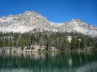
Reward Peak side trip - I had long been intrigued by this peak, mostly due to its name. It was a quick and easy scramble up the north ridge. Lots of talus down low, and some fun class 3 boulders just below the summit. The peak itself isn’t particularly impressive, but the views were stellar. It was a great position to survey the terrain we’d covered during the prior two days. But some Mountain House lasagna was calling my name, so I headed down to catch up with the others. The slopes leading down to Lake Kathryn were a little steeper than I’d expected, but there were no major obstacles. A couple sections were made easier by boot glissading down the occasional snowfields that were lingering into late July. I met the others at the lake, and we eventually decided on a campsite near the northeast corner of the lake with a great view. Lake Kathryn is one of the most beautiful places I’ve camped, with the hulking twin-summitted Elk Peak looming in the distance. We enjoyed our dinner while swatting mosquitoes and taking in the fantastic view of the sunset alpenglow.
Day 3
 Elk Peak attempt - The next morning I set off from camp at 6:15 to climb Elk Peak, with the agreement that I’d be back no later than 10am. It was an impressive peak, and I was hoping to climb up a chute to the east ridge and scramble to the summit. Off I went, along the east side of the lake and past the two tarns to the south. Next there were some neat polished granite slabs followed by a large boulder field that was partially covered in snowfields. This brought me to the base of a steep snow-filled gully that led to the ridge. The snow was soaking in the sun, so I was hoping to kick steps up the softening snow to an exposed rocky section, then scramble to the top. This worked until I reached the exposed section. Unfortunately, there were minimal options in the way of stable holds, and it was quite steep. So in the interest in time and safety, I was forced to turn back less than 100’ below the ridge. This would have been a straightforward climb with crampons and an ice axe, but I had neither. So I headed back down to camp, bummed that I hadn’t made the summit but content knowing that I’d made the right decision. Elk Peak attempt - The next morning I set off from camp at 6:15 to climb Elk Peak, with the agreement that I’d be back no later than 10am. It was an impressive peak, and I was hoping to climb up a chute to the east ridge and scramble to the summit. Off I went, along the east side of the lake and past the two tarns to the south. Next there were some neat polished granite slabs followed by a large boulder field that was partially covered in snowfields. This brought me to the base of a steep snow-filled gully that led to the ridge. The snow was soaking in the sun, so I was hoping to kick steps up the softening snow to an exposed rocky section, then scramble to the top. This worked until I reached the exposed section. Unfortunately, there were minimal options in the way of stable holds, and it was quite steep. So in the interest in time and safety, I was forced to turn back less than 100’ below the ridge. This would have been a straightforward climb with crampons and an ice axe, but I had neither. So I headed back down to camp, bummed that I hadn’t made the summit but content knowing that I’d made the right decision.
 Bushwhacking back to Redfish - The plan for our final day was to explore the other Upper Redfish Lakes, then bushwhack down to the valley and pick up the Cramer Lakes trail. So down we went, following Kathryn’s outlet for a while, then descending a steep slope to the south side of the middle lake. The lake was very nice, and we spent some time fishing and lounging. We repeated the process at the lower lake, and decided we should probably get moving if we were going to catch the three o’clock boat. On the way down, we tried to parallel the outlet stream from the middle lake in order to avoid a cliffy section to the north. Then we veered to the northeast to try and lessen the amount of time spent in the dense brush of the creek bottom. This was mostly effective, and we crossed the creek at about 7600’. We stopped for a snack break after a while, and tried to figure out where we were in relation to the trail. I thought we had a ways to go, but JJ thought we were pretty close. Fortunately JJ was right, and we met the trail only a few hundred yards later. It was a welcomed site, and allowed us to pick up the pace quite a bit. After the final creek crossing near Flatrock Junction, some quick calculations told us we just might make the three o’clock boat if we hurried. So off we went in our best high-speed death-march mode, and arrived at the dock a few minutes ahead of the boat. Once back at the lodge, we experience a bit of culture shock after joining what felt like several hundred people recreating there on the beach. We didn’t hang around long, and made the hot hike over to the backpacker’s parking lot. Next was a quick drive to Stanley for some much deserved bacon cheeseburgers. Bushwhacking back to Redfish - The plan for our final day was to explore the other Upper Redfish Lakes, then bushwhack down to the valley and pick up the Cramer Lakes trail. So down we went, following Kathryn’s outlet for a while, then descending a steep slope to the south side of the middle lake. The lake was very nice, and we spent some time fishing and lounging. We repeated the process at the lower lake, and decided we should probably get moving if we were going to catch the three o’clock boat. On the way down, we tried to parallel the outlet stream from the middle lake in order to avoid a cliffy section to the north. Then we veered to the northeast to try and lessen the amount of time spent in the dense brush of the creek bottom. This was mostly effective, and we crossed the creek at about 7600’. We stopped for a snack break after a while, and tried to figure out where we were in relation to the trail. I thought we had a ways to go, but JJ thought we were pretty close. Fortunately JJ was right, and we met the trail only a few hundred yards later. It was a welcomed site, and allowed us to pick up the pace quite a bit. After the final creek crossing near Flatrock Junction, some quick calculations told us we just might make the three o’clock boat if we hurried. So off we went in our best high-speed death-march mode, and arrived at the dock a few minutes ahead of the boat. Once back at the lodge, we experience a bit of culture shock after joining what felt like several hundred people recreating there on the beach. We didn’t hang around long, and made the hot hike over to the backpacker’s parking lot. Next was a quick drive to Stanley for some much deserved bacon cheeseburgers.
The trip was a lot of work crammed into three days, but it was very satisfying. It’s hard to think of another trip that I’ve taken with more fantastic scenery than this one. The Warbonnet cirque is spectacular. The off-trail lakes to the southwest were amazing. And we couldn’t have asked for a better campsite setting than Lake Kathryn. I think if I were to do it again, I'd stretch this to a four day trip to allow more time for gawking at the scenery.
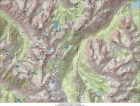
Map of our route. 21 miles and 5500 feet gain for the main loop. 26 miles and 8400 feet gain including side trips.
|
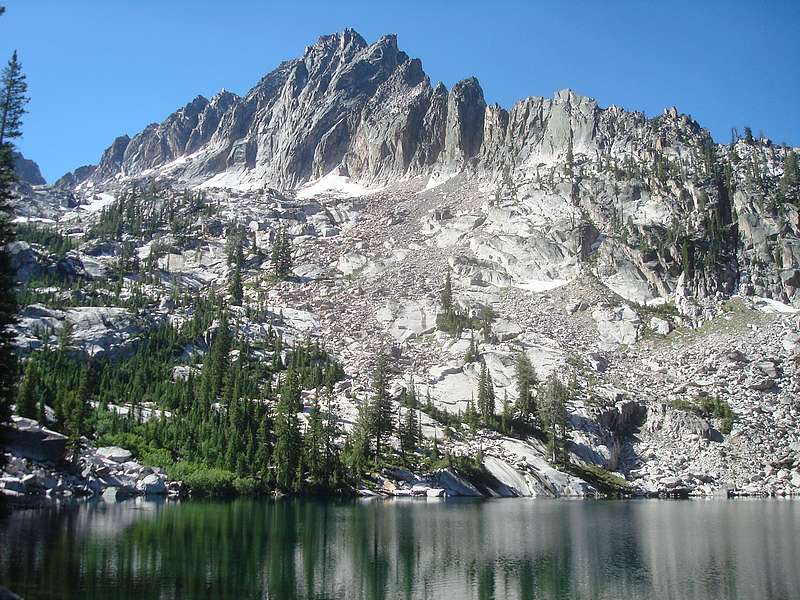
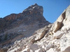
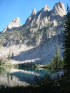
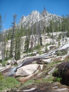
View of Elk Peak from the Alpine Lake trail.
|
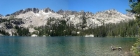
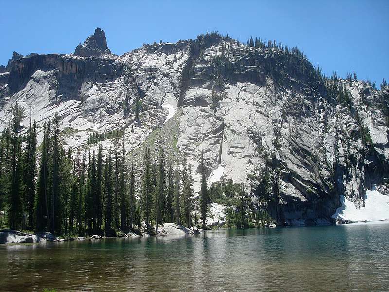
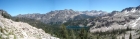
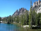
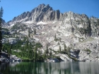
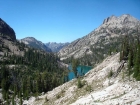
Alpine Lake panorama.
|
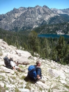
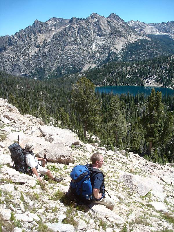
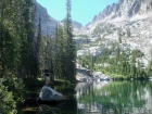
Bill and Ken taking a breather above Alpine Lake.
|
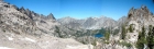
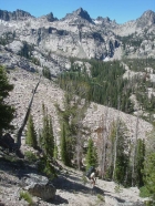
Panoramic view from the ridge of Alpine Lake, with Decker Peak in the background.
|
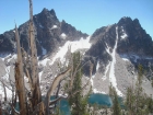
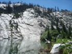
Looking down on Baron Lakes. Big Baron Spire on the left, with Thompson and Horstmann in the distance.
|
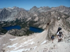
JJ and Bill climbing along the ridge north of Pt 9769', with Baron Lakes in the background.
|
Packrat Peak and the Mayan Temple above Warbonnet Lakes.
|
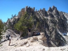
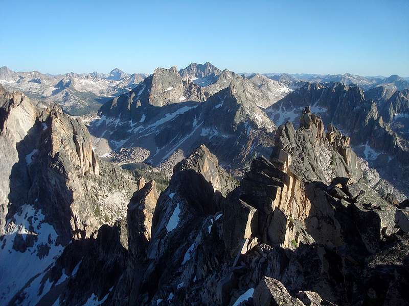
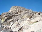
Taking a break on the second saddle with the Monte Verita Ridge in the background.
|
View of Packrat Peak from Little Warbonnet Lake.
|
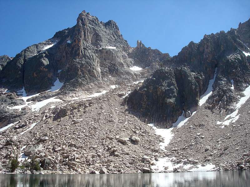
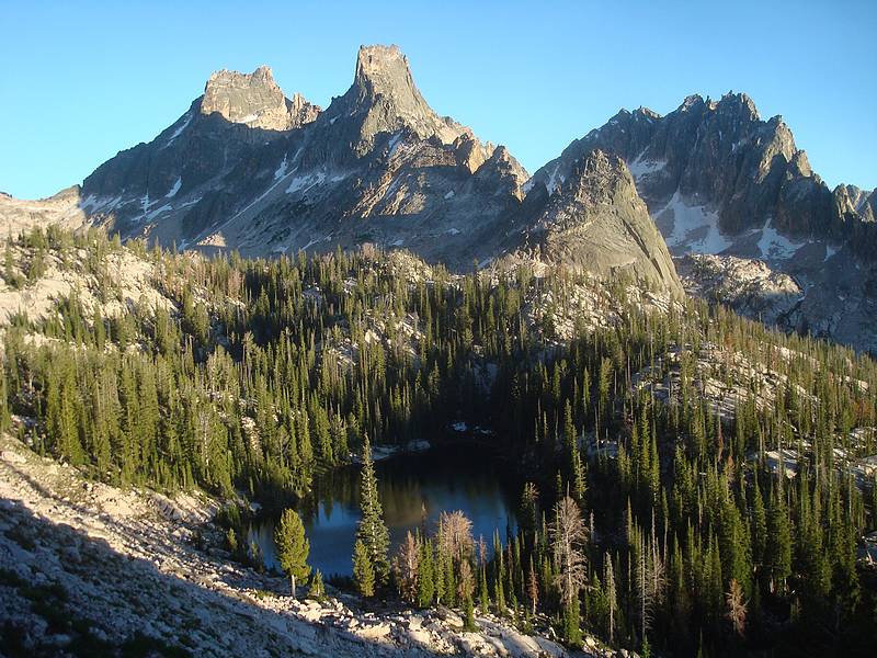
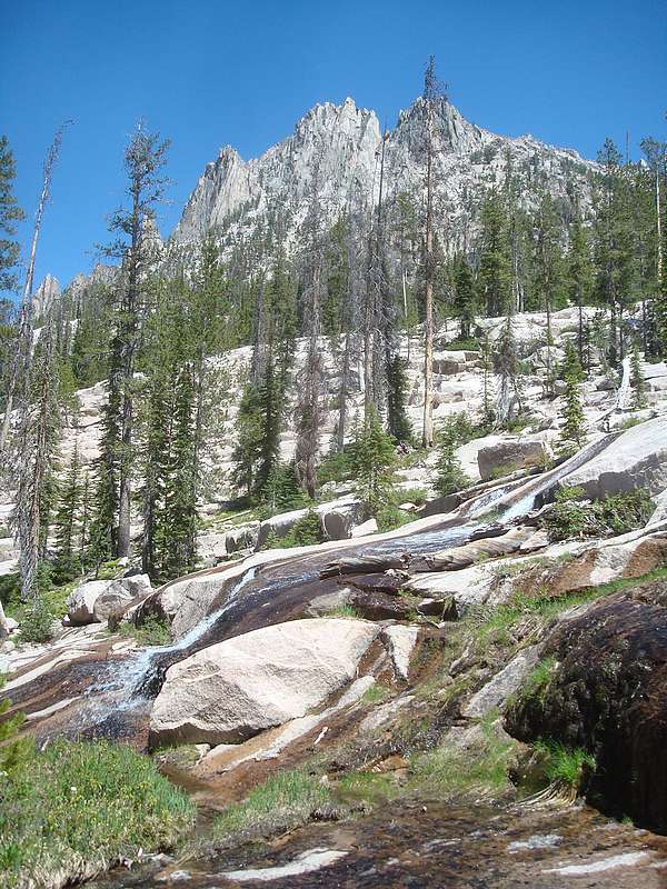
Warbonnet Peak and the Cirque Lake Group from one of the Feather Lakes.
|
Nearing the saddle east of Warbonnet Peak.
|

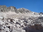
Looking down from the saddle at what would be our route for day 2.
|
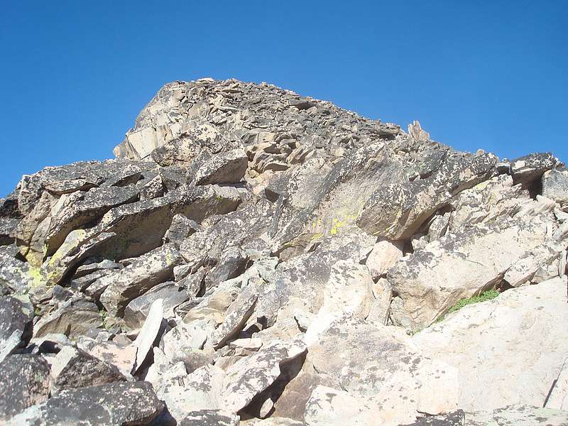
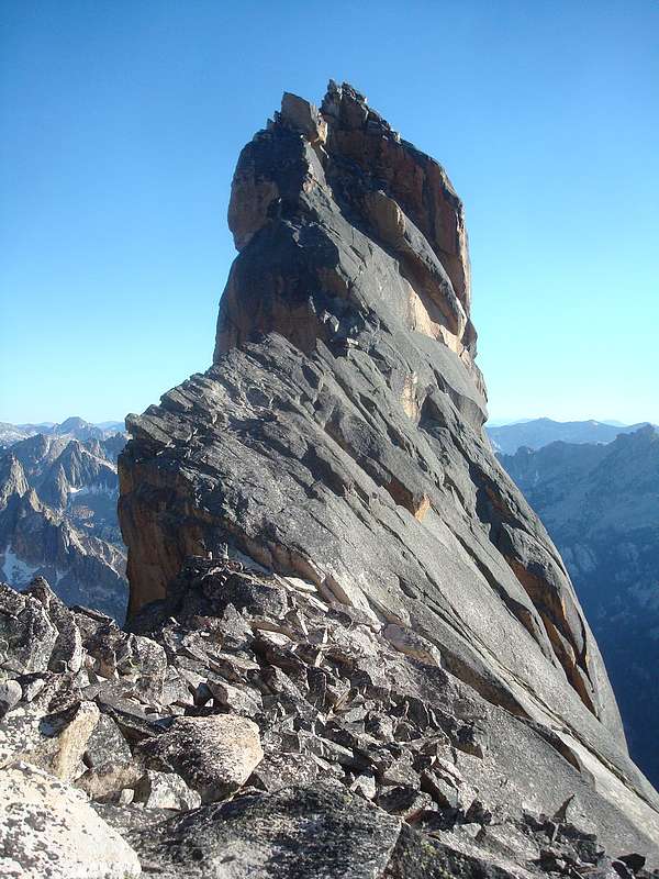
The summit block of Cirque Lake Peak.
|
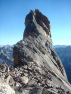
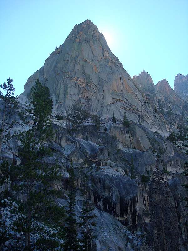
Backside view of Cirque Lake Tower (rated 5.4).
|

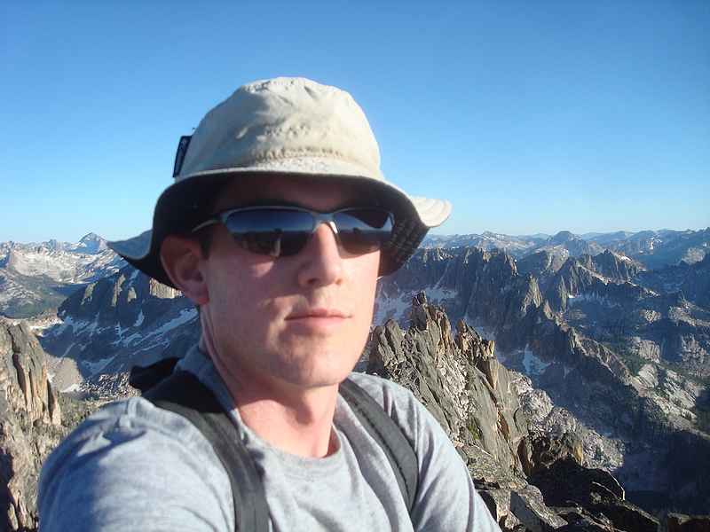
Dave on the summit of Cirque Lake Peak.
|
Fantastic summit view looking southeast from Cirque Lake Peak.
|
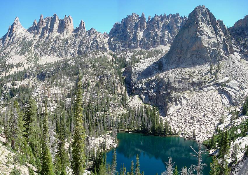
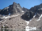
A view of the lowest Bead lake during my descent. Packrat, Mayan Temple, and La Fiamma form a dramatic backdrop.
|
Warbonnet and friends towering above lower Bead Lake.
|

Looking up at the hulking Blue Rock Dome.
|
This peak, called La Fiamma, forms an impressive backdrop to Blue Rock Lake.
|
Ken fishing in Blue Rock Lake.
|
Looking back on Blue Rock Lake. The background is highlighted by Warbonnet, Cirque Lake Peak, Monte Verita, and Blue Rock Dome.
|
Bill descending toward the boulder field, en route to McWillards Lake.
|
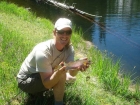
Jordan and his trophy trout from lower McWillards Lake.
|
Bill and JJ fishing at McWillards Lake, and getting lots of action.
|
Warbonnet and friends as seen from our lunch spot near McWillards Lake.
|
Cliffs above Oreamnos Lake.
|
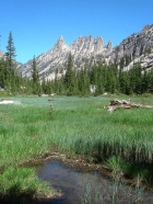
The Oreamnos Lake inlet stream flows over slabs of slick rock granite.
|
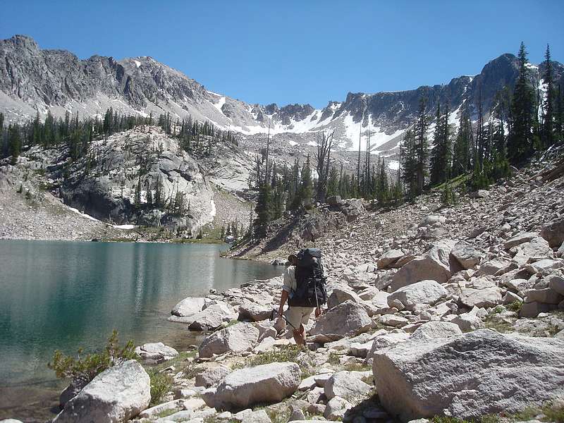
Bill hiking along the shore of Packrat Lake. We've got to find a way over that ridge in the background.
|
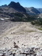
Looking down on Packrat Lake as we climb towards the ridge.
|
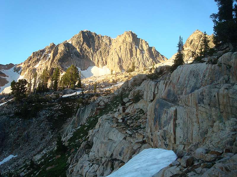
Reward Peak from the northwest. We'd climb the tree-filled gully just to the left of the peak.
|
Ken and Bill climbing the boulder field.
|
Ken, JJ, and Jordan nearing the steepest section.
|

Nearing the summit of Reward Peak.
|
Summit view looking north from Reward Peak
|
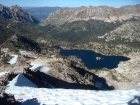
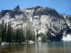
Lake Kathryn form the north ridge of Reward Peak. Redfish Lake in the distance.
|
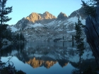
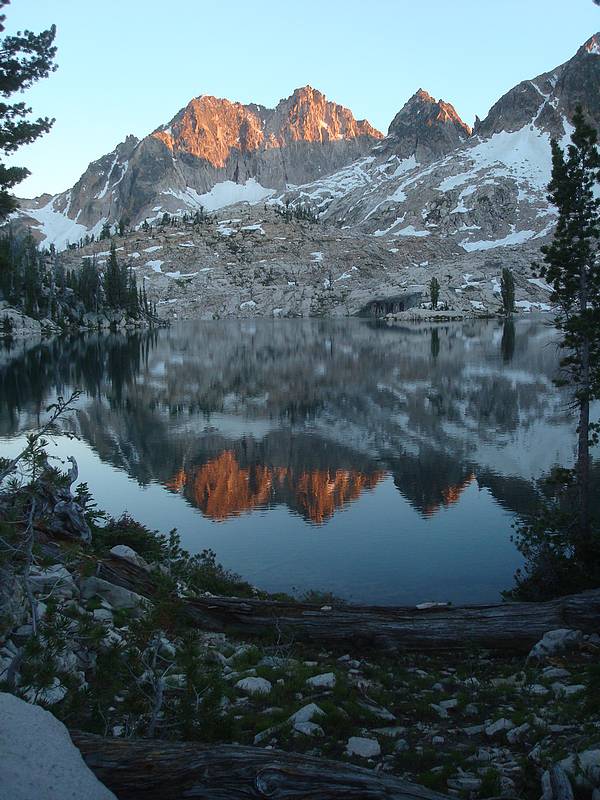
Sunset alpenglow on Elk Peak, reflecting in Lake Kathryn.
|

Another reflection shot of Elk Peak from Lake Kathryn.
|
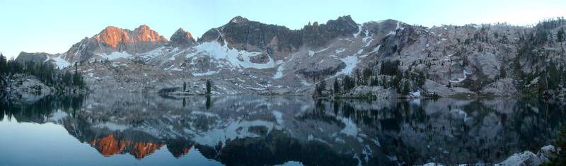
Sunrise on the north face of Elk Peak.
|
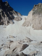
Snowfield leading to the saddle on the east ridge of Elk Peak. I made it to within about 100' feet of the ridge.
|
Morning view of Lake Kathryn from the south, on my way back to camp.
|
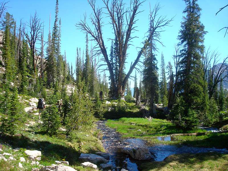
Stopping to check out a huge old tree during our descent to the middle Upper Redfish Lake.
|
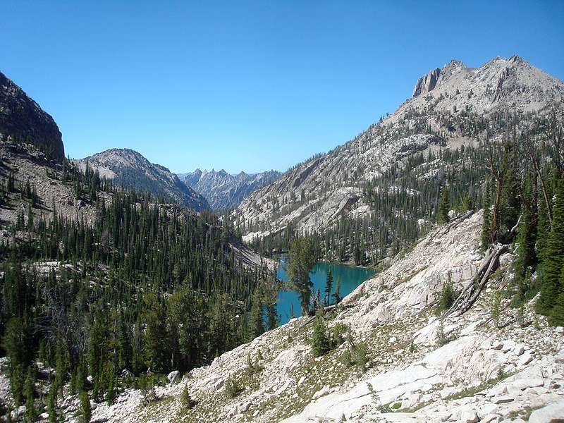
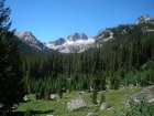
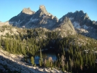
Mount Underhill and Packrat Peak stand to the northwest of Upper Redfish Lakes.
|
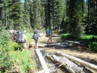
Bill, JJ, and Ken at a log crossing of Redfish Lake Creek during our bushwhack.
|
|