|
After what seemed like years of buildup (really only a few weeks) plans were finally set to climb Lost River Peak along with George, John, and Pat. The goal was to make a snow climb up the "Super Gully" on the peak's southwest face, which is the most common route up the 12078' tall giant, Idaho's sixth tallest peak. The gully is a bowling alley full of loose rock when climbed later in the summer, but ascending on snow would greatly reduce the effort required to reach the summit.
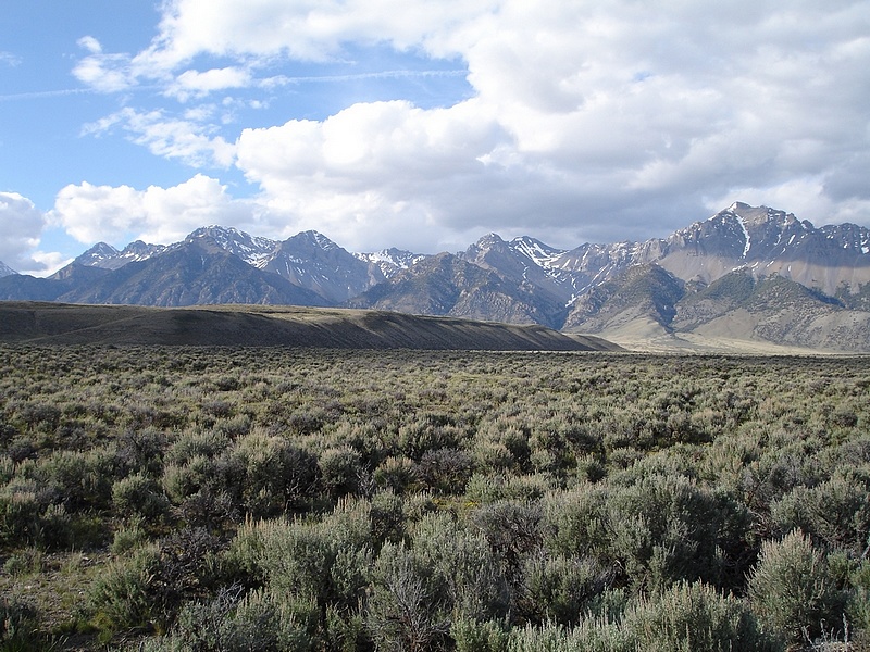
We got out of Boise at around 3pm and made good time on the roads, including a drive over Trail Creek Summit that had just been opened for the year. As we approached the peak from the west, we weren't sure if there'd be enough snow, but those fears were quickly relieved when we turned off the highway across from Mackay Reservoir. With the straight on view, we could see there was plenty of snow remaining. After passing through a couple gates on the way to the trailhead, we were able to make camp right at the base of the mountain and there were even a few flat spots to sleep (a rarity in the Lost Rivers).
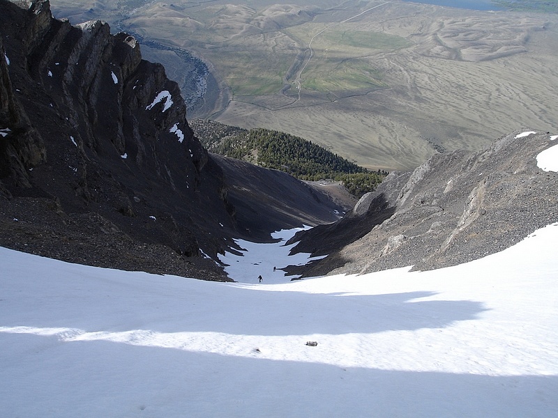
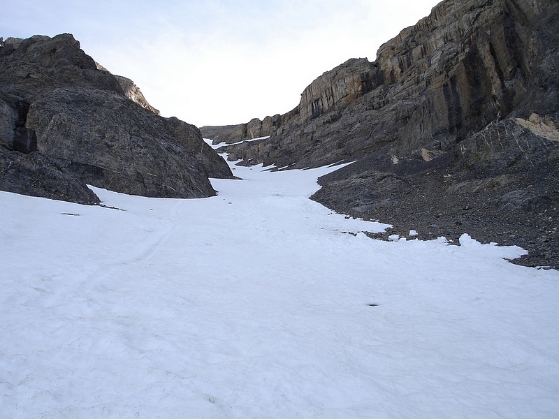
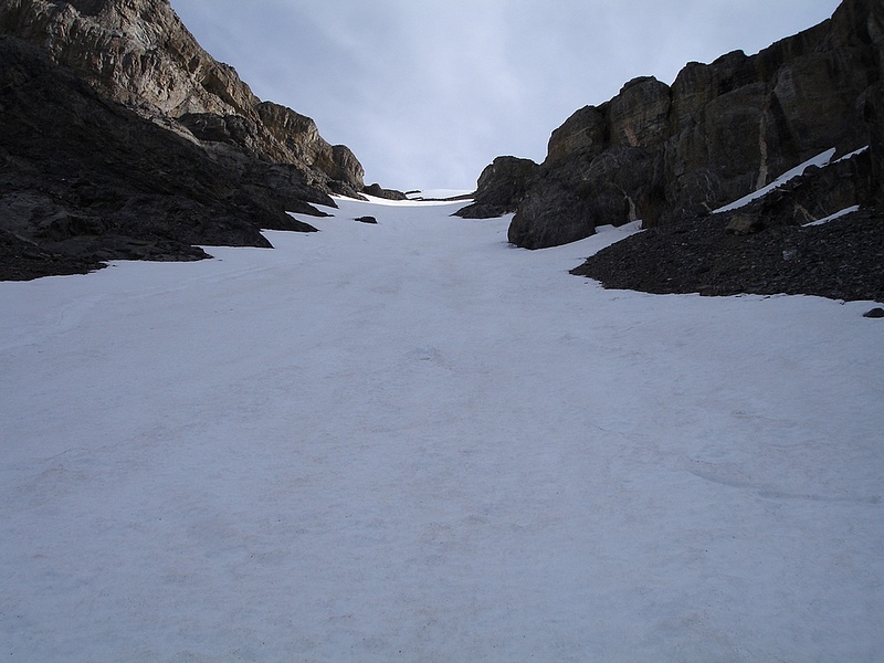
The next morning we were up by first light and on the trail by 6:30. With about 4500' of gain in 2.5 miles, there's not much of a warm-up section on this peak, so the blood starts pumping right out of the gates. Pat led us up the slopes in the general direction of Pt 8881', but we stayed well below that before crossing over to the ridge to the left just after leaving the trees. From here we could see a good trail traversing the scree over to the base of the Super Gully and the bottom of the snow field. I was pretty excited when we finally got to the snow. Other than a course taken a month or so earlier, this would be my first time in crampons, so I was pretty giddy to give them a shot. Within the first few steps, I could tell this was the way to go. With firm footing in near perfect snow conditions, we began the nearly 2000 vertical feet of snow climbing. Even following a switch-backing pattern, this was still quite the calf and ankle work out, but was a ton easier than it would have been later in the season on the loose scree.
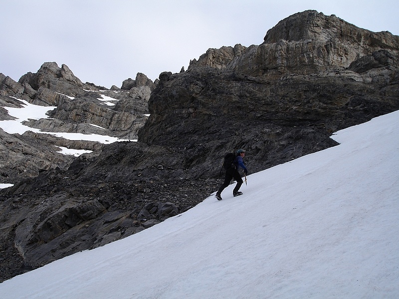
Once we passed through the narrowest part of the Super Gully and the "stadium of the gods" (looks kind of like benches in the roman coliseum), the slope got a bit steeper. We chose to head left to the west ridge leading to the false summit. We could have gone right towards the east ridge, but it was snow free and would have been loose scree climbing. Upon reaching the west ridgeline, we were rewarded with awesome views along the Lost River Range crest including nearby Breitenbach as well as neighboring Donaldson and Church. Mount Borah also stood out in the distance. From here it was an easy scramble on fairly stable rock to reach the false summit where the work ended. From the false summit, it’s a fun ridge walk back to the highpoint a few hundred yards away. The ridge is a bit narrow in places, but nothing too hairy.
After hanging out on the summit for a little while taking some photos and doing a little register reading, it was getting a little chilly so we headed down. George claimed he could see his breath in the 30mph wind, but I think he may have had been mentally altered by the tang slushy he'd concocted while on the summit. Next up was the much anticipated glissade down the long narrow snowfield in the Super Gully. After some brief instruction from Pat, we were off. The snow had softened up just enough to allow for a nice controlled slide down, and we were able to drop nearly 2000' in under five minutes while getting pelted with hail for a little while. It was a blast with the snow spraying up in our faces. I was able to stop myself a couple times by just digging in my heals a bit, but never had to self arrest. Now that's the way to travel! From the bottom of the snow, it was just a matter winding our way back to the car. Other than getting a flat tire on the way home (John and Pat claim Trail Creek Road is cursed), I couldn't have asked for a better trip. The company was great and the climb was most excellent. However, 3 out of 4 climbers agree that Dave won't be driving next time.
Access Road Update June 2022: Upper Cedar Creek Road is currently blocked by a locked gate and NO TRESSPASSING signs where it crosses the private ranch property. It’s unclear if these are new owners, or if the gate got left open one too many times. Whether or not this is a permanent closure, be prepared for an alternate drive approach. Reportedly the best option now is the next (unmarked) gate about a mile-and-a-half north off US93.
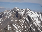
A view of the Lost River Range from the south. Lost River Peak lies to the right. |
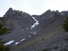
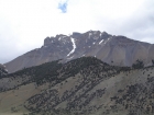
Lost River Peak and the famous Super Gully. |
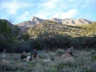
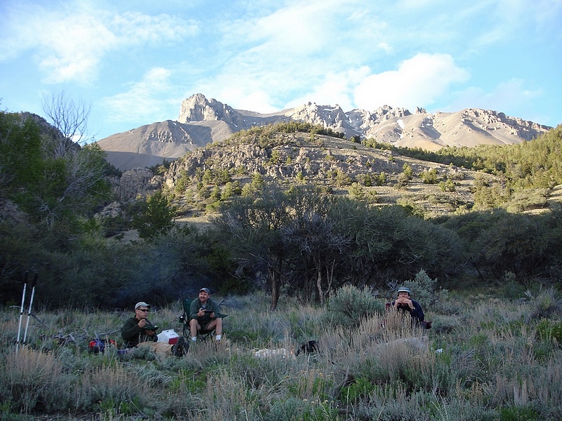
Sitting around the campfire at the trailhead with Lost River Peak behind us. |
A distinct trail in the scree leads to the base of the Super Gully. |
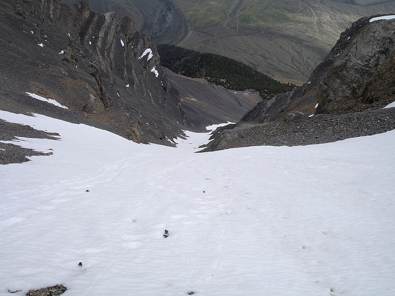
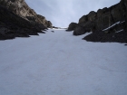
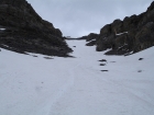
There was still plenty of snow in the Super Gully. |
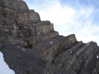
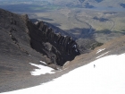
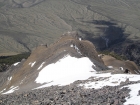
These ledges have been referred to as the "Stadium of the Gods" because of their resemblance to a Roman Coliseum. |
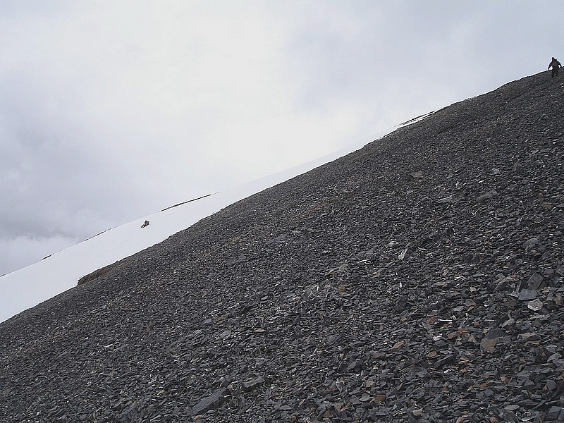
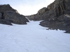
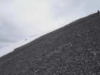
The Super Gully gets steeper and steeper the higher you climb. |
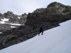
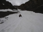
Here's a shot of Pat powering his way up. |

John and George making it through the mid-section of the Super Gully. |
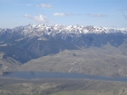
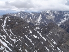
The White Knob Mountains lie to the south of Lost River Peak. |
Looking down on George from the west ridge above the Super Gully. |
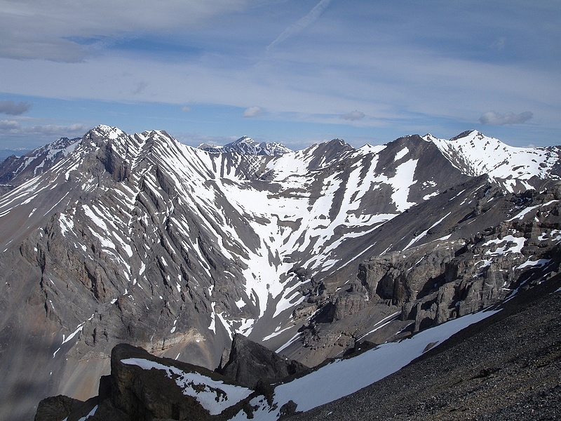
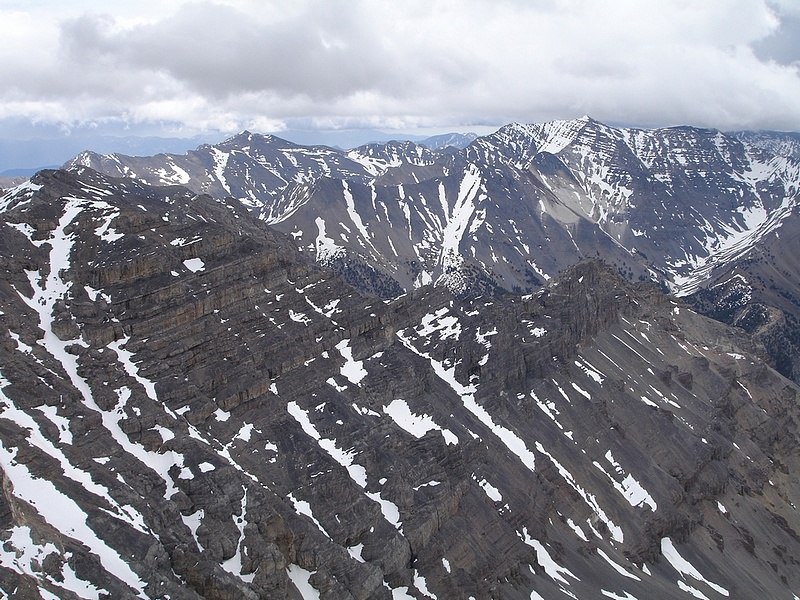
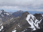
A close-up view of 12ers Church and Donaldson from the top of the Super Gully. |
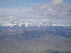
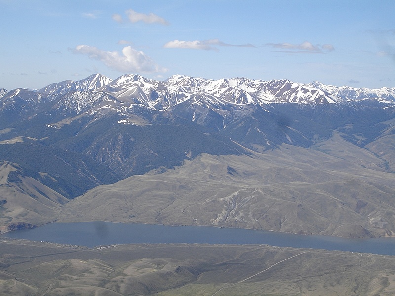
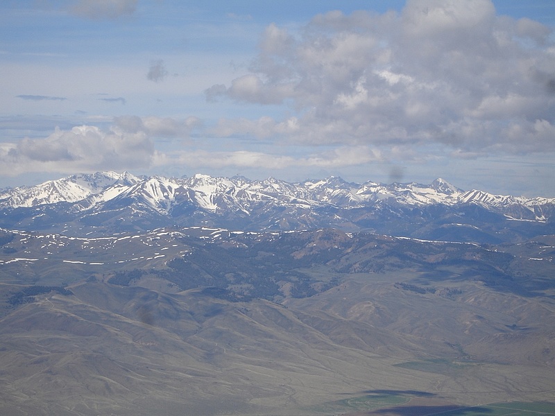
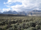
The snow covered Pioneer Mountains can be seen to the southwest. |

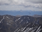
Upon reaching the west ridge of the Super Gully, you're rewarded with an awesome view of numerous high peaks including Mount Borah (center). |
George climbing the steep snowfield to reach the west ridge. |
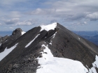
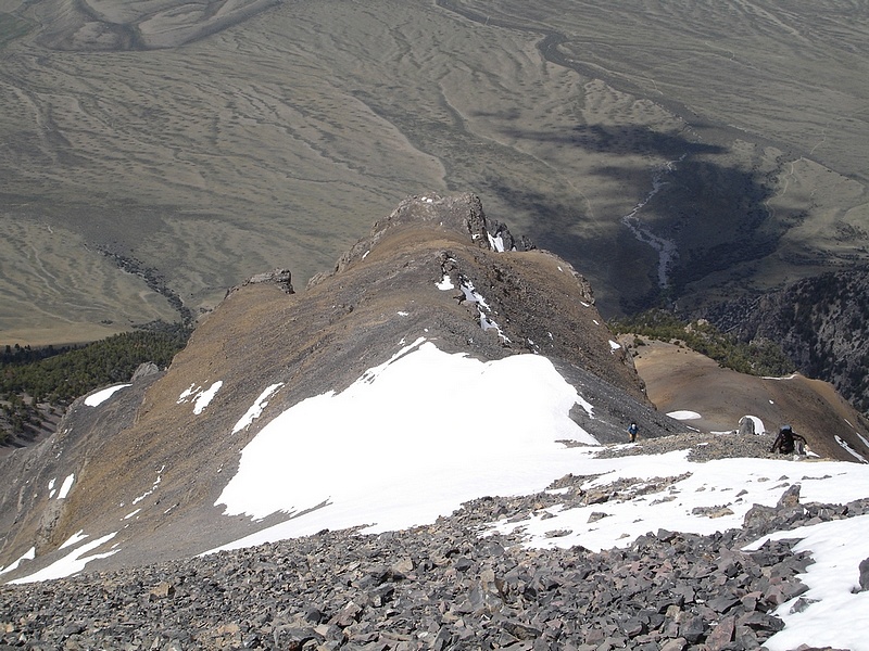
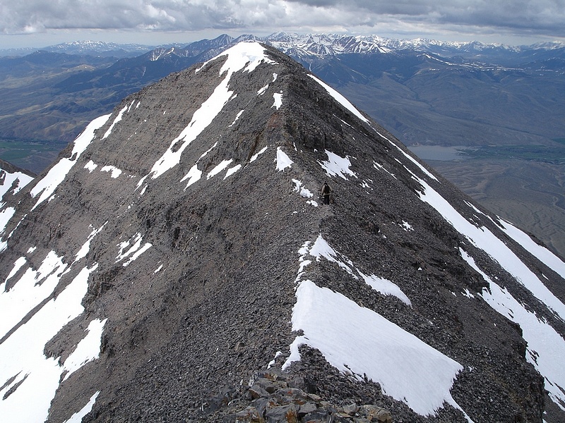
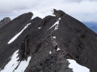
From the false summit atop the Super Gully, it’s a fun ridge walk to get to the true summit. Pat is on the snow in the distance. |
John and George climbing the west ridge. |

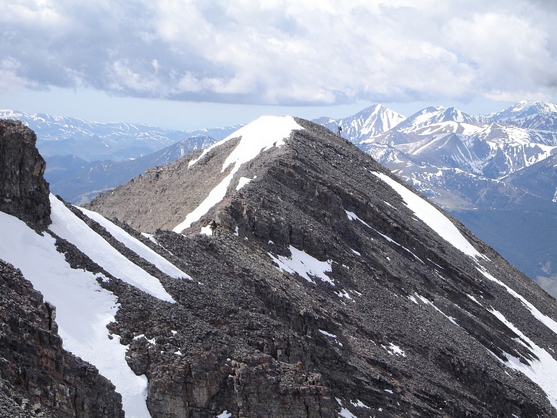
John making his way across the ridgeline as George approaches the false summit. |
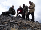
Group shot of the four of us on the summit. |
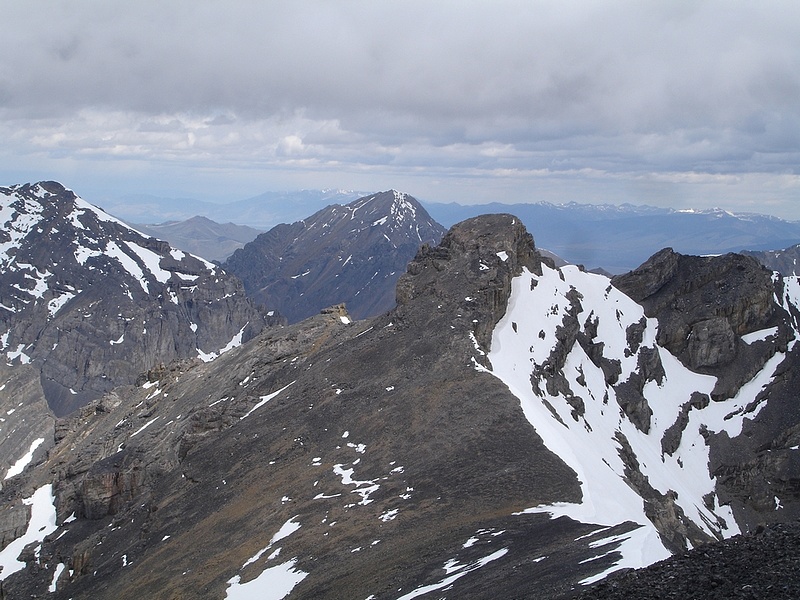
This is the north summit of Lost River Peak. Mount Corruption lies behind it with Mount Breitenbach to the left. |
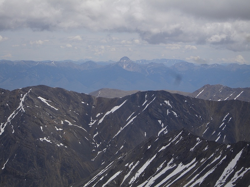
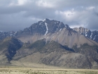
Close-up view of Bell Mountain in the Lemhi Range to the northeast. |
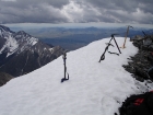
Our ice axes taking a break on the summit, notice the low cloud ceiling in the background. |

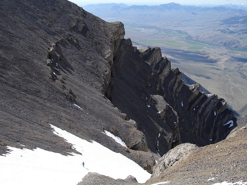
Pat crosses the ridge on the way back to the top of the Super Gully. |
George and John on the "sidewalk" portion of the ridgeline leading away from the summit. |
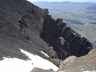
The view to the east is dominated by USGS Peak (to the right in this photo). |
This is George glissading down the step snowfield from the west ridge. John is in the upper right scree skiing. |

Looking down the Super Gully from the top of the snow and getting ready for a fast ride. |
Taking a peak back up towards the next glissader to make sure I'm not going to get run over. |
George nearing the end of his slide, John's still a ways behind him. |
One last view of Lost River Peak and the Super Gully as we make our way home. |
|