|
Horseshoe Mountain is located in the Lost River Range of eastern Idaho, just north of Mount Borah and not far from Doublespring Pass. Fittingly, the peak stands at the head of an impressive horseshoe shaped glacial carved cirque. Spring and early summer are prime conditions in the Lost Rivers because you can avoid the abundance of relentless scree since the loose rock is often covered with snowfields. Horseshoe Mountain is a good example of this; with a gully on the west face that is a good beginner snow climb. May is probably the ideal time to tackle this peak. A word of caution though, the upper ridgeline is probably not a good place for beginners.
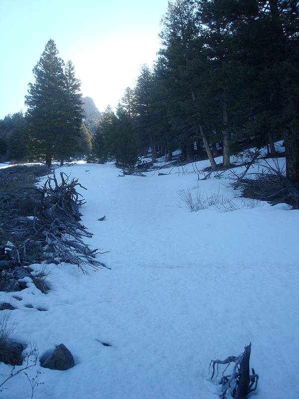
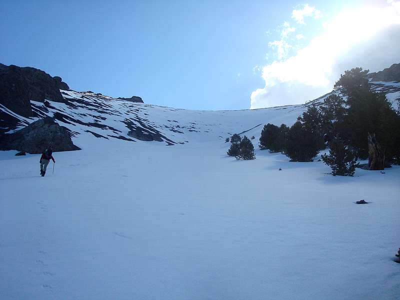
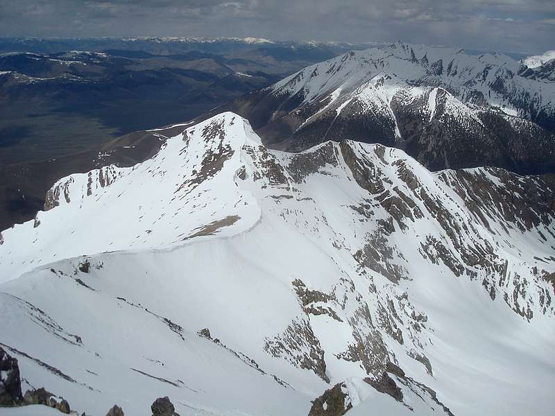
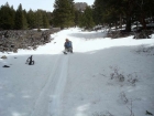
After a four-hour drive from Boise, Splattski and I reached the trailhead just after 8am. Our starting point was at around 7400’ on Doublespring Road, and we initially had good views of the various snow gullies on the west face of the peak. Down low, we spent some time thrashing through the mahogany brush before reaching the more friendly evergreen forest. Soon enough, we reached the base of the snow, which was in ideal shape for crampons. So up we went, gaining about 2000’ of snow climbing. This pretty well toasted my legs, but the views from the ridge re-energized me. The ridge surrounding the cirque was very cool, and it looked like you might be able to link up Horseshoe Mountain and Doublespring Peak to make a great loop.
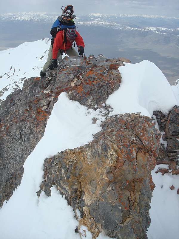
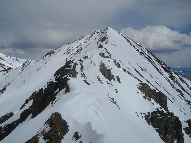
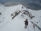
We made our way up the ridge, over one bump, over Pt 10982’ and then to a ridge junction where the route to Horseshoe turned northeast. At this point, the winds kicked in and it was snowing so we bundled up while eyeing the route ahead. It looked kinda spicy with cornices overhang the ridge and a fair amount of exposure off both sides. The route wasn’t obvious, but we forged ahead. We took our time, being very cautious as we crossed the ridge. There were a couple tricky moves to keep our blood pumping as we stayed directly on top of the ridge for the most part along the way to the summit.
Once on the summit, it was decision time. We discussed the merit of continuing on to Doublespring Peak to finish the loop, but opted not to. The combination of weather, softening snow, fatigue, and the clock made the decision pretty easy. We both felt the route would go, but probably would have required starting a couple hours earlier. No regrets though, as we were both very satisfied with the day. After retracing our steps back down the dicey section of the ridge, we stopped for lunch at around 11200’ for an extended break. The sun had come back out, and we soaked in the warmth and views of the north face of Borah. My PB&J was tasty, as usual.
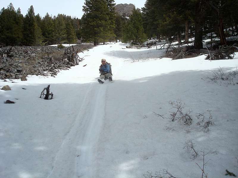
On the way down the mellower portion of the ridge to the northwest, the snow was getting softer and balling up on our crampons a ton. John took his crampons off, but I endured for a while as we descended back down to the top of our gully. Conditions were perfect for a nice long glissade, and we dropped over 2000’ feet in under 5 minutes. It probably took twice that long for our butt-cheeks to thaw out afterwards. From there, all that was left was some wandering through the fields of mohohany shrubs before reaching the car at a little after 3pm. It had been a fantastic day in the mountains. A challenging climb, great views, and great company. Hard to beat.
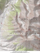
Map of our route. About 6 miles and 4300' elevation gain round trip.
|

The beginning of our snow climb.
|
John angling across the snowfield.
|
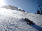
Entering the upper portion of the gully.
|
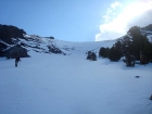
Looking back down from near the top of the gully. Dickey Peak in the background.
|
Heading up the ridge, staying a safe distance from the edge of the cornice.
|
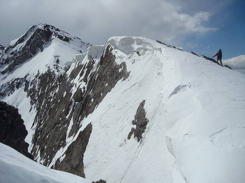
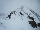
Cornices overhanging the northwest ridge of Horseshoe Mountain.
|
John at the beginning of the exposed portion of the ridge.
|
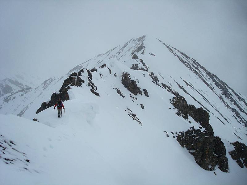
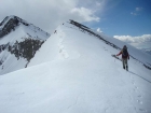
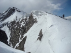
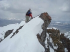
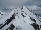
Nearing the summit of Horseshoe Mountain.
|
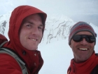
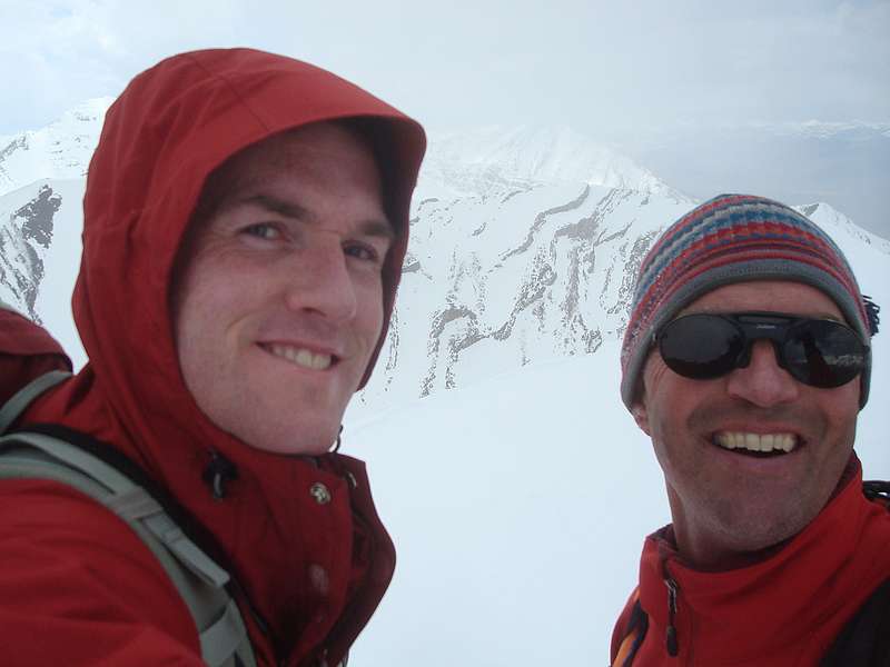
Simul-splattski on the summit.
|
John starting back down the ridge.
|
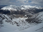
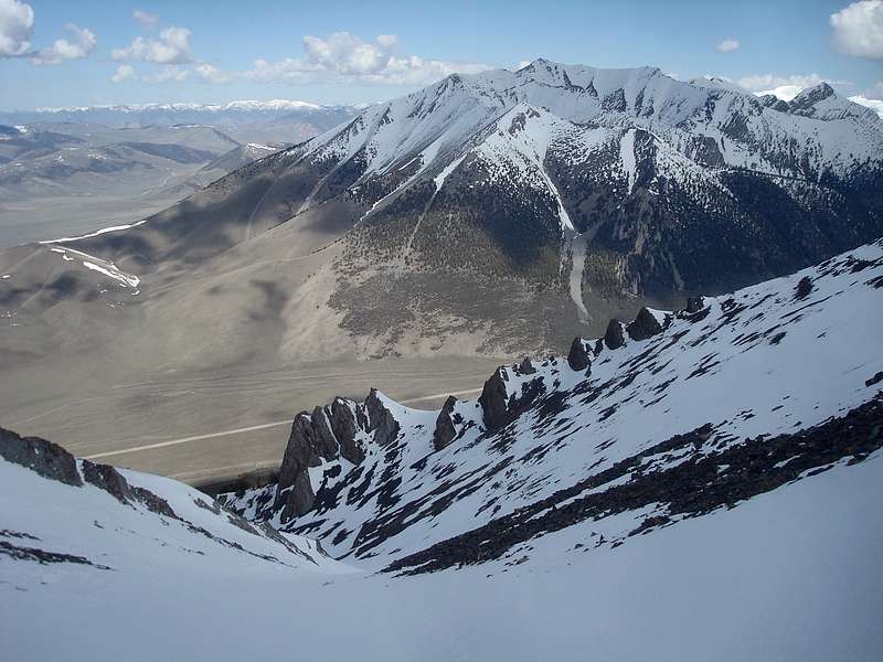
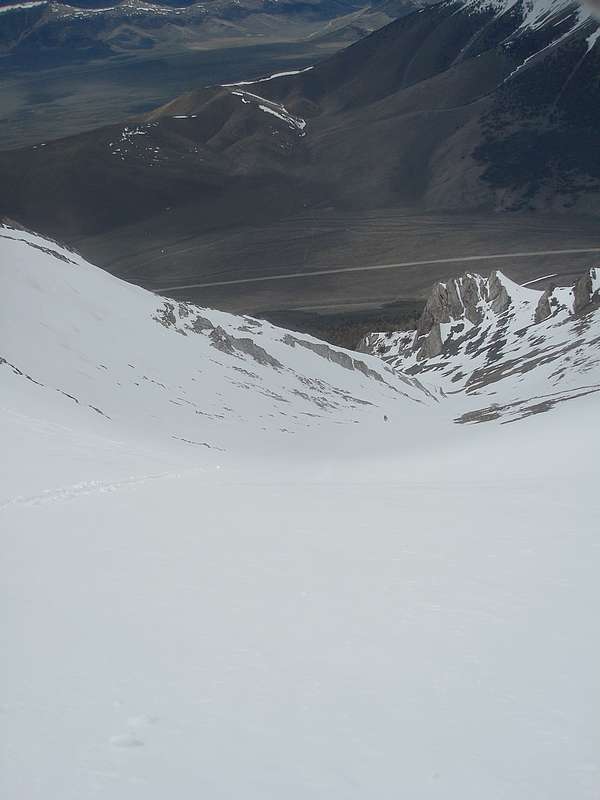
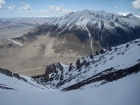
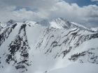
A view down into the cirque, with the northern Lost Rivers in the background. Visible are Dickey, Petros, Pavlos, Gooseberry, Trinity, Grouse Creek Mtn, etc.
|

Mixed climbing on crumbling rock.
|
Exposure on both sides of the ridge.
|
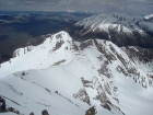
Looking back down the ridge from our lunch spot.
|
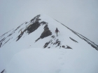
One last view up at the crux section.
|
The north face of Borah, with Al West Peak in the foreground.
|

The top of our glissade path, John has a head start on me.
|
John finishing off our nice long glissade.
|
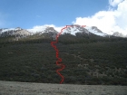
A look at our route, from the trailhead.
|
|