|
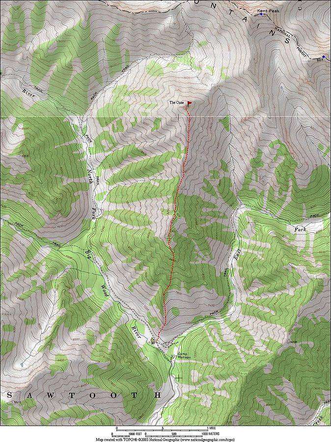
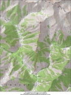
THE CONE is a lesser-known peak located in the Boulder Mountains, just north of Ketchum. Its not the tallest peak in the area, but its central location make it an excellent vantage point for taking in the views of the big peaks that surround it. Splattski picked a great route for us that would climb the south ridge from the trailhead on the North Fork Big Wood River (just past Camp Manapu). We had a healthy group of six (Splattski, Erik, Jacob, George, John R, and me) even after Tom had to head home due to feeling under the weather.
After a 3-hour drive from Boise, we arrived at the trailhead with just a few inches of snow on the road, thanks to a low snow year. It was pretty chilly at the start of the hike, but we warmed up quickly. The lower slopes of the south ridge were steep enough that we all began layering down as we made our way up. After less than a mile of hiking, we begrudgingly broke out the snowshoes. The weather was fantastic as we wound our way through the trees en route to the ridgeline. It was a clear sunny day, although a couple of the guys voiced concerns with the wind that was blowing pretty hard at times.
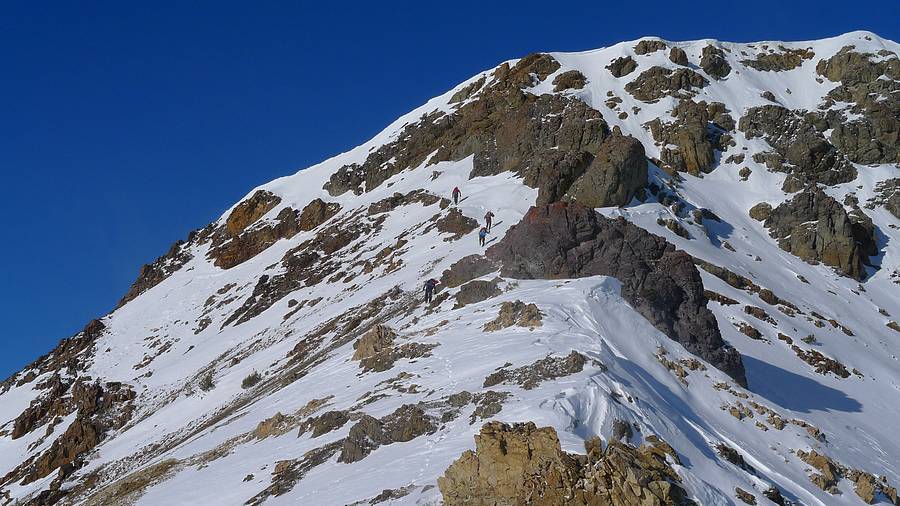
Once on the ridge, the views were excellent, with snow covered peaks in all directions. We stopped on a regular basis to check out the scenery. Ahead, the summit came into view. The ridge ahead of us didn’t look too bad, but there were a couple of rocky gendarme (French for “traffic cop”) sections that stood between the highpoint and us. Once at the base of the first rocky section, most of us left the snowshoes behind to save weight. We did some fun class 3 scrambling up the rock, with no major obstacles. From this point on, the terrain alternated back and forth between snow and rock. We forged on ahead with occasional wind gusts blowing us around. Looking up, we still wondered what the winds would be like on the summit. The final section was a fun snow climb, with just enough of a crust on the snow to kick steps.
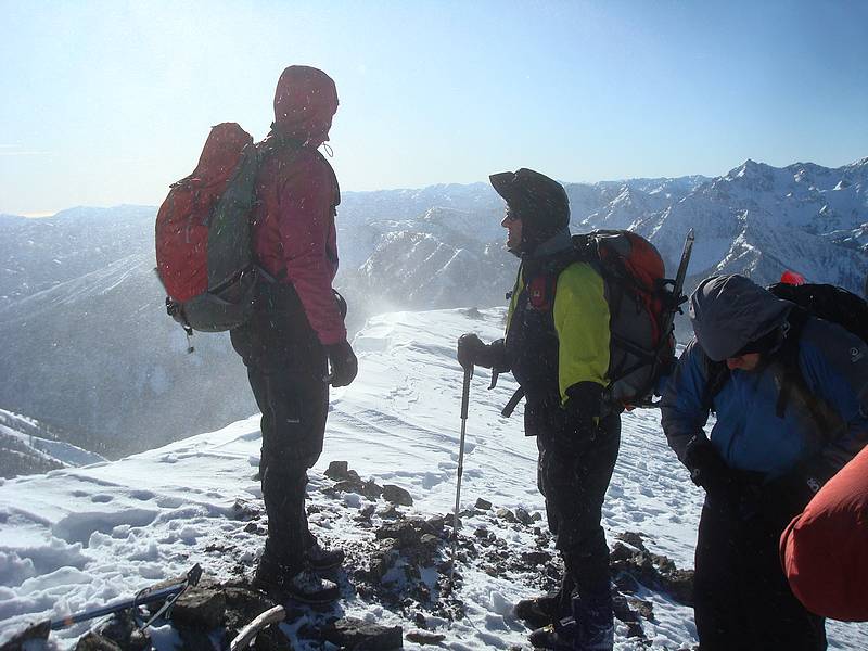
The summit views were very impressive, with Kent Peak staring us in the face. Glassford Peak was an eye catcher as well. Thankfully, the wind had let down a bit. But those of us that arrived first made sure to bundle up while waiting for the rest of the group to join us. We were cold, but none of us were complaining. What a treat to stand on a peak in November with great views and great weather. Eventually we all made it up, and snapped a few summit photos before heading back down.
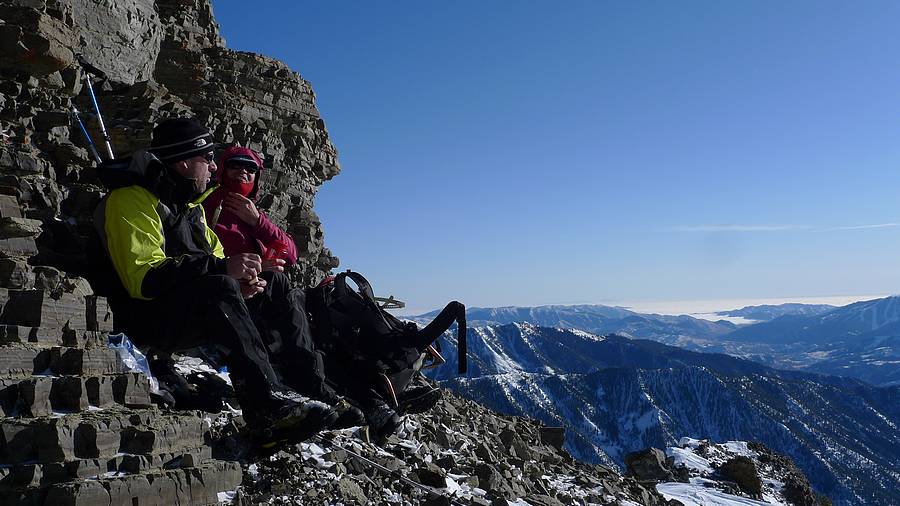
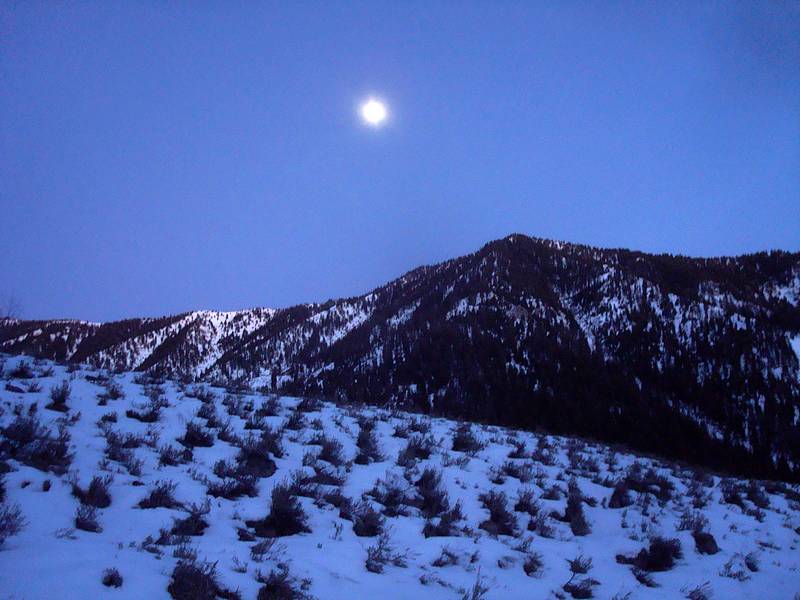
The descent was no problem, thanks to the trail that the six of us had broken on the way up. We stopped for an extended lunch next to a cool rock wall that faced the warm sun and kept us out of the wind. From here we ate casually, taking the views for a while longer. At some point, we realized we should pick up the pace unless we wanted to be hiking out with headlamps. The schedule worked out just about right, as we got back the trailhead just as the moon started climbing into the sky.
The crux of the day was probably the drive home, with five of us piling in to Jacob’s pick-up for the last leg of the drive from Mountain Home to Boise. It’s a long story…
About 6 miles round trip and 4000' gain.
|
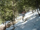
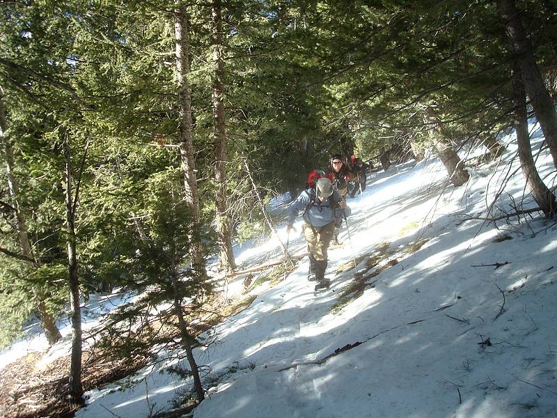
Making our way up through the trees early in the hike.
|

George on the lower portion of the south ridge with Baldy in the background.
|
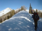
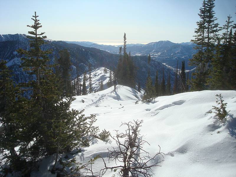
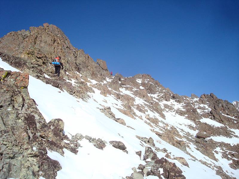
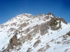
Snowshoeing along the ridge, summit in the distance on the left.
|
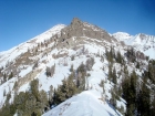
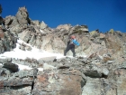
A good view of the cliffy section we would scramble up.
|
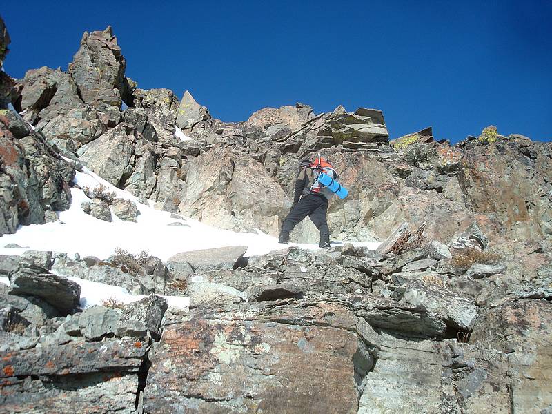
John R making his way up the rocks.
|
John R and Splattski on the rocks.
|
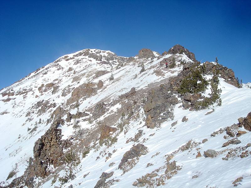
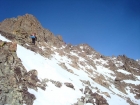
Looking towards the summit, Splattski out in front.
|

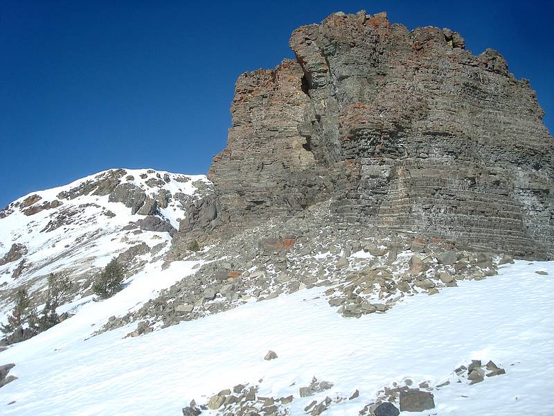
Neat looking layered rock tower on the ridge.
|

Climbers nearing the summit of The Cone. Photo by Erik P.
|
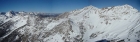
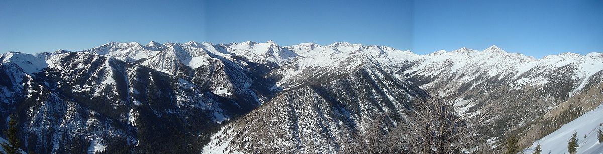
Summit pano to the northwest. Includes Glassford, Ryan, and Kent peaks.
|

Getting caught in spin drift while on the summit.
|
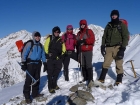
Very colorful group shot on the summit of The Cone. Photo by Erik P.
|
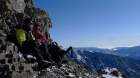
Lunch stop on the way down. Notice the inversion in the distance. Photo by Erik P.
|

Moonrise shot as we got back to the trailhead.
|
|