|
Bad Rock Peak is the 13th highest peak in Idaho and is located in the rugged Lost River Range near Mackay. It is found on the main crest of the range, between Leatherman Peak and Mount Church. It is the shortest of these “three sisters”, falling just 47 feet short of 12er status. This aptly named peak is seldom climbed thanks to vast fields of loose scree and talus that guard its lower slope. The rock up high on the peak isn’t much better. I’m not a big fan of long hot scree fields, so summer isn’t a great time to climb this peak. But early winter or late spring provides an opportunity for a snow-climb and relief from the loose rock.
Splattski and I had eyed Bad Rock during our climb of White Cap Peak last year, so when the opportunity presented itself to take shot at it this year, it was an easy destination choice. (In spite of a 4am departure, 4 hour drive, and a worsening weather forecast.) Sean was also up for it, along with John’s brother Tom. I’d been up Sawmill Gulch two other times, but had always parked at the lower trailhead, below a rough washout area. But this time Sean was feeling weak, and gave in to our urging to head farther up the road. This saved us about 2 miles round trip, and nearly 1000 feet of elevation gain. But in hindsight it may not have been worth it due to the rocky road.
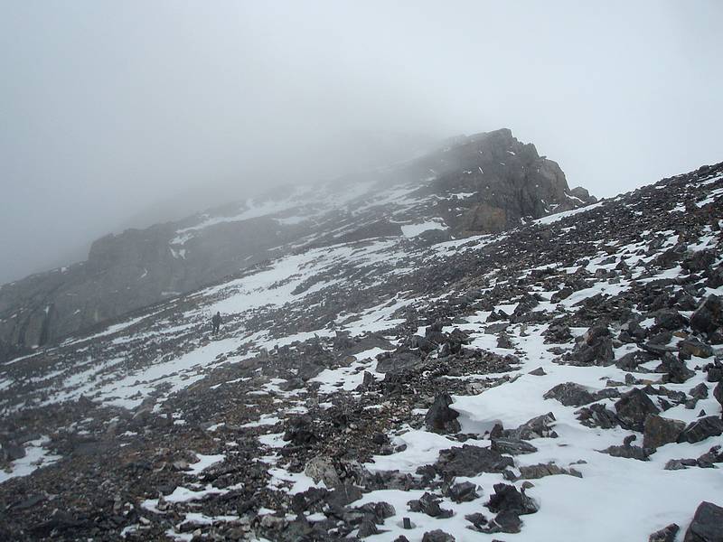
We started hiking at about 8:30 and made good time hiking up the road. At a sharp turn in the road, a trail leads off into the trees to the right. There was occasional snow in places, but it wasn’t until we neared Sawmill Pass that we began to question our decision to leave the snowshoes at the car. We sank in to our knees in a few spots, but fortunately it wasn’t bad for long. Once at the pass, we looked across the valley at Bad Rock. There were a few continuous snowfields in gullies leading up the southwest face to the saddle between Leatherman and Bad Rock, just as we had hoped. The next step was deciding how to get around to the base of the snowfields. We made a long traverse, keeping at about the same elevation as we side-hilled back into the cirque below Leatherman Pass, then out onto Bad Rock’s southwest face. There was a mixture of snow and scree that made for a good ankle workout along the way. Eventually the crust got firmer and we put on crampons for better footing.
Now the real climbing began. We chose a snow filled gully that took a direct line, about 1300’ up to the saddle at 11300’. John broke trail most of the way, and did a great job keeping us on firm snow. There were a few places that we punched through almost to knee depth, fortunately those areas were few and far between, and the snow conditions were pretty good most of the way up. The steepness wasn’t bad either, probably a max of 40 degree slope in a couple places. Thanks to John for breaking trail, on yet another climb!
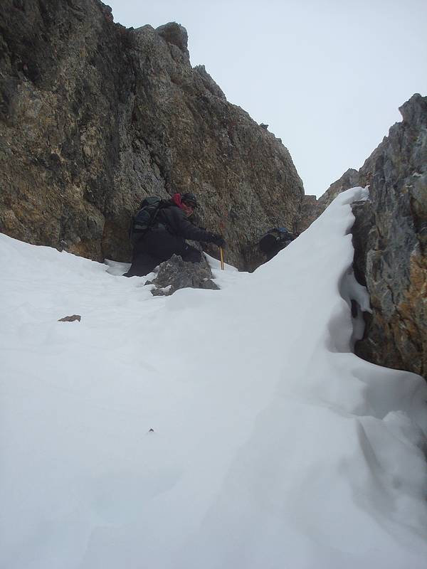
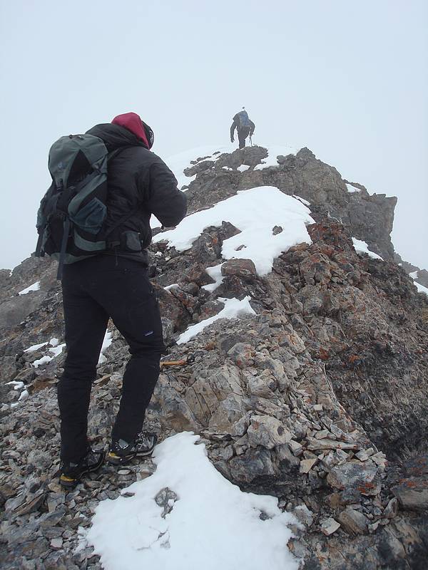
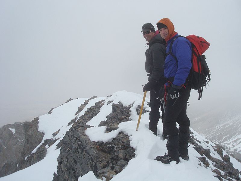
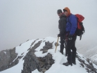
Once at the saddle, the wind was howling and we found some shelter for a quick snack before making the summit push up the northeast ridge, into the clouds. We kept our crampons on, which made for some interesting walking up the snow and scree mixture. Having read about a chimney that leads to the summit, we knew it was up there, but the clouds made it hard to see until we were just across from it. After a short climb down a notch (tricky in crampons), Sean lead the way up the chimney, which was guarded at the bottom by steep snow. The chimney tightened as we got higher, and we made a few scrambling moves using the loose rock. We spread out a bit to reduce the risk of anyone getting hit by falling rubble. I thought this section was challenging and fun, with enough action to keep your attention. Once above the chimney, there was a short ridge leading to the summit, with the highpoint marked by a cairn, which we reached at about 12:30. The fog kept the views to a minimum and there wasn’t much room, so we didn’t stay long before heading down.
Down climbing the chimney was the next big hurdle. We went one at a time to prevent rock-fall injury, and took it slow. John went first, and provided coaching to anyone who wanted it as the rest of us came down behind him. After making it back down to the saddle, we stopped for a lunch break. The weather had been okay up to this point. Cold and windy with a low cloud ceiling, but as we made our way back down the gully, it started snowing. The graupel (cross between snow and hail) was blowing horizontally and blasting into my eyes, yee-haw! It lessened as we got lower, and was pretty much over with by the time we made it to the base of the gully.
Next was the traverse back to Sawmill Pass. After crossing most of the snowfields, we finally took off the crampons, and it was nice to walk flat-footed again. The 100 or so feet of climbing to get back up to the pass wasn’t super fun since I was tiring at the end of the day, but we made it without any issues. We skirted around the edges of the snow to prevent post-holing in the flats, and then eventually reached the trail section. I enjoyed listening to the other 3 swapping stories about Denali on the way back to the car, which was a mile closer than it could have been and was a welcome sight. The last remaining challenge was the drive down to the highway, which was an obstacle course of rocks for Sean to maneuver through. I think all of us were relieved when that was behind us.
It had been a great day in the mountains, with a great group of guys. Bad Rock had provided a good challenge for us, and it feels very satisfying to have summited this big peak in November. The weather wasn’t great, but it could certainly have been worse.
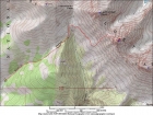
Map of the route. About 7 miles and 3900' gain round trip from the "upper trailhead".
|

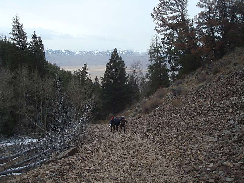
Hiking up the road early on.
|

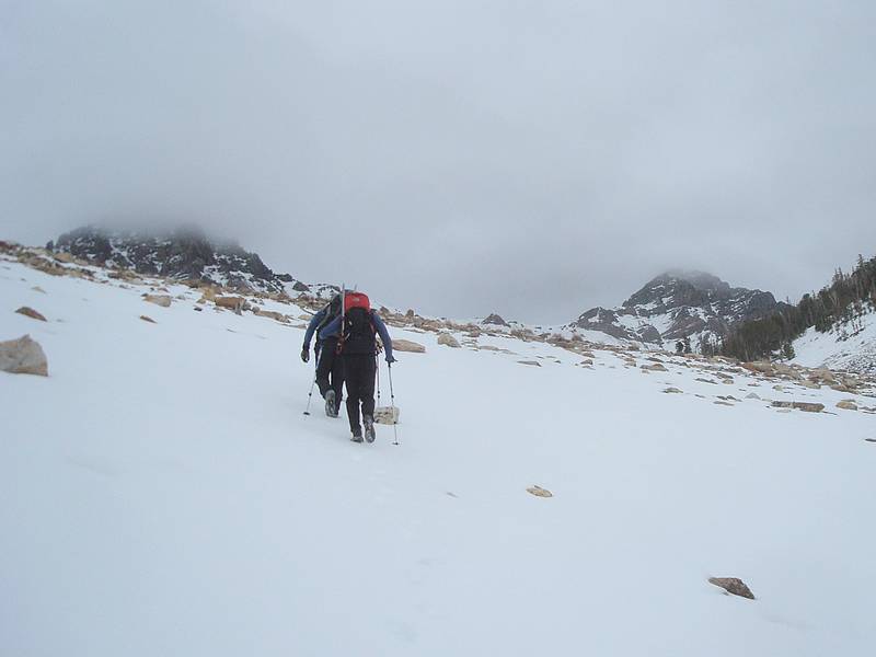
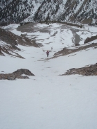
Nearing Sawmill Pass, with Leatherman and Bad Rock in the background.
|
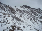
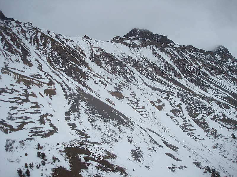
Looking across at the Bad Rock's southwest face, from Sawmill Pass.
|
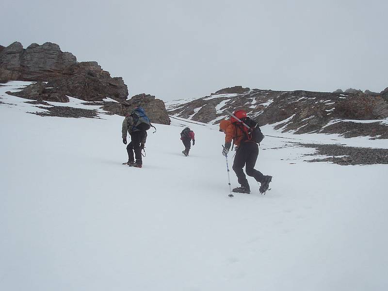
Starting up the gully on the southwest face.
|
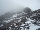
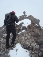
Climbing into the clouds on the northwest ridge of Bad Rock Peak.
|
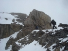
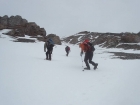
Nearing the chimney.
|

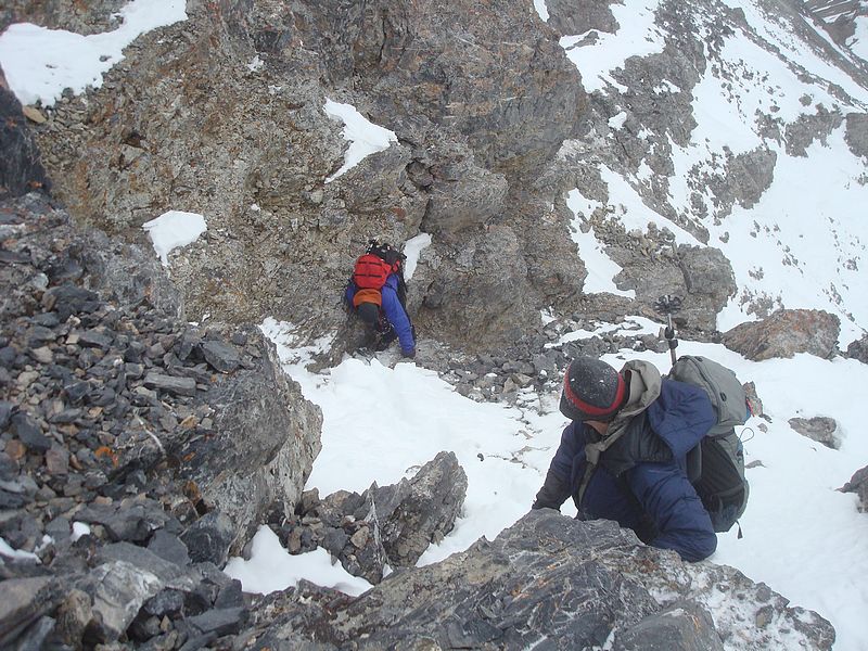
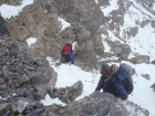
John and Sean making their way up the chimney.
|
Sean nearing the summit, John not far behind.
|
The Platt brothers leaving the summit.
|

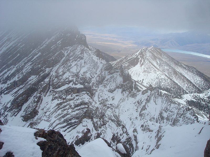
The gnarly west ridge of Mount Church, Mackay Reservoir in the background.
|
Tom and Sean down-climbing the chimney.
|
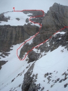
Looking back on the chimney, our route in red.
|

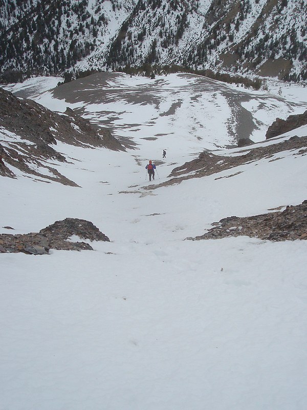
Making our way back down to the saddle.
|
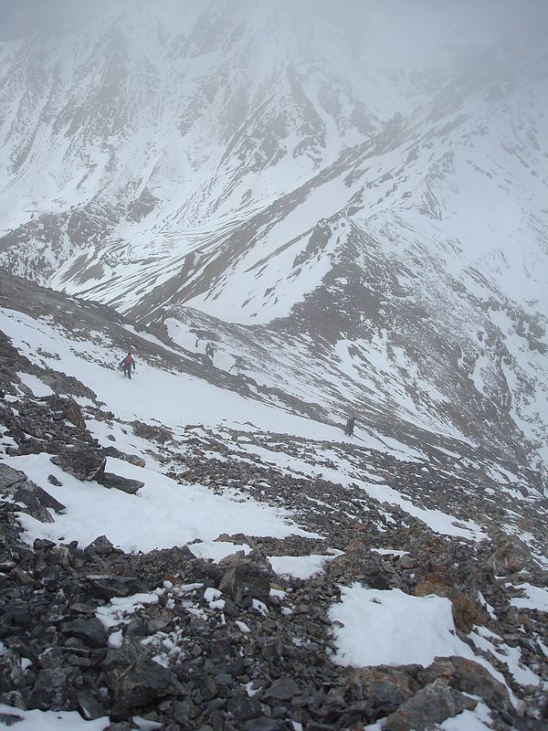
Descending the southwest face gully.
|
|