|
Bull Trout Point is located on the southeast fringe of the Salmon River Mountains, very close to the northern Sawtooths. It can be climbed any time of the year, but probably sees the most visitors during winter since it's pretty close to Highway 21. The peak shares the same starting point as Copper Mountain, which is very popular in winter amongst backcountry skiers. Bull Trout Point sees far less activity than Copper Mountain since the approach is longer, and there aren't nearly as many ski-able slopes, but it makes a great snowshoe destination.
We chose Bull Trout Point from a list of options, and ended up with a party of three. John R, Splattski, and myself met at Albertson's at 6am, made the long windy drive up through Idaho City, and were geared up and ready to go by about 9am. We were greeted by single digit temps and tons of powder. The hike starts at a pullout on the highway neat the road to Bull Trout Lake. After hiking the road for a little while, we hung a right at a sign for the "Bench Creek Trail". At this point, we were warming up pretty fast, and took off a few layers as we wound through the stands of lodgepoles at the base of the mountain. The initial portion is pretty flat, but we soon starting gaining elevation and got some better views. As we climbed the slopes to the first false summit in knee deep powder, we were definitely wishing for a couple extra trail-breakers. It didn't take long for us to decide on a rotation after every 30 steps to keep a steady rhythm. The clouds began lifting as we climbed, so we had some nice warm sun and great views. Once on the ridgeline at around 8300', the going got easier and we made our way along the corniced ridge. Lot's of steep chutes on the north side of the peak, and some very cool snow formations along the way. There were a few rock outcroppings to negotiate around near the top, but nothing too bad. Conditions on the summit were great. Nice views, minimal wind, and about 4 hours to get there.
We took a fairly leisurely pace on the return trip, checking out the cornices along the ridge. We passed 4 skiers who'd used our trail to reach the ridge, and Splattski was wishing in a bad way he had some skis. All in all, a great way to finish off 2007. The peak is a great winter snowshoe option, with minimal avalanche danger. Its a worthy goal (but not a killer) at just under 3.5 miles one way, and close to 2000 feet of elevation gain.
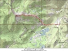
Overview map of the east ridge route.
|
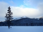
Looking up at the first false summit from the beginning of the hike.
|
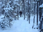
John winding his way through the trees.
|
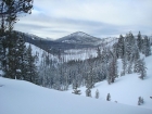
The view south towards "Spring Peak" early in the hike.
|
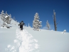
Heading up through the powder early in the climb.
|
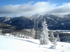
Looking back at across at Copper Mountain, early in the climb.
|
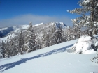
An early view of the summit.
|
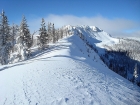
The fun and scenic east ridge route ahead of us.
|
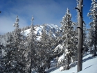
Trees on the ridge, another false summit in the distance.
|
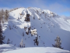
The steep north face of Bull Trout Point.
|
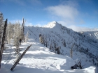
John going along the corniced ridge.
|
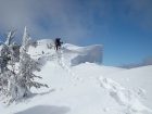
Splattski crossing a cool looking snaggle-toothed cornice.
|

Summit view east towards Copper Mountain.
|

Summit view northwest towards Bear Valley.
|
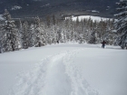
A look at the trough we made, taken on our way back down.
|
|
