|
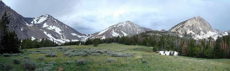
The Pahsimeroi River valley in the Lost River Range is truly one of the most ruggedly beautiful areas in all of Idaho. Few people visit the area, since the access "roads" are very bad. Assuming you don't get a flat tire, it takes an hour or so of high-clearance dirt road driving to reach either the east fork, or west fork trailheads. But once there, the scenery is spectacular, offering unique views of the backside of some of Idaho's tallest peaks including Borah, Leatherman, Church, and Breitenbach. The lay of the land makes it hard to put together a typical multi-day backpacking trip, but we were able to come up with an itinerary that allowed us to backpack in to three different campsites, with return trips to the car in the middle of each day. The total stay for Ken, Nick and I was 4-days and 3-nights, with Nick's brother Nate joining us for the first day and a half.
Day 1
The Drive - We didn't get out of Boise until almost 11am due to work obligations, and began the day by picking up a couple hitch-hikers heading to Wyoming for the Rainbow Family Gathering. Then there was a stop at the Subway in Hailey (they were out of meatball's), followed by a drive over Trail Creek road. Then we met up with Nate at Doublesprings Pass road, and eventually made it the the East Fork Pahsimeroi Trailhead at just before 4pm. The road isn't quite as bad on average as the west fork road, but there are a couple of fairly deep river crossings to deal with.
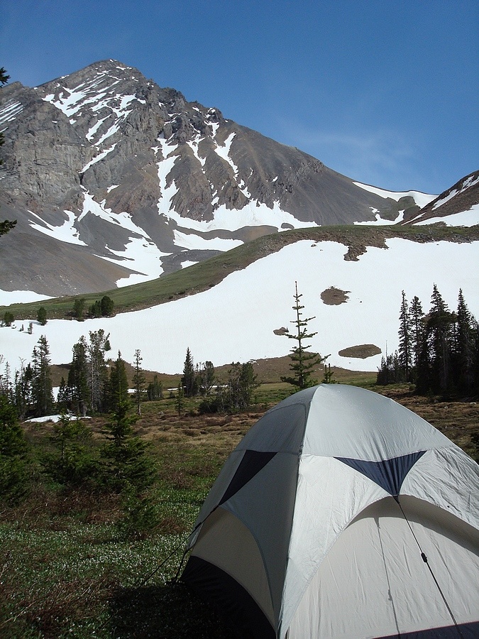
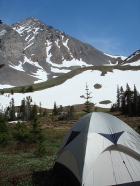
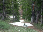
Hike to Lake 9682' - Its about 3.5 miles of cross-country hiking and 1600' of elevation gain to reach the lake. When we came here in 2005, and the hike took us quite a while due to bushwhacking. But this time we kept well above the creek to the east to stay out of the brush. We were able to follow a series of game trails for the first couple miles before crossing the creek into more open terrain, and great views of Mount Church and Badrock Peak. After crossing a few snowfields on the final section, we made it to the lake by about 7pm, where Ken and I immediately partook of some instant pudding. The lake is treeless and pretty exposed, but still a truly beautiful setting.
 Day 2 Day 2
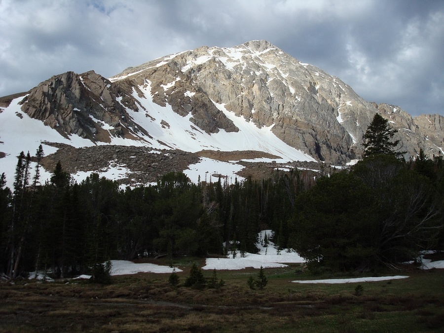
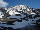
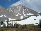
 North Face of Mount Church - I'd been daydreaming about climbing this route for a couple years, and it was finally go time! Nick and Nate got an early start for their climb of No Regret Peak, and I finally got up and going by 6am, with the first rays of sunlight already shining on the top of Church. The snow was pretty firm down low, but softened up a bit in the mid section. The going was pretty steep (maybe 45 degree slope), and I eventually moved from the snow to a band of rock for the last 500 feet up to the ridge. Then it was just a quick 5-minute traverse to the summit at about 9am. The weather was perfect with no wind, so I hung out for about 20 minutes reading the register before starting the traverse to Donaldson Peak. There were a few cornices to cross on Church's east ridge, but no obstacles from the saddle up to Donaldson. I took a lunch break on Donaldson's summit, and could see Nick and Nate descending the ridge from No Regret. Then I descended the northeast ridge for a while before glissading back down into the lake basin. I was the last one back to camp, and was greeted by a group of close to 20 bighorn ewes and lambs. They weren't too worried about us, and most of them just flopped down on the rocks to watch us break camp. No issues on the way back to the trailhead, we just let Ken handle the route finding down through the trees on our way down. North Face of Mount Church - I'd been daydreaming about climbing this route for a couple years, and it was finally go time! Nick and Nate got an early start for their climb of No Regret Peak, and I finally got up and going by 6am, with the first rays of sunlight already shining on the top of Church. The snow was pretty firm down low, but softened up a bit in the mid section. The going was pretty steep (maybe 45 degree slope), and I eventually moved from the snow to a band of rock for the last 500 feet up to the ridge. Then it was just a quick 5-minute traverse to the summit at about 9am. The weather was perfect with no wind, so I hung out for about 20 minutes reading the register before starting the traverse to Donaldson Peak. There were a few cornices to cross on Church's east ridge, but no obstacles from the saddle up to Donaldson. I took a lunch break on Donaldson's summit, and could see Nick and Nate descending the ridge from No Regret. Then I descended the northeast ridge for a while before glissading back down into the lake basin. I was the last one back to camp, and was greeted by a group of close to 20 bighorn ewes and lambs. They weren't too worried about us, and most of them just flopped down on the rocks to watch us break camp. No issues on the way back to the trailhead, we just let Ken handle the route finding down through the trees on our way down.
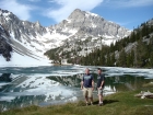
 Merriam Lake - Once back at the east fork trailhead, we climbed in the Durango, and made the drive over to the west fork trailhead (minus Nate, who had to head home). It was raining when we got there, so we stayed in the car eating PB&J's for a while. The rain finally started slowing down as soon as Nick put on his raingear, so we headed up the trail after a couple of raging creek crossings. It was only about 2 miles and 1500' of elevation gain to the lake, but the trail is very steep for the last half mile, and we were already pretty worn out from mountain climbing that morning. But it was all worth it when we finally got to Merriam Lake at 7:30pm. The lake was about half frozen over, and the ice in the water made for quite the sight. Its hard to describe just how beautiful it was. Merriam Lake - Once back at the east fork trailhead, we climbed in the Durango, and made the drive over to the west fork trailhead (minus Nate, who had to head home). It was raining when we got there, so we stayed in the car eating PB&J's for a while. The rain finally started slowing down as soon as Nick put on his raingear, so we headed up the trail after a couple of raging creek crossings. It was only about 2 miles and 1500' of elevation gain to the lake, but the trail is very steep for the last half mile, and we were already pretty worn out from mountain climbing that morning. But it was all worth it when we finally got to Merriam Lake at 7:30pm. The lake was about half frozen over, and the ice in the water made for quite the sight. Its hard to describe just how beautiful it was.
Day 3
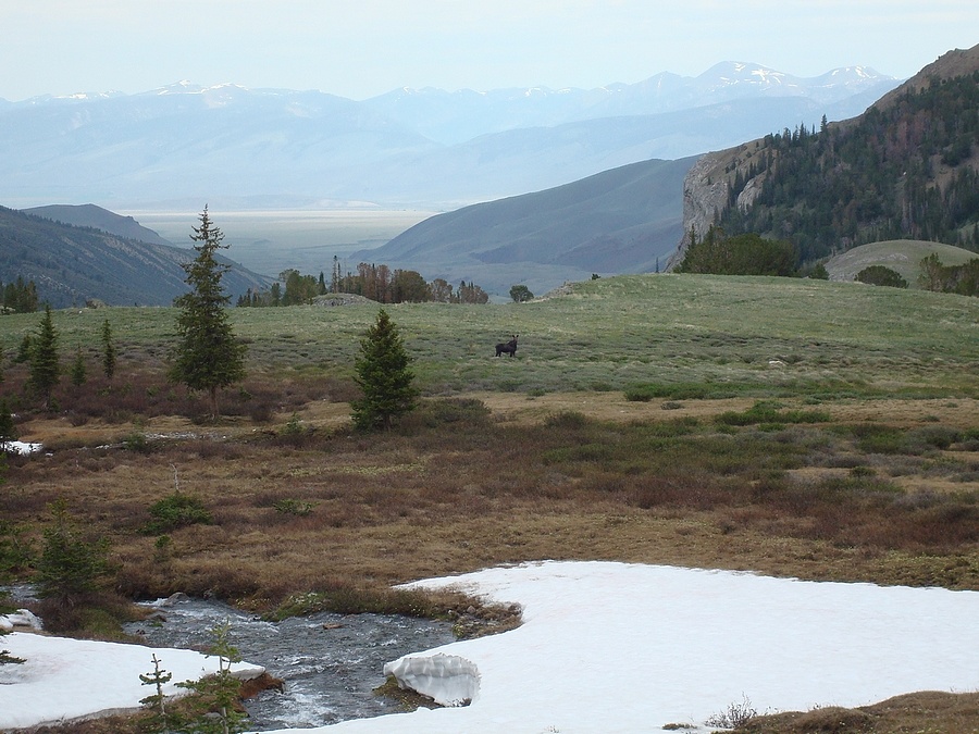
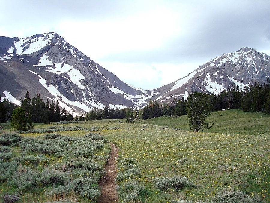
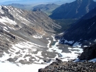
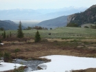
Merriam Lake to West Fork Pahsimeroi - After a good night of sleep, we awoke to great weather and awesome views all around us. We took it easy for a few hours, taking in the scenery and doing some exploring close to camp. Eventually we pried ourselves away and hiked back to the trailhead where we re-stocked on food and began the hike up towards Leatherman Pass and Pass Lake. This section of the trail was much easier, and only gained about 1300' in the 3 miles to our eventual campsite. The upper valley was very beautiful, and the wildflowers were just starting to take over. We even saw a cow elk grazing in the meadow. With thunderclouds looming, we hightailed it into the trees around the Pass Lake trail, and ended up with a great campsite next to the trail at about 9500' elevation.
Dayhike to Pass Lake - After having a bite to eat waiting for the rain clouds to pass, we decided to take a hike up to Pass Lake. There were quite a few snowfields to cross along the way, especially around the lake. The lake itself was just barely starting to thaw, which made for a cool setting. The rock in the area was pretty unique, almost moon-like, and we did a little exploring before heading back down to our campsite, scaring up a mule deer along the way. I'd seen a few photos of Pass Lake, and always thought it looked pretty barren. But there were actually a few trees up there, and a handful of places to camp (after the snow melts off of course). Once back at our camp, we had a good time sitting around the fire, and working out the details of our soon to be patented "boot drier-outer rods".
Day 4
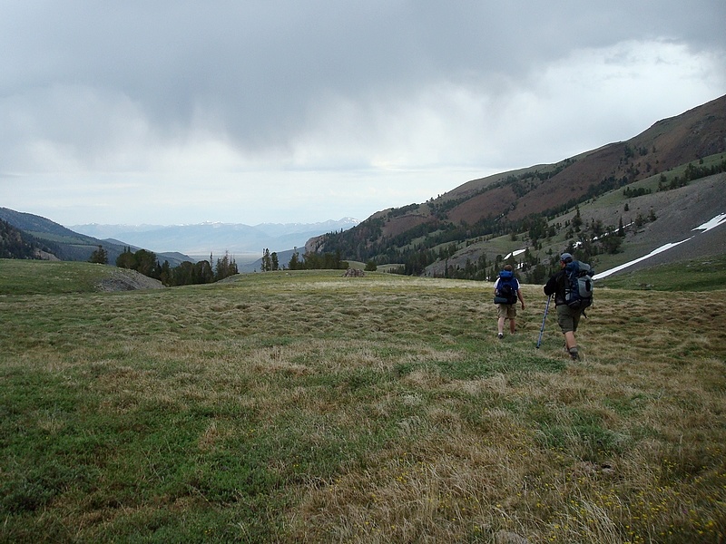
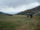
 Back to the car and back on the road - When we woke up, the skies were grey, and it looked like just a matter of time before it started raining. So Ken and Nick broke camp quickly (I was a little less quick), and we hit the trail. Not to far into the hike, we came across a Moose, which was very cool. It watched us for a while, then trotted off into the trees. Then a little further down the trail, we saw another elk. The area is obviously full of wildlife. After that, we set a steady pace back to the car to beat the weather, but it never did rain on us. The drive out was lousy, partially because we didn't want the trip to end, but mostly because the road is in such bad condition. Luckily we didn't get a flat tire, and made it into Mackay for long awaited burgers, fries, and milkshakes, before finishing off the long drive home. Back to the car and back on the road - When we woke up, the skies were grey, and it looked like just a matter of time before it started raining. So Ken and Nick broke camp quickly (I was a little less quick), and we hit the trail. Not to far into the hike, we came across a Moose, which was very cool. It watched us for a while, then trotted off into the trees. Then a little further down the trail, we saw another elk. The area is obviously full of wildlife. After that, we set a steady pace back to the car to beat the weather, but it never did rain on us. The drive out was lousy, partially because we didn't want the trip to end, but mostly because the road is in such bad condition. Luckily we didn't get a flat tire, and made it into Mackay for long awaited burgers, fries, and milkshakes, before finishing off the long drive home.
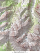
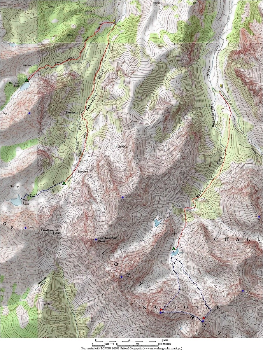
Overview map of our 4-day route.
|
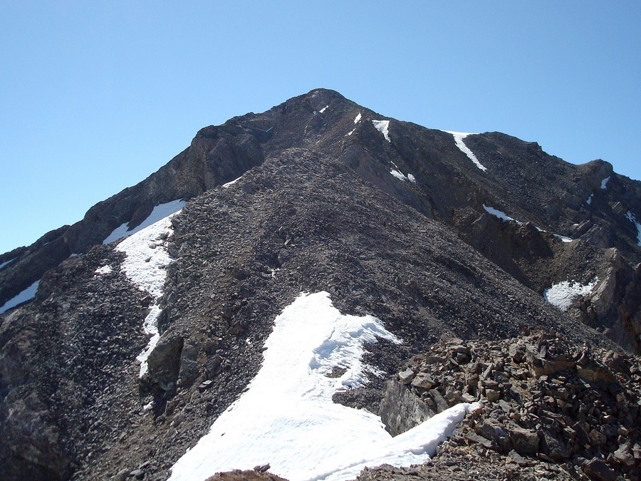
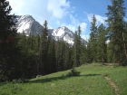
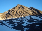
The north face of Mount Church, from the meadow near the East Fork trailhead.
|

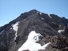
Sketch of the route I used for Church (photo taken the day before).
|
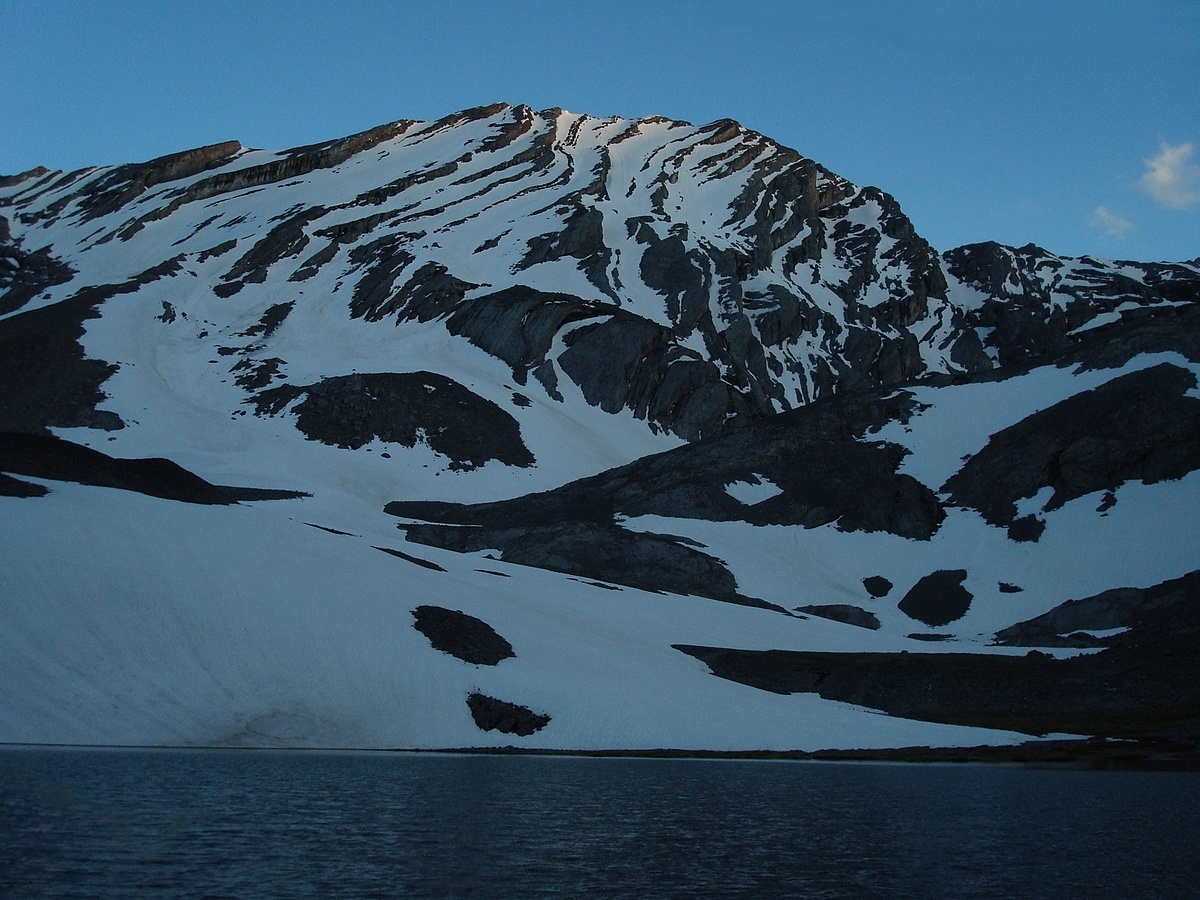
The last rays of sun on Mount Church, from out campsite at Lake 9682'.
|
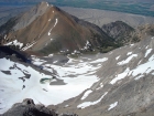
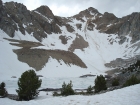
A view of the east face of Badrock Peak, taken from the north face of Mount Church.
|
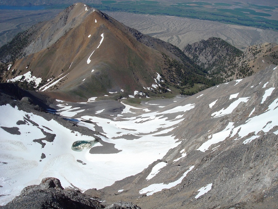
Looking back down at the lake from the summit of Mount Church.
|

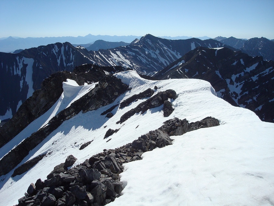
Cornices on the east ridge of Mount Church.
|
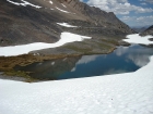
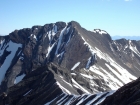
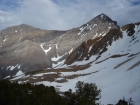
The "standard route" for Church & Donaldson, with the pond still nearly frozen over.
|
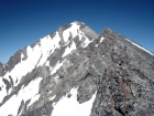
The east ridge of Church from the saddle.
|
The west ridge of Donaldson from the saddle.
|
No Regret Peak from the west ridge of Donaldson. Nick and Nate are the small dots descending one of the snowfields.
|
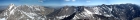
Summit pano from Donaldson, spanning about 200 degrees from Church to McCaleb.
|
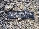
Donaldson's summit banner.
|

Our campsite at Lake 9682', with the bighorns near the center of the photo.
|
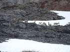
This herd of Bighorn Ewes and Lambs watched us break camp.
|
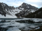
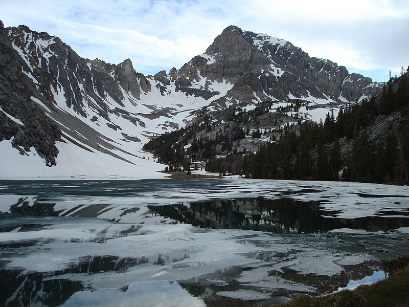
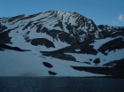
Evening view of Mount Idaho and partially frozen Merriam Lake.
|
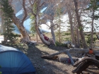
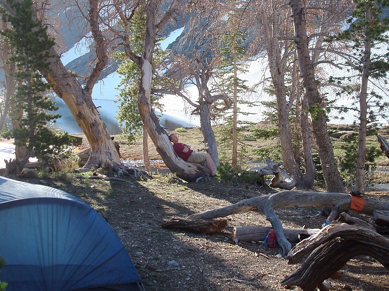
Ken enjoying the scenery in a comfortable recliner.
|
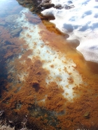
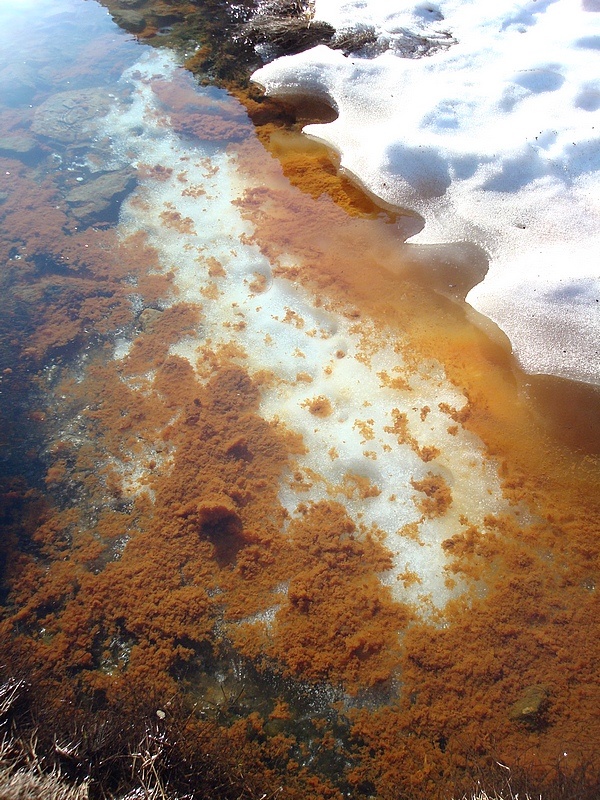
Some interesting algae growing on top of the ice in Merriam Lake.
|

Pano of Mount Idaho and Sacajawea Peak from the inlet to Merriam Lake.
|
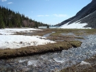
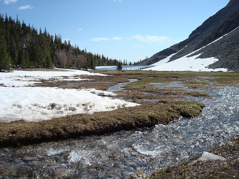
Merriam Lake's inlet stream.
|
Ken and Dave getting ready to hit the trail.
|

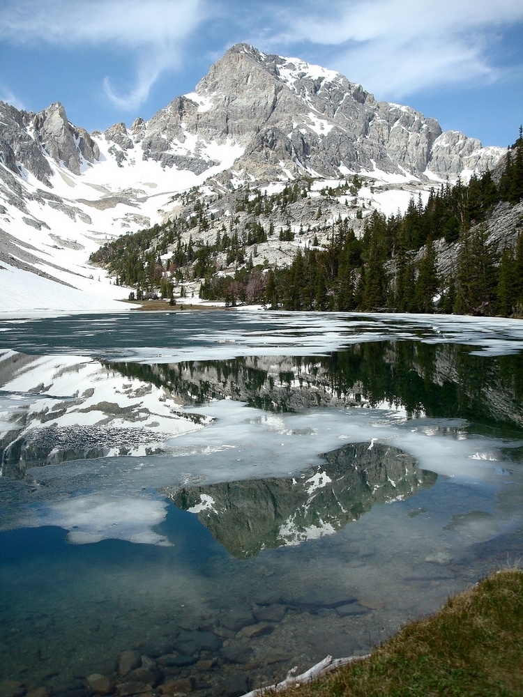
Mount Idaho reflecting in a partially frozen Merriam Lake.
|
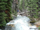
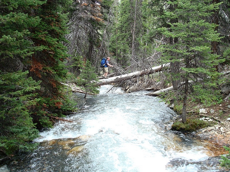
Ken crossing a log over the West Fork Pahsimeroi River.
|

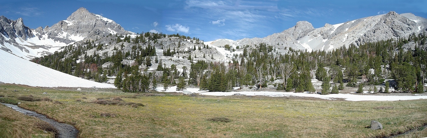
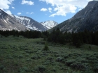
Pano taken in the upper Pahsimeroi Valley, including Leatherman Peak, Leatherman Pass, and Whitecap Peak.
|
Elk near the trail with Whitecap Peak in the background.
|
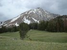
A view of Leatherman Peak from our campsite, located near the trail to Pass Lake at about 9500'.
|
The west face of Leatherman Peak.
|
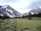
Peak 11909' and Leatherman from the trail to Pass Lake.
|
A mostly frozen Pass Lake, with Peak 11967' above.
|
Mule deer we saw on the trail from Pass Lake.
|

The morning sun shining on Whitecap Peak, with storm clouds building in the background.
|
Moose in the upper Pahsimeroi Valley.
|
Ken and Nick hiking down through a meadow in the upper Pahsimeroi Valley.
|
Looking back on Leatherman Pass.
|

One final view of Leatherman Peak from the trail.
|
|