|
Whenever there's an opportunity to spend time on the trail with more experienced climbers, I always try to take advantage of it. This year's IdahoSummits fall outing definitely fit the bill. Dan chose an excellent location in the Lost River Range with multiple options and combinations of peaks to link up. All but one of the 9 man group drove up the Friday night and made camp at the Loristica campground, not far from Pass Creek Summit. The campfire stories were great and I think it was hard for all of us to leave the conversation and turn in for the night in spite of the big day we had planned.
The next morning most of us broke camp and were ready to hit the trail by around 7:30 am. The early part of the hike was on good trail from the Wet Creek trailhead up to the saddle between Warren Mountain and Octoberfest Peak (10800'). That was a good warm-up, then we left the trail at the saddle and headed up the steeper terrain on the east ridge of Octoberfest. Soon we were at the 10400' level where we had excellent views of the large 10000' basin to the southwest and our route for the day, which was to traverse the three other peaks that surrounded the basin. We even got to watch 3 bull elk make their way across the basin, an unlikely site with hunting season in progress. From here we made our way up the last 400' to the summit of Octoberfest where we had great views of the gnarly rugged that surround the headwaters of Wet Creek.
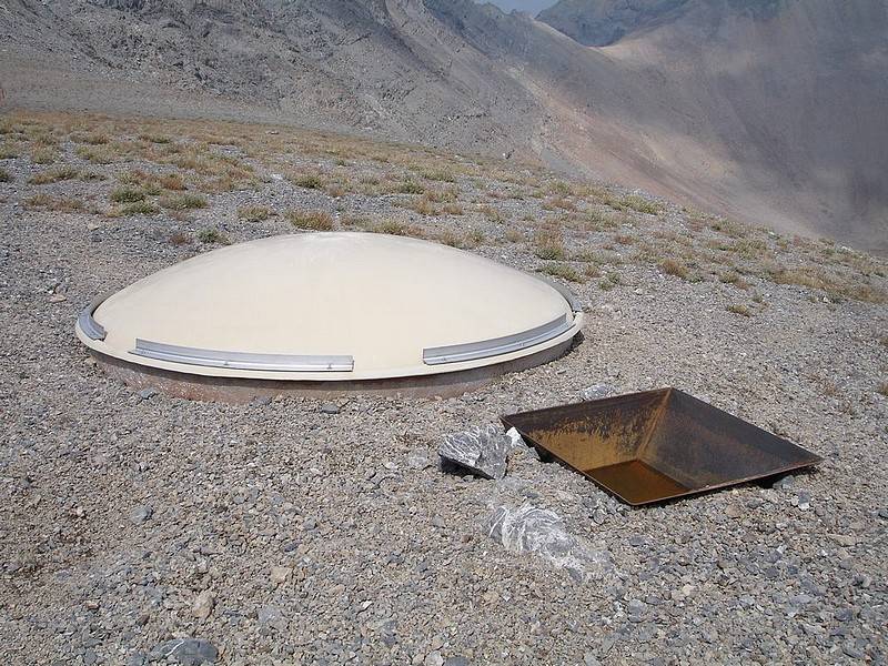
After a short break, we made a quick descent down into basin and then began making our way up Hidden Peak (11308'). The 1300' of gain was the steepest climbing of the day, but was Class 2 on stable rock so it went pretty quickly. We took a longer break on top of Hidden and shared good conversation while soaking in the views of the basin below as well as USGS Peak and Mount McCaleb to the west. After a while we made our way down about 500' feet to the saddle between Hidden Peak and Wet Peak. Next up was a 500' climb up the north ridge of Wet Peak, where we encountered our only Class 3 scrambling of the day. But like all of terrain we'd been on so far, the rock was stable and the climb was very enjoyable. We didn't stay on top of Wet very long, but did manage to find 2 of the 3 triangulation benchmarks on the summit. Looking down on the saddle between Wet Peak and South Wet Peak (11138') we could see some kind of big white disk. After checking it out for a while up close, we decided it had to be some kind of weather station. From the saddle we made our final climb of the day, an easy 300' up to the summit of South Wet Peak. Here took a longer break and checked out the views to the south of Sheephead Peak and Invisible Mountain.
After relaxing on the top of our fourth peak of the day, we made our way down to the floor of the 10000' basin and crossed over to the low-point between Octoberfest and Hidden Peak. The plan was to drop down into the Wet Creek drainage that lead back to the trailhead. We figured this was doable since we knew the Elk had crossed through this notch earlier and someone had spotted a trail down in the valley visible from on top of Octoberfest. It was a great opportunity to see even more new terrain. This ended up working out pretty well for the most part. We were able get some pretty unique views of Hidden Peak and the gnarly north side of Octoberfest. Wet Creek also lived up to its name and the surrounding area was green and lush, a rarity in the Lost Rivers. The lower part of the drainage was a little cumbersome as we zig-zag'd back and forth across the creek, crossing numerous downed trees. Most of the party made it back to the trailhead without incident, but a couple of us got to see a bit more of the area than we'd planned. After overshooting the junction with the trailhead a bit, we had to circle back up and around to the road leading to the campground. This added a couple miles and an extra hour to the day for us. Other than taking the "scenic route" at the end, I couldn't have asked for a better day. We got to enjoy excellent and unique views of the rugged Lost River Range and got to know some new people. A fantastic day!
Lastly, this write-up wouldn't be complete without mentioning one other thing related to the group. Eight of us (Dan, Aaron, George, John R, Pat, John P, Art, and myself) traveled together for the most part with Rob L going at a slightly faster pace. He'd given us a big head start, but passed us on Octoberfest while jogging up the ridge. For the first part of the day, we continued to watch him traverse around the basin ahead of us at an amazing rate. It is one of the most impressive displays I've seen. But what do you expect from someone who climbed all 9 of Idaho's 12ers in under 39 hours last summer...
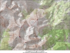
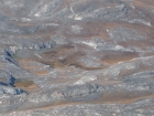
Map showing our figure-eight route.
|
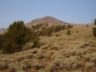
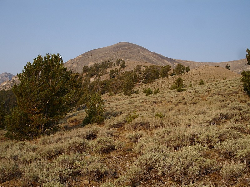
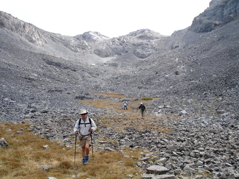
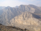
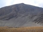
This gives you a feel for the terrain low on the eastern slopes of Octoberfest Peak.
|
Three bull elk crossing the 10000' basin, as seen from the 10400' shoulder below Octoberfest Peak.
|
The east face of Hidden Peak, as seen from the 10400' shoulder below Octoberfest Peak.
|
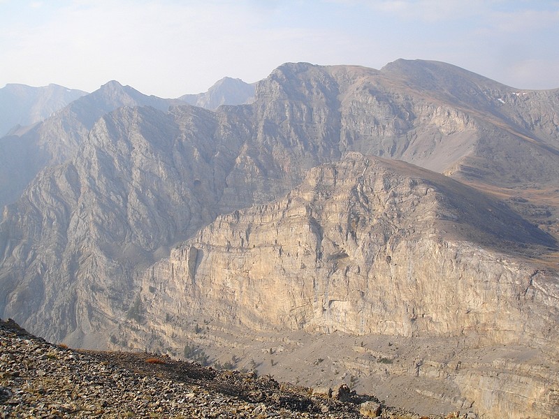
Here's the east face of Wet Peak, as seen from the 10400' shoulder below Octoberfest Peak, 10000' basin below.
|
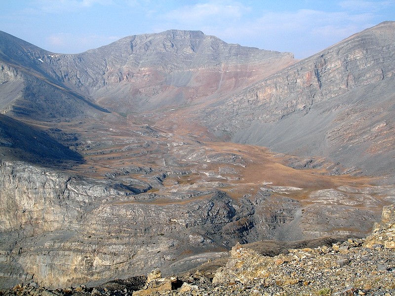
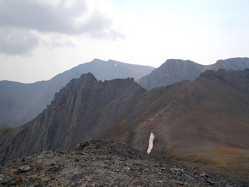
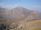
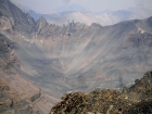
Shown here is a steep canyon draining into Bear Creek. South Wet Peak is on the far right, Invisible Mountain is in the distance on the left, and a portion of Sheephead Peak can bee seen in the center.
|
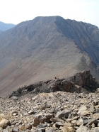
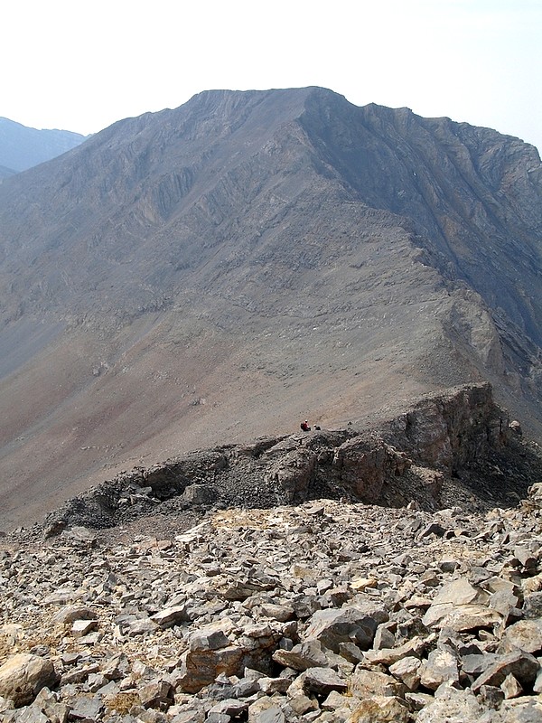
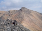
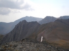
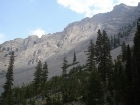
Wet Peak as seen from Hidden Peak. Several members of the group are visible below.
|
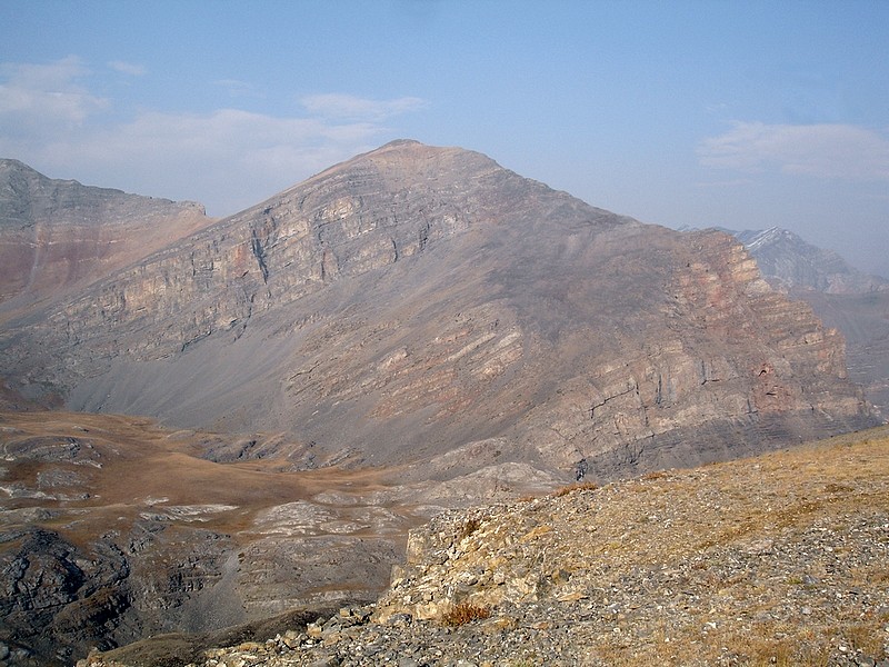
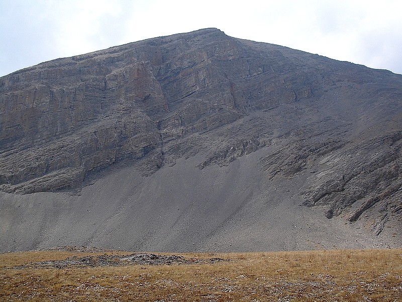
This is the east side of Mount McCaleb as seen from Hidden Peak.
|
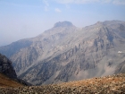
The southeast face of USGS Peak from Hidden Peak.
|
Scrambling the north ridge of Wet Peak with Hidden Peak in the background.
|
Some cool towers northwest of Hidden Peak.
|
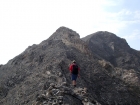
Heading towards the crux of traverse, some Class 3 terrain on the north ridge of Wet Peak.
|
The final approach to the summit of Wet Peak, with the 10000' basin below.
|

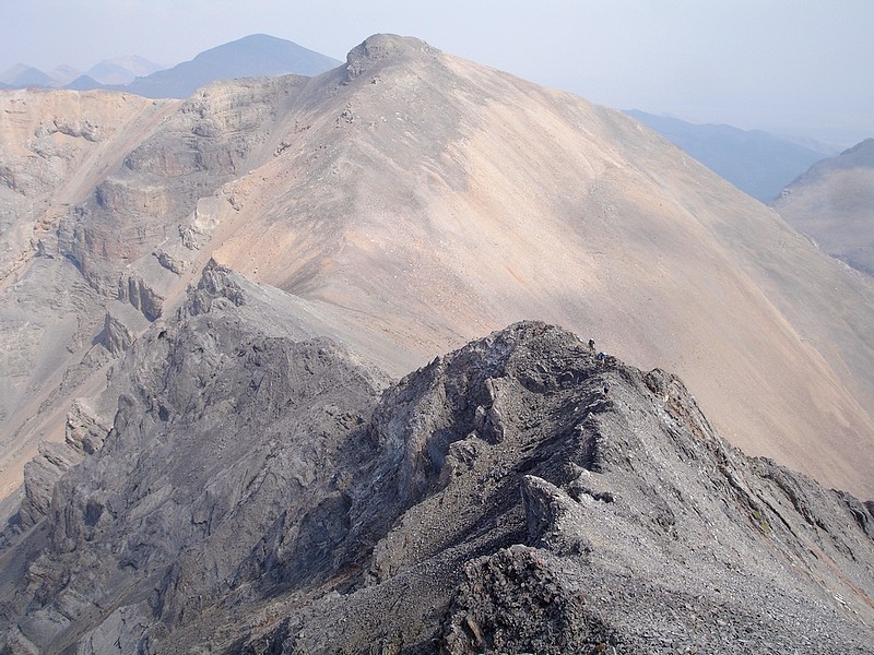
Climbers making there way up the north ridge of Wet Peak, with Hidden Peak behind.
|

A weather station of some kind sits on the saddle between Wet Peak and South Wet Peak. The disk is about 7' in diameter.
|
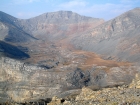
11ers Invisible Mountain and Sheephead Peak as seen from South Wet Peak. Storm clouds are moving in.
|
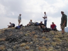
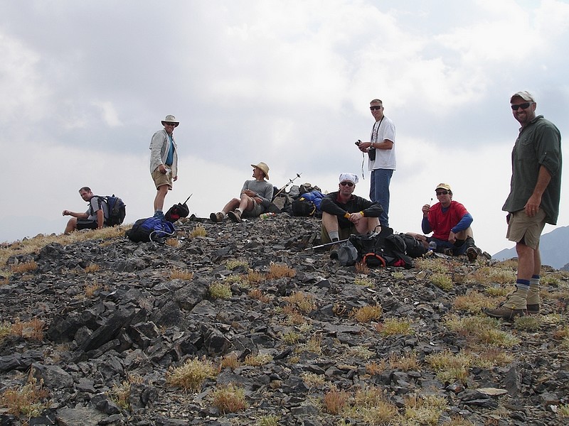
Here's the group taking a break on the summit of South Wet Peak.
|
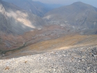
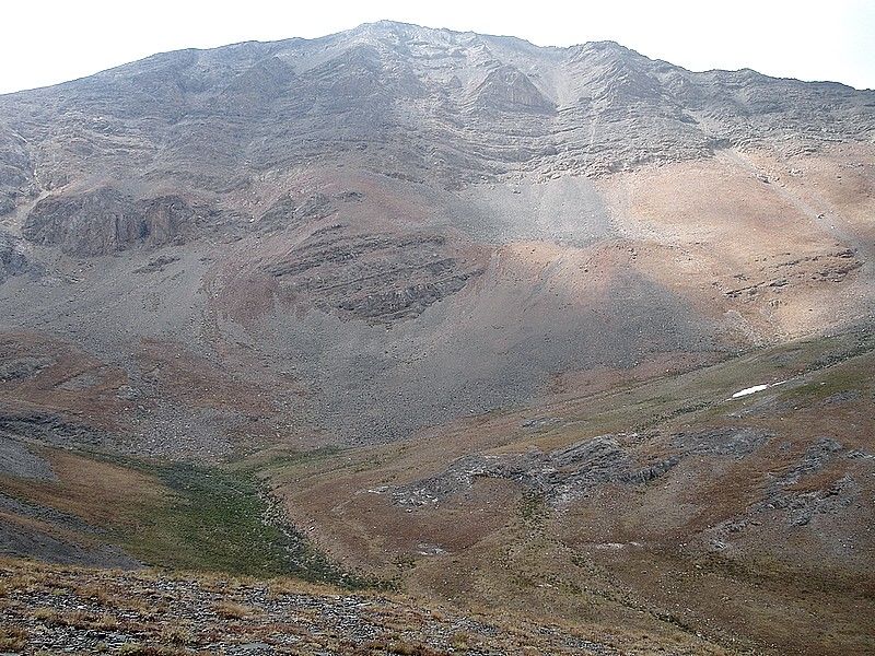
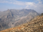
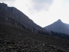
Looking down on the 10000' basin with Octoberfest Peak in the background to the right. The notch in the center leads to the Wet Creek drainage.
|
The east face of Wet Peak, as seen from the 10000' basin.
|
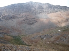
This is the steep east face of Hidden Peak from the 10000' basin below.
|

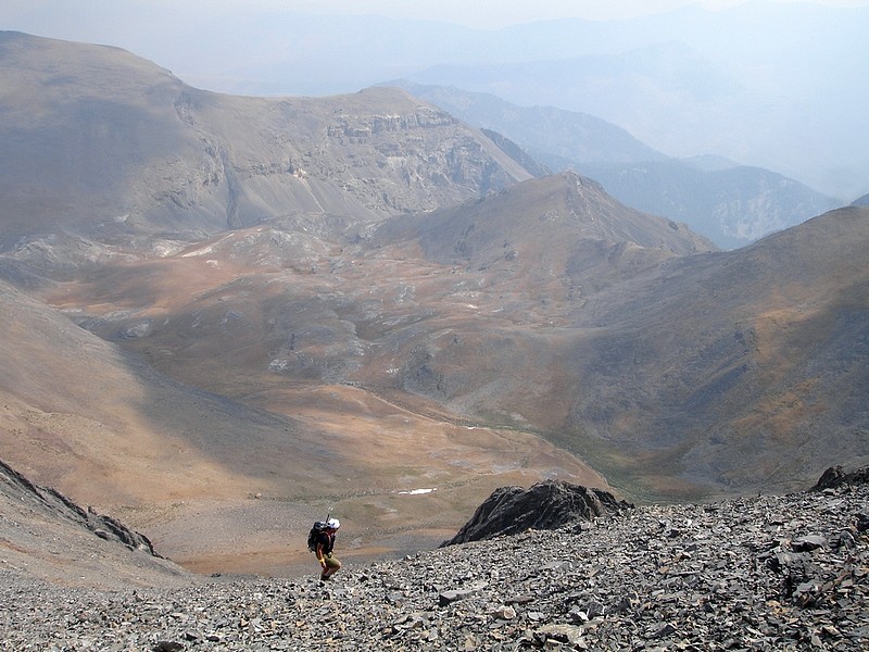
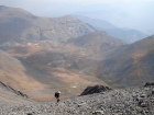
Here we are leaving the 10000' basin, beginning the descent to Wet Creek.
|
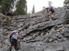
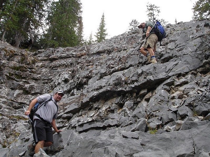
We got to down-climb this blocky wall on our way down to Wet Creek.
|
This cave on the north side of Octoberfest Peak is one of many interesting features we saw in the upper Wet Creek drainage.
|
Here are some deep folds in the north side of Octoberfest Peak, with a pointed perspective of Hidden Peak seen on the right.
|
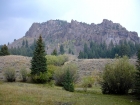
Fall colors on a hillside just north of the Wet Creek trailhead.
|
|