|
Chamberlain Basin Loop
Backpacking in the White Clouds
July 11-13, 2003
The White Cloud Mountains are located in central Idaho, on the east side of the Sawtooth Valley. They are packed full of awesome alpine scenery, but aren’t heavily traveled since more folks tend to visit the nearby Sawtooths instead. JJ had suggested the White Clouds for backpacking trip this summer, and I was all for going to check out a new area. After reading through the Margaret Fuller book, we came up with a loop from the Fourth of July trailhead, past Born Lakes, Four Lakes Basin, Quiet Lake, Baker Lake, Castle Divide, Chamberlain Basin, Washington Lake, and back to the trailhead.
Day 1 – Fourth of July trailhead to Quiet Lake
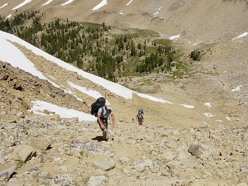
After camping at the trailhead the night before, we (JJ, Jordan, Arron, Ken & Dave) made our way up the well used trail to Fourth of July Lake, then up the switchbacks to Antz Basin Divide for a great view of Antz Basin (formerly Ants Basin) and alabaster colored David O Lee Peak. It was very impressive! Next, we descended to the north, and followed the unmapped trail over to Born Lakes for a lunch break and some fishing. The lakes are full of Cutthroat, and we caught/released several before hitting the trail again. Next up was the most strenuous section of the trip, a steep climb up to the pass that would lead us to Four Lakes Basin. There wasn’t much a trail up through the rocks, and our multi-day packs made for kind of slow progress, but eventually we made it to the top and were rewarded with some awesome views. We weren’t in any hurry to leave, but the high-alpine Four Lakes Basin was beckoning us so down we went to do some exploring and a little more fishing. The basin is very impressive, but also very fragile so camping there isn’t advisable.
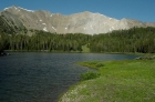
So we made our way down the outlet stream to Quiet Lake, and set up camp on the west side of the lake. The lake is a true gem, with Serrate Ridge as a backdrop and the northern slopes of Castle Peak high above. The mosquitoes seem to like the scenery there too, as there were an abundance of them there enjoying the surroundings. Fortunately they died down later in the day, and I took a relaxing after-dinner hike up the inlet stream and watched mountain goats climb around on the rocks south of the lake.
Day 2 – Quiet Lake to Chamberlain Basin
We made a leisurely departure the next morning, and headed down Slickenside Creek past Noisy Lake to Baker Lake. This section of trail isn’t used much, and its petty steep so climbing up it would have been a challenge, but climbing down wasn’t bad. From the marshy Baker Lake, we headed south to find the main trail. This seemed to take quite a while, but we finally found it. Next was the climb up to Castle Divide. As we got higher and the trees started thinning out, the views opened up and the gigantic east face of Castle Peak was right on top of us. I was so busing soaking in the scenery that I didn’t even notice the steepness of the trail. This was my favorite section of the entire hike, and we even took a side trip from the divide up to Pt 10248’ from some even better views. In spite of the windy conditions, we didn’t want to leave. But there were still a few miles to go, so we headed down the other side and around to Chamberlain Basin.
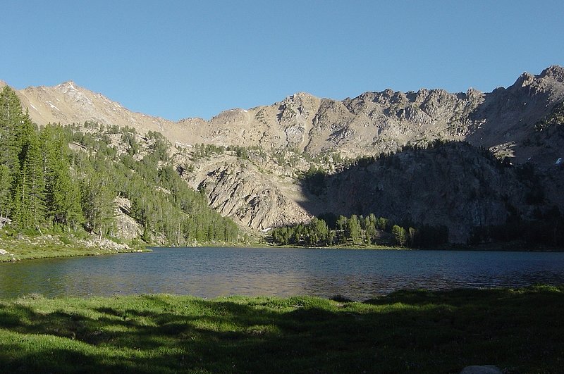
Once in Chamberlain Basin, we passed the lower lake, and headed up to Lk 9477’ to make camp. It was a beautiful, as was the next smaller lake up above. (Although that one did claim a pair of glasses that made the walk out a bit less scenic for one hiker.) The fishing was great too, and we cooked up a few for dinner on a flat rock in the fire.
Day 3 – Chamberlain Basin to Fourth of July Trailhead
The next morning I don’t think any of us wanted to leave, so we didn’t exactly get an early start. But it was a bright crisp summer morning, and the hiking was nice. We passed by the lower lake, and made our way up the trail to the ridge for a great view of the south face of Castle Peak. From the ridge we descended down into the forest before climbing back up to Washington Lake where we stopped for one last snack break before heading back to the trailhead. It was a great trip, and I came away from it with a huge appreciation for the area. The first of many trips into the White Clouds, I am sure.
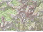
Overview map of our route, about 28 miles round trip.
|
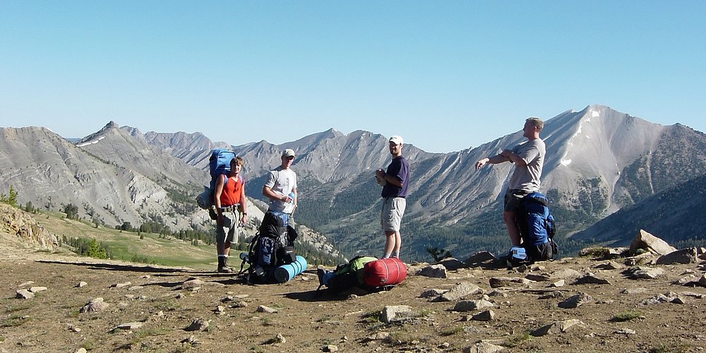
The view north from Antz Basin Divide, David O Lee Peak in the background, Arron, Jordan, JJ, and Ken in the foreground.
|
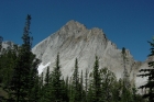
Fourth of July Peak, to the south of Antz Basin Divide.
|
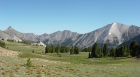
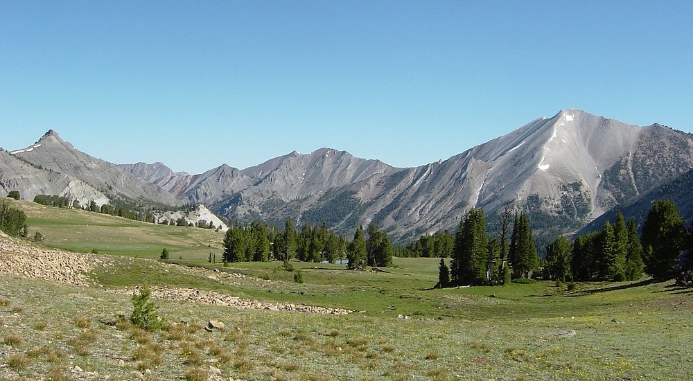
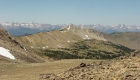
The northern White Cloud Peaks as seen from Antz Basin.
|
This is "Devil's Staircase" above one of the Born Lakes.
|
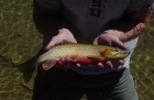
The largest of many cutthroat trout we caught at Born Lakes belonged to Jordan (as usual).
|
The pass leading to Four Lakes Basin from Born Lakes.
|

Looking down the towards Born Lakes from the top of Four Lakes pass.
|
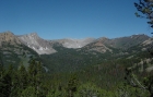
The view west from Four Lakes pass includes Antz Basin, Blackmon Peak, and the Sawtooths in the background.
|
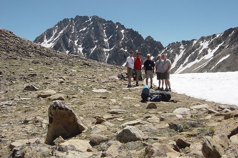
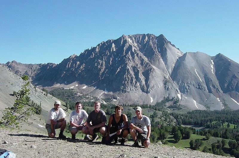
Group photo taken on Four Lakes pass, with Castle Peak behind us.
|

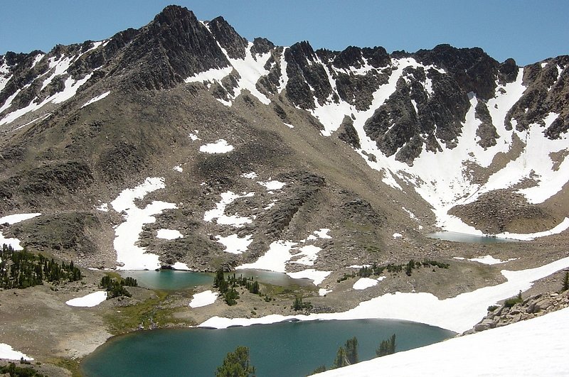
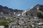
The view down on Four Lakes Basin.
|

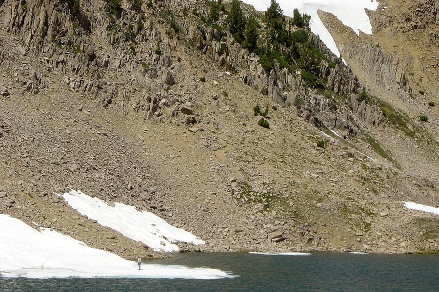
Ken walking on an "iceberg" in Emerald Lake. Notice the crack on the left…
|
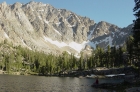
Ken fishing in Quiet Lake with Castle Peak towering above him.
|
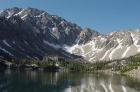
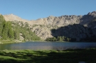
Castle Peak and Quiet Lake as seen from the outlet stream (Slickenside Creek).
|

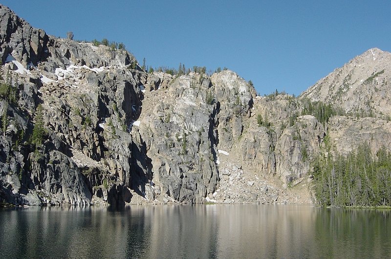
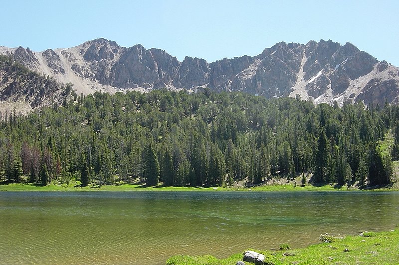
The cliffs behind Noisy Lake.
|
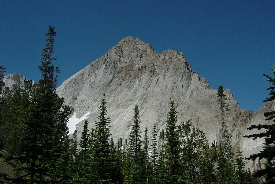
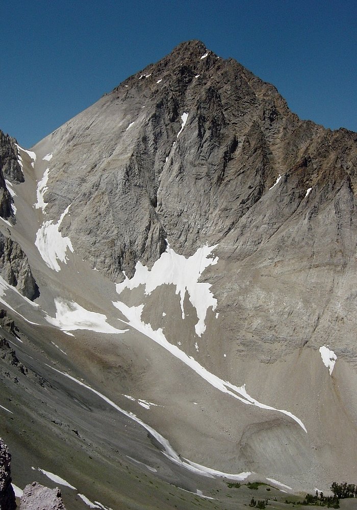
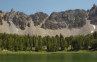
Looking up at Castle Peak from the trail south of Baker Lake.
|
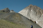
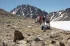
Arron taking a break on a mound above Castle Divide as Ken nears the saddle. Castle Peak behind them.
|
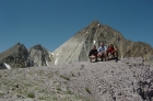
Dave, Ken, and Arron on Point 10248' with Castle Peak behind us.
|

The gigantic east face of Castle Peak, as seen from Point 10248".
|
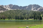
Chamberlain Lake 9477'.
|
Looking to the west from the outlet of Chamberlain Lake 9197'.
|
The group posing on the pass south of Castle Peak.
|
The view west from the trail into Washington Basin. Croesus Peak is on the left with the steep face, Washington Peak is back and to the right.
|
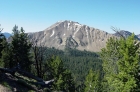
Fourth of July Lake.
|
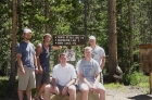
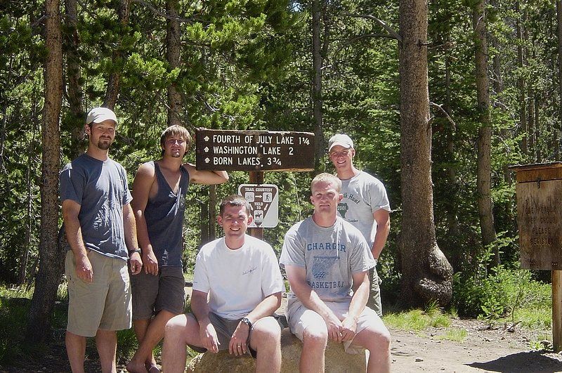
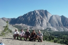
The motley crew back at the trailhead after the hike.
|
|