|
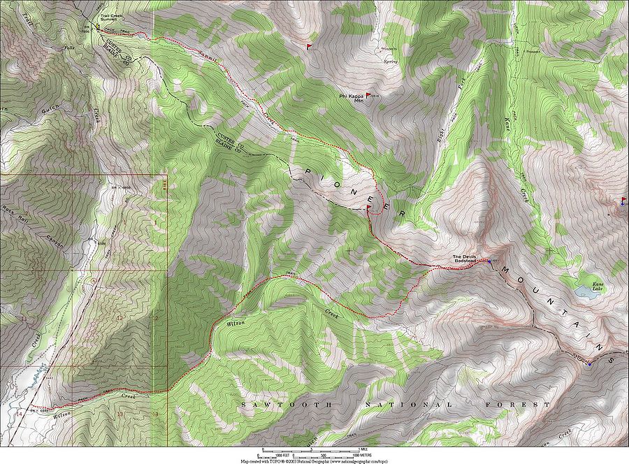
The Devils Bedstead West is located in the northwest corner of the Pioneer Mountains in central Idaho outside of Ketchum. It is the easternmost 11,000 peak in the range. The most common route starts at Trail Creek Summit, follows the trail up the Summit Creek drainage, drops into the upper Kane Creek basin, and then climbs up to the saddle at the base of the peak’s west ridge.
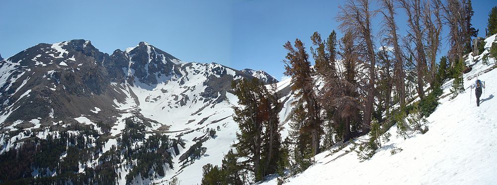
Michael and I got an early start and were on the trail hiking by 7:30. We hoped this would be early enough to give us firm snow, but unseasonably warm temperatures prevented a hard overnight freeze. The lower valley was very nice, although we couldn’t take advantage of the trail since it was buried in snow most of the way. Instead, we hiked along the north side of the valley where there was less snow, but more avalanche downed trees to deal with. Still we made decent time until we neared the saddle, where there was a lot more snow coverage, much of which was quite soft. We angled up to the ridge at about 9800’. Near the ridgeline, Michael enjoyed wallowing in some waist-deep slush for a while until we finally got over the top into a more sun crusted section.
The sun was already soaking the snow in the upper Kane Creek basin, and we debated for a while about whether or not to descend into the basin and risk more deep post-holing, or heading up the ridge to traverse across to Devils Bedstead West. Eventually we decided on the traverse option, but some cornices on the saddle sent us a bit higher than planned. So high in fact that I couldn’t resist continuing up the west face of Peak 10,419’ (SV Peak) to tag the summit. The face was fairly steep, and the rock was very loose and less than enjoyable. Michael and I agreed that we’d never done some much work just to summit an obscure unnamed Idaho peak. The views were great though, and it put us in good position to assess our ascent options (more on that later). After a snack, we began making our way down the ridge back towards our originally planned destination. I’d hoped the south facing side of the ridge would be snow free, but that didn’t entirely pan out. Fortunately it wasn’t too bad though, and we followed fresh goat tracks up and over Peak 10,380' (Right Kane Peak) on the way to the saddle at the base of DBW.
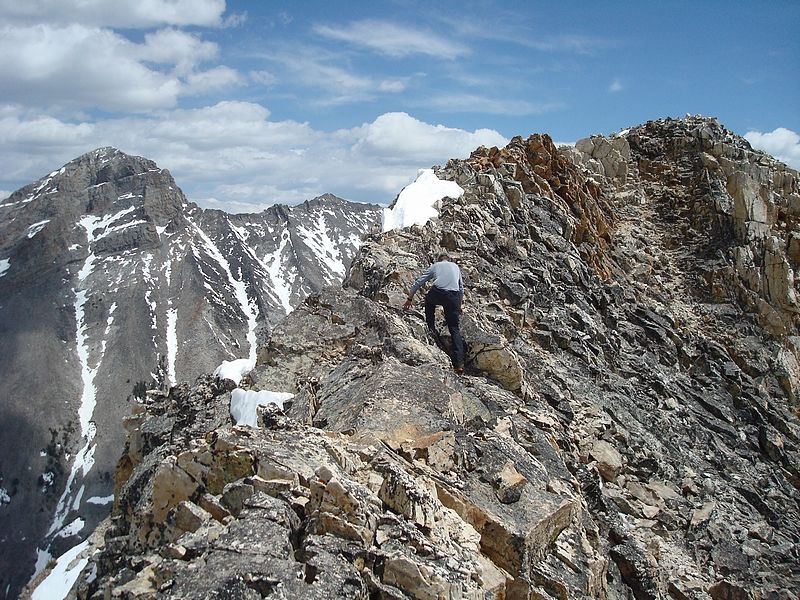
The west ridge was almost entirely snow free, and we made the 1100’ climb from the saddle in about 50 minutes. Not bad considering how much work we’d already put in that morning. Undoubtedly the highlight of the day was the short knife-edge section of ridgeline just before the summit. There was quite a bit of exposure, especially to the north, but the rock was very solid so the going was easy. (Note, you can get around this section by dropping off to the south side of the ridge and avoid the exposure.) The summit views were fantastic and we hung out for a while admiring the massive Devils Bedstead East, Goat Mountain, and Salzburger Spitzl.
It was getting kind of late in the day, so we hustled back down to the saddle and were faced with making a decision on our descent route. We’d been discussing our options, and there seemed to be three choices. Either walk the ridge most of the way back to the car (lots of ups and downs equals lots of work), drop back into the Pass Creek drainage (lots of soft snow equals even more work), or descend to the south to Wilson Creek and hopefully pick up the mapped trail leading back to the road and then hitchhike back up to the car. We ended up choosing Wilson Creek since it appeared to be snow free, and the trail would make for easier going. So down we went, making great time descending about 1500 feet to where the trail should have been. But there was little evidence of a trail even though Michael’s GPS indicated that we should have been right on top of it. As we made our way west we’d see occasional signs of the trail, but probably spent more time looking for it that it was really worth. It wasn’t until about 7300’ that the trail became easier to follow, right near a stream crossing that would make for a nice campsite. Our barking doggies were thankful for the trail, which made for nice hiking next to Wilson Creek until we finally reached the road at almost 5:30. Thankfully, the first northbound car stopped to offer a ride, so we didn’t have to wait long.
It had been a beautiful day in the mountains with fantastic scenery. Even though the climb took much longer than expected, and we ended up with a route that neither of us could have planned, I think the adventure made it worth the extra effort. In the end, we’d spent 10 hours covering about 13 miles and 4000 feet of elevation gain.
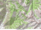
Map of our route, 13 miles round trip with 4000' gain. |
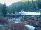
Large beaver dam near the start of the hike. |
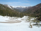
Looking down Summit Creek from near the saddle. |
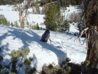
Michael stopping to cool off in the snow on the way up the ridge. |
Devils Bedstead West on the left, Michael on the right. |
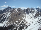
DBE, DBW, Goat, and the Spitzl from 'SV Peak'. |
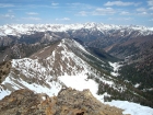
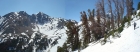
Summit Creek and the Boulder Mountains from 'SV Peak'. |
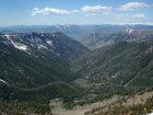
Wilson Creek and Baldy from 'SV Peak'. |

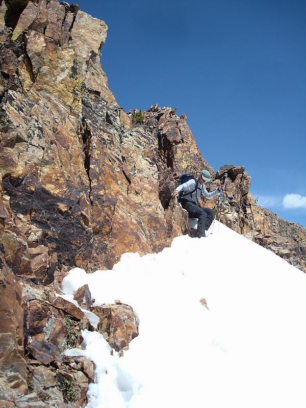
Michael descending from 'SV Peak'. |

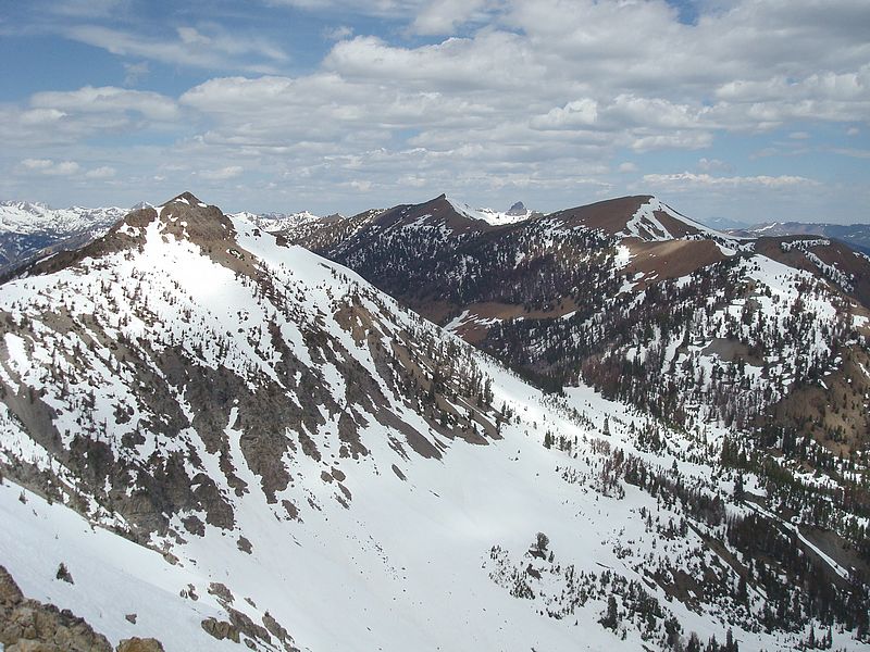
SV Peak, Summit Creek Peak, and Phi Kappa Mountain from the ridge west of DBW. Mystery Peak in the distance. |
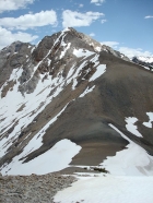
The west ridge of Devils Bedstead West. |

Michael on the exposed ridge just before the summit. |
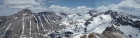
DBW summit pano of Devils Bedstead East, Abel Peak, Goat Peak, and Salzburger Spitzl. The frozen Kane Lake is below. |

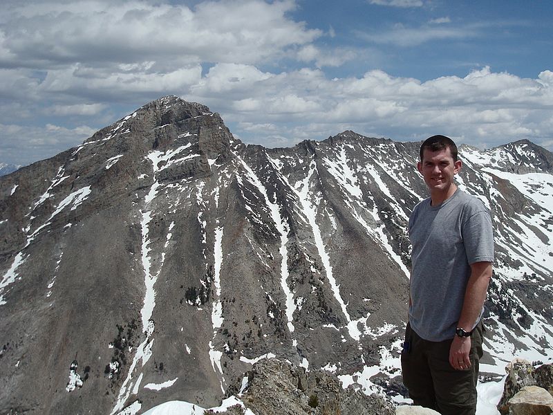
Dave on the summit of DBW with the massive Devils Bedstead East in the background. |
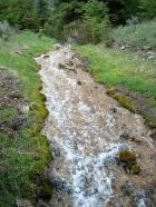
Cool stream flowing into Wilson Creek at about 7300'. |
|