|
|
Related Links:
- IdahoSummits Trip Report
- Splattski Trip Report
- Sean's Trip Report
- Fourth of July Peak: SP, LOJ, MAP
- Ivory Peak: SP, LOJ, MAP
- Ebony Peak: SP, LOJ, MAP
- Washington Peak: SP, LOJ, MAP
- Croesus Peak: SP, LOJ, MAP
- Bible Back Mountain: LOJ, MAP
|
Washington Basin is located on the southern edge of central Idaho's White Cloud Mountains. Its home to many historic mining remnants dating back to the late 1800's. The area is also bordered by a horseshoe shaped ridge system made up of 5 peaks, with a sixth peak just to the north. I'd been studying maps of the area for several months looking at climbing options, and after talking to Dan, it turned out he'd been doing the same. We both had this weekend available, as did JJ, John P, and his brother Tom. We swapped ideas back and forth, including maps with routes drawn in different colors. The route that stood out the most to everybody was the one I'd titled the "black crazy route". It would encompass 6 peaks and two separate groups. We'd leave from different trailheads, and swap car keys somewhere along the way. Seemed pretty ambitious, but the lay of the land offered many options to bail out if needed.
We met up at 6am at Albertson's, then hit the road in two cars. John and Tom went to the southern Three Cabins Creek trailhead, with Dan, JJ, and myself starting at the Fourth of July trailhead to the north.Our first target for the day was Fourth of July Peak (10713'), following the class 2 northwest ridge to the summit. On the way, we weaved in and out of forest burned in the 2005 fire, and passed through some patchy snow. The summit view's were great, especially of Castle Peak, and we also got our first glimpse of some mountain goats we'd see at various points throughout the day, as well as the rest of the peaks on the itinerary. It was obvious that we had our work cut our for us. We took a few photos from the summit, then began the descent down the south face to the saddle east of Phyllis Lake. It was obvious at this point that we'd gotten the better end of the deal when it came to starting points, since the other guys would be stuck climbing up the loose sand and rock at the end of their day. We fanned out a bit on the way down to keep from kicking rocks down on anyone. The saddle area was very nice, and we paused there for a while to check out the steep ridge we were about to climb up to "Ivory Peak" (10408'). We had no beta on this route, but it looked doable. As we climbed the class 3 ridge, it was just as steep as it looked, but the rock was surprisingly stable with lots of good holds. It was great fun for climbing up, but John and Tom's down-climb wouldn't be as enjoyable.
The summit of Ivory Peak was a great vantage point to see the rest of our route, including the ridge leading west to "Ebony Peak" (10514'). Next we made the class 2 stroll to Ebony, and then continued towards Washington Peak (10519'). This section was still mostly class 2, but the loose rock made it challenging in places. We met up with John and Tom along the way, where we swapped keys and route details. Both parties had 3 peaks down with 3 to go, but our remaining ones were easier than theirs. After a quick bite to eat and some goat watching, we went our separate ways. The rest of the climb to Washington was pretty fun, with some easy class 3 mixed in. We took another break on Washington's summit to enjoy the awesome fall weather, then headed down the climbers trail leading south. Our pace began slowing a bit as we rounded the corner at point 10180' and water was running low, but we were determined to reach the higher of the two summits on Croesus Peak (10322'). The 500' of vertical up to the highpoint was tiresome and the trees were a bit dense, but we made it without issue. There was some discussion about whether or not to hit the lower (but named) eastern summit, but we all agreed that it was the sporting thing to do. The goats showed up in this area too and wandered along in front of us, mostly unconcerned about us being there.
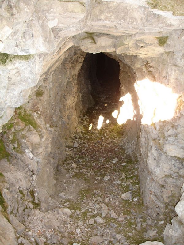
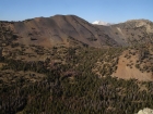
After dropping down off Croesus to the saddle below Bible Back Mountain (9928'), we talked about our options. We were all out of water, running low on energy and daylight, and were guaranteed to miss the meeting time with John and Tom. I'd been mentally preparing all day to reach all 6 peaks, but fatigue was setting in. Fortunately, Dan talked some sense into us, and we began the climb up the last peak. It was loose down low as we passed a deep mine addit, then turned into class 3 scrambling higher on the ridge. Finally we reached the summit, with the sun beginning to set. We didn't hang around long since there were still over 2 miles of hiking left to get to Tom's vehicle. We hippitty-hopped down the hillside, eventually meeting up with the jeep trail, then followed it for what seemed like forever down to the trailhead, where we arrived just before darkness began setting in.
I calculate the day at about 11 miles (mostly ridge traversing) and 5500' of elevation gain spread over about 11 hours. It had been a great day. We were wasted by the end, but the weather had been awesome, the views fantastic, and summitting 6 peaks in a single day was a rare opportunity. I think its safe to say that we all felt very good about the accomplishment.
(Footnote: John and Tom decide to pass on their 6th peak. The down-climb off Ivory had been a challenge, the south ridge of Fourth of July Peak didn't look very appealing, and they didn't want to keep us waiting. Of course they later told us if they'd known how late we were going to be, they could have easily knocked if off with time to spare...)
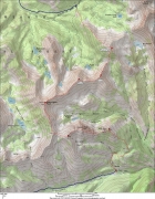
Overview map of our route.
|
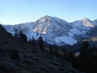
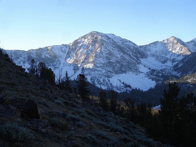
North face of Ebony Peak from the lower slopes of Fourth of July Peak.
|
From the west ridge of Fourth of July Peak, a good view of Blackmon Peak, as well as DO Lee Peak and the northern White Clouds in the distance. In the foreground, you can see the upper reaches of the fire that struck in late 2005.
|

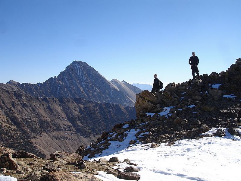
JJ and Dan Standing on Fourth of July Peak with Castle Peak in the background.
|
From Fourth of July Peak, we could see the long day that was ahead of us.
|
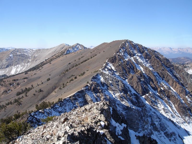
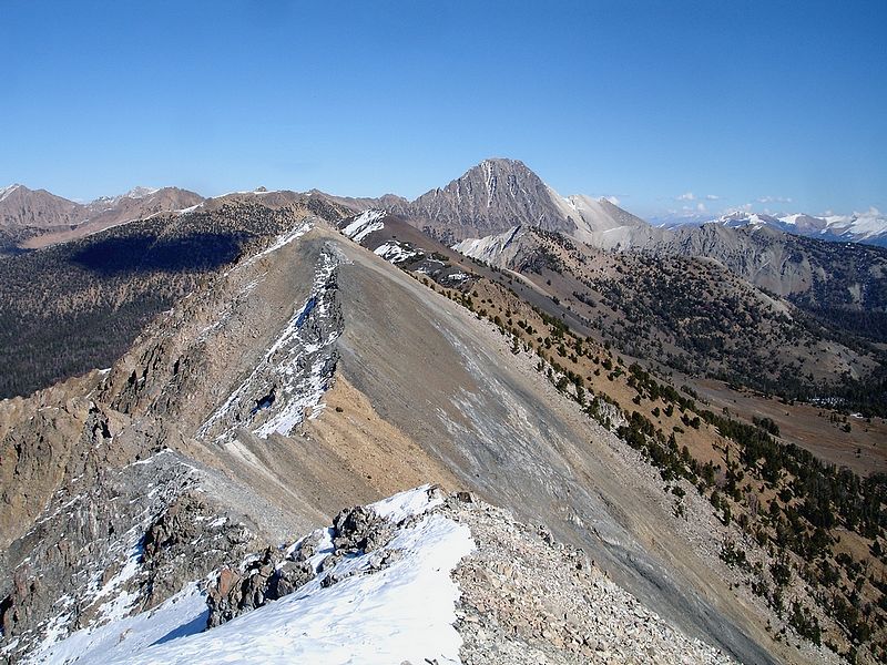
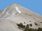
Ivory and Ebony from the slopes of Fourth of July Peak. Phyllis Lake is at the bottom right.
|

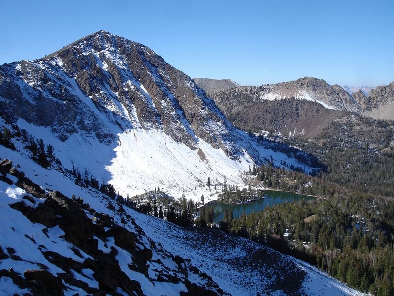
Ebony Peak with Phyllis Lake below.
|
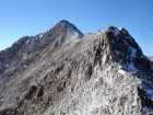
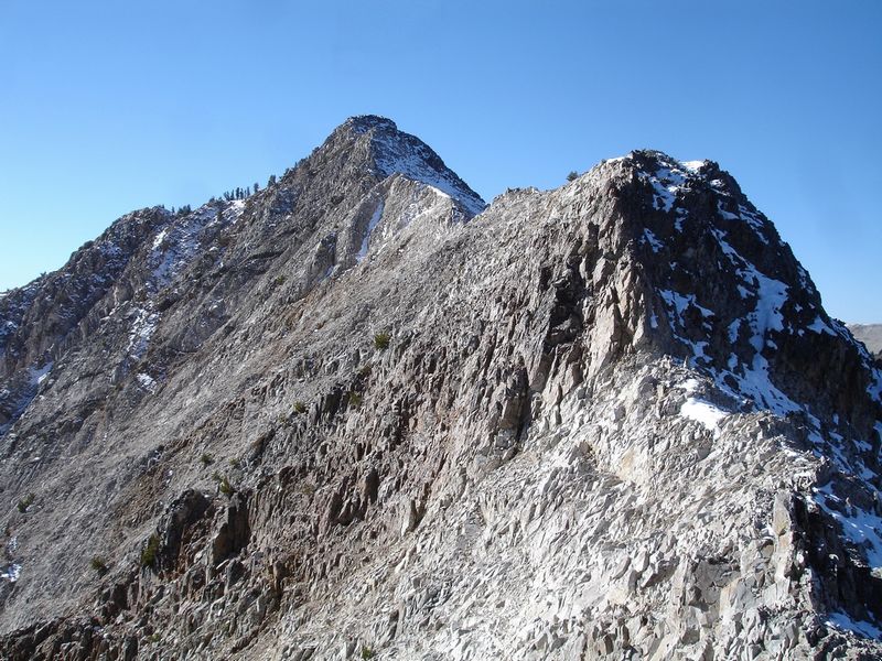
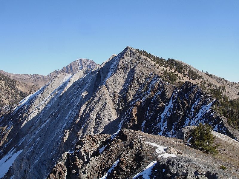
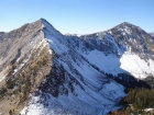
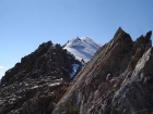
The Class 3 north ridge of Ivory Peak.
|
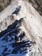
Dan and JJ climbing the steep Class 3 north ridge of Ivory.
|
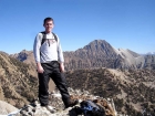
Me on Ivory's summit with ever present Castle Peak in the background.
|

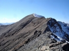
Ebony Peak as seen from Ivory Peak.
|
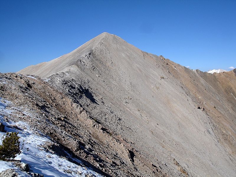
A view of Ivory Peak from the west.
|
Looking up Washington Peak's east ridge.
|
Dan and JJ reaching the summit of Washington Peak.
|
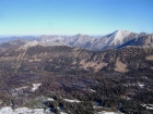
"Six Lakes" as seen from Washington Peak, with DO Lee Peak and the northern White Clouds in the background.
|

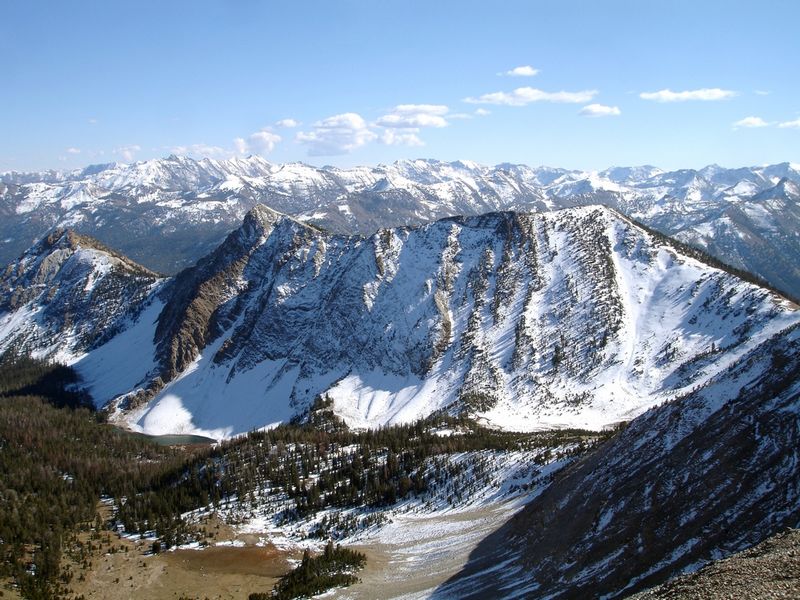
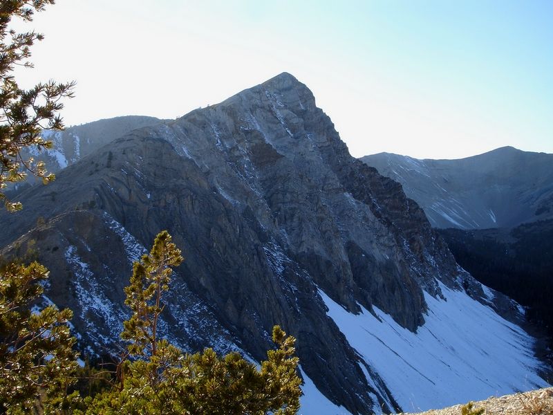
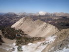
Croesus Peak as seen from Washington Peak with the Boulder Mountains in the background.
|

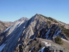
Looking back on the route to Washington Peak. Castle Peak looms in the background.
|
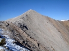
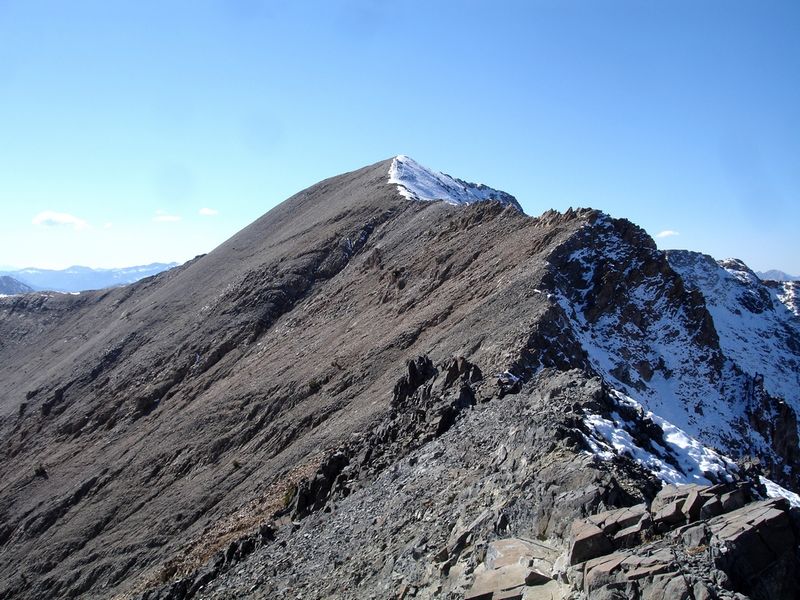
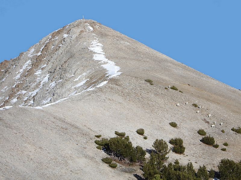
Washington Peak from its south ridge.
|
Mountain Goats grazing on the named summit of Croesus Peak.
|
Ebony Peak as seen from Croesus Peak.
|

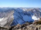
Looking down on BBM from Croesus Peak.
|
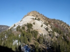
Bible Back Mountain's Class 3 west ridge.
|

Mineshaft we saw on Bible Back Mountain.
|

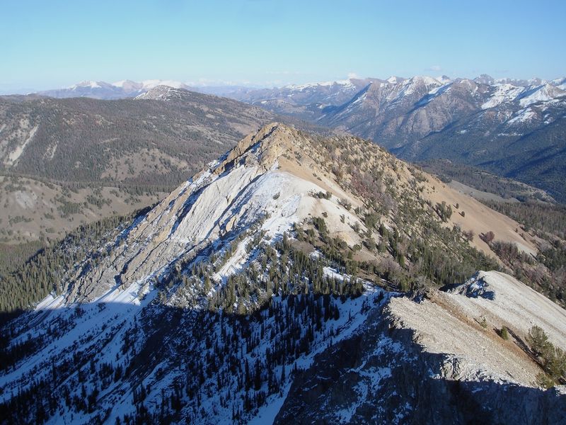
Looking back on Croesus Peak from Bible Back Mountain.
|

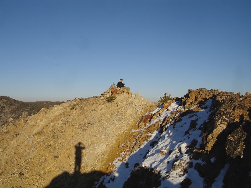
JJ resting on the summit of Bible Back Mountain, nearing the end of a very long day.
|
|