|
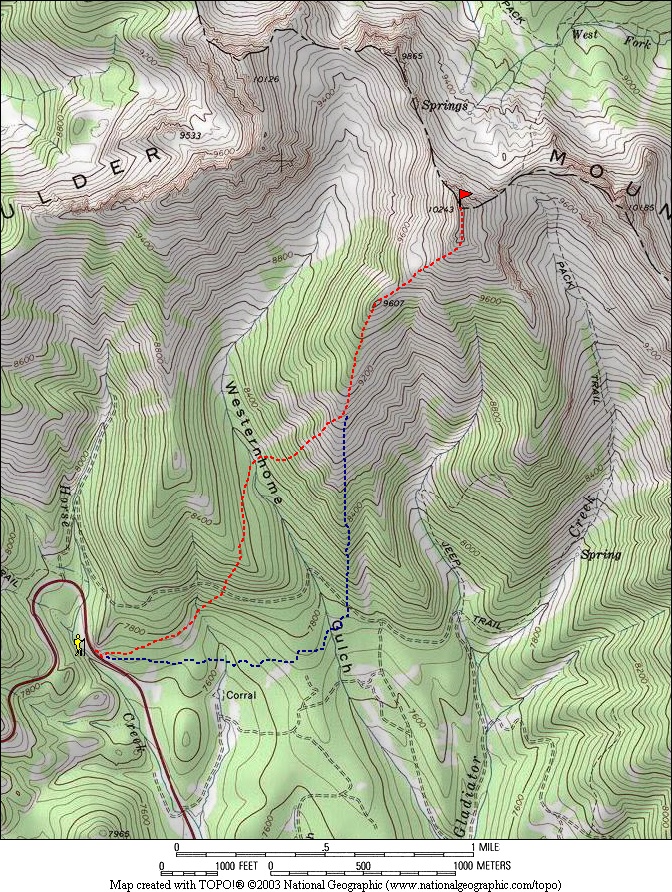
Gladiator Peak is located in the Boulder Mountains, northwest of Ketchum. Since it's not too far from highway 75, Gladiator makes for a nice winter ascent option. After a three-hour drive from Boise, George and I hit the trail at about 9:30am. We started out just below the first switchbacks on the highway below Galena Summit. The best route would have been to stay down low and head east across the flats for about a mile, and then start climbing north. But we started our climb one ridge too soon, so we had to down climb a little into Westernhome Gulch before making our way up the southwestern slopes of Gladiator Peak.
The snow conditions were very good down low (for snowshoeing). A little powder in the shadier spots, but a nice crust most of the way up to the ridge. It was perfect terrain for our televators (heel lifters on the snowshoes). The weather was great too, and we layered down quite a bit to stay cool. Once on the ridge, the views opened up and we made good progress up to Point 9607. The slope got much steeper the rest of the way, and the snow was a mixture of drifts and powder. Often there wasn't much of a bond between the shallow sugar snow and the crust below, so the climbing was a bit tricky in places. Soon enough we made it up to the windblown summit ridge. We took off our snowshoes and finished off the climb by tiptoeing across the mostly flat summit ridge about 50 yards out to the highpoint, this made for a fun ending to the climb It had taken us about 3.5 hours to summit, but we were feeling good thanks to a heavy-duty breakfast burrito eaten during the drive up.
Since the sun was out and winds were calm, we were able to hang around on the summit for about 30 minutes to eat lunch. The views were great of the surrounding Boulders, White Clouds, and Smoky Mountains. But we weren't alone. A couple snowmobiles had made their way up from the other side of the peak and were having their way with the powder in the bowl north of the peak. I told George that this would probably be the last season for snow machines in this area, since CIEDRA would likely pass in 2009 turning this into Wilderness Area.
The climb down was uneventful. We went straight down the south ridge, enjoying the views and the weather along the way. The last mile along the flats seemed to take quite a while, but it was still only about 4pm when we made it back to the car. A day in the mountains like this one is hard to beat.
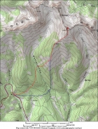
Overview map of the route, 6 miles round trip and 2700' gain. Ascent in red, descent in blue.
|

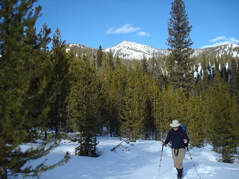
Climbing the southwest slopes under sunny skies.
|
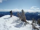
Boulder 11ers Galena Peak, Cerro Ciento, and Easley Peak to the east.
|
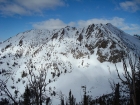
The summit comes into view once on the ridge.
|
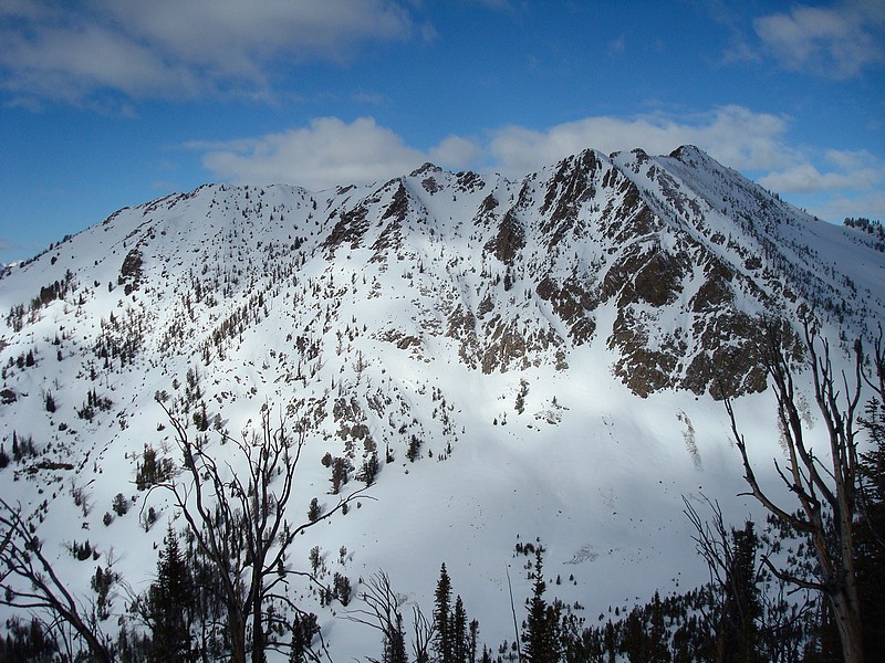
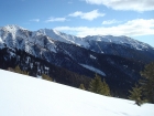
The view west and Peak 10126'.
|
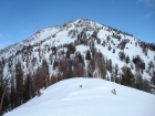
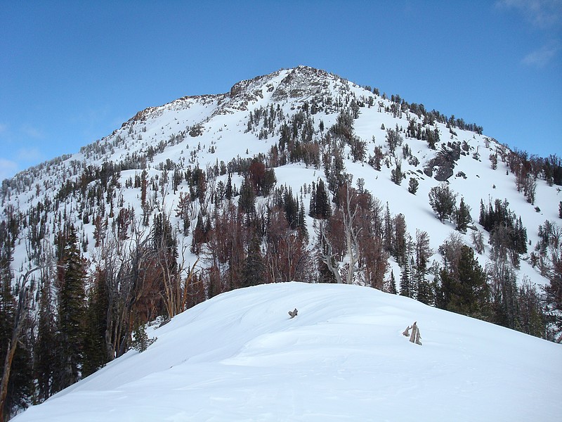
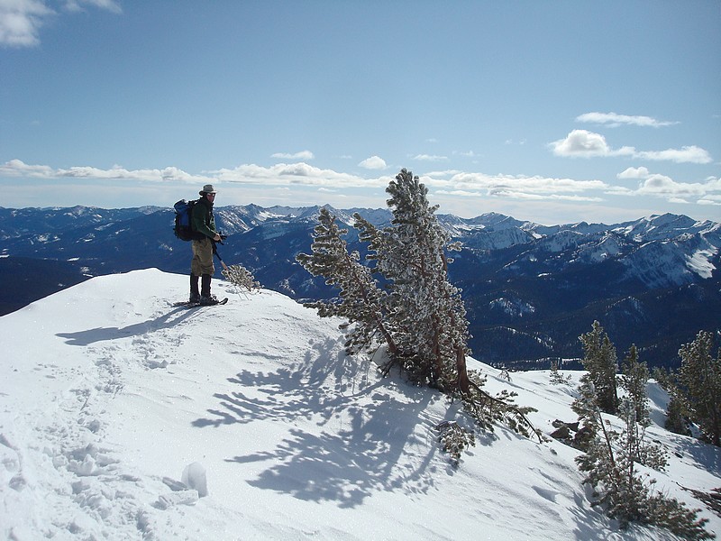
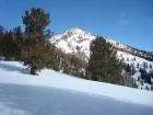
Looking up at the summit from Pt 9607'.
|
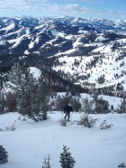
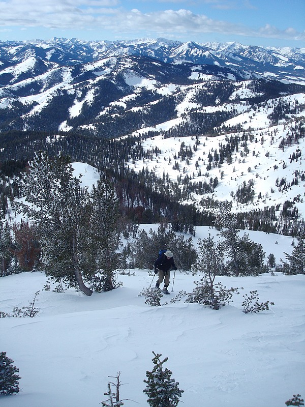
George climbing with the Smoky Mtns in the background.
|
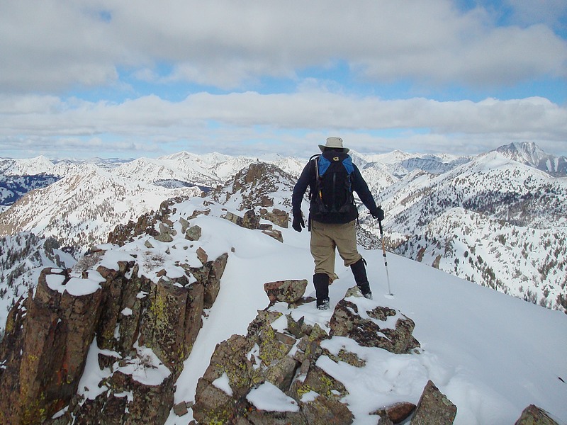
The final stretch to the summit.
|

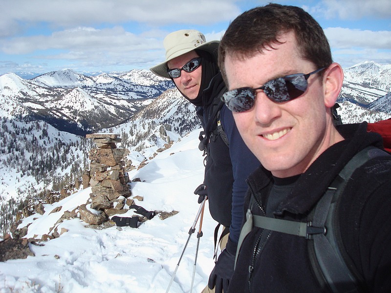
Us with the summit cairn.
|

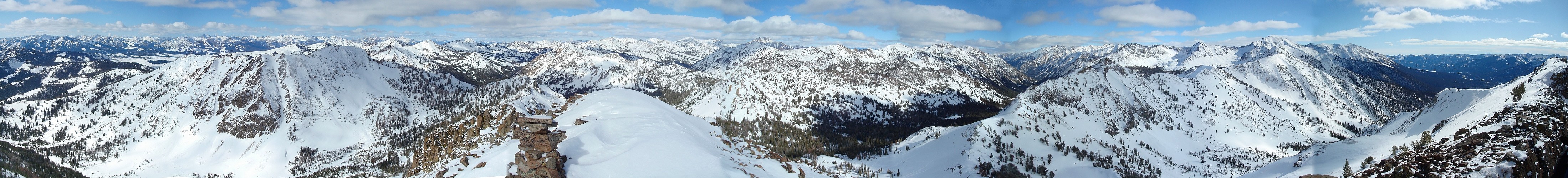
350 degree panoramic view from the summit, includes Smoky Mtns, Sawtooths, White Clouds, and Boulders.
|
Looking back along the ridge at the lower south summit.
|

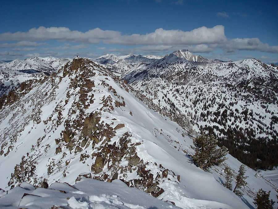
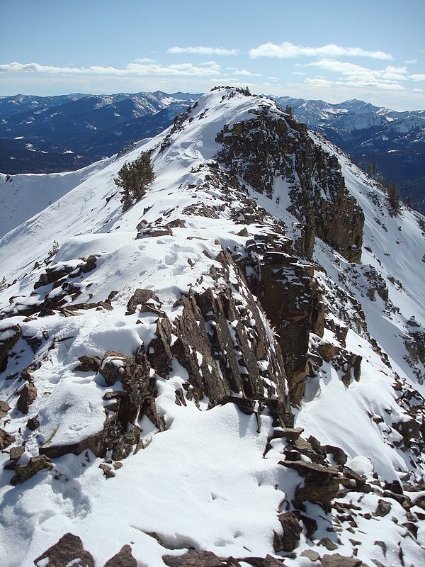
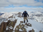
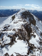
Nice shot of the summit ridge and Castle Peak.
|
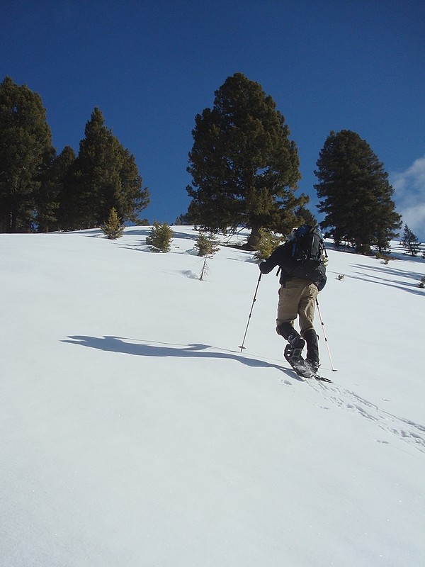
Ready to hit the trail after stepping back into our snowshoes.
|

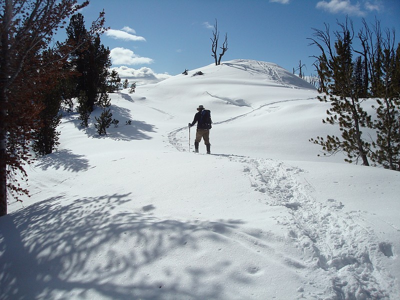
Retracing our steps back to Pt 9607'.
|
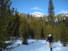
Down on the flats, with Gladiator Peak in the background.
|
|