|
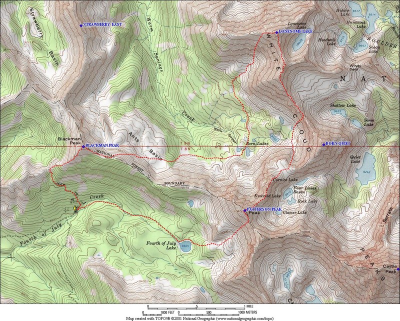
The Fourth of July trailhead is located in the center of the White Clouds, and is the most popular trailhead in the range. It gives access to places like Fourth of July Lake, Born Lakes, and other scenic destinations. The most popular summits in the area are Blackmon Peak (formerly Blackman Peak) and Patterson Peak. The route that Sean D and myself had chosen would use those as bookends, with a climb of Lonesome Peak (11302’) in between.
Sean and I had been bouncing emails around most of the summer and finally decided on a Wednesday to do a climb. After taking care of some morning obligations, we got a bit of a late start and made it to the trailhead by around noon. The two of us made pretty quick work of Blackmon’s southwest ridge, and covered the 1500’ of elevation gain in just under 45 minutes. The summit is a great vantage point to check out David O. Lee Peak and the rest of the northern White Clouds. To the south you can also see most of the peaks that surround Washington Basin.
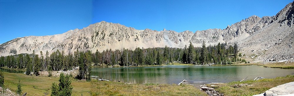
After snapping a few photos, we descended Blackmon’s east ridge, dropped down into Ants Basin, and then picked up the trail leading to Born Lakes. The lakes are very pretty, and make a great backpacking destination or a nice day hike. We filled up our water bottles at the lake, and then went pretty much due north from the second lake. The terrain is partially forested, but doesn’t have too much underbrush, so the going is fairly easy. Soon enough we met up with a creek bed that lead us up into the small cirque southwest of Lonesome Peak. We’d originally planned to go all the way over to the base of the west ridge, but there was a gully on the south face of the peak that looked doable, so we decided to climb that instead. You might be able to keep this route to class 2 terrain, but the rock is pretty loose, so choosing some rocky class 3 ribs makes for easier going. We continued up the face, and gained the ridge a couple hundred feet below the summit. The final section of the climb was on blocky granite that is a little loose at times, but not bad if you’re careful.
On the summit of Lonesome Peak, we found a register with only Rick Baugher’s 1999 entry (but I know of a couple others who’ve climbed it since then). The views are awesome in all directions. You can see all 7 of the other White Cloud 11ers, and the view looking down the Boulder Chain of Lakes is very cool. Lonesome Lake sits at the top of the chain. It is arguably the highest lake in Idaho, and based on the view from above, it’s easy to see how the very isolated lake got its name. It was about 3:30 by the time we reached the summit, and there was still quite a bit of ground to cover, so we started heading down the south ridge.
The rock on the ridge was fairly loose near the summit, with an abundance of breadbox-sized chunks ready to let go at any time. But as we got lower, the consistency of the rock changed, and the ridge became mostly larger refrigerator-sized granite blocks and slabs that we weaved in and out of during the descent. I paused a couple time to peer into slots and gaps in the rock that were at least 50 feet deep. It was fun terrain, but the going was slow. After getting through the final loose section along the east side of the ridge, we finally reached the top of the Devil’s Staircase almost 2 hours after leaving the summit. The original plan was to continue from here up “Born Quiet Peak” (10857’), but the ridge looked tricky and we only had a couple hours of light left. So we decided to descent the staircase towards Born Lakes, then climb back up to the broad 10200’ saddle in order to reach Patterson.
During the climb up to the broad saddle, fatigue was setting in for me, but the day was getting short so I did my best to keep pushing on and not hold Sean back too much. The scenery on our way up the ridge was tough to beat. We saw 4 goats (Dad, Mom, & 2 Kids) in Four Lakes Basin. The highlight was the orange light on the peaks as the sun began setting. Castle Peak and Merriam Peak looked very cool, and so did Lonesome Peak. The class 3 northeast ridge on Patterson was full of ups and downs and route-finding along the way, and we finally reached the summit at around 8pm. The view of the sun setting behind the Sawtooths was hard to leave behind, but we still hoped to get back to the trail before dark. The talus slopes on Patterson’s south face wouldn’t be fun without some light to guide us. We made good time, and descended to around 9700’ elevation before the sunlight was gone. From here we wandered through the trees to Fourth of July Lake, where we startled some backpackers, and then pumped some water to replenish ourselves. At this point we pulled out the headlamps for the final trailed section back to the car. We finished at 10pm, just before the full moon popped up.
It was an excellent 3-peak day, covering just over 11 miles and 5400’ of elevation gain in 10 hours. (Sean probably could have shaved a couple hours off this if he’d been going solo.) I especially liked traversing down the ridge south from Lonesome Peak, although climbing up it may not be as fun. The light show at the end of the day was excellent, and well worth doing a couple miles of trail in the dark.

Overview map of the 3-peak route. We took the loop clockwise.
|
Looking north to David O Lee Peak from Blackmon Peak.
|
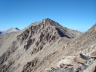
The ridge that connects Blackmon and Patterson, with Castle Peak in the background.
|
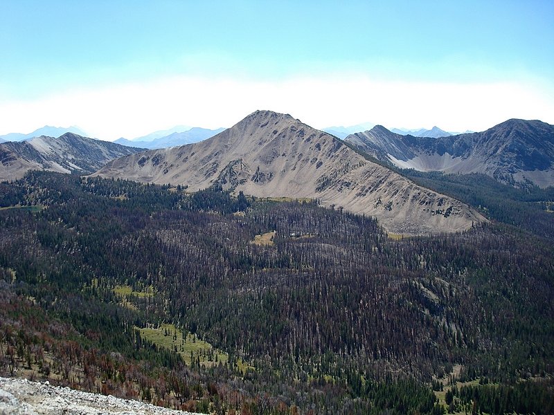
Fourth of July Peak (10713') from Blackmon. This shot gives you a feel for the effects of the 2005 wildfire.
|
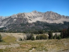
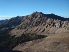
Southwest aspect of Lonesome Peak from Ants Basin.
|

Panorama from Born Lakes, Lonesome Peak in the back right.
|
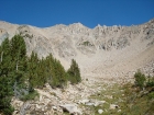
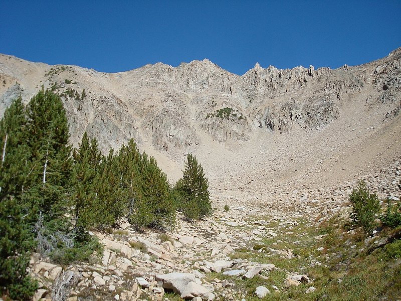
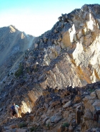
Looking up from the base of Lonesome Peak's south face.
|
Nearing the top of Lonesome Peak's west ridge.
|
View of Castle Peak, SSE from Lonesome Peak. Serrate Ridge and Merriam Peak to the left.
|
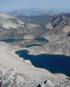
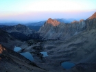
The Boulder Chain of Lakes from Lonesome Peak.
|
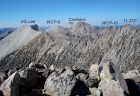
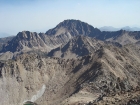
Five 11ers to the north of Lonesome Peak.
|
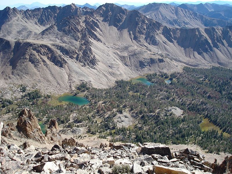
Peak 11202' and the Boulder Chain Lakes.
|
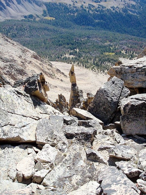
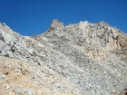
This 50' tall spire is hidden just south of the summit of Lonesome Peak.
|
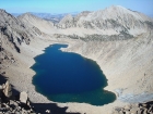
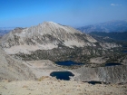
Lonesome Lake, with Peak 11202' in the background.
|
Looking back up the south ridge of Lonesome Peak.
|

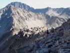
Looking down on the Born Lakes, with Patterson Peak in the background.
|
Sean on the blocky south ridge of Lonesome Peak.
|
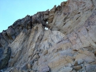
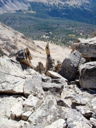
Keyhole on the rocks on Lonesome Peak's south ridge.
|
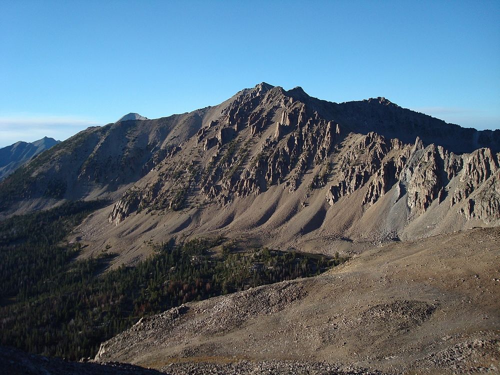
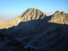
The view north to Lonesome Peak from Patterson Peak's northeast ridge.
|
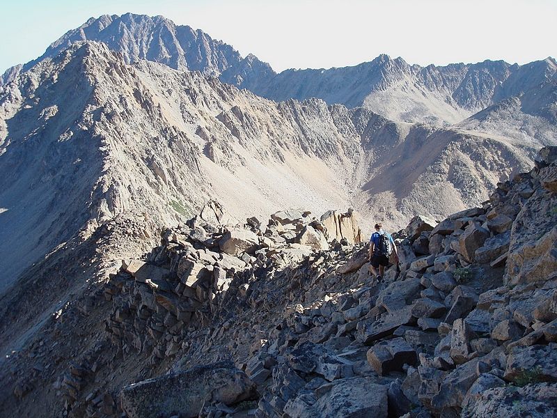
Sean crossing through a notch on Patterson's northeast ridge.
|
The sun setting on Castle Peak.
|
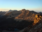
Intense sunset on Lonesome Peak from Patterson Peak.
|

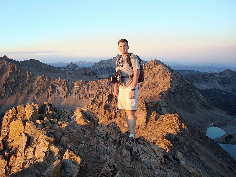
Dave on the summit of Patterson Peak, our route in the background.
|
Merriam Peak and Serrate Ridge above Four Lakes Basin.
|
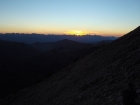
The sun dipping behind the Sawtooths, almost time for those headlamps.
|
|