|
Since we’d enjoyed our climb of Lost River Peak so much two weeks earlier, it was decided to tackle Mount Breitenbach. With an elevation of 12140’, Breitenbach is fifth highest mountain in Idaho. George and I left town right after work on Friday, and ended up pulling off the highway near the trailhead after 10pm. We decided to make camp at the same spot we’d used a couple weeks prior since we were familiar with the area. The next morning we made the rough drive over to the Pete Creek trailhead and were on the trail by just after 7am.
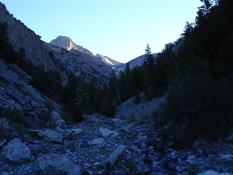
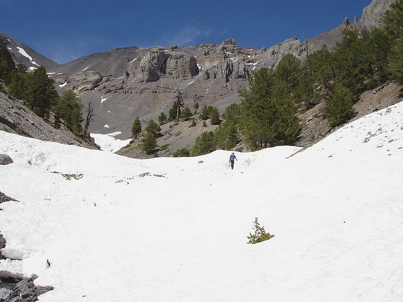
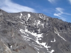
The initial part of the hike is through fairly thick underbrush along the creek bed. The trail disappeared shortly after leaving the truck, so we just ended up winding our way through the brush trying to avoid the densest thickets. It seemed like we had to cross the creek about every two minutes, so that kept things interesting. Eventually the brush thinned as we gained elevation and soon we were hiking on hard frozen snow that had accumulated in the base of the canyon during the winter and spring. This was much easier going than the dense underbrush. After about two miles, the canyon got wider and the slope got steeper. It was pretty much an open field of scree. The rock was pretty stable, but it was still a bit of a mental grind to keep climbing. We were able to occupy ourselves by watching for the occasional fossil amongst the rock.
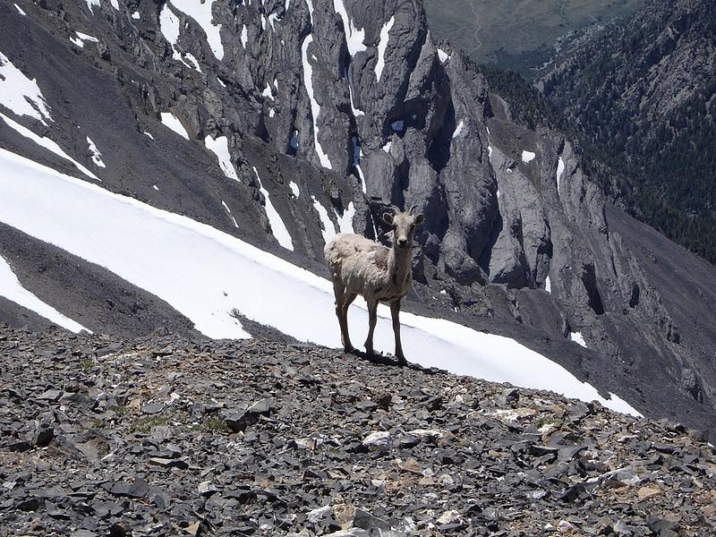
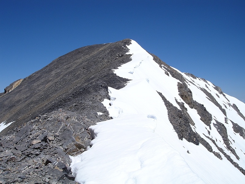
Soon we were nearing the 11400' saddle at the top of the canyon. At this point George noticed a white animal far above us that he correctly identified as a female bighorn sheep. Then three more appeared including one young lamb. The original one came to within 50 feet of us before disappearing. From here we continued on to the saddle where we took a break. Ahead of us was a steep climb up the false summit, then a ridge traverse that looked pretty snowy from our angle. Luckily the ridge ended up being snow free on the other side, so we were able to climb the final section without issue.
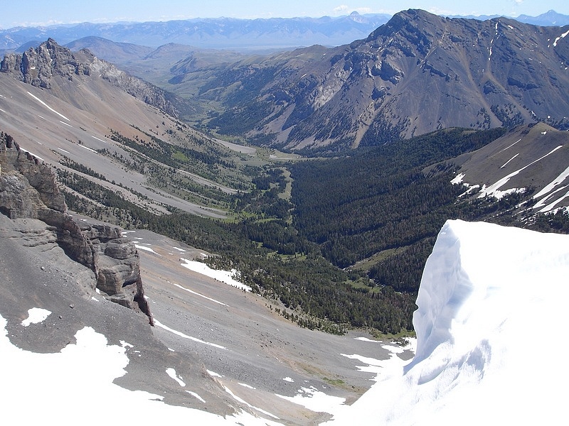
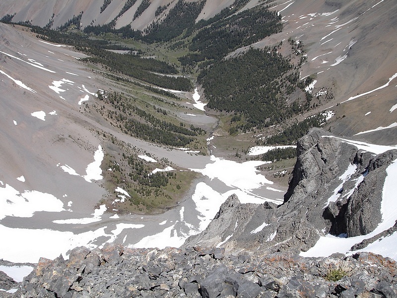
The views from the summit were great, especially looking down the steep north face on the headwaters of the East Fork of the Pahsimeroi River where I’d camped the previous July. As we prepared to leave, George spotted a different bighorn ewe heading our way. It was about forty feet away at first, and then strolled to within twenty feet of us. She was in no hurry and let us take a bunch of photos before she wandered away. It was an awesome experience to say the least.
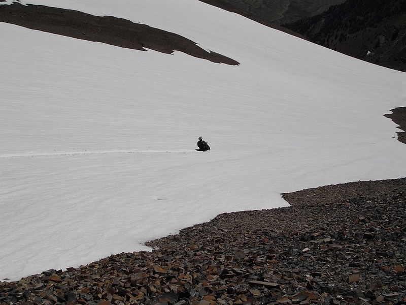
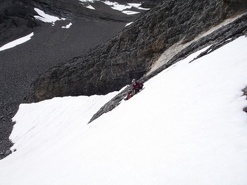
Feeling good, we began our descent. After dropping back into the canyon, we were able to do some decent glissading on the snowfields. Not sure if this actually saved us any time since we had to traverse around quite a bit to get to some of them, but it was a lot of fun regardless. At one point, George noticed the sheep was keeping an eye on us from the ridge above, obviously curious about what we were up to. From here the hike out was uneventful, but seemed to take forever wandering our way back through the brush in the bottom of the canyon. At the end of the day, we were pretty tuckered out but felt great about our accomplishment.
Access Road Update June 2022: Upper Cedar Creek Road is currently blocked by a locked gate and NO TRESSPASSING signs where it crosses the private ranch property. It’s unclear if these are new owners, or if the gate got left open one too many times. Whether or not this is a permanent closure, be prepared for an alternate drive approach. Reportedly the best option now is the next (unmarked) gate about a mile-and-a-half north off US93.
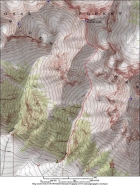
Map of the standard route for Breitenbach up Pete Creek, about 8 miles round trip and 4500' elevation gain. |

Early in the hike, Pete Creek must be crossed numerous times. |
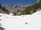
Pete Creek canyon gets wider towards the top. George making his way up. |
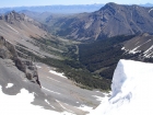
Looking the to the north from the 11400' saddle and the Dry Creek valley. The Lemhi's can be seen in the background, including Bell Mountain and Diamond Peak. |
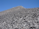
A steep climb to the false summit awaited us after reaching the saddle. |
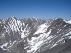
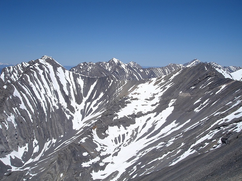
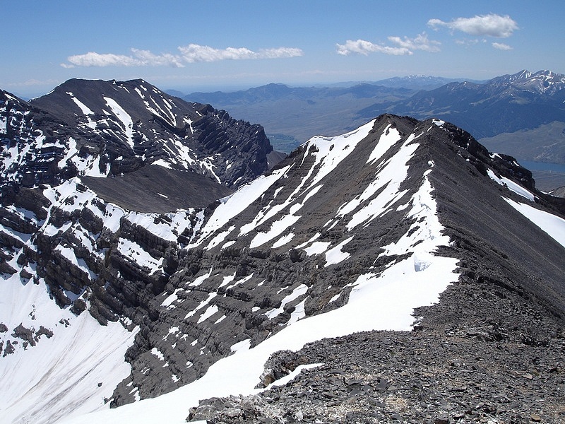
The Lost River Range to the northwest of Breitenbach, including Mount Borah in the distant right of this photo. |

Cornices lining the east side of the ridge on the final section to the summit. |
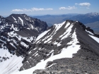
Looking back towards the false summit and the 11400' saddle to the left. Lost River Peak is in the background. |

This is overlooking the very steep north face of Breitenbach, with the headwaters of the East Fork Pahsimeroi River below. |
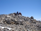
George and Dave on the summit. |

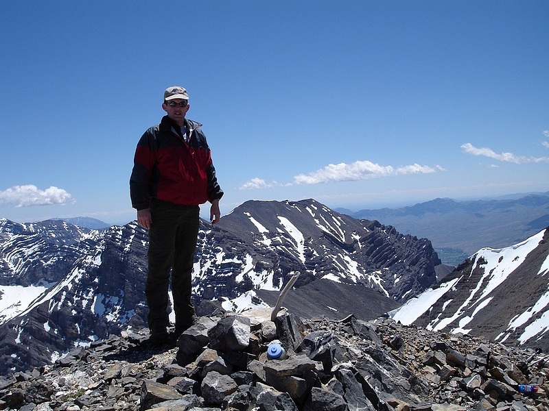
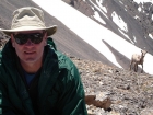
Me standing on the summit with Lost River Peak behind me to the southeast. |
As we prepared to head down, a bighorn ewe started wandering towards us. |
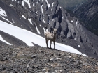
She got closer and closer, and was eventually within twenty feet of us. |
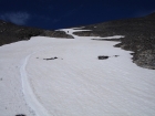
We tried to take advantage of snowfields below the 11400' saddle to speed up our descent. |
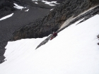
This is George trying to match my winding glissade route (a skill learned through years of practice of course). |
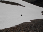
Here I am glissading down one of the steeper snowfields at the top of Pete Creek canyon. |
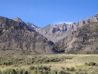
A view of Lost River Peak towering above the canyon. |
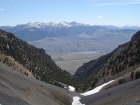
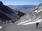
Looking down Pete Creek canyon with Mackay Reservoir and the White Knob Mountains in the background |
George in the snow on our way back down. Some cool "hoodoo" columns stand on the ridge behind him. |
This is the view back up Pete Creek from the valley floor. |
|