|
Mount Borah
Mount Borah
Elevation 12662'
August 11, 1990
August 10, 1991
August 6, 1994
44.1373°N / 113.7811°W
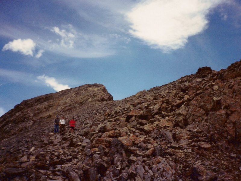
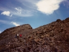
Mount Borah is the tallest peak in Idaho and is located amongst the most rugged mountains in the state, the Lost River Range. It is the state's busiest peak, with folks coming from all over to climb the highest point in Idaho. The standard route comes from the southwest, and crosses the famous "chicken out ridge". The route involves some Class 3 scrambling, but the rock is generally pretty stable in this section. There is quite a bit of exposure though, with steep drops on both sides of the ridge. For an experienced scrambler, it's no big deal, but for those who are afraid of heights, or don't get off the trail much, its a common place to "chicken out" and head back to the car.
I've climbed Borah three time, all back in my teenage years. I was in better physical shape back then, and probably didn't fully appreciate the effort required to summit Idaho's highest peak. Thinking back on the first time, I can remember thinking how steep "the trail" was in the lower stretches. I think has been re-routed a bit since then, but have heard its still pretty steep. After a couple miles, you get above tree line and the summit comes into view. When you first see it, the west face looks very steep and its obvious there's still a lot of work ahead to get to the top. The next stretch is an easygoing stroll as the route follows the flat portion of the ridge. But the stroll section doesn't last long as the terrain steepens as you slowly work your way up. Gradually you begin using your hands to help gain elevation (aka scrambling). There are no obstacles at first, but soon enough you reach the crux, "chicken out ridge". People start choosing their options from here. I basically stayed right on top of the ridge each of my three climbs. My first time through here gave me the biggest dose of mountain adrenaline I'd ever experienced up to that point in my life. The drops to the south and north are very dramatic, but the summit still looms far above. I can remember feeling my heart beating fast due to the altitude and the exposure, what a blast!
After Chick Out Ridge, the route side-hills around to the left of point 11898’ and then reaches a saddle with a great view of the north face of Sacajawea Peak. After this, its only around 900 more vertical feet to get to the summit. The climbers trail heads to the left, but I opted to go straight up the ridge to the summit. Once on top, the views are awesome, just as you'd expect. I can remember it being pretty cold and windy, even in August. On the way back down, the climbers trail back to the snow-bridge is the probably the best option, and chicken out ridge seems to be easier to cross on the way down. Just be prepared for the pounding on your knees as you make your way back to the trailhead.
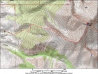
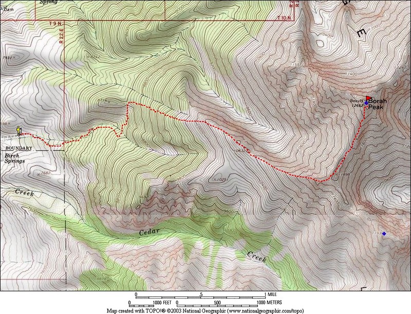
Overview map of the southwest ridge route. |
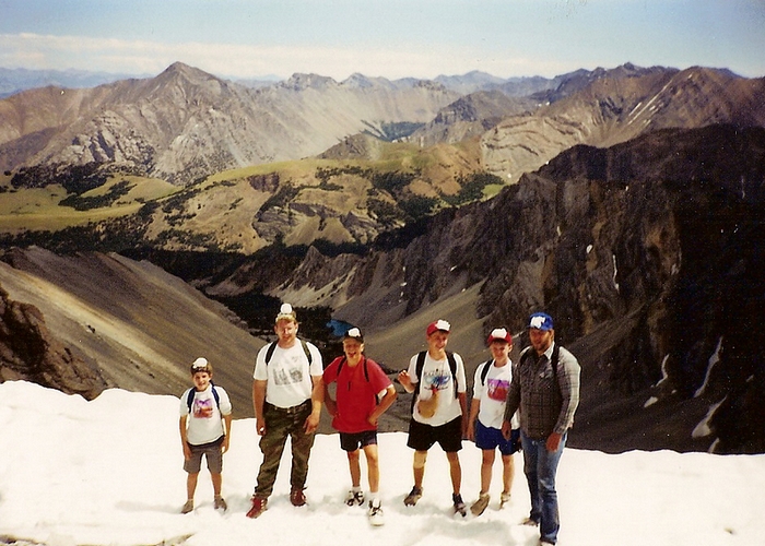
Posing for a photo on the snow bridge. |
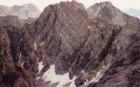
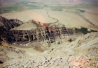
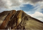
Looking back on the north face of Sacajawea Peak during the climb. Mount Idaho is on the right, with Leatherman Peak to the left. |

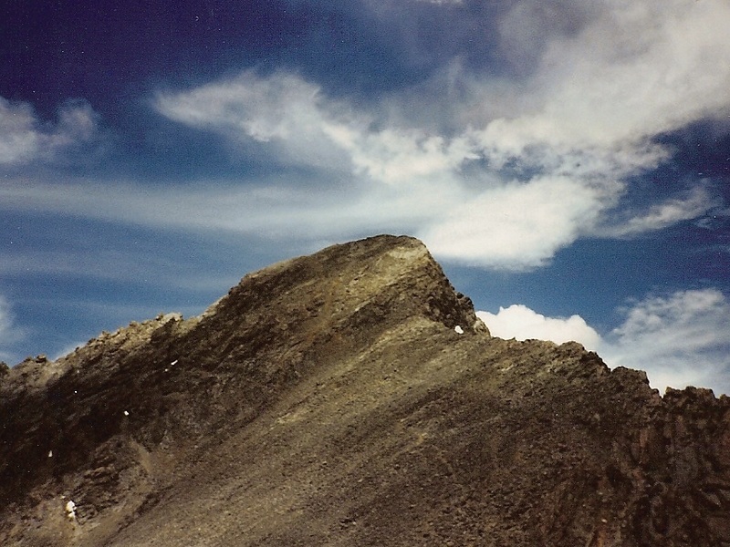
This is the final portion of the climb, with the summit in view. |
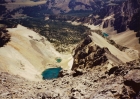
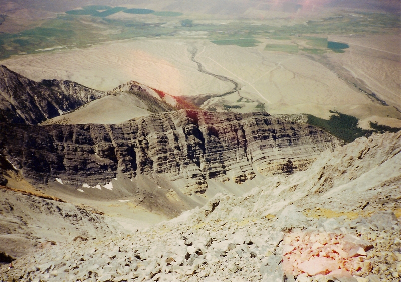
Summit view of the unnamed lakes west of Mount Borah. |
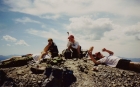
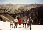
Lounging around on the summit. |
Summit view of the route and the steep drop-off north of the ridge. |
Stalling around, not wanting to leave the summit. |
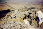
Making our way down off the summit block. |
Shot of the route from below. Point 11898' is on the left, with Chicken Out Ridge just to the right. |
|